The deadliest volcanic events of the second millennium
(2013-08-11)
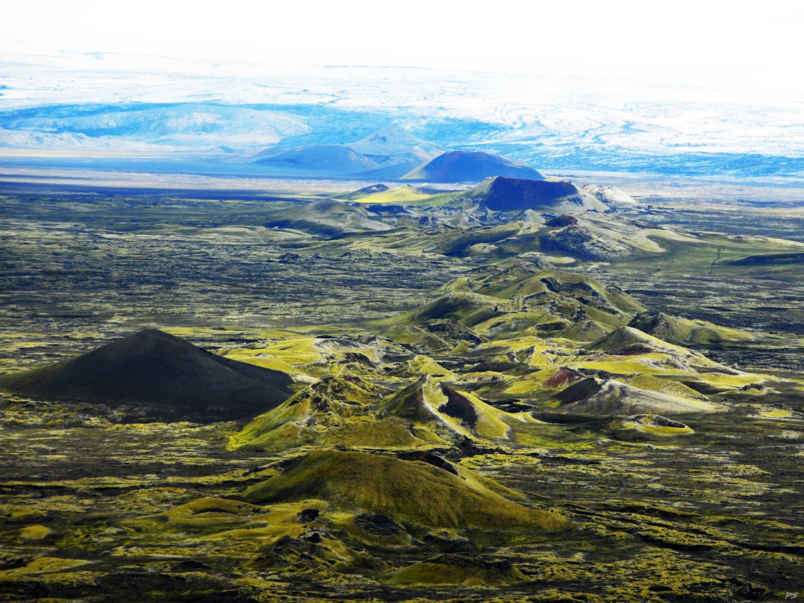
The Laki or rather Lakagígar (=laki-craters) eruption started 8 June 1783 and lasted eight months. In Iceland it is known also as Skaftáreldar (=Skaftá[r]-fires, á=river). Its source was a 27 kilometres long fissure with 130 craters, running southwest of the Grímsvötn caldera. The mountain Laki is located roughly in the middle of the crater row, but was not substantially affected by the eruption. This picture is taken from the top of Laki (alt. 812 m, 200 m above the surround), showing the craters towards northeast. The row extends almost to Skaftárjökull, this part of the great Vatnajökull glacier. The area is now partly covered with Woolly Fringe Moss.
(2013-08-11)
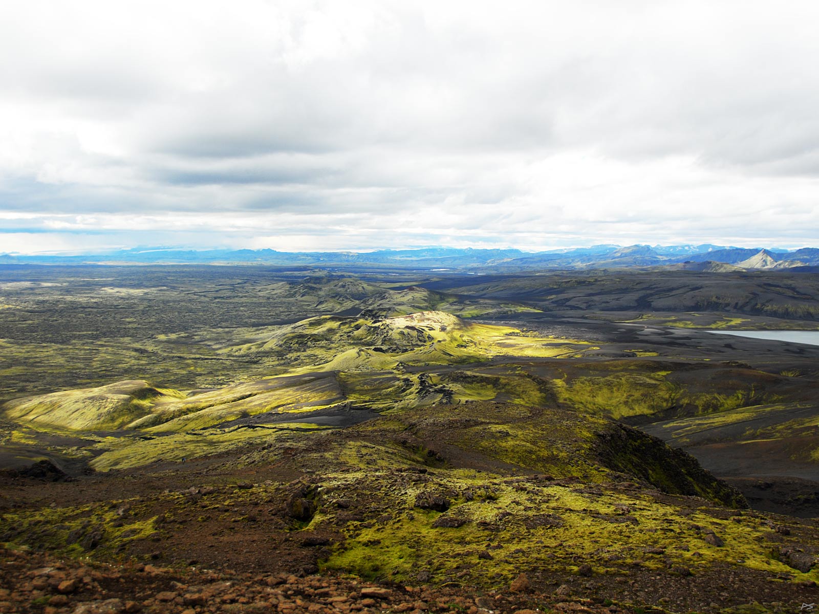
View from the top of Laki towards southwest, showing the rest of the crater row. This part can now be viewed up close from a 26 km "road" (F207) running from the end of F206 at the foot of Laki and back to F206 further south.
This seems to be the most, or second most, devastating volcanic events of the second millennium. During the first weeks the emitted sulfur dioxide spread over Europe and North America, creating a thick fog that induced respiratory sickness and many deaths, especially among those that laboured in the fields. However, this did not cause the greatest number of deaths. The lower atmosphere pollution subsided during the autumn, but a lot of sulfur dioxide had been blown high into the stratosphere of the northern hemisphere, transformed into a haze of sulfuric acid droplets. This haze stopped parts of the sunshine, causing an extremely cold winter (e.g. ice on the Mississippi at New Orleans). The next few winters and summers the weather was not only cold, it was abnormal, and the crops were low or even failed completely, causing famines around the northern hemisphere. In India and North Africa the climatic upset caused a severe drought. Some researchers have estimated the total number of additional deaths to be as much as six millions. Also, it has been suggested that the suffering of the French peasants initiated the Revolution starting in 1789. (The eruption of Mount Tambora in Indonesia beginning 10 April 1815 was ten times as large in terms of ejected lava volume [160 km³], )
The volcanoes also spewed out lots of hydrofluoric acid which is absorbed by the vegetation. In Iceland 4/5 of the sheep and more than half of the cattle and horses died from fluorosis, and more than 1/5 (about 10,000) of the population died from starvation, maybe also fluorosis (possibly also lung irritation from sulfur dioxide). A third of the Icelandic population lived by fishing and had plenty of fish to eat, and even exported fish during the crisis. Unfortunately there was no authority to distribute fish (or imported food) to the farmers (Denmark was still far away). The Danish King, Christian VII, offered to evacuate the remaining forty thousand to Denmark, but the Icelanders preferred to stay.
(2010-06-03)
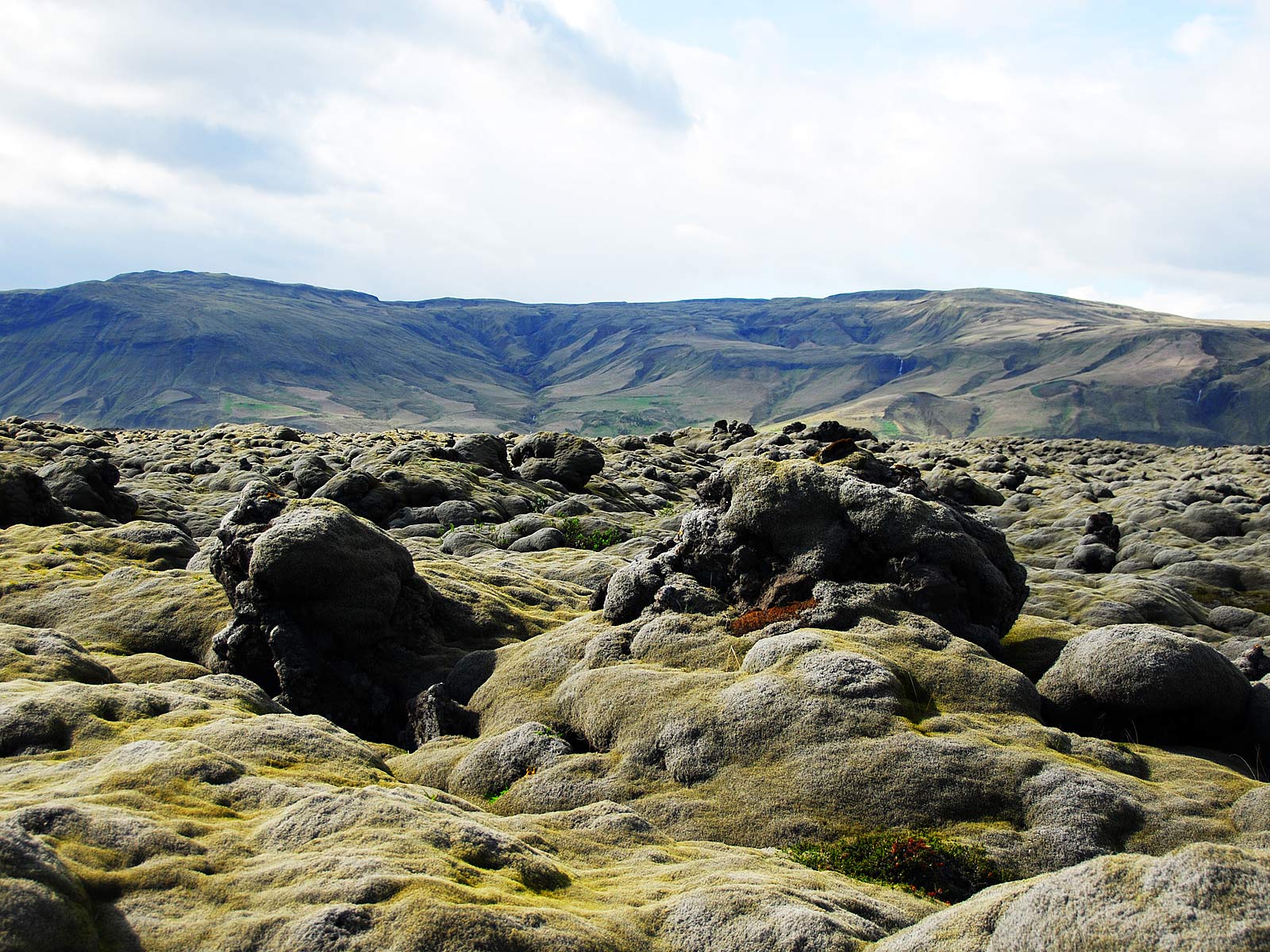
Southwest of Kirkjubæjarklaustur (Klaustur for short) the Ring Road runs through Eldhraun (=fire-lava-field) for nearly thirty kilometres. The Laki craters spewed out estimated 15 km³ of lava, and most of it flowed down the Skaftá valley and ended up here. The total area of all lava fields created is 565 km².
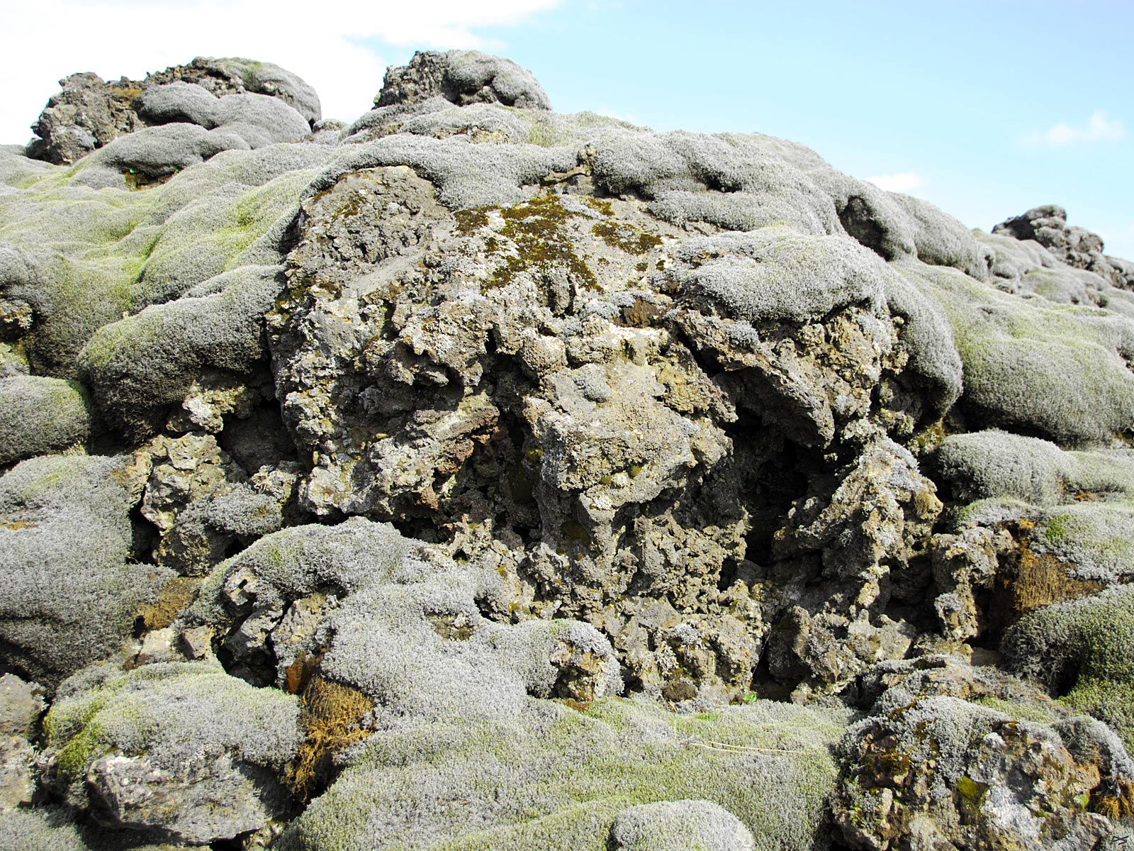
(2013-08-11)
Just a detail from Eldhraun. Do you see the beast?
(2013-08-11)
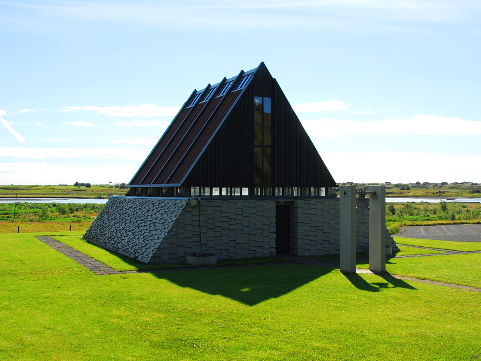
This is a chapel in Kirkjubæjarklaustur, built 1969–1974 in memory of Reverend Jón Steingrímsson (1728–1791) who held the legendary Eldmessa, Fire Mass. On 20 July 1783, six weeks after the eruption had started, the lava flow was approaching Kirkjubæjarklaustur. Jón Steingrímsson gather his parishioners in the church where he preached and prayed for hours while the lava came closer and closer. Then the lava flow stopped.
(2013-08-011)
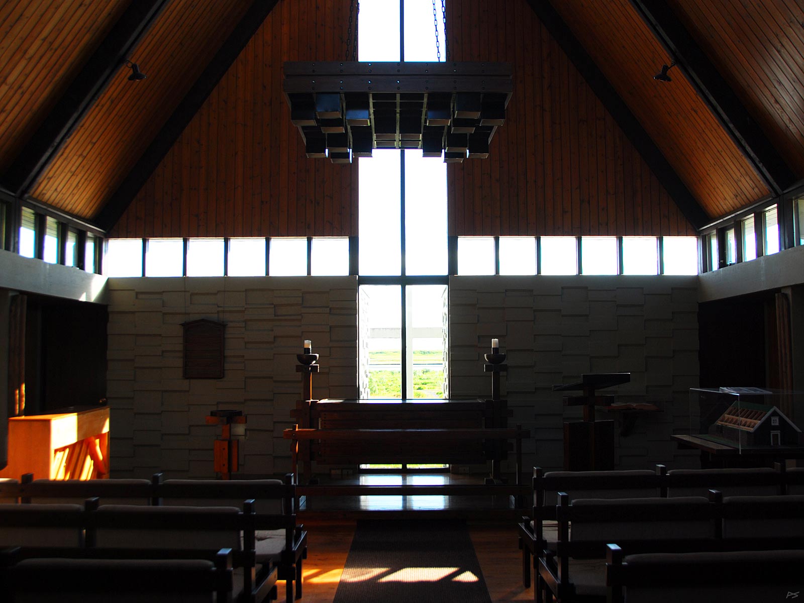
The chapel interior. Jón Steingrímsson and his wife are buried in the old graveyard just west of the chapel and close to the old church ruins.
(2013-08-10)
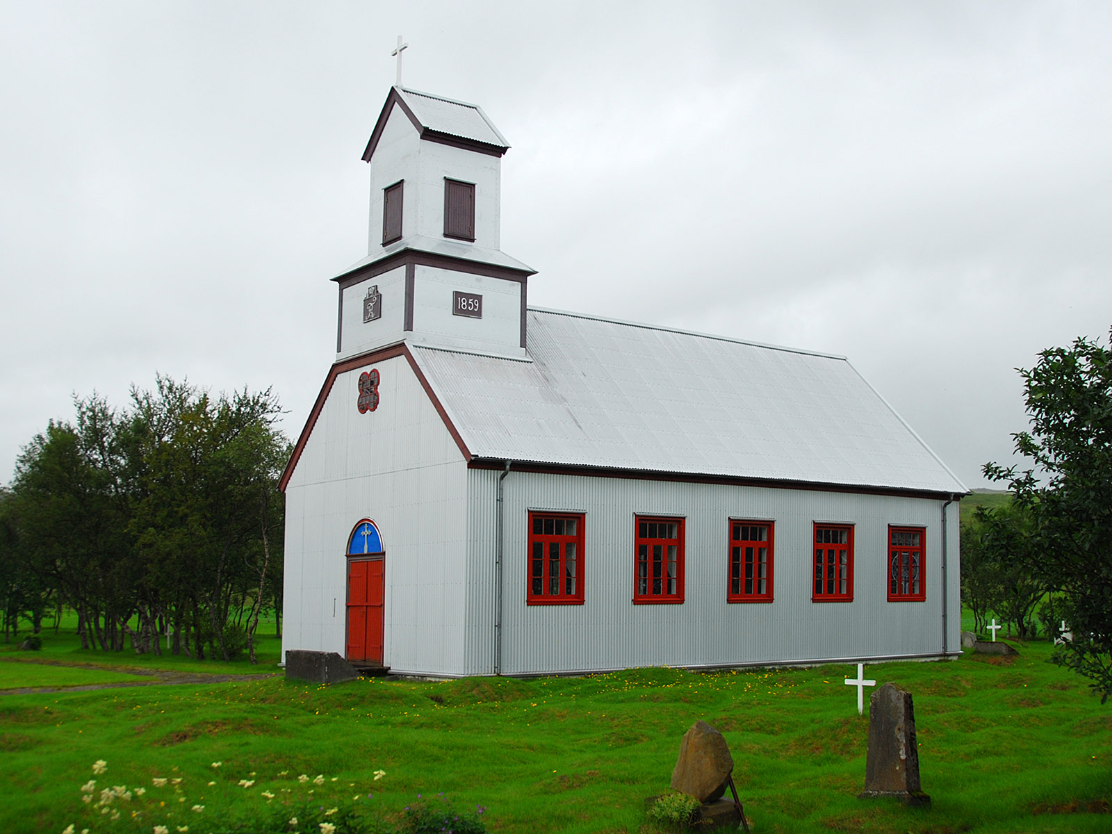
The church on Prestbakki (=priest-hill), the site of the old parsonage, some 5 km north of Kirkjubæjarklaustur. In 1859 the parish church was moved from Klaustur to Prestbakki.