Nice paved roads
Varying standard gravel roads
"Mountain roads" or rather tracks – 4WD only
(2013-08-13)
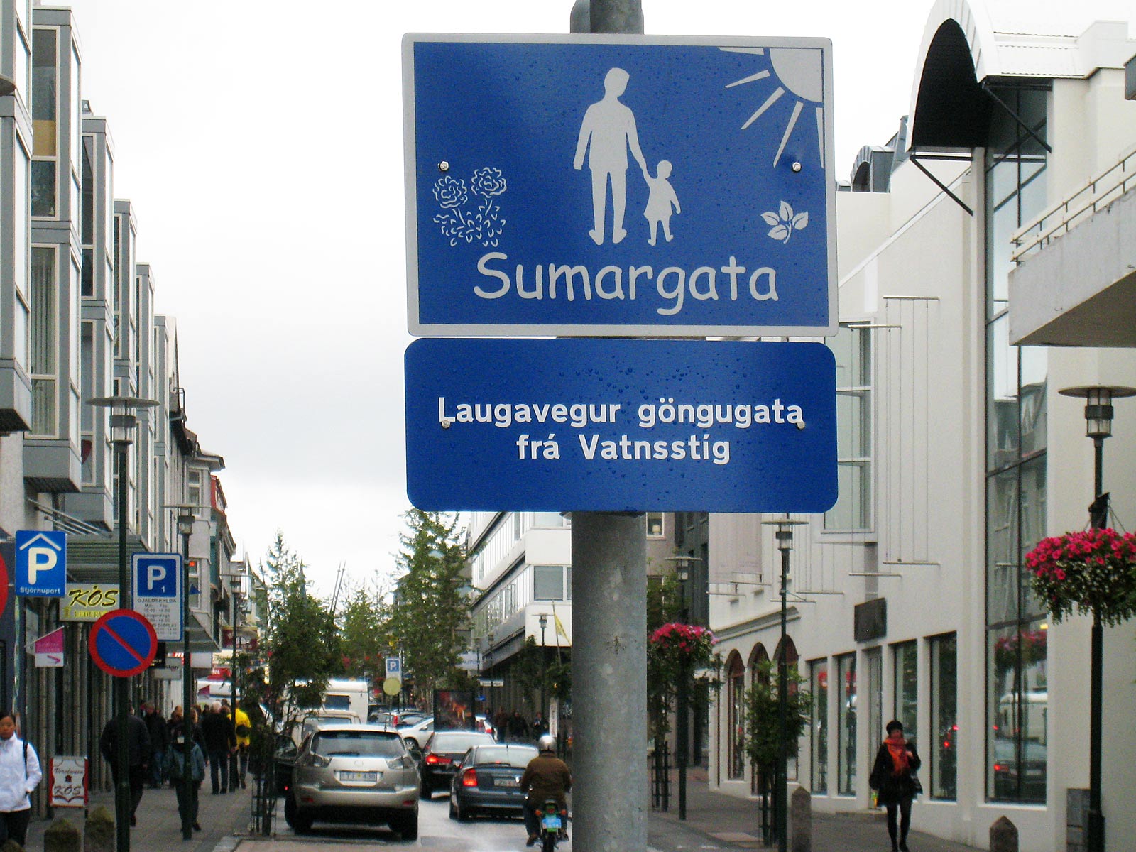
In the Reykjvík area the roads are excellent. The impression from the Reykjavík town is that the traffic system is partly made for a big city, but has details typical of a village. Which may be reasonable, because outside rush hours the there isn't that much traffic. More surprising is that what may look like a pedestrian street is where the private cars drive and park. The sign shows that this street turns into a pedestrian one somewhere ahead; maybe it does.

Except in the Reykjavík city centre, parking is free, and there seems to be ample parking space. Anyway, the Icelanders park where they find convenient.
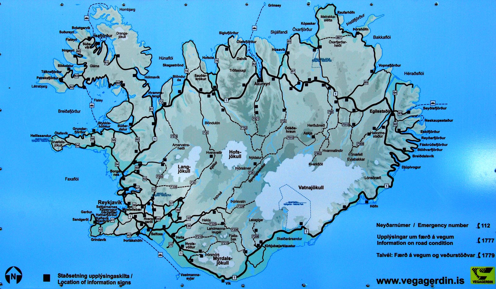
Outside the Reykjavík area, including the road to the Keflavík airport, the Ring Road (Þjóðvegur 1, Route 1, the thickest black line on the map) is the big thing. It is 1339 kilometres long and was finished in 1974 to celebrate 1100 years of settlement. It is paved and has a general speed limit of 90 km/h.
(2010-06-03)
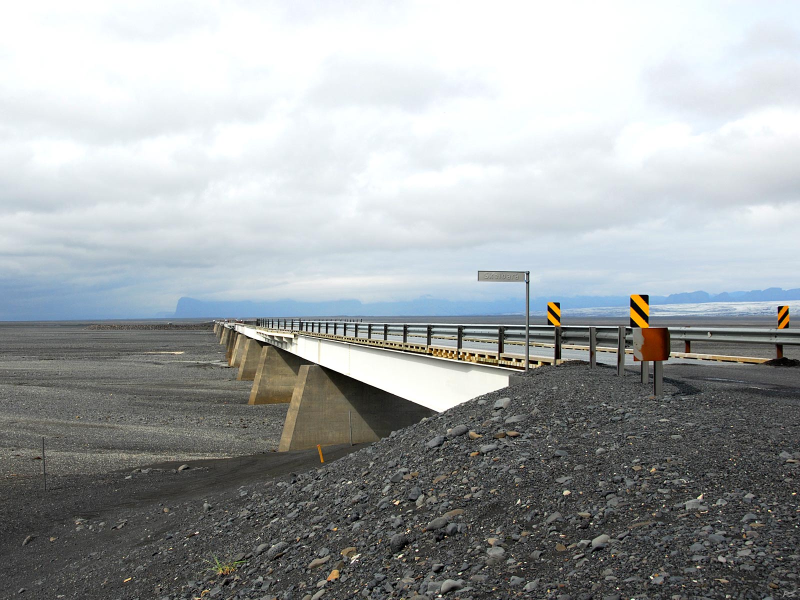
Finishing the Ring Road was greatly delayed because of an Icelandic peculiarity, jökulhlaup (=glacier-run): Most volcanos here resides under glaciers, and when they erupt, large quantities of ice is melted, and a devastating flood may result. The biggest challenge was the coast south of the great Vatnajökull, notably Skeiðarsandur, the largest sands in Iceland, roughly 1000 km², littered with rivers coming from the glacier.
This is the 904 meter bridge across the river Skeiðará near the east end of Skeiðarsandur, opened to complete the Ring Road in 1974. It is situated south of the glacier Skeiðarárjökull, a branch of the west part of Vatnajökull. Hidden below Vatnajökull there are several volcanos, the most active one is Grimsvötn whose name actually refers to a cluster of subglacial lakes. When it erupts, it doesn't always result in a jökulhlaup (flood), but in the autumn of 1996 it did. After meltwater had been collecting for more than a month in the caldera, the ice lifted, and all the water rushed to the sea within two days, carrying icebergs with it. The flood culminated after 15 hours and the volume was then estimated to be nearly 50,000 m³/s, close to one fourth of the average Amazon River discharge. This bridge was partly destroyed, another bridge (Gígjukvisl) was totally destroyed, and a substantial part of the road was also washed away.
(2010-06-04)
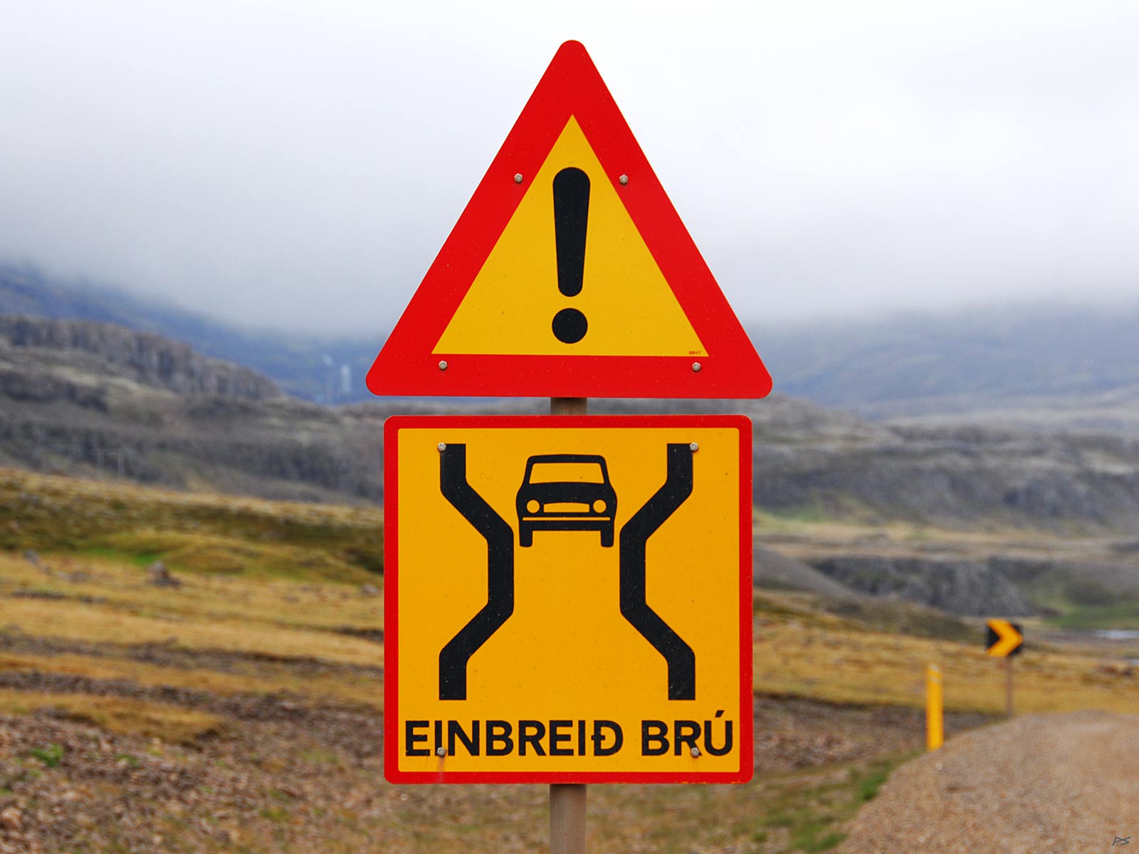
The south coast in particular have lots of rivers, coming from the glaciers. Although the Ring Road is dual lane, bridges here are usually single lane. It doesn't matter much, because the traffic is low. And they are all provided with this wonderful traffic sign.
(2010-06-03)
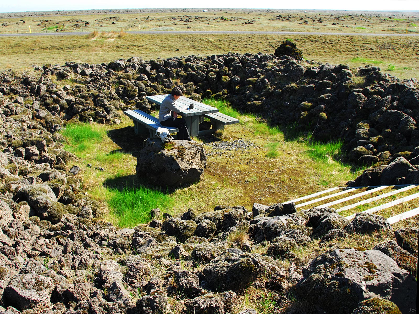
We didn't see many rest areas on our way, then the weather here isn't always favourable for enjoying an outdoor thermos coffee and something to chew on. Solving the wind problem is evidently attempted on this one. An urban tourist might also wish for a toilet, and you may find one on the nearest tourist attraction or rare café. Else forests are also rare, but side roads have often very little traffic.
(2010-06-04)
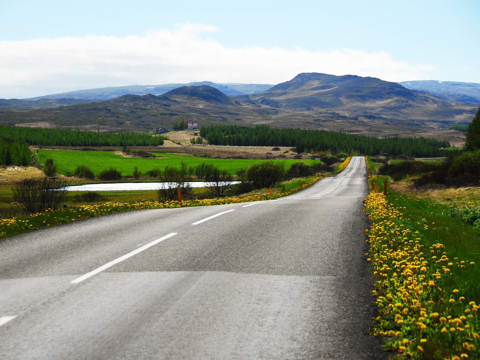
Side roads have varying quality. This is a good one, rout 931 running through Hallormsstaðarskógur east of the lake Lagarfljót (or Lögurinn), southwest of Egilstaðir. It's a typical paved road with a white midline, no edge line, but yellow marker 'poles' outside the road surface (longer 'poles' where much snow might be expected). Minor roads usually have a gravel surface and may be very bumpy, dirty when wet and dusty when dry. Luckily rural petrol stations and hotels usually offer free hand washing brushes (but unfortunately the water hose often wrings itself loose :( ).
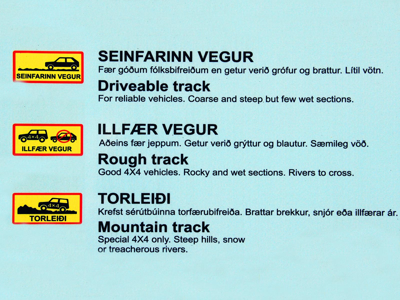
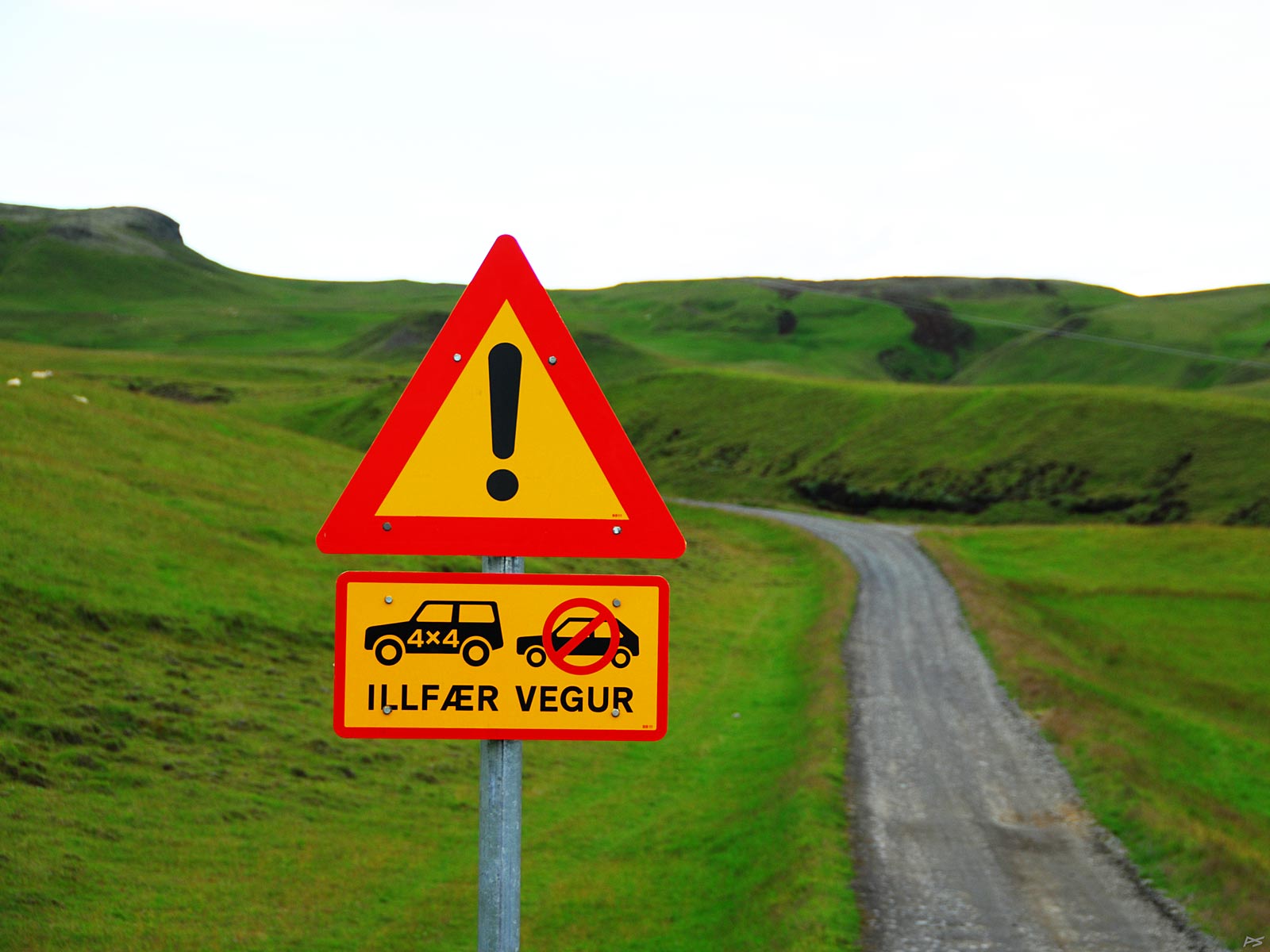
This is the list of bad road categories. The last category (torleiði) is for experts only, but you may go with a 4WD on "illfær vegur" across the highlands. Those roads are marked with an 'F' before the road number, but if you hire a ordinary car, a few other bad roads are also not permitted.
(2013-08-11)
Central Iceland doesn't have much soft ground, peat and bogs, just sands (and rocks and rivers). Therefore a major part of these "roads" are just marked tracks, marked with yellow "poles" and often also lines of rocks on both sides. When necessary, loose rocks have been removed. Only in some places a bulldozer has been digging through a sand slope. Please note that driving outside the marked tracks is forbidden. The picture shows the start of route F206 to Laki, the site of the 1783 eruption. Here it looks like a real road, but a bit further on it gets quite bad. This road even have a second warning sign closer to its other end: 'HILLTOP', and the ordinary driver is definitely not used to that kind of hilltop. Even special busses drive on these roads or tracks, carrying tourists to many attractions. If you get seasick easily, don't try such a ride.
(2013-08-09)
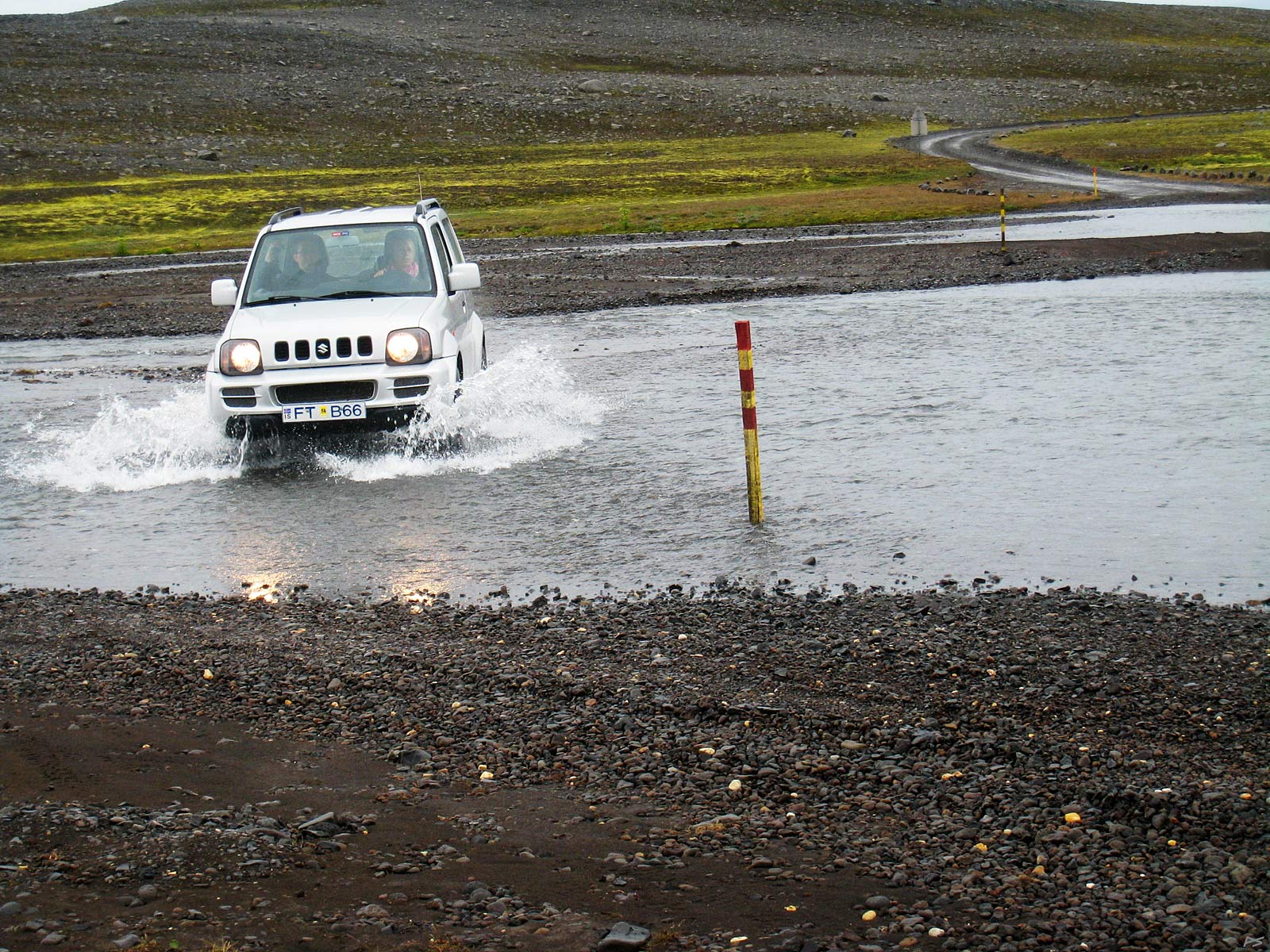
"Roads" of the "illfær" category usually have no bridges, but the rivers to ford are small, and during a couple of summer months the water level is usually low. But you have to trust that an invisible river bottom doesn't contain big surprises. During snow melting and after heavy rain the water level may be much higher, and then (if the road is open) you may have to keep the car running steadily all the way across to avoid water entering the exhaust pipe. Vehicles driving across a stream stir up sand that is transported downstream. Usually a depression then develop where most vehicle go, but slightly downstream the river will be shallower because of material buildup. This picture from Nýidalur on the Sprengisandur route illustrates the situation with a very safe water level; the car is driving downstream of the marked crossing and the depression. Note that deep water has an even surface, while shallow river water is evidently running. Incidentally, this ford is known to sometimes cause trouble, but during the summer months there is a manned hut a couple of hundred meters from the south side of the river ...
(2013-08-10)
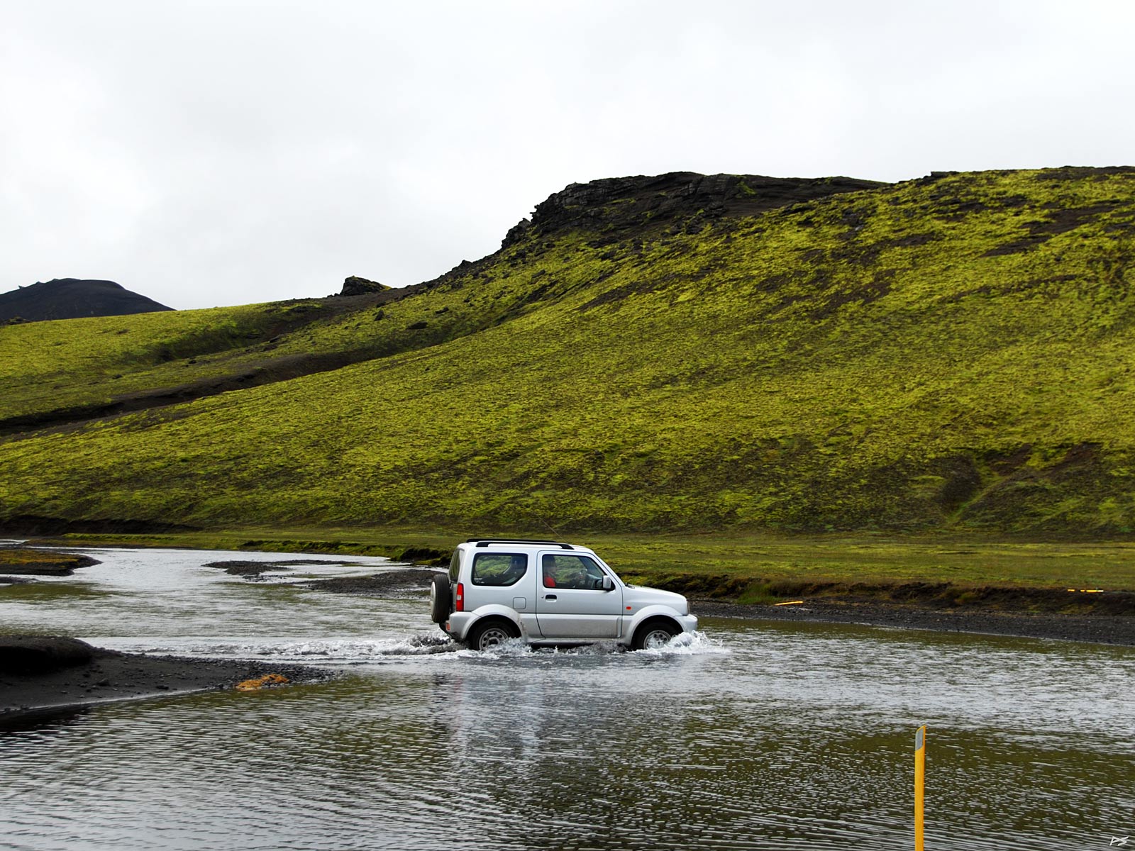
Another ford. This seem to be in Jökuldalir south of Landmannalaugar, where the track runs along a mostly dry river bed for many kilometres.
(2013-08-10)
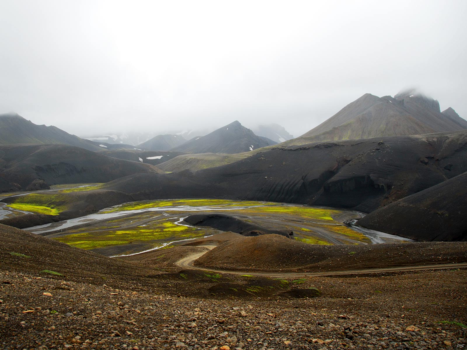
An example of a track finding its way through the landscape. This seems to be in the neighborhood of Eldgjá south of Landmannalaugar where the road leaves the valley floor.
Lately plans have been put forwards to replace the primitive Kjölur route, and likewise the Sprengisandur route, with all year paved roads. This is a resolution by the Icelandic Tourist Industry Association concerning the Kjölur route:
"A road of the type we are talking about deprives the Highlands of their distinctive features and the wilderness experience that tourists are pursuing. The Icelandic Highlands are of great value for the nation and by providing a paved traffic through one of the main highland areas the experience people seek is being destroyed."
The roads in Iceland may be quite different from those you are used to, so I'll include a couple of warnings:
Loose gravel is very dangerous if you don't adjust the speed properly. Furthermore, the edges of gravel roads may be unreliable. The maximum allowed speed on gravel roads is 80 km/h. Usually that speed is safe, but sometimes it's way too high.
When you see a warning sign, like reduced speed limit or sharp bend, this may be more serious than what you are used to.
The distance between fuel stations may be longer than what you are used to, so fill when you have the chance. This is most important if you cross the highlands (in a 4WD), where the only possible source of fuel is another car. A friend who did a lot of driving here in the 1980s, told me that it often happened that a driver would have to walk to the nearest farm with a can to buy fuel, and the situation haven't improved everywhere.