During the last twenty million years
Iceland has been create from lava from below,
pushed up by the great Iceland plume.
And the act of creation continues ...
slowly as ever
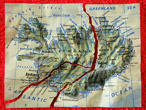
Iceland lies on the Mid-Atlantic Rift. On the west side of the rift is the North American Tectonic Plate and on the east side the Eurasian Tectonic Plate, and in the Iceland area they now move apart at a speed of roughly two centimetres per year. So the Earth's crust is stressed and from time to time it cracks, often opening a way for the glowing magma below. The picture shows crudely where the (forked) rift runs across the island.
However, a major reason for large amounts of melted rock flowing to the surface right here, is the Iceland plume or hot-spot, an upwelling in the hot soup below. This is what created Iceland. Some 20 million years ago, give or take, the first volcanic mountain emerged from the sea, and the island has continued growing ever since. The latest contribution, in terms of emerging from the sea, was Surtsey in 1963. That island was only 2.7 km², and half of it has already been eroded away.
(2010-06-01)
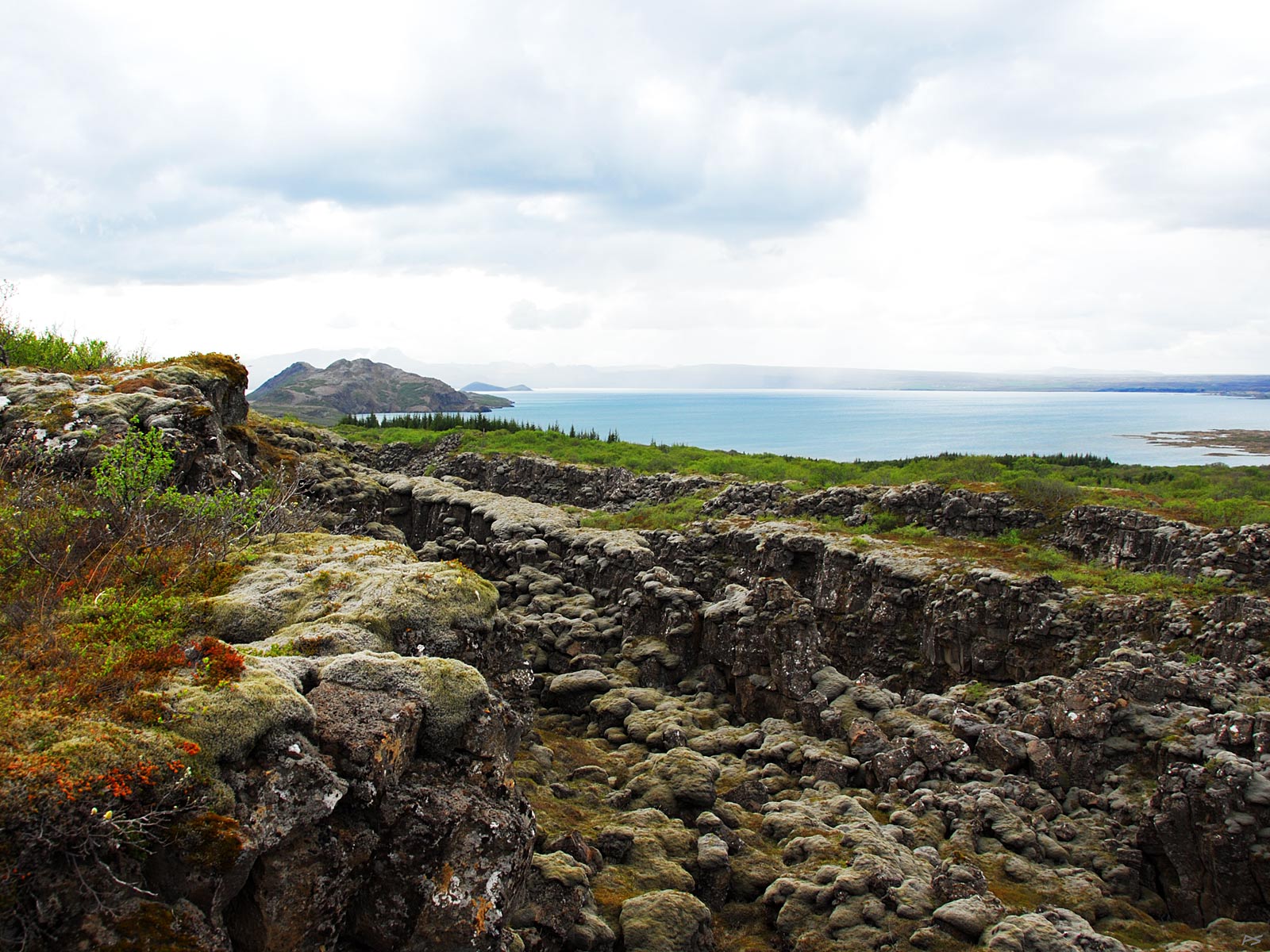
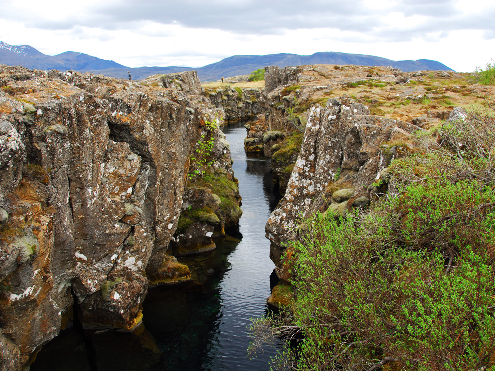
Þingvallavatn is the largest lake in Iceland, 84 km². This area is used to illustrate how the island is being torn between the two tectonic plates; it's littered with tears. They don't extend down to the scorching interior though.
(2010-06-01)
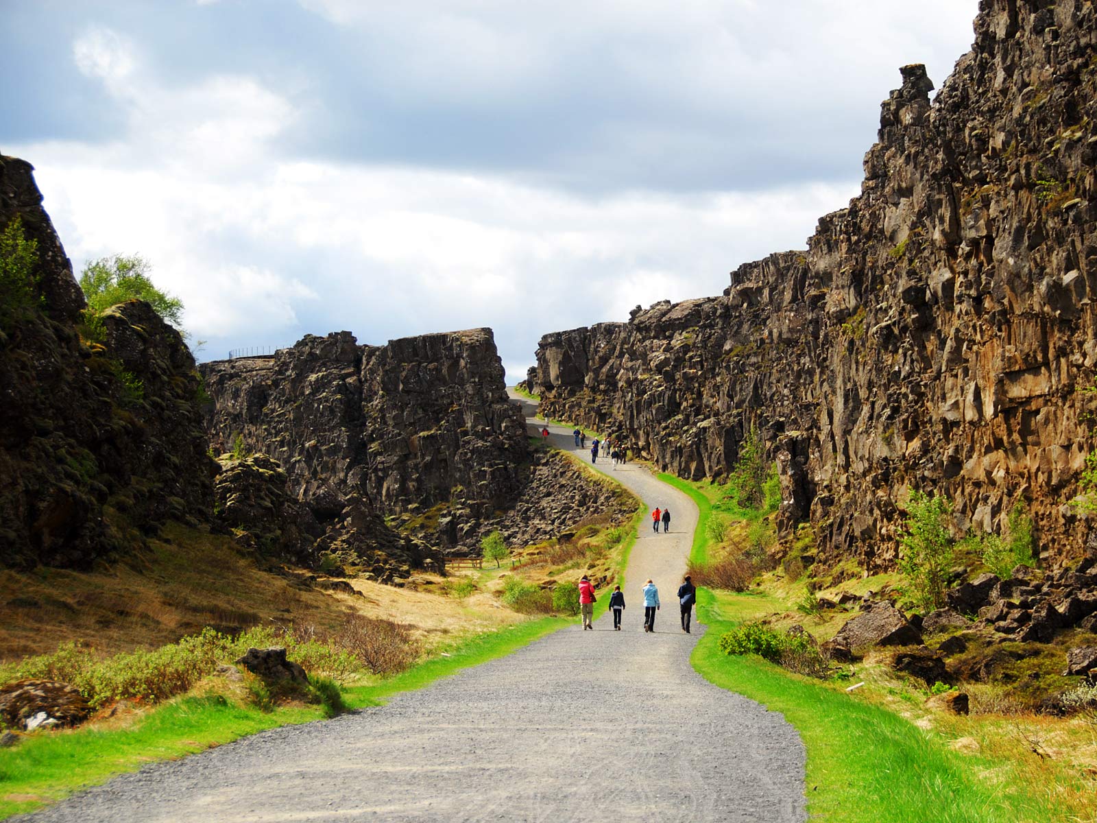
Þingvellir, the area of the old thingstead, is also rich in surface tears, some large like this one. Here the valley sides are moving apart at a speed of about seven millimetres per year (or roughly 70 meters since the last ice age when many such "details" were smoothed out).
(2010-06-01)
Þingvellir. Some cracks are filled with water. (And it isn't boiling!)
In this Iceland section most pages show, or refer to, volcanic phenomena. Below is a couple of extra pictures of volcanic phenomena.
(2010-06-01)
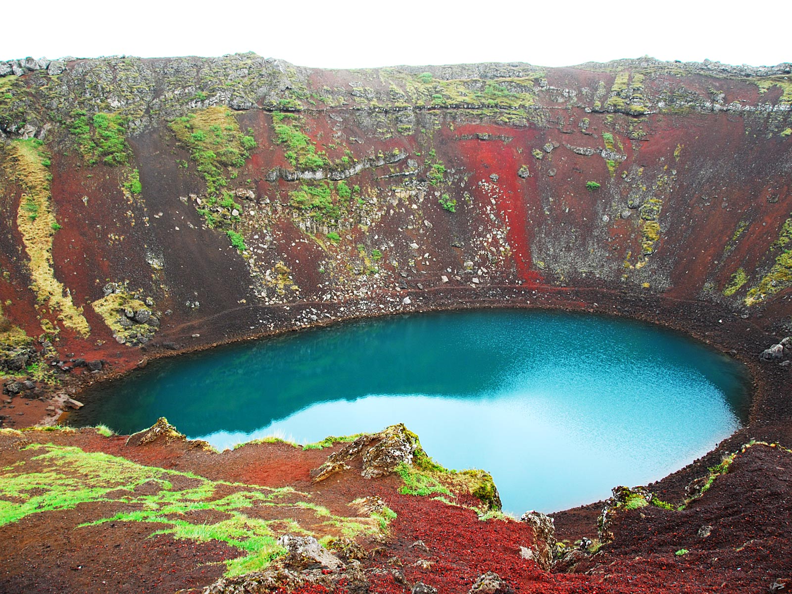
The Kerið volcanic caldera on route 35, about 15 km north of Selfoss, is about three thousand years old. This 170×270 meters elliptic crater is 55 m deep. In 1986 the well-known singer Björk held a concert on a raft in the middle of the lake. Yes, we observed fish feeding on surface insects.
|
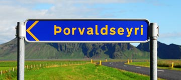
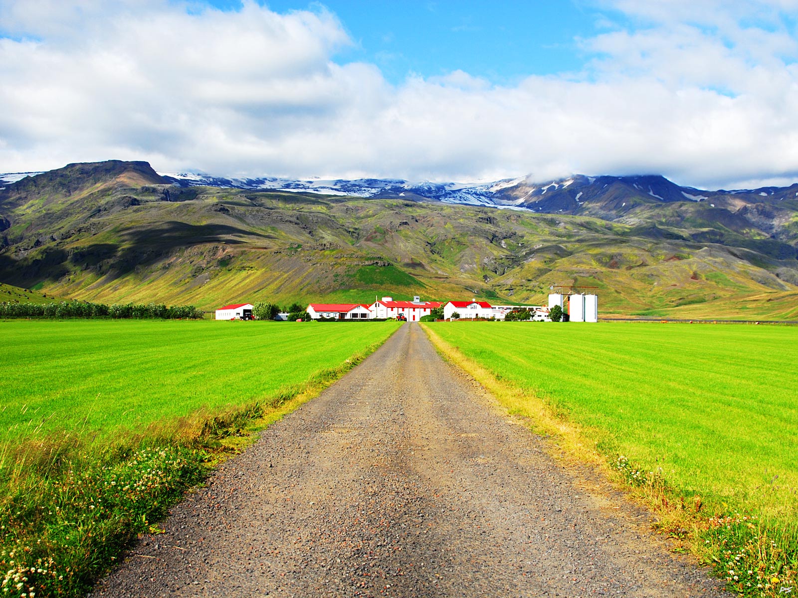
The farm Þorvaldsöyri lies close to the Ring Road immediately south of the glacier Eyjafjallajökull. |
(2010-06-02)
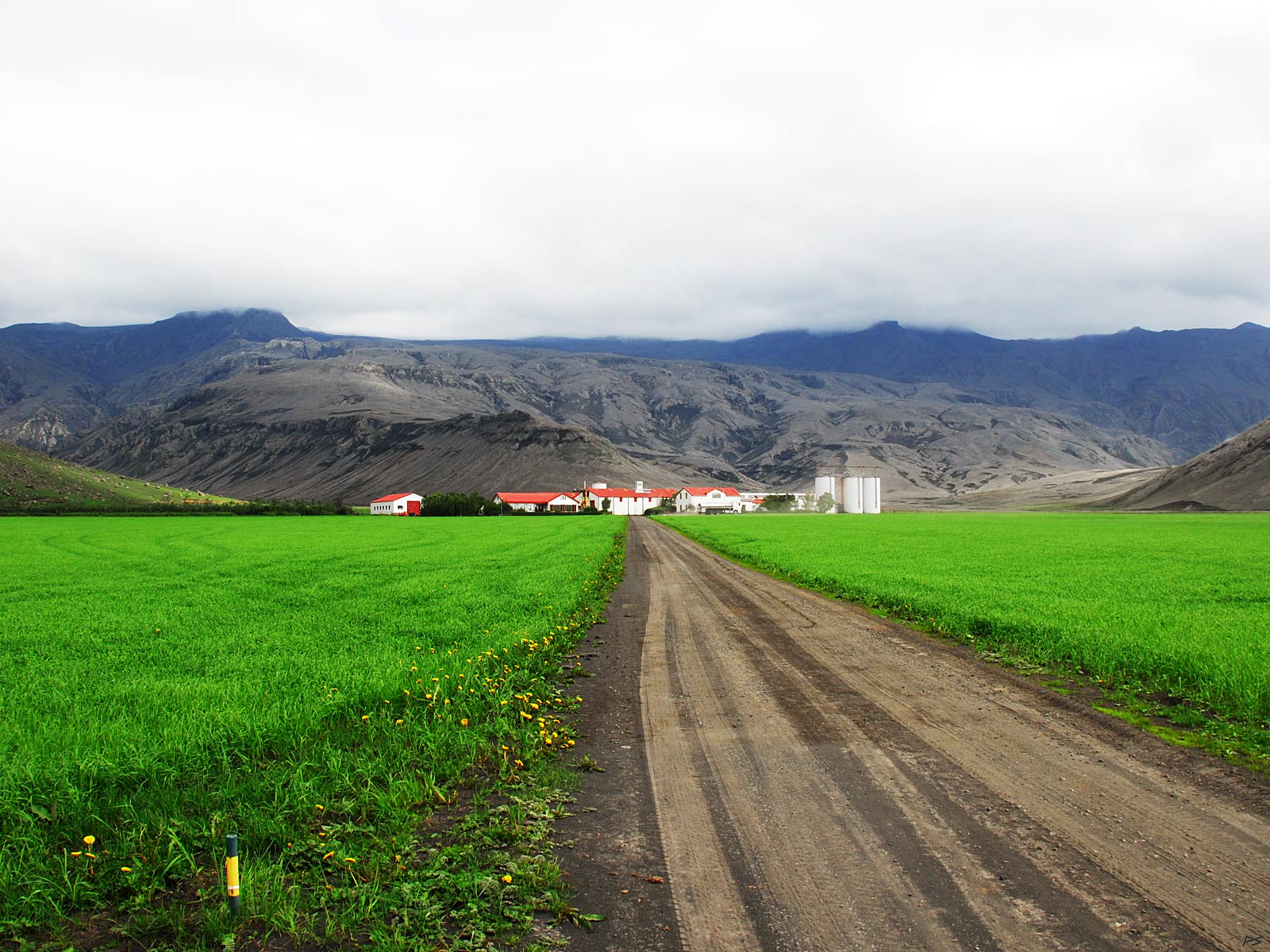
Þorvaldsöyri, early June 2010. Regrettably the glacier was hidden by the clouds when this picture was taken. This spring, between 14 April and 23 May 2010, the volcano under Eyjafjallajökull erupted (preceded by a smaller eruption at Fimmvörðuháls between Eyjafjallajökull and Mýrdalsjökull starting 20 March). Although this was a quite small eruption, the ash clouds did cause a lot of air traffic problems. Close to the volcano everything got covered with a thick layer of ashes, including these fields. Maybe because the ashes contributed extra fertilization and absorbed more heat from the sun, the grass (and the grains) grew even better than normally; this photo was taken 2 June. The road shown has been cleared of ashes, but we tried driving on a side road a bit further east. It was like driving on a thick layer of slush, the car "swimming".
(2013-08-12)
Þorvaldsöyri August 2013, and a bit more of Eyjafjallajökull shows; clouds tend to linger above glaciers. There was a television program, shown also in Norway, describing the time after the last eruption, mostly featuring Þorvaldsöyri and its charming owners. This year, reading on a pack of cakes ("lefse" actually) that we had bought in Reykjavík, we found "made with barley grown on Þorvaldsöyri". Some time after our visit in 2010 a convenient place for stopping had been prepared at the gate. Last time we gathered a sample of the ash from the ground here; this time there was a large cement bowl full of ash for the visitors.