There are many great waterfalls in this country
Waterfalls can generate electric power and that means money.
Waterfalls are tourist attractions and that also means money.
Besides
virgin nature allegedly has a value of its own.
So
there are choices to make
and battles to fight.
(2013-08-05)
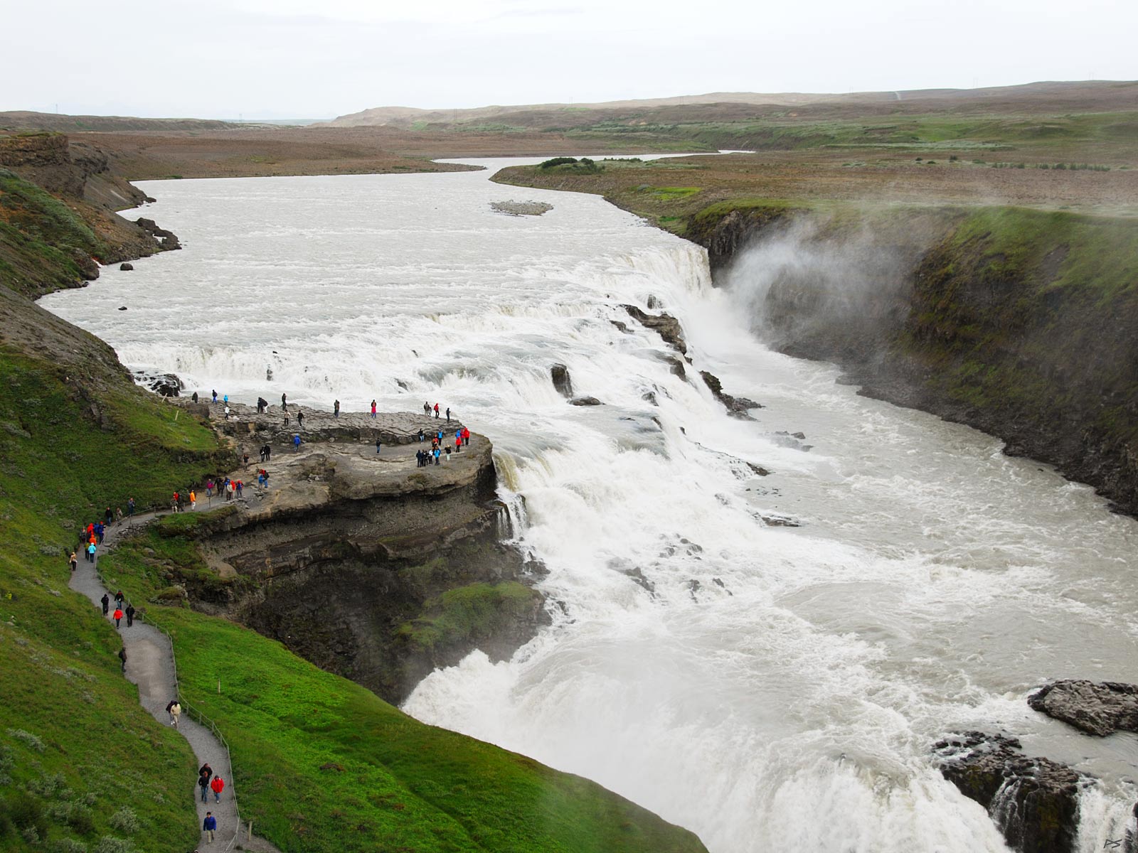
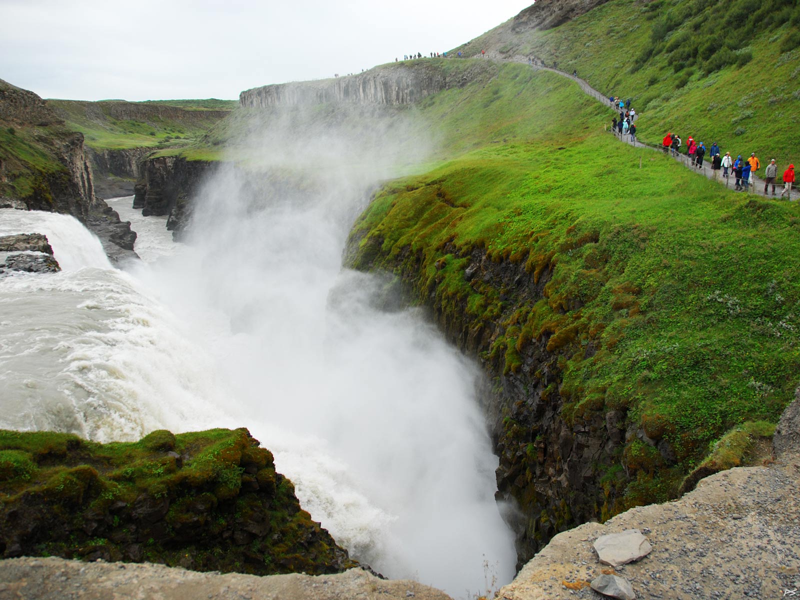
Gullfoss (=gold[en]-waterfall) in the river Hvítá (white-river) comprises two falls, the upper one 11 m, the lower one 21 m. Located in 'The Golden Circle' (tourism term) east of Reykjavik, it is the best known waterfall in the country. It's summer and melting of the glacier Langjökull (and to a smaller extent Hofsjökull) supplies a lot of water – and fine particles worn off the rock, colouring the water.
(2013-08-05)
The second fall of Gullfoss where the water thunders into the ravine. There were plans to use the water of Gullfoss to generate electricity, but by sheer luck it didn't happen. In 1975 the owner donated the land to the nation on the condition that these waterfalls should run free forever.
(2010-06-02)
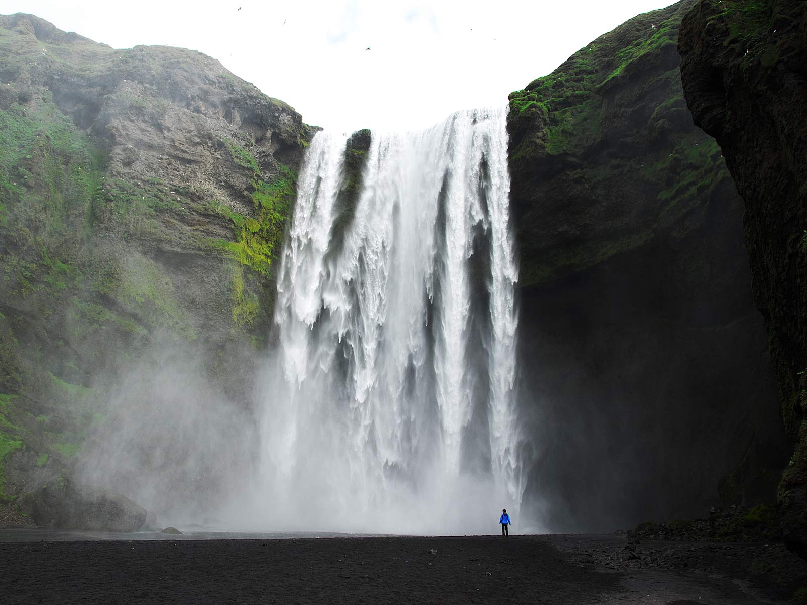
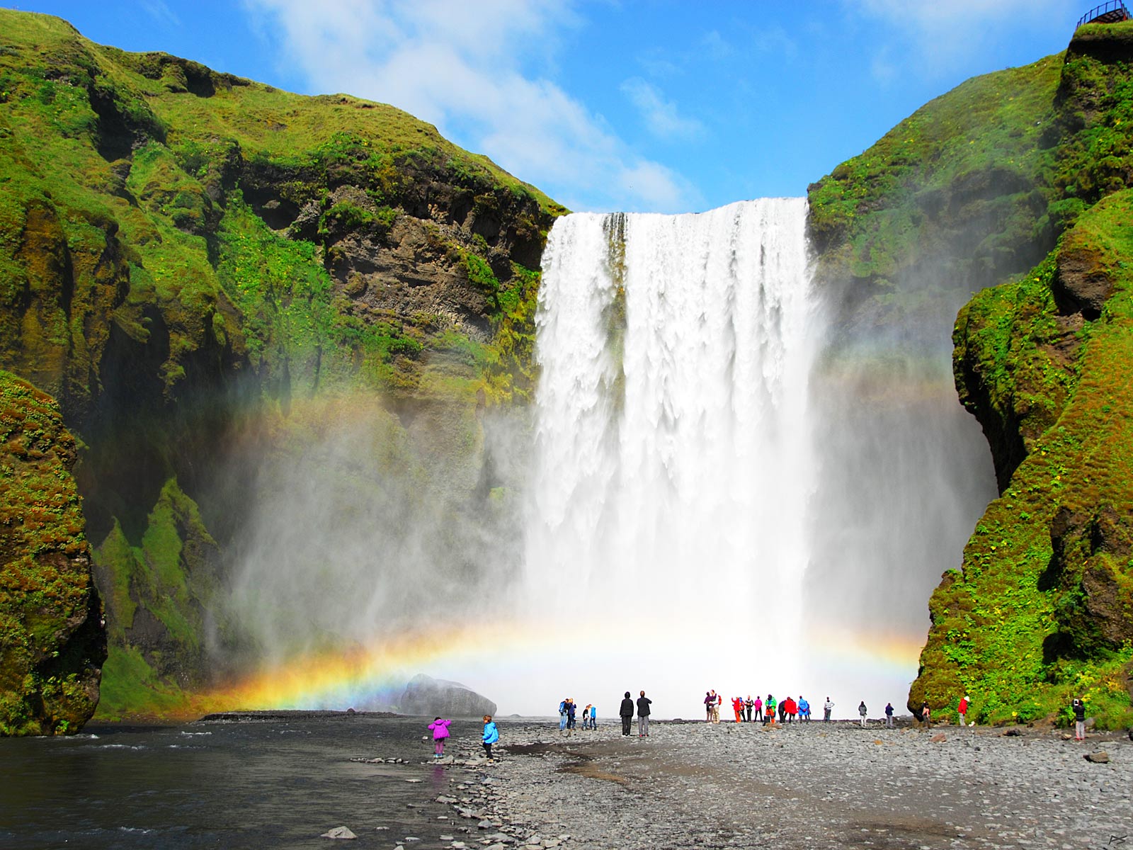
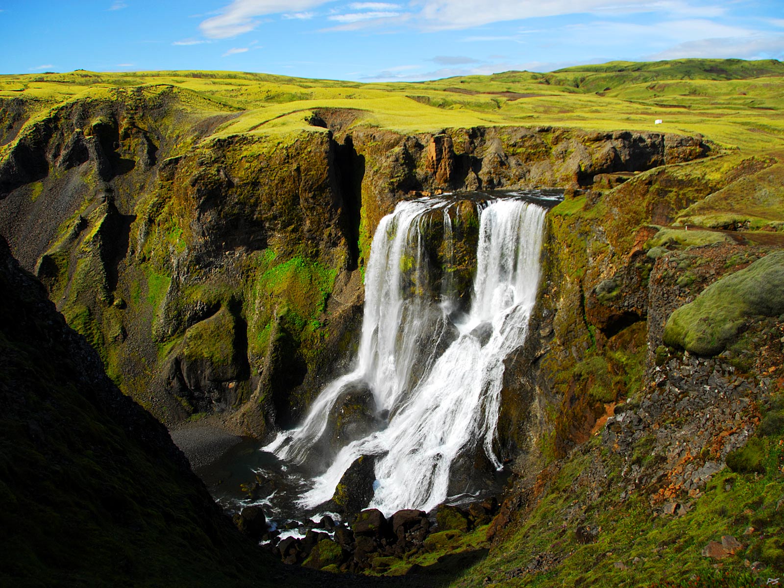
The beautiful waterfall Skógafoss is 60 meters high. It's found in Skógar immediately south of the glacier Eyjafjallajökull, the one hiding the volcano that stopped European air traffic in the spring of 2010. The water falls off a long cliff shaped by the sea when the land was depressed by the ice sheet during the last Ice Age.
(2013-08-12)
Skógafoss in summer and sunshine. The glaciers Eyjafjallajökull and Mýrdalsjökull are melting and the water volume is considerably larger than in the spring picture above.

(2013-08-12)
Seljalandsfoss drops 60 m from a former sea cliff, just like Skogafoss above. It is possible to walk behind the waterfall. The waterfall indicates a breeze from the west. It is found west of Eyjafjallajökull near the river Markarfljót, just north of the Ring Road.
(2010-06-03)
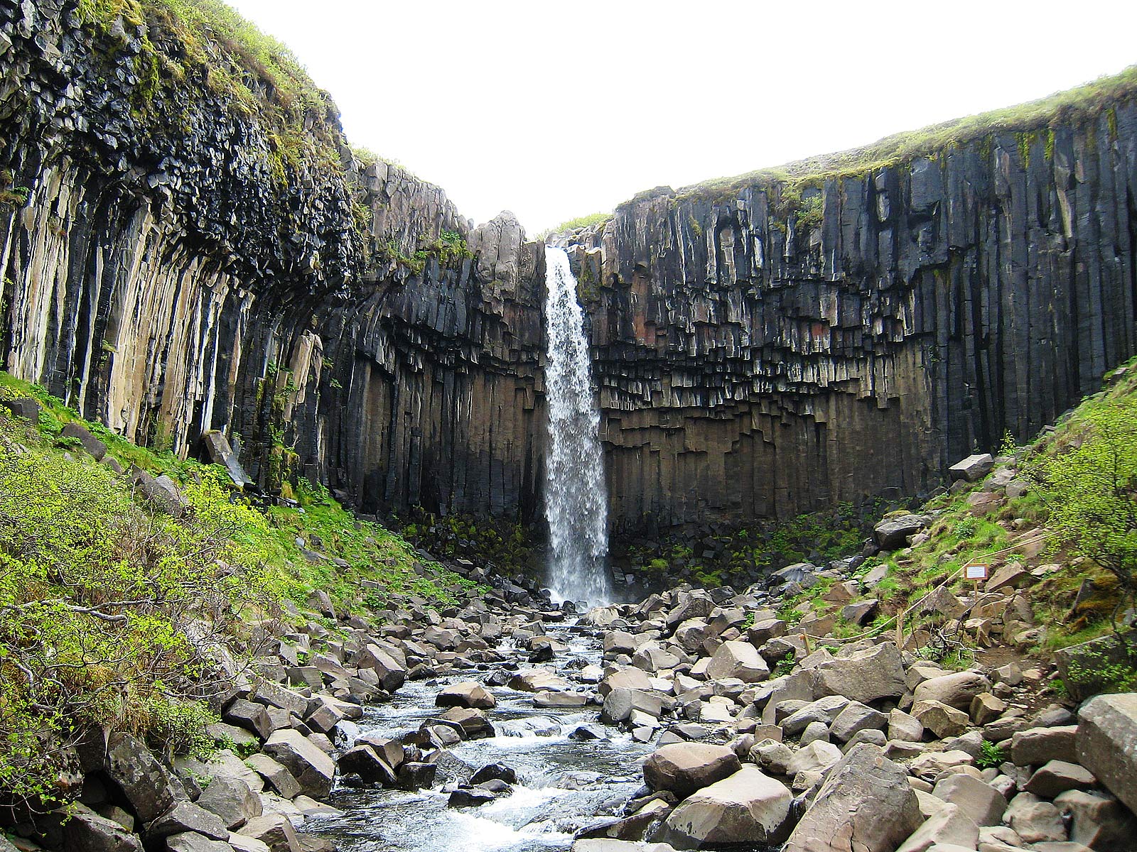
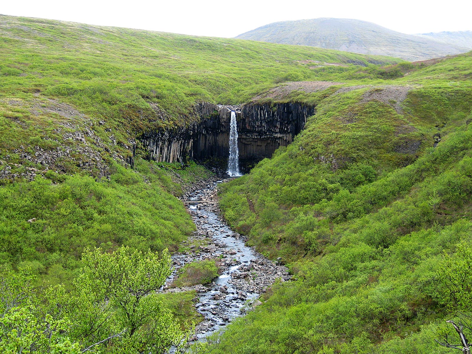
The 20 m Svartifoss (=black-waterfall) doesn't thunder, but its surround is quite peculiar: Black hexagonal basalt columns formed by crystallization of very slowly cooling lava.
(2010-06-03)
Svartifoss is situated within the great Skaftafell National Park which includes most of Europe's largest glacier Vatnajökull. The Vatnajökull branches Skaftafellsjökull and Skeiðarárjökull are close neighbors. You'll have to hike uphill to get here, the trip to the waterfall and back takes 1–1½ hours. On a fine day you'll also get a good view of the large plain Skeiðarsandur with its many rivers, and an even better view if you follow the signs to a lookout point.
(2013-08-13)
Fagrifoss (=beautiful-waterfall) is reached by the rough track F206 (the road to Laki). To get there you have to ford this and other small rivers.
(2010-06-05)
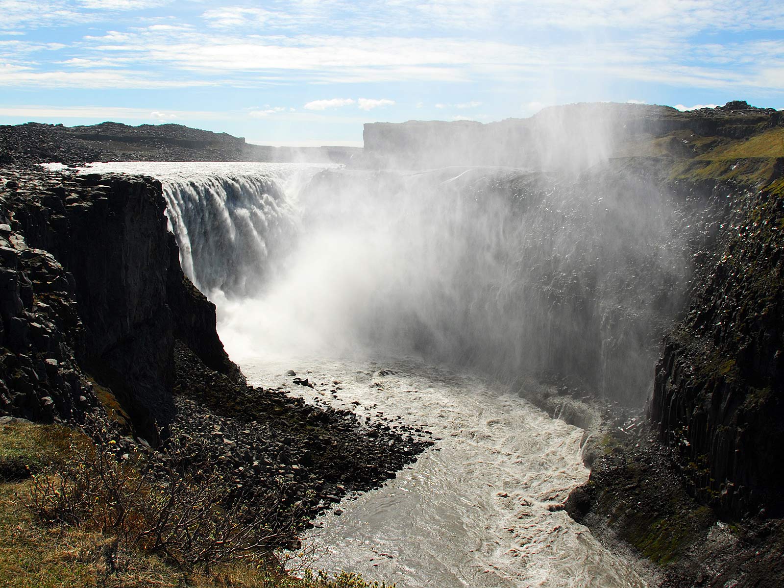
The east side of Dettifoss may be reached by driving 35 km on the often bad gravel road 864 northwest from the Ring Road east of Mývatn. The river Jökulsá á Fjöllum comes from Vatnajökull and a river (á) coming from a glacier (jökull) tends to be called Jökulsá. Fjöllum means mountains, plural and dative case. The name Dettifoss seems rather unimaginative: 'Detta' means 'fall or fall down' and foss means 'waterfall'.
From poster
Dettifoss is 45 meters high and the average flow is 193 m³/s (cubic meters per second), but the maximum flow may be some 4–500 m³/s. Using these numbers we get an average power of 85 MW (megawatts) or a maximum power of roughly 200 MW, which supposedly makes it the most powerful waterfall in Europe. (This power is of course wasted, it just heats the water by slightly more than a tenth of a centigrade.)
(2010-06-05)
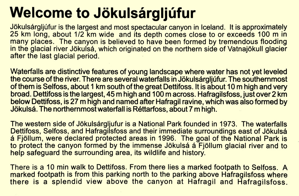
Spectators at the top of Dettifoss, east side, sensing its power.
(2013-08-08)
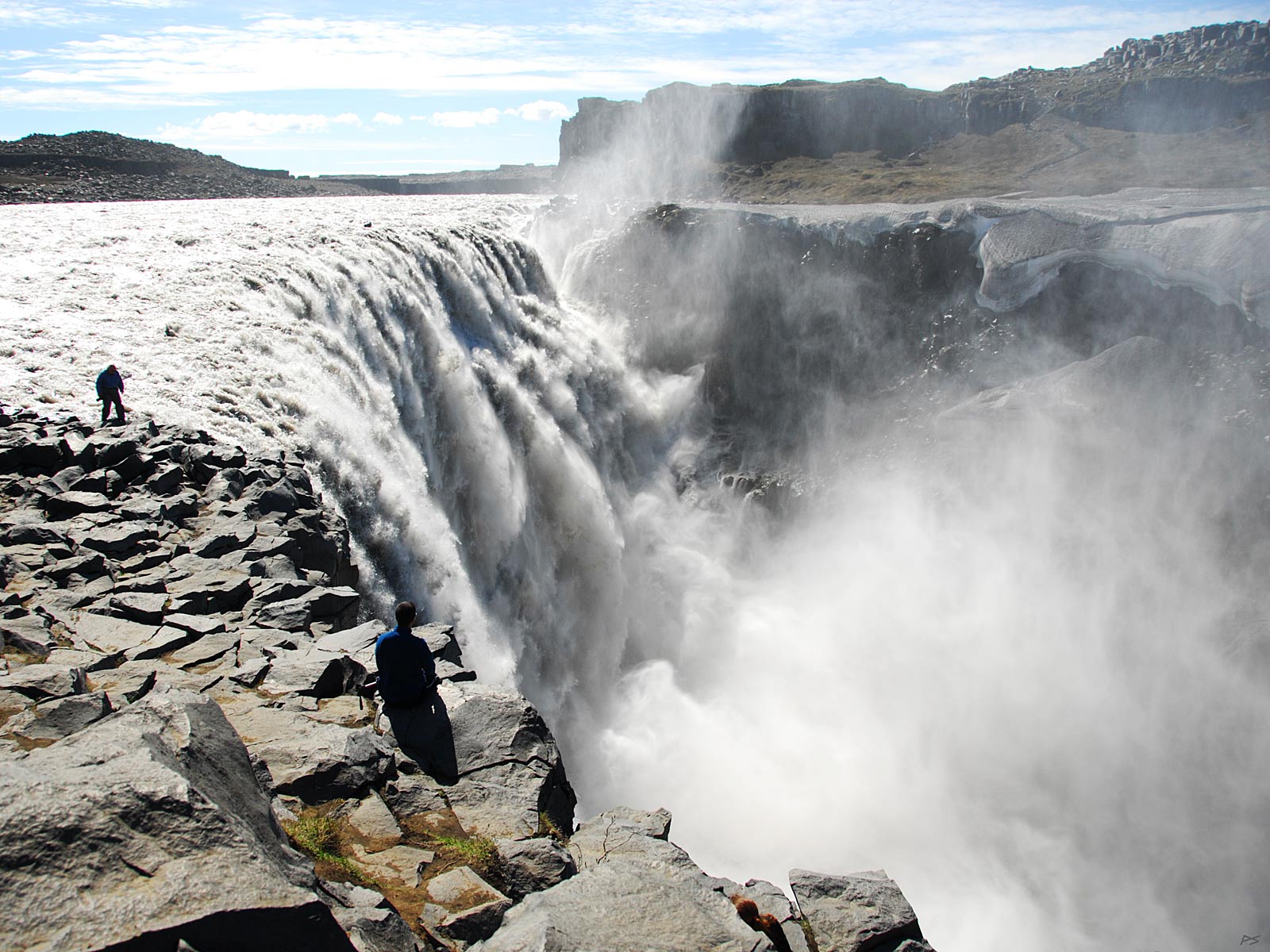
The west side of Dettifoss (and Selfoss) can be reached by driving route 862 northwards from the Ring Road. It is now paved north to Dettifoss (but further north a 4WD car is advisable). It's summer and Vatnajökull is melting, creating a more impressive waterfall.
(2010-06-05)
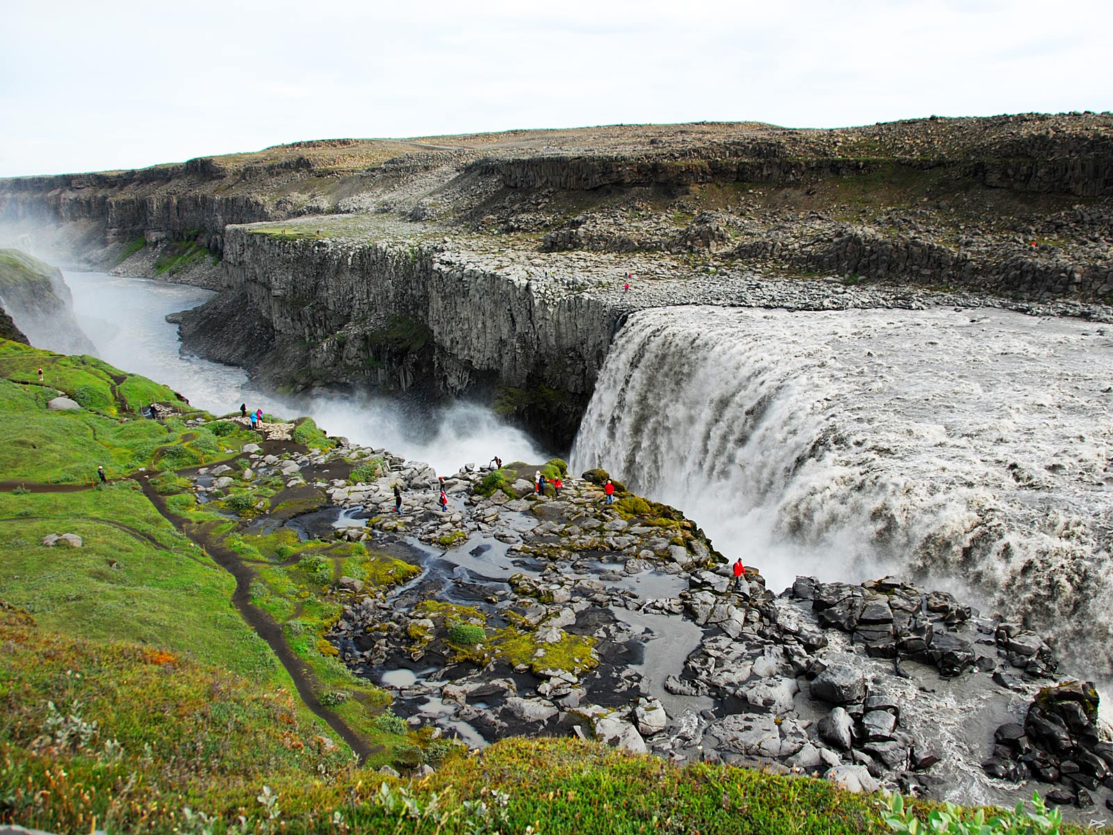
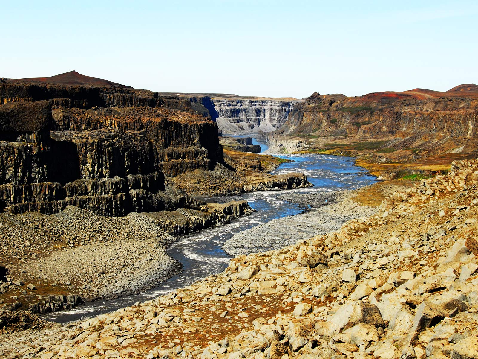
Looking downstream a part of Jökulsárgljútur immediately north of Dettifoss, the start of a 25 kilometres long ravine. (Please note that it's still springtime on North Iceland.)
(2010-06-05)
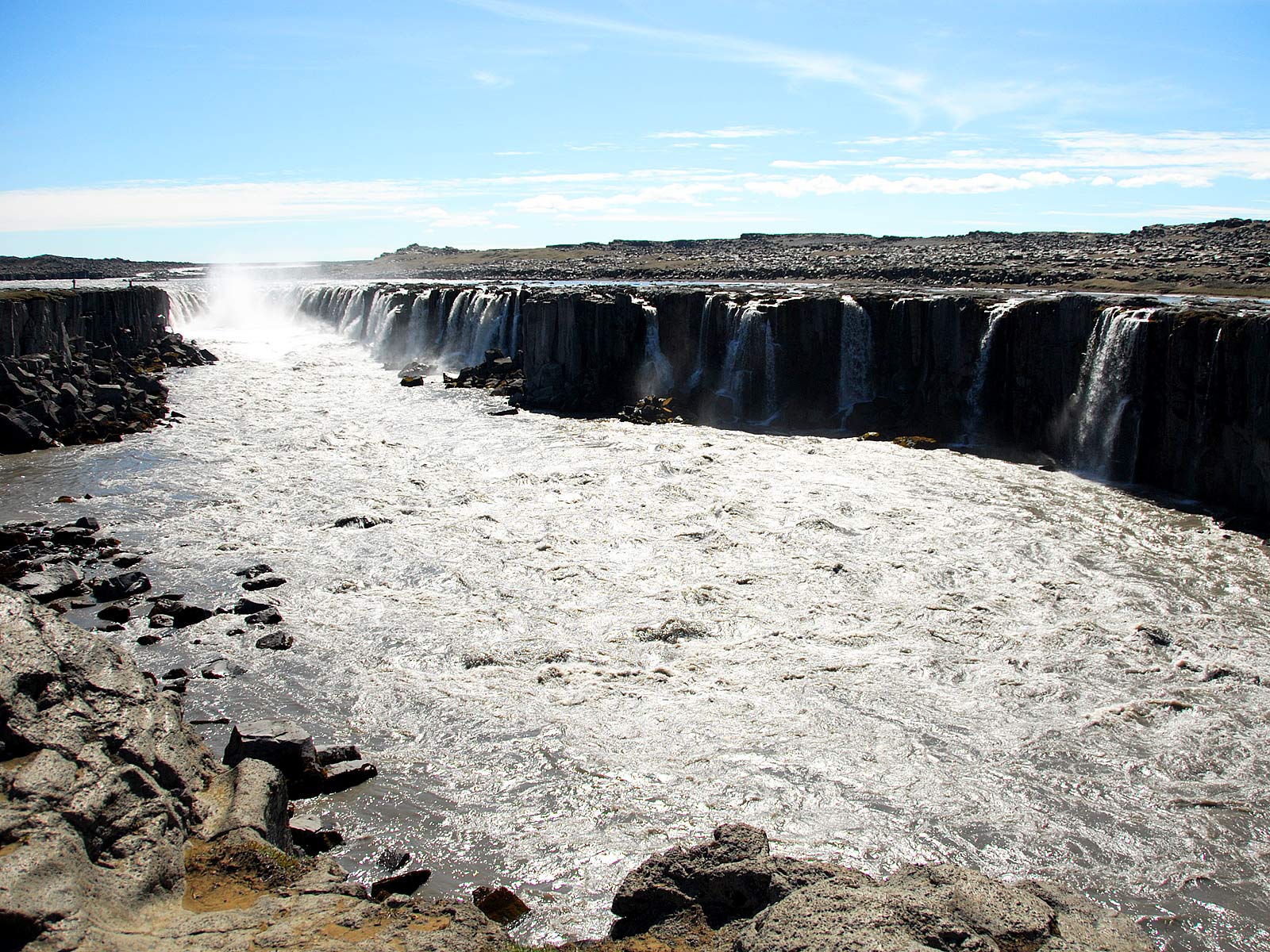
From the east side of Dettifoss you may continue on foot along a very rough 1.4 km trail upstream to Selfoss. This waterfall is only 11 meters high, but because of its total width it may look even more spectacular than Dettifoss. (Unlike the other Selfoss at the south coast, the present name has nothing to do with the marine mammal seal. Instead it is derived from the name of an abandoned farm, Holssel, 'sel' meaning mountain (summer) dairy.)
(2013-08-08)
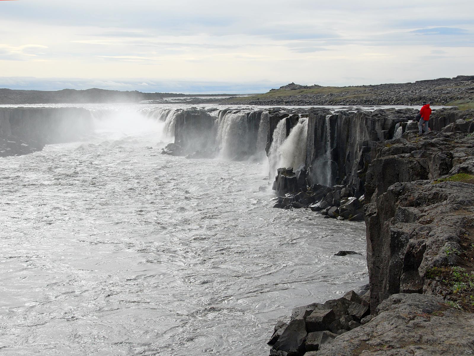
Selfoss seen from the west bank. There is a track forking off from the one to Dettifoss, shorter and less rough than the one on the east side.
(2010-06-07)
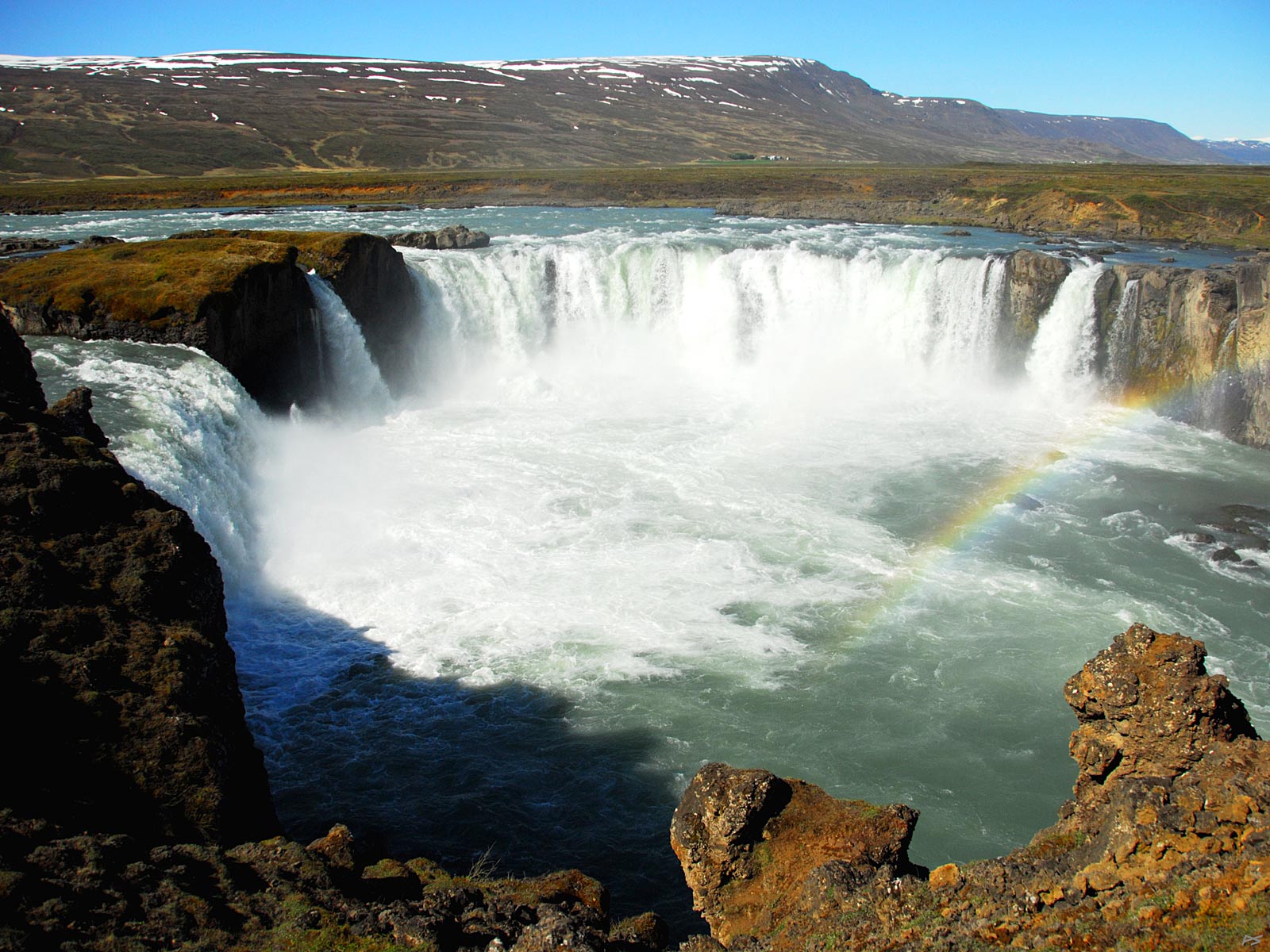
Goðafoss (waterfall-of-the-gods) in the river Skjálfandafljót falls 12 meters. Here it's seen from the east bank. It is situated at the Ring Road roughly midway between Mývatn and Akureyri. On the annual Alþingi (parliament) in Þingvellir the summer of 1000, lögmaður (lawspeaker) Þorgeir Ljósvetningagoði obtained a resolution that made Iceland Christian. After returning home he threw his figures of the Norse gods into this waterfall, and this is the origin of its name.
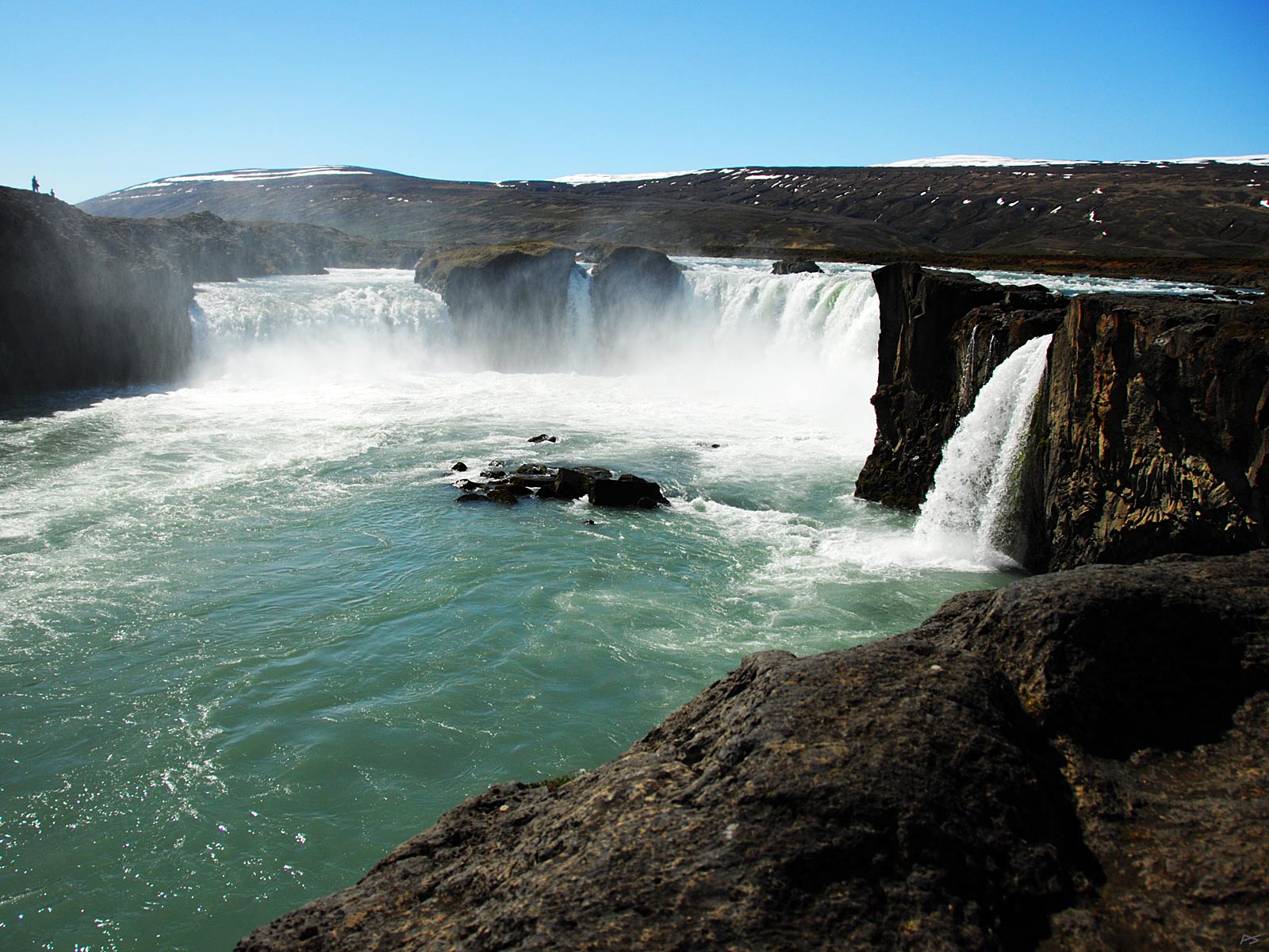
(2010-06-07)
Goðafoss seen from the west bank.
(2010-06-08)
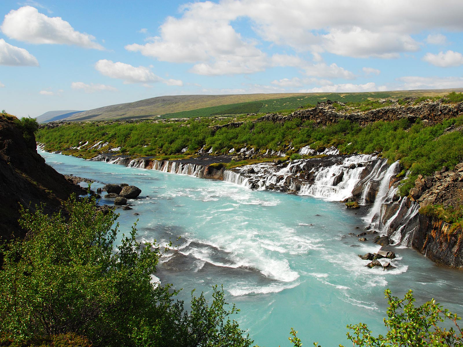
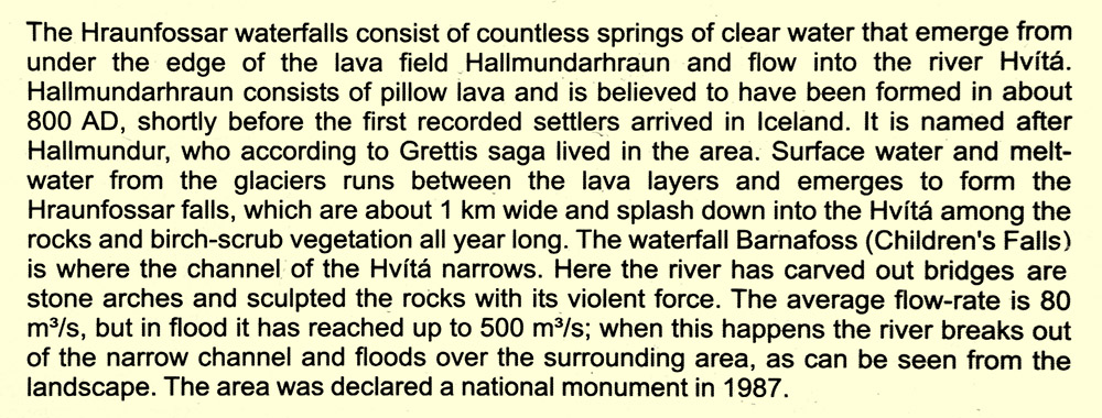
Hraunfossarar (=lava-waterfall), a series of waterfalls emerging from under the lava of Hallmundarhraun. It's situated in West Iceland, east of Reykholt.
From poster
(2010-06-08)
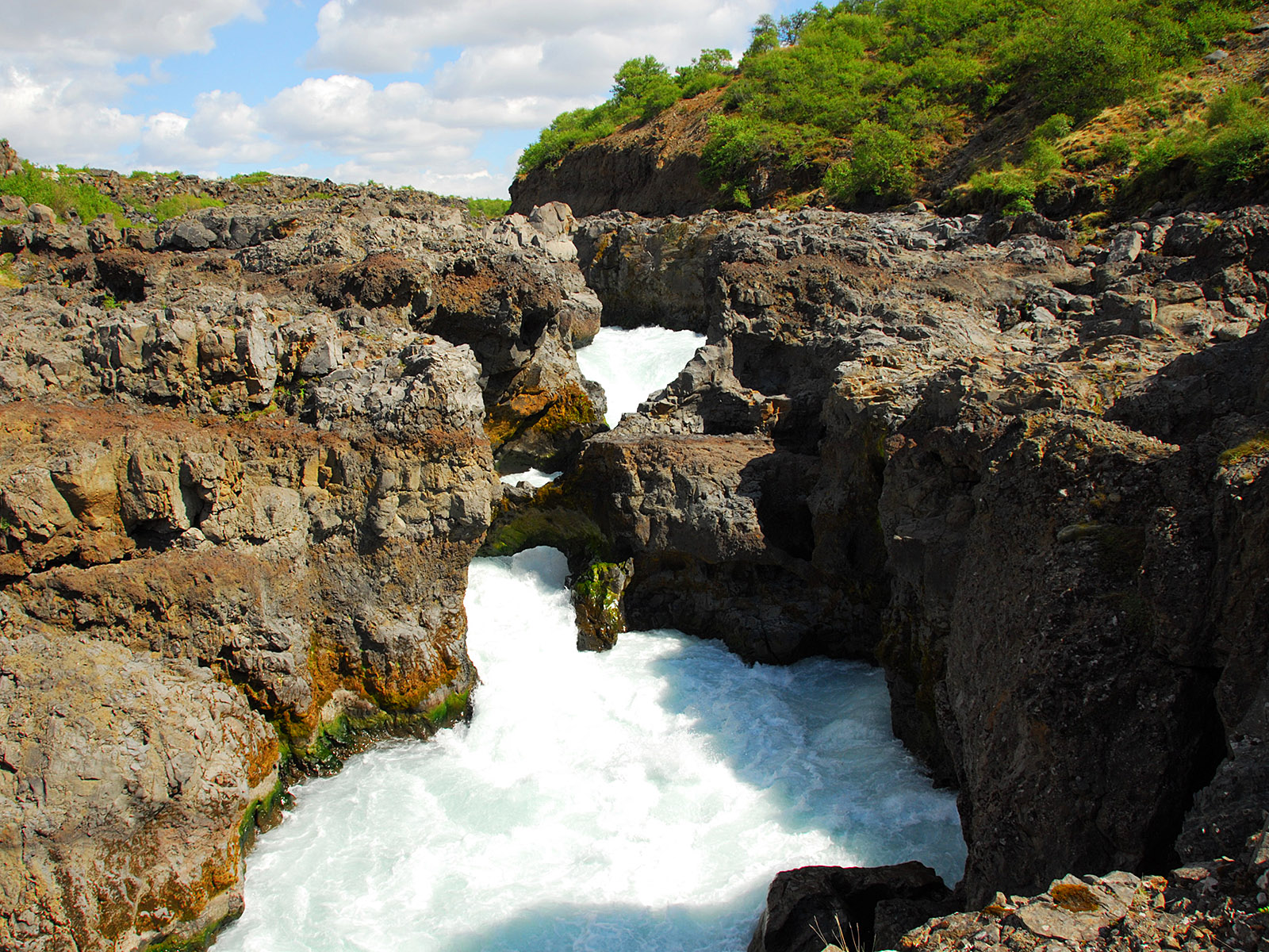
Barnafoss, just upstream from Hraunfossar.
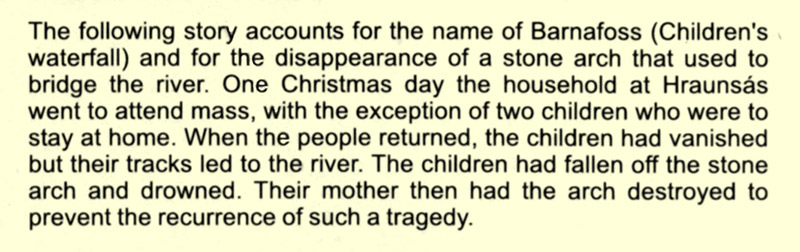
From poster