Reynisfjara with basalt columns
and
Dyrhólaey, the southmost end of Iceland
equipped with "doors"
(2013-08-12)
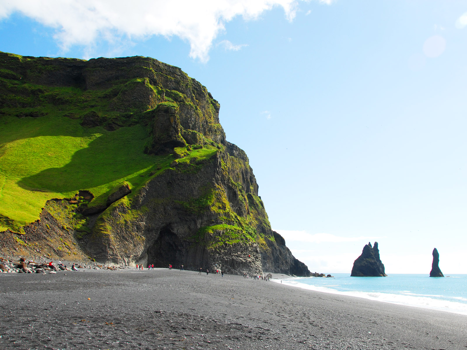
This is Reynisfjara (fjara=beach). It is reached from Vík by going west on the Ring Road and turning on to a side road on the other side of Reynisfjall. The rock here is littered with caves where puffins are nesting, but they leave in the middle of August. Reynisdrangar [plural] are seen from the west side.
(2013-08-12)
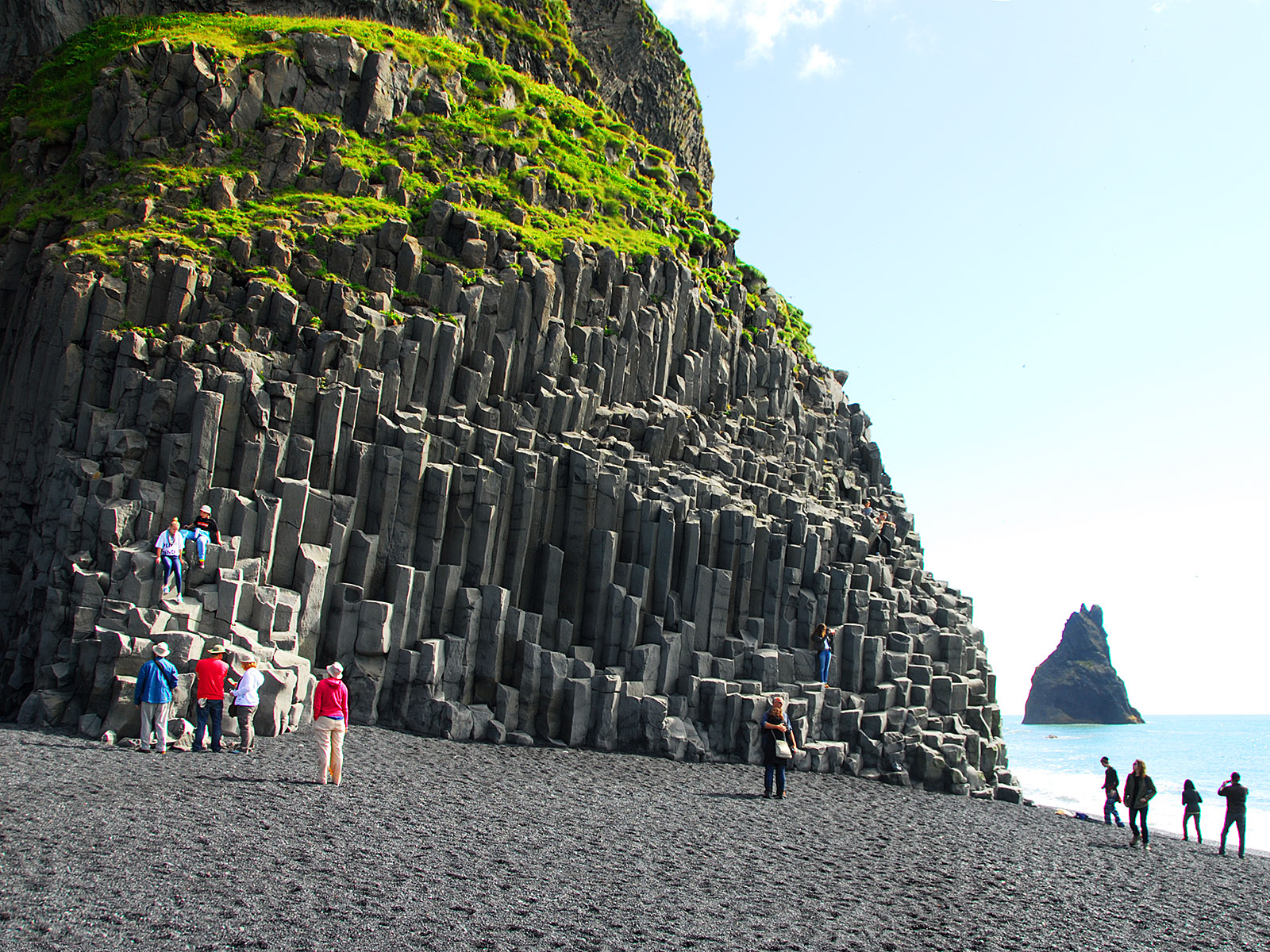
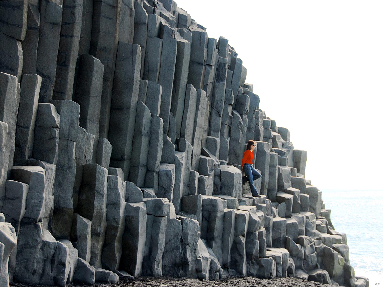
Most striking in Reynisfjara are these basalt columns. They are often littered with tourists.
(2013-08-12)
Going even closer to the basalt columns.
(2013-08-12)
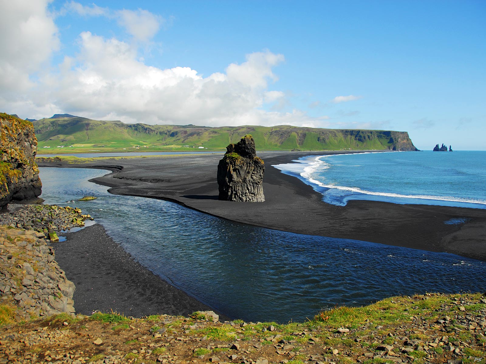
Less than three kilometres west of the basalt columns of Reynisfjara lies Dyrhólaey (=door-hill-island). You have to drive back to the Ring Road to get here from Reynisfjara. This is the view towards east from Dyrhólaey. Closest to the camera is the tidal river from the lagoon that separates Dyrhólaey from Reynisfjara.
(2013-08-12)
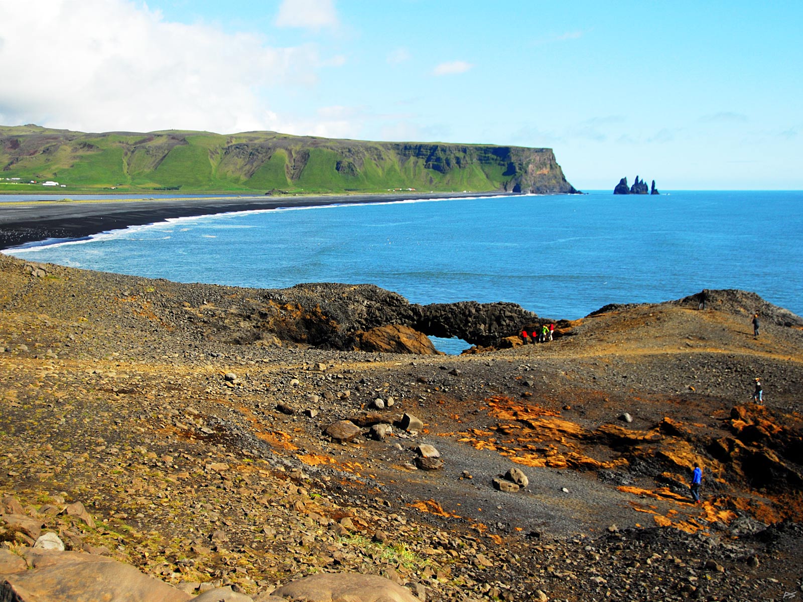
Another view towards east, showing another weird rock formation. All this was created by a submarine eruption some 80 thousand years ago.
(2013-08-12)
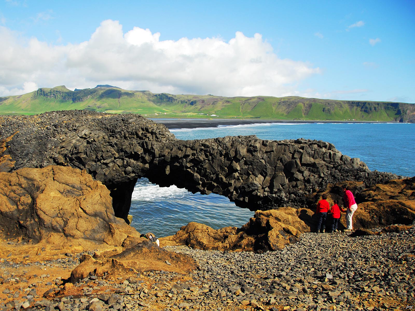
A closer look at the rock formation above.
(2013-08-12)
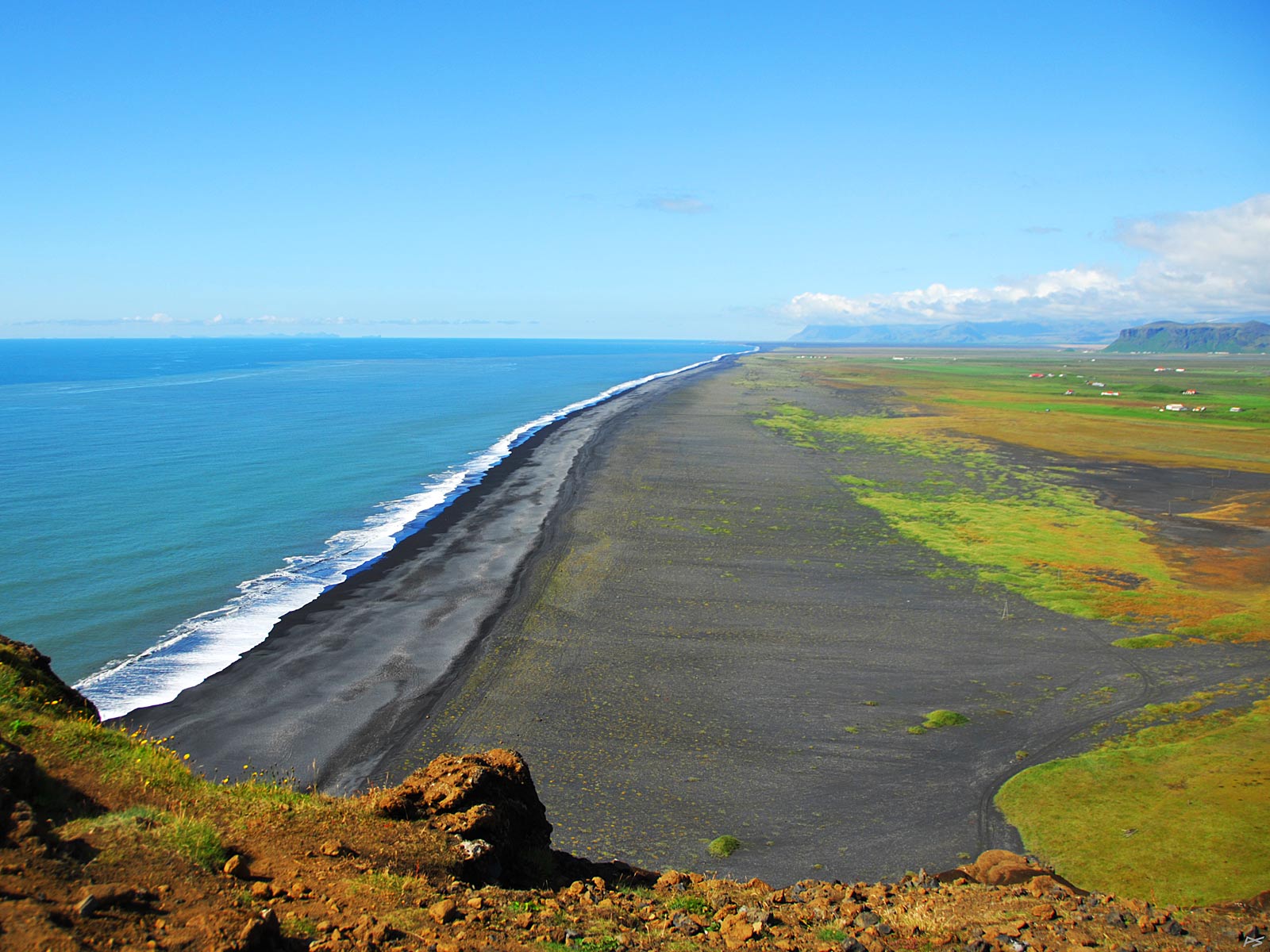
Looking west towards the south end of Dyrhólaey.
(2013-08-12)
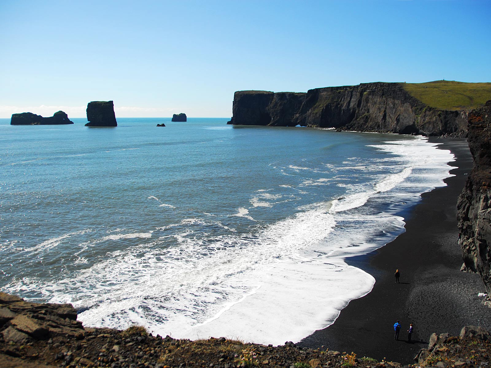
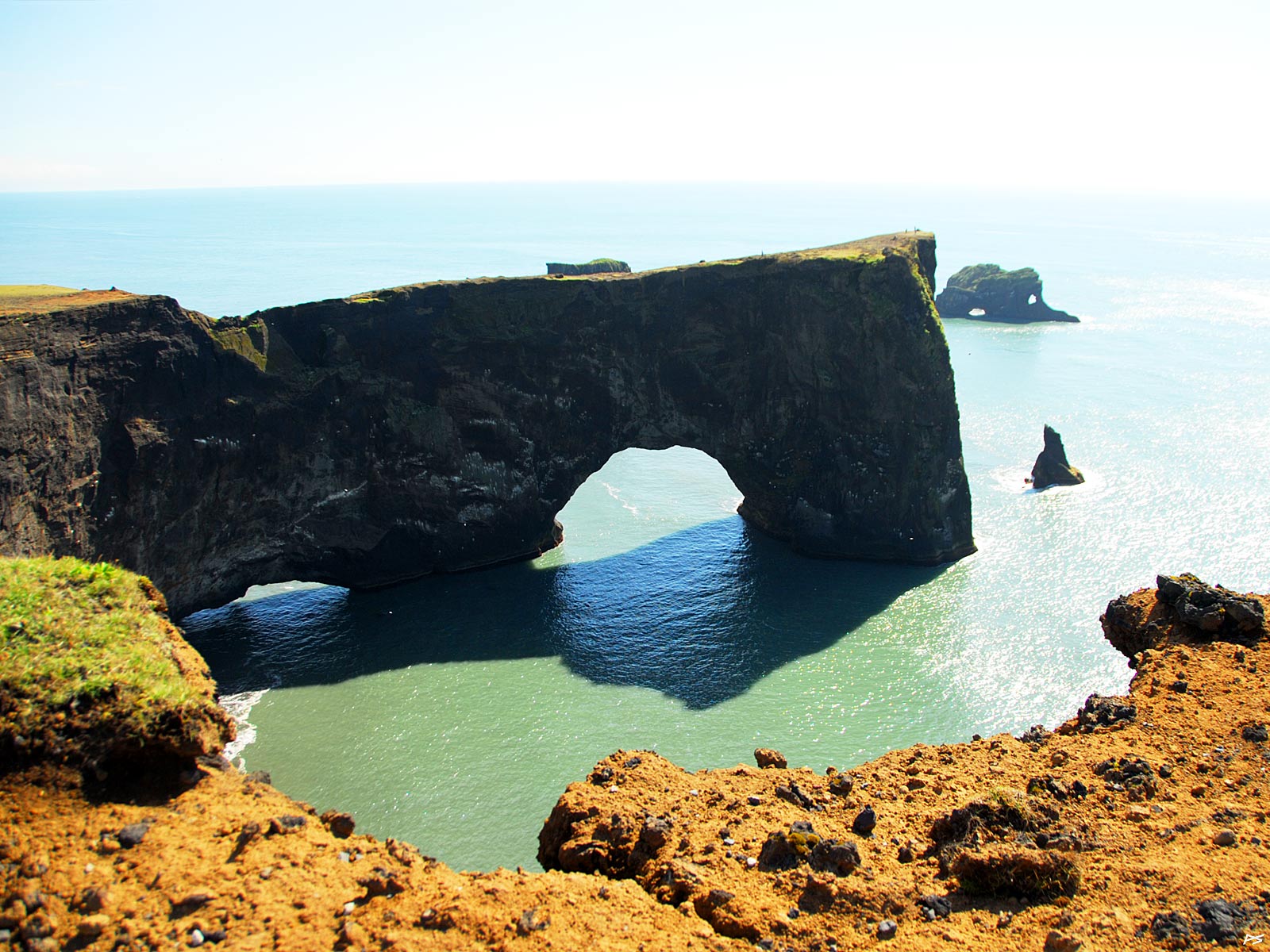
View towards east from the west part of Dyrhólaey (=door-hill-island), showing some of the "doors".
(2013-08-12)
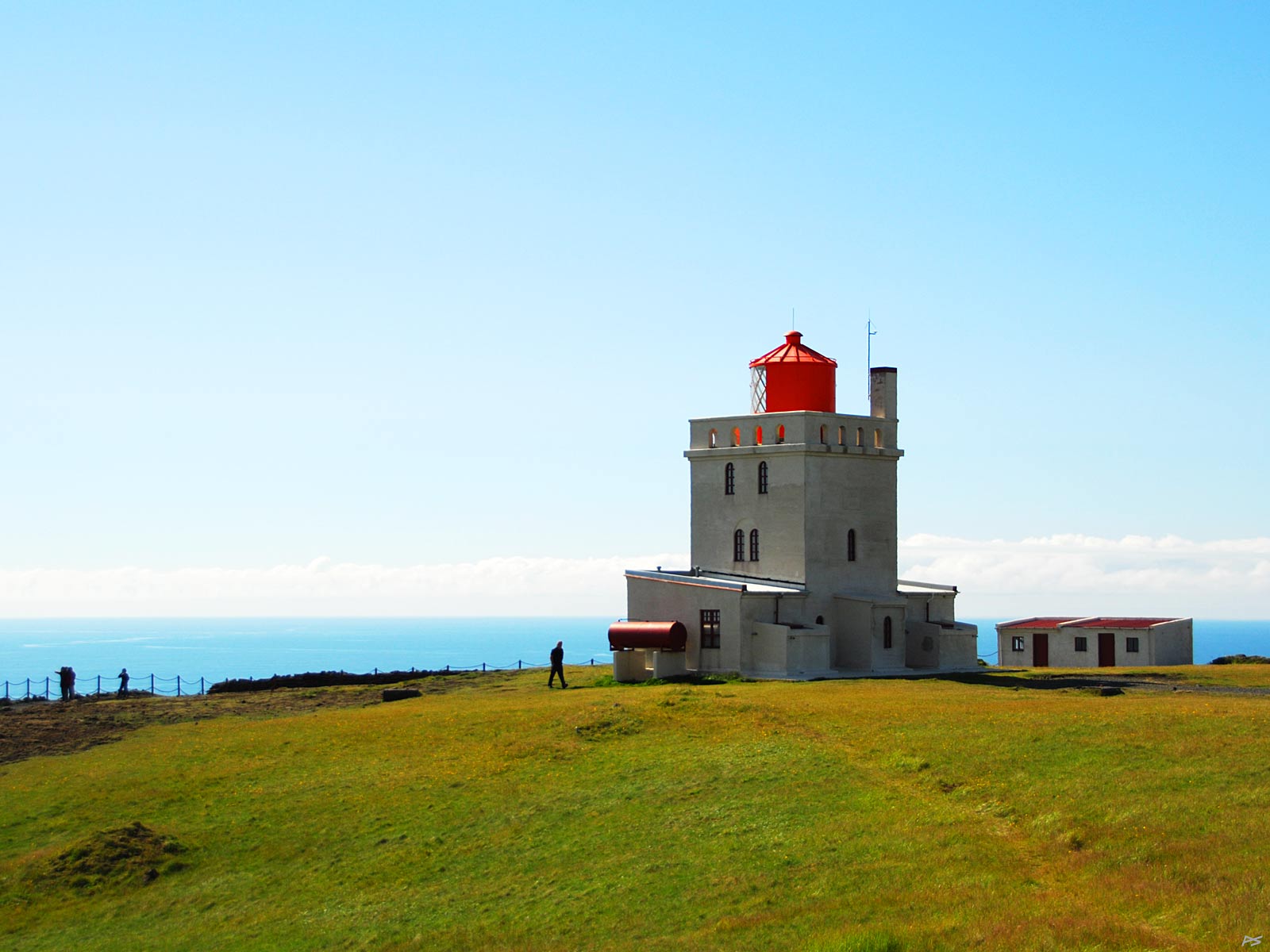
The lighthouse on Dyrhólaey, the southmost point of Iceland mainland. Because of the nesting birds (like puffins), traffic here is restricted between 1 May and 25 June.
(2013-08-12)
View towards west from the west end of Dyrhólaey. Out there in the ocean, 55 km off (left), the volcanic island group Vestmannaeyjar may be spotted below its accompanying clouds.
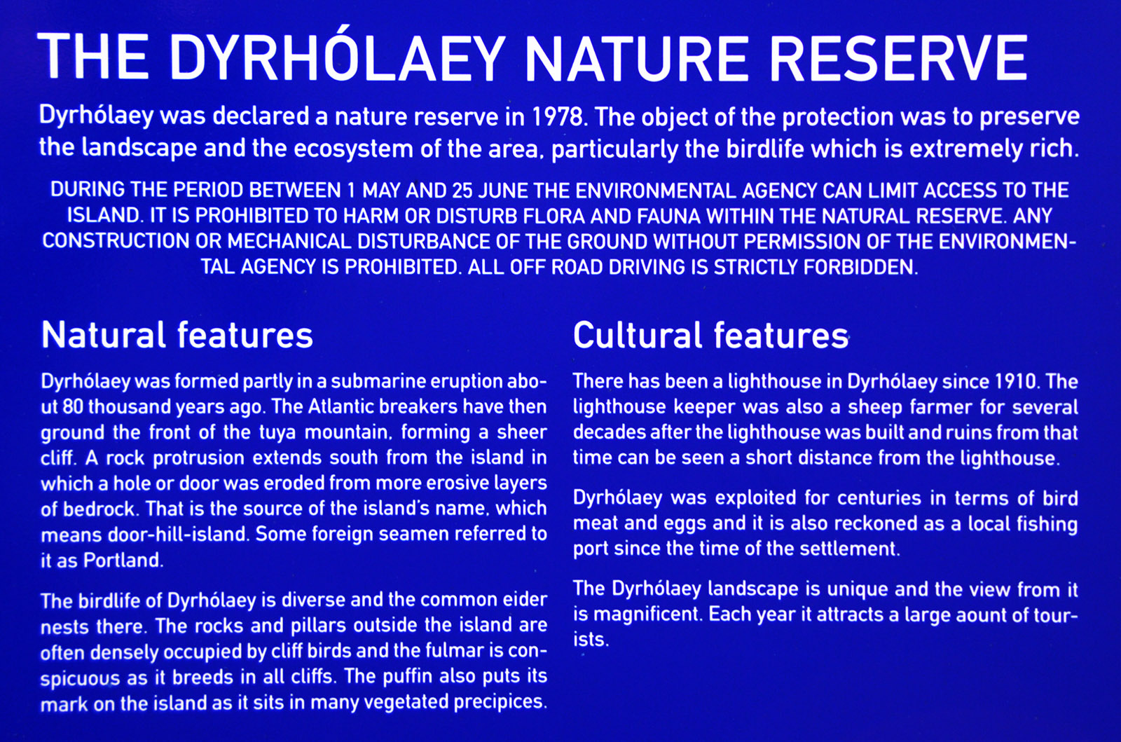
From poster