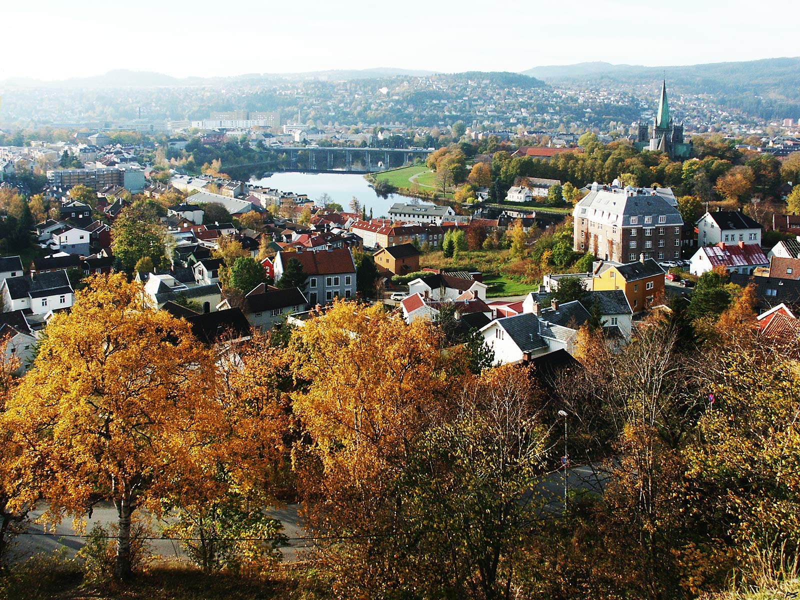
– the old town
King Olaf Tryggvason is claimed to have founded the town in the year 997 on the delta where the river Nið winds its way into the fjord. 29 July 1030 the Christian King Olaf Haraldson, fighting an army worshiping Odin and Thor, fell in the Battle of Stiklestad, and the body was brought to the town. The year after he was declared holy and from then on until the Lutheran Reformation in 1537, pilgrims came from Catholic Europe to the grave and the Cathedral that was built upon it. The town was then known as Niðaróss, "Nið's Mouth". During the 1300s the name changed to Trondhiem – home of the þrœndr (meaning strong or prolific) folk, now trønder – and at some time Nið got the 'river' suffix and became Nidelva (or Nidelven in Danish-Norwegian lingo). After an interlude 1930–31 with the name 'Nidaros', the town's name has been Trondheim as decided by the country's elected parliament (Stortinget). Now the population of the municipality is above 207,000 (2021). This includes some rural areas around the town, but only some of the 40,000 students.
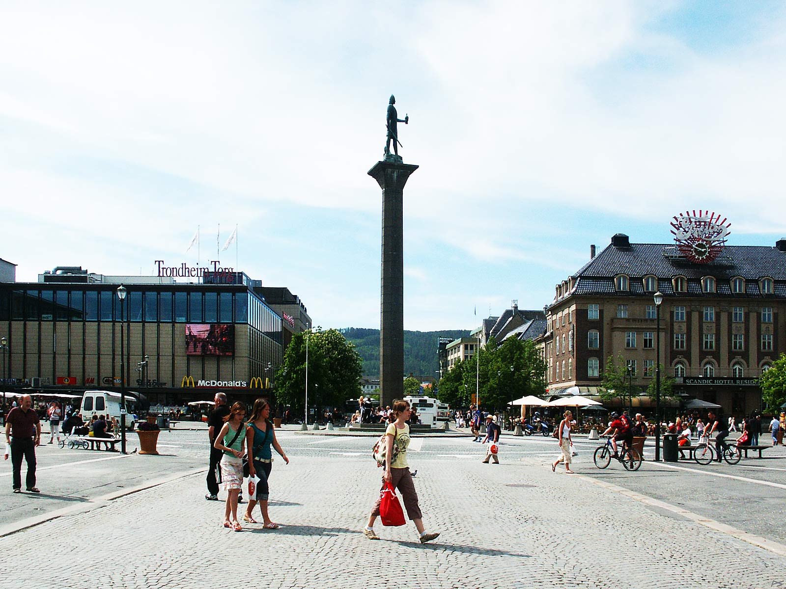
The town square, not too crowded that day. King Olaf Tryggvason (lifespan 968–1000) founded the town in the year 997 and he is still there on the top of the granite pillar. The statue was made by Wilhelm Rasmussen (1879–1965) and unveiled in 1921. The height from the ground to the top of the helmet is 18 metres. On the ground the tiling forms a large sundial. This page shows an even more grandiose work by this artist. Lately the square has been totally revamped, which includes removing all motorized traffic, but a picture taken today would look almost the same.
(2006-06-12)
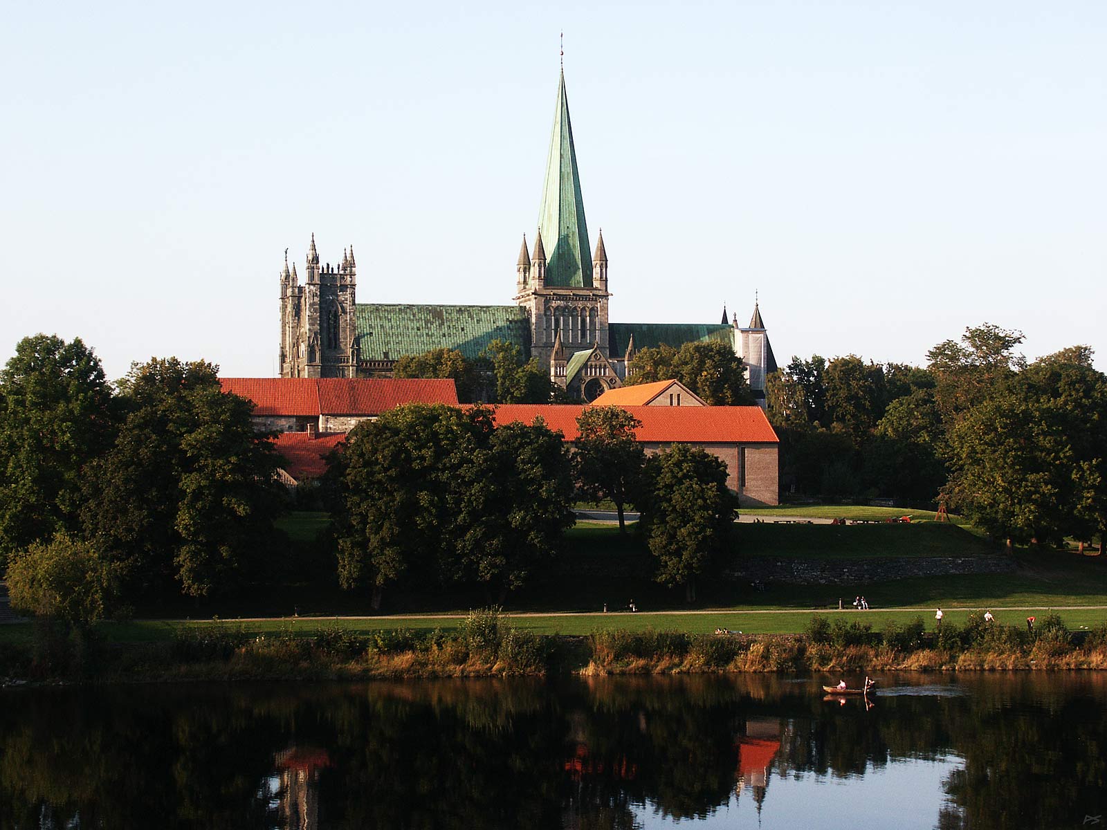
The Nidaros Cathedral, behind the old (partly 1160s) Archbishop's Palace, on the north side of the river Nidelva.
King Olaf Haraldson (lifespan 995–1030) wanted to christen Norway and he succeeded – after his death. He fell on the battle of Stiklestad in 1030 and his body was brought to the place where the cathedral now stands. The next year he was declared holy and his name in history has since been King Olaf the Holy or St.Olaf. In the beginning there was only a small wooden chapel above his grave, but during the years 1070–90 it was replaced by a stone church. Pilgrims from all over Europe came to his grave, an important reason for continuing building on the church. In 1153 Norway became a separate church province and the cathedral, then sometimes called "Cor Norvegiae" ("Heart of Norway"), became its centre. During the centuries the cathedral has been destroyed by fire several times, but always rebuilt. The Lutheran Reformation in 1537 to some extent changed that. However, by 1869 the growing nationalism had spurred restoring the cathedral to its former glory, which took more than a century.
(2006-09-14)

Pilgrimages on foot to the Nidaros Cathedral (and other sacred places) have been resumed in recent years. There are a handful of routes, all through natural surrounds, avoiding roads with motor traffic when possible. You may hike the whole route (e.g. Oslo–Trondheim) or part of it, enjoying your company or using the silence for contemplations. A warning though, don't try this on your own, you won't get far before you get lost.
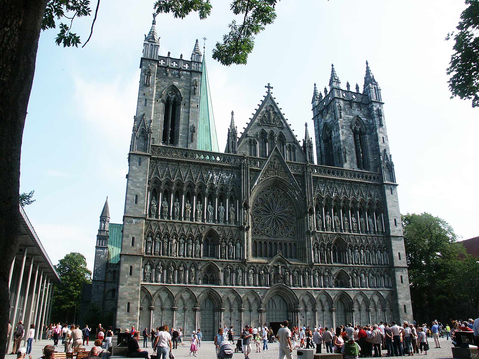
Nidaros Cathedral, the West Wall. There has been some discussion about removing the steeple, which is out of style, but don't mention that to any of the aborigines.
(2006-08-11)
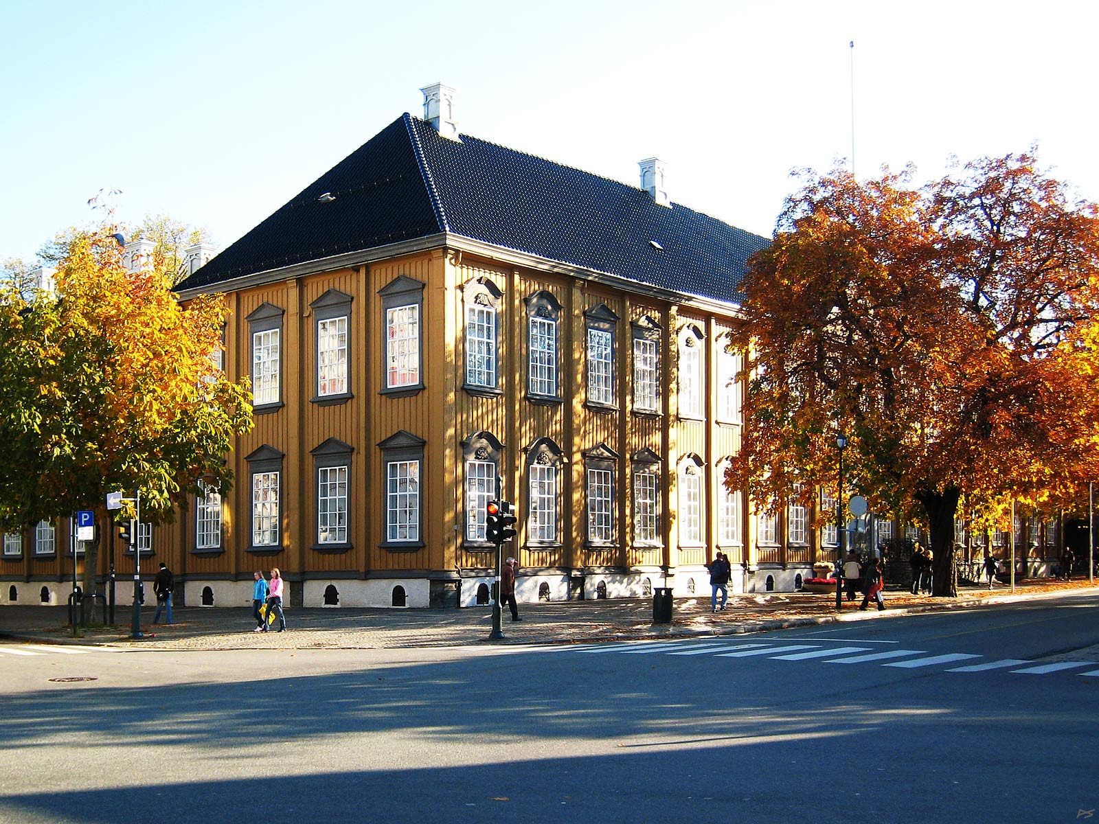
Stiftsgården, a large wooden building, was built in 1774–78. It became Government property in 1800 and since 1906 it has been solely the Royal residence. The King and his family do visit Trondheim sometimes.
(2007-10-05)
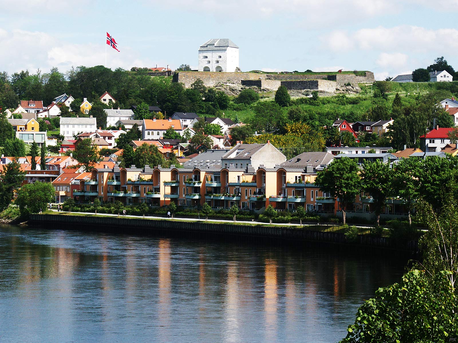
View from Elgeseter Bridge: Nidelva and Kristiansten Fortress on top of the hill. The fortress was built as a defence against the Swedes, see caption of next picture. On this day they have hoisted the big flag because the royal family is in town celebrating the centennial of the crowning in the Nidaros Cathedral of King Haakon VII, the first Norwegian monarch in modern times.
(2006-06-22)
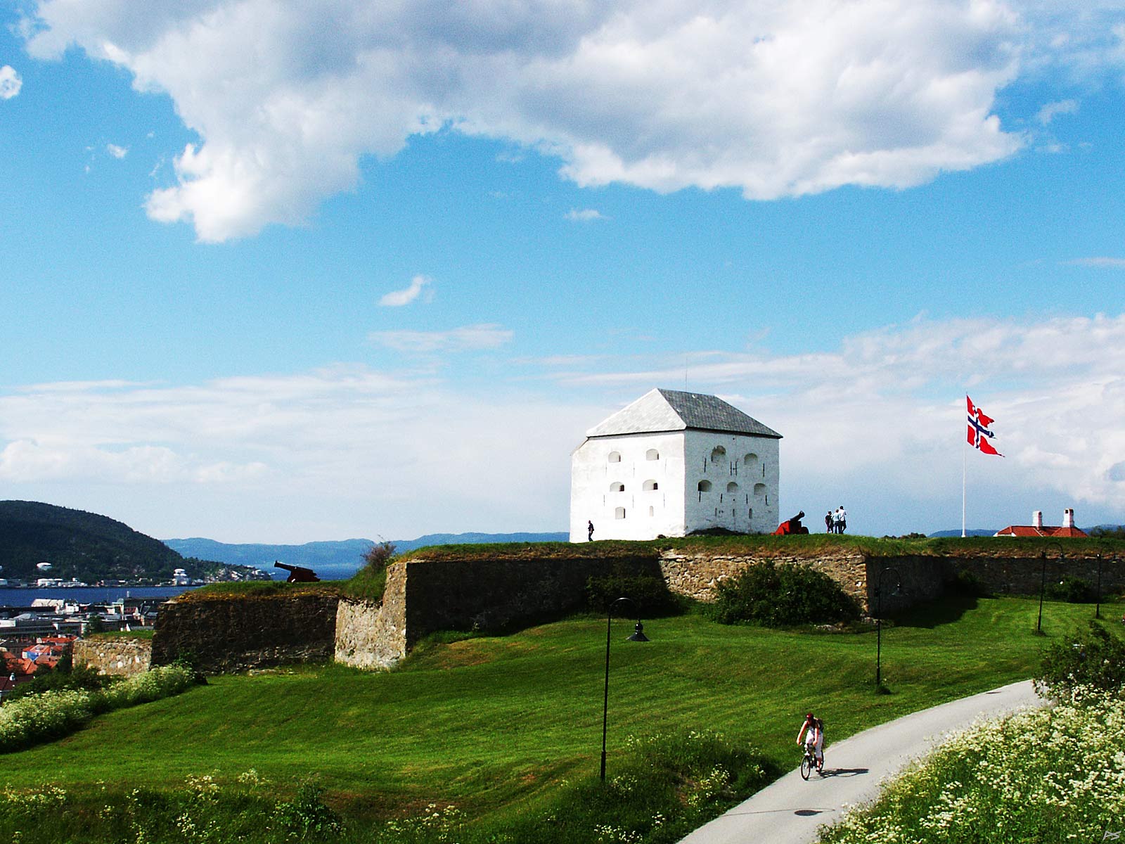
The Kristiansten Fortress was built in the years 1682–84 and was in combat in the autumn of 1718.
During the Great Nordic War (1700–1721), in 1718, the Swedish King Karl XII decided to conquer Norway. The King led an army towards the south part of the country (Oslo) and he order General Armfeldt to conquer Trondheim. Armfeldt set off with seven thousand soldiers, but they got into trouble. The heavy equipment needed to take a fortress got stuck in the wetlands and they couldn't get enough food, a problem that persisted throughout the operation. They arrived late in the autumn of 1718 and was met by nearly seven thousand Norwegian soldiers. About a thousand soldiers were stationed on Kristiansten, four hundred on the Munkholmen Fortress, and the rest in the town. The Swedes suffered from hunger and illnesses, which finally reduced the army to six thousand. They were unable to conquer the town, and when they much delayed got the news that the King had been killed 30th of November, General Armfeldt decided to retreated to Sweden. On the twelfth of January 1719 they had reached the border mountains. Dressed in worn summer uniforms and without skis they met a snowstorm and extreme cold. Three thousand soldiers froze to death, many died shortly after and many became invalids.
(2006-06-22)
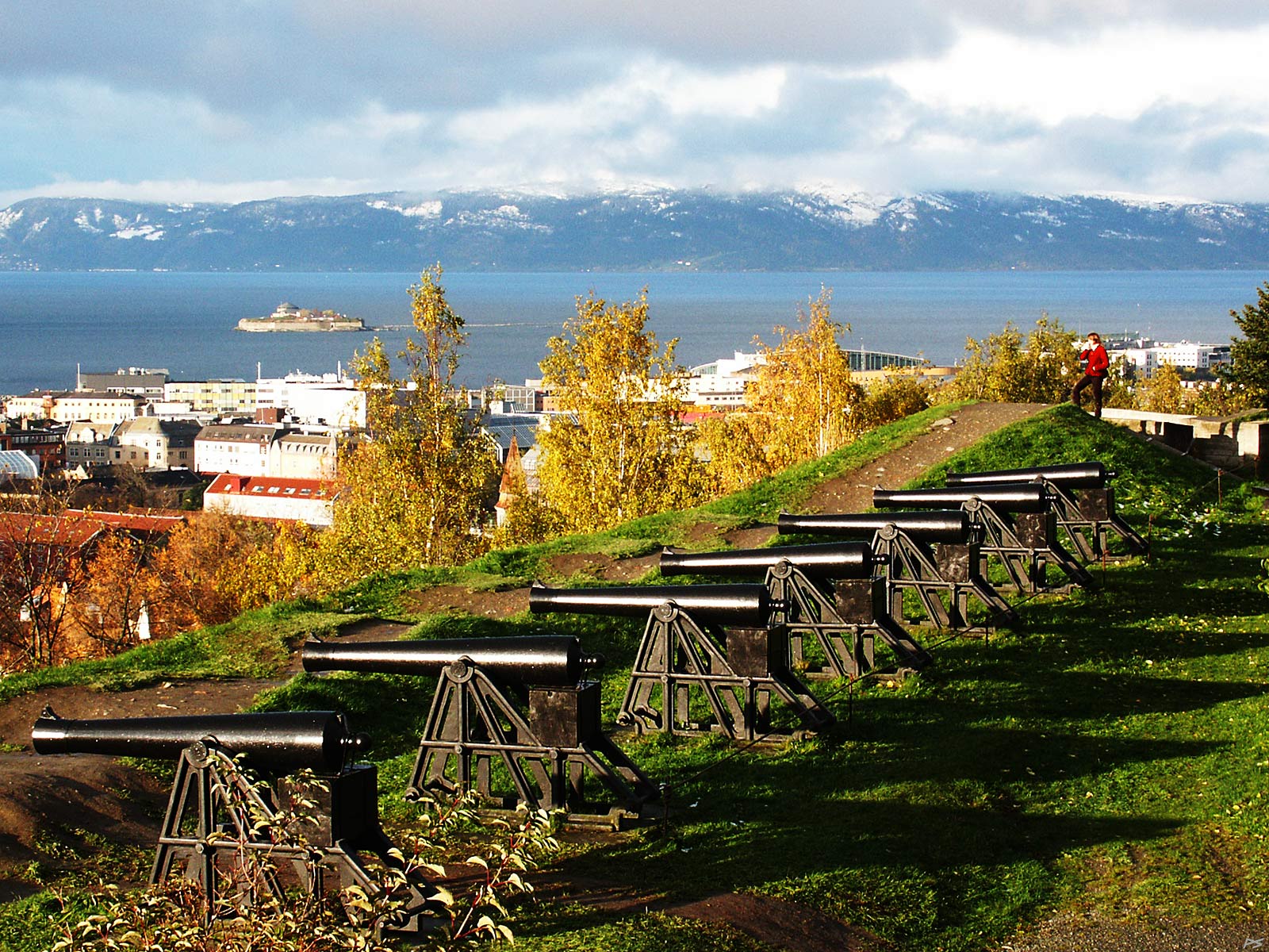
View from Kristiansten Fortress in late autumn. The islet Munkholmen (see next image) top left on the fjord named Trondheimsfjorden. In 1681 there was a great town fire and after that the town was rebuilt, according to General Johan Caspar de Cicignon's plan. Later you may draw a straight line on the map from the Nidaros Cathedral, down Munkgata ("the Monk Street"), including the town square halfway, ending on Munkholmen. Cicignon also designed the Kristiansten Fortress in the same period.
(2006-10-28)
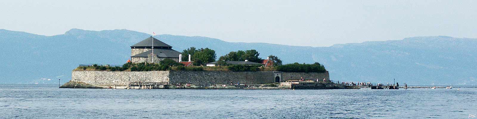
Munholmen is an islet about two kilometre (one mile) off the Trondheim harbour. During the tourist season you may catch a boat taking you there. The locals use Munholmen it for bathing and sunning.
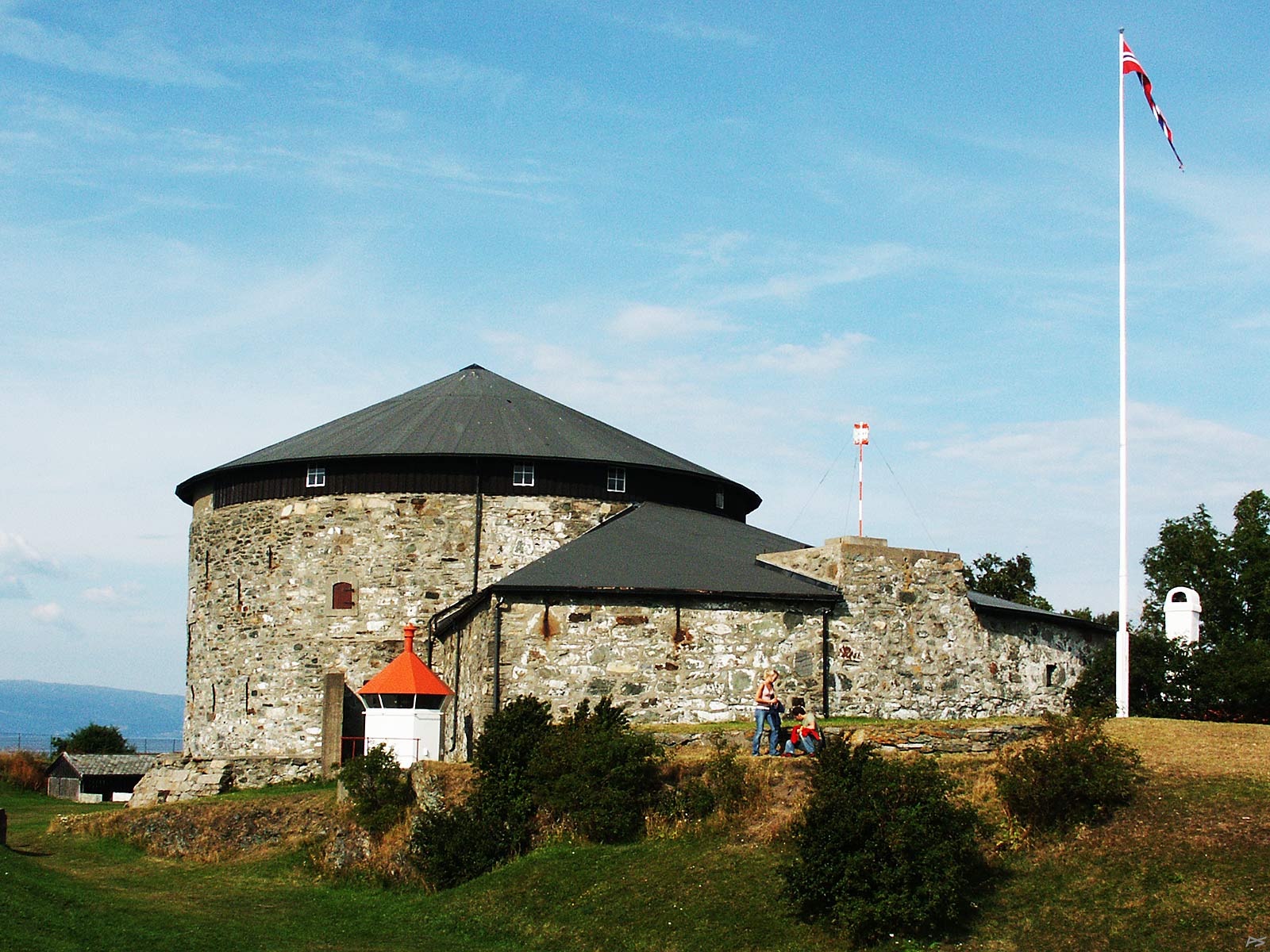
A thousand years ago its name was Niðarhólmr and it was used for executions. About 1100 (maybe earlier) a Benedictine monastery was built on the islet and this lasted until the Lutheran Reformation in 1537. The name Munkholmen ("Monk Islet") came into use maybe a century after the monks had left. A fortress was built there in 1660. It was rebuilt several times and was in active, though non-combat use until 1893. The fortress also served as a national penitentiary between 1680 and 1850
(2006-08-13)
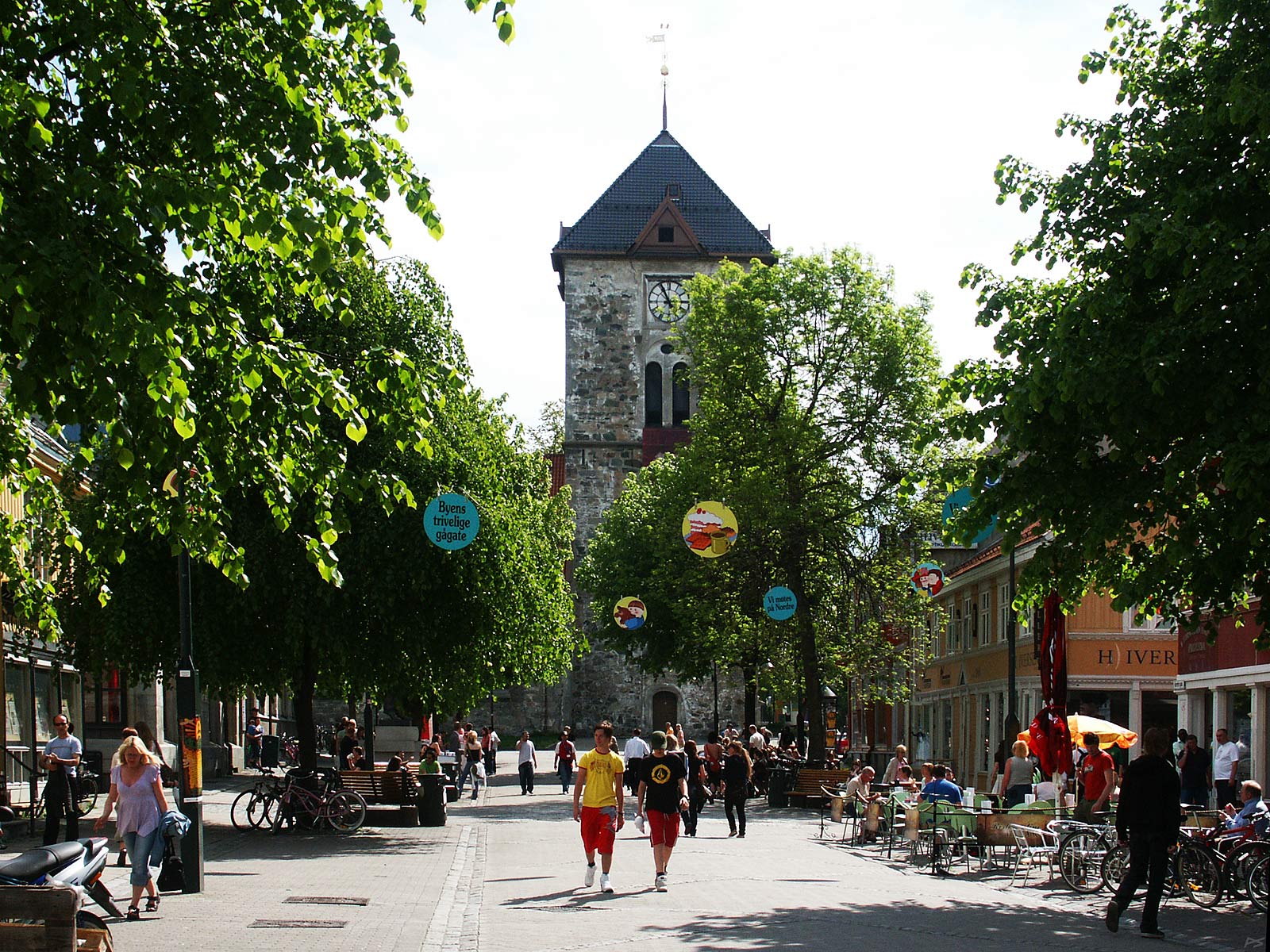
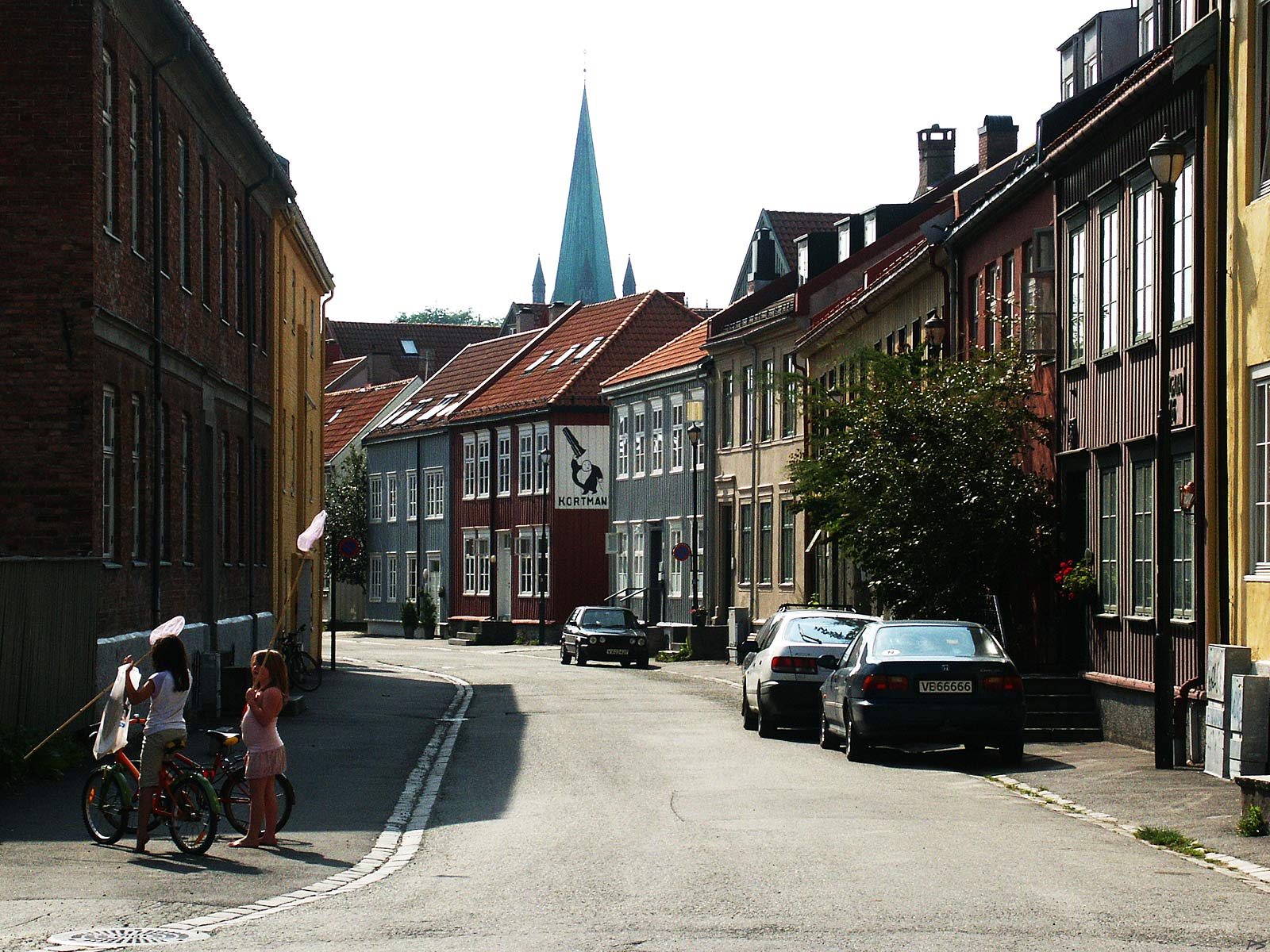
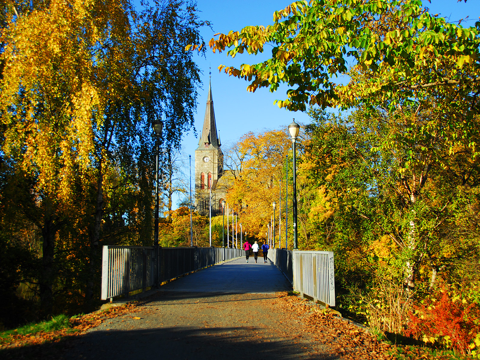
The south end of Nordre [gate] ("North [Street]"), for many years now a pedestrian street. At the end of the street stands Vår Frue kirke (Our Lady Church).
(2006-06-12)
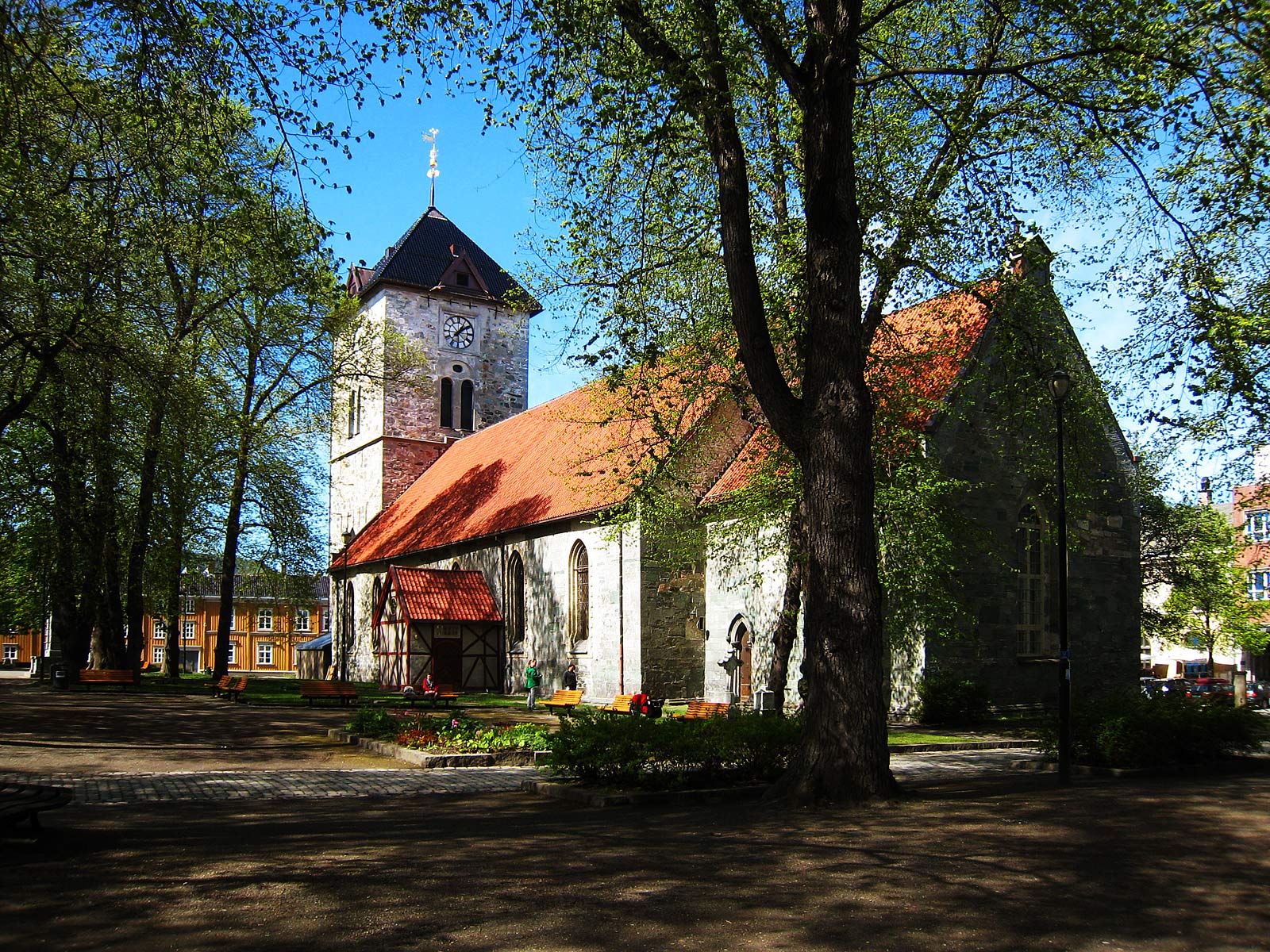
Vår Frue kirke (Our Lady Church), springtime view, south side and east end. The east (right) part – comprising the present choir and half the nave – is identical to the Younger (Virgin) Mary Church built around 1200. The rest of the church was built in the 1600s and 1700s, the tower in 1739. This church has 'survived' five fires, the last one in 1708. Prior to its 800 years official anniversary in 2007 the church has been renovated. From then on the church is permanently open (except week nights after twelve) so that you can enter to worship your God, chat with friends, or whatever you prefer. The church even contains a small 'café' where coffee and waffles and sweet buns are served.
(2011-05-18)
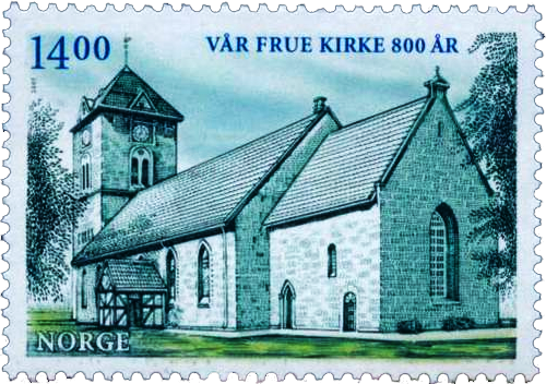
The church 800 years anniversary stamp
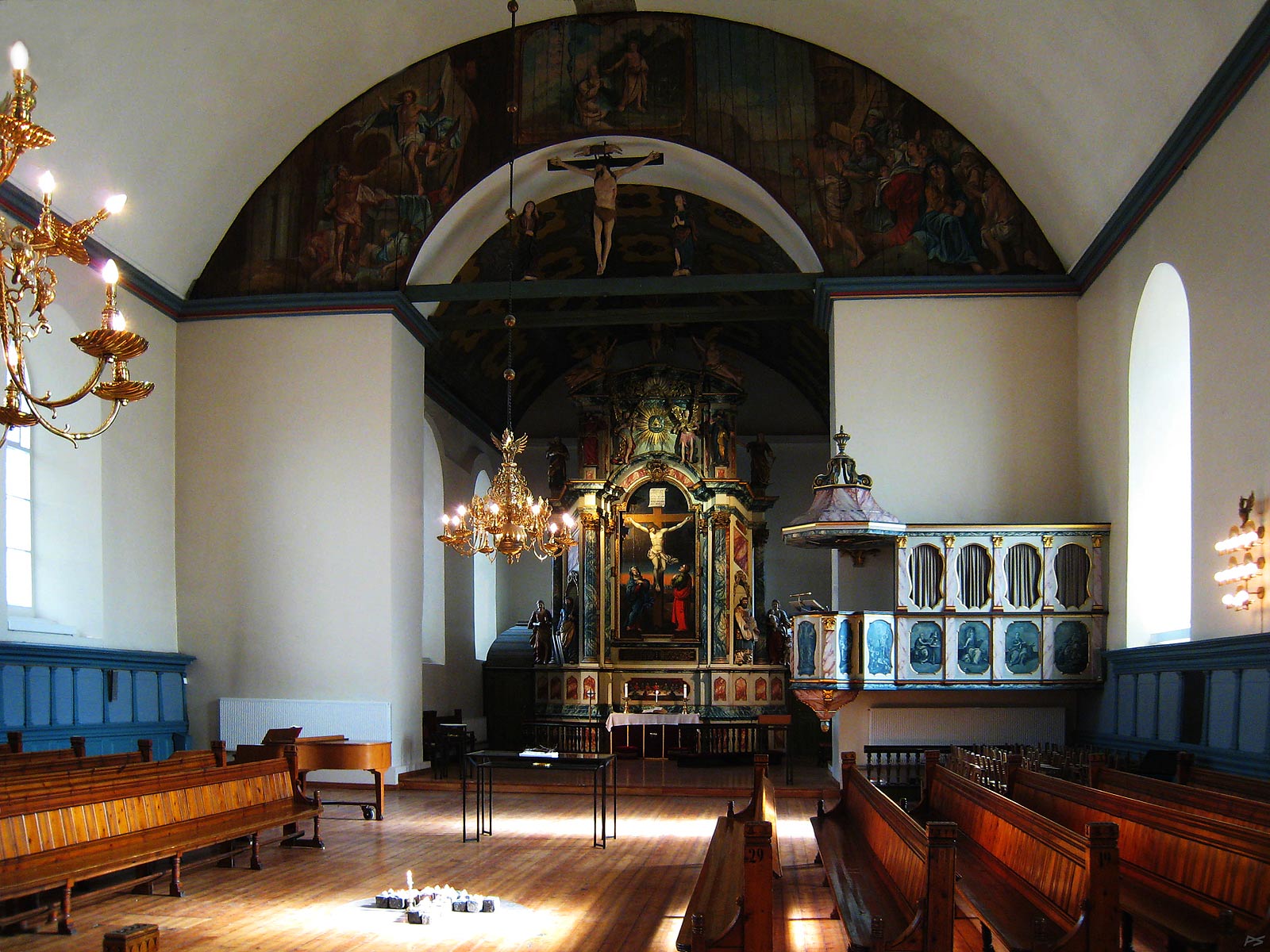
Inside the Church of Our Lady. The altarpiece was made in 1742-44 for the Nidaros Cathedral and moved to Our Lady Church in 1837. The pulpit was made in 1771 and the chandelier dates back to 1652.
In addition to the daily – and nightly – coming and going of people, drinking coffee, lighting candles etc.; there are occasional events – more or less ecclesiastical. The varied use may explain the unusual arrangement of the pews and why the candles are placed in the middle of the floor.
(2011-05-18)
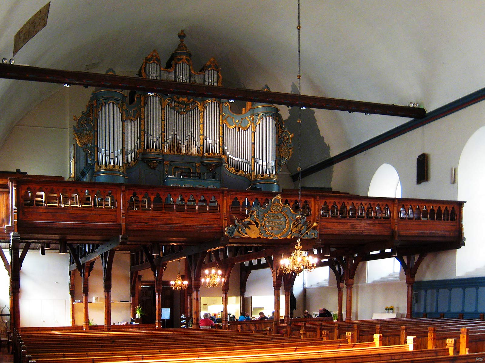
Inside the Church of Our Lady. The organ from 1922 is in excellent condition and nobody has complained about the acoustic of this church. The little café is seen to the right.
(2009-04-11)
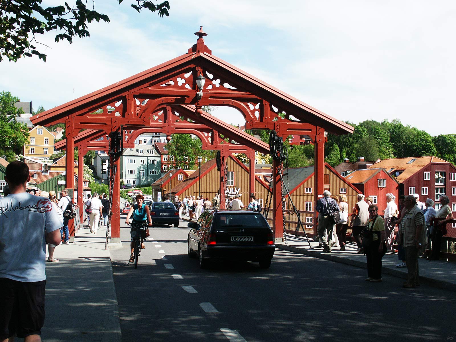
The Old Town Bridge seen from town centre side. Here you see the "Portal of Joy" ("Lykkens portal" in Norwegian), so called in the old and popular waltz song "Nidelven". Among the numerous Norwegian descendants in U.S.A. this seems to be the most popular song from "Gamlelandet" i.e. the Old Country.
(2009-04-11)
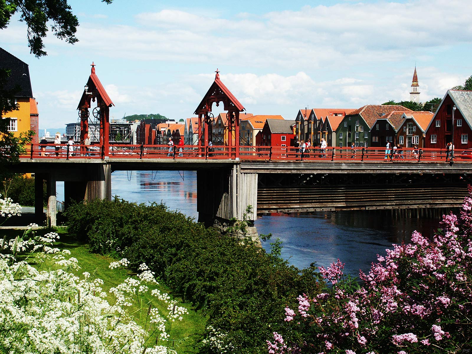
The Old Town Bridge. There has been a bridge here since 1685, but the bridge in the present shape was built in 1885. In the old days they could raise this bridge for small ships to pass, now the chains and wheels are not used, and the river is too shallow anyway
(2006-06-22)
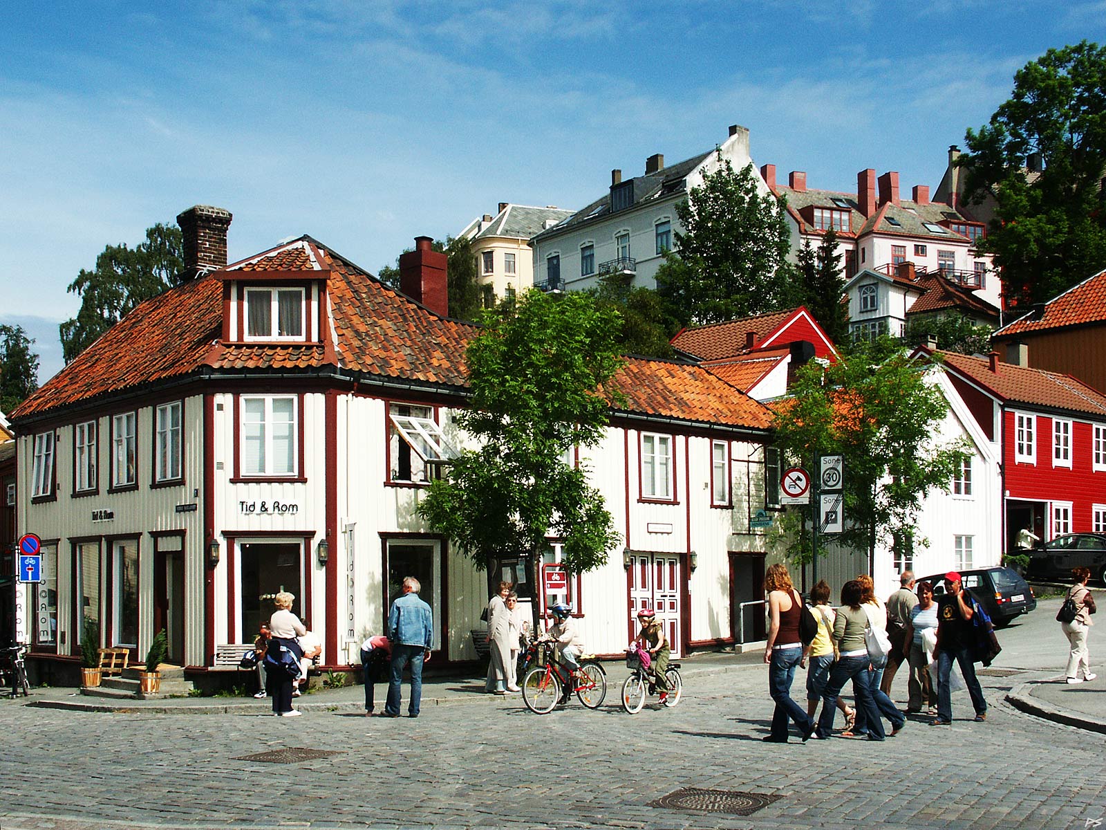
Bakklandet is a name indicating a steep land. The picture is taken just across the Old Town Bridge showing the lower end of Brubakken, one of the steep streets. There is also some students – they're everywhere in this town.
(2006-06-17)
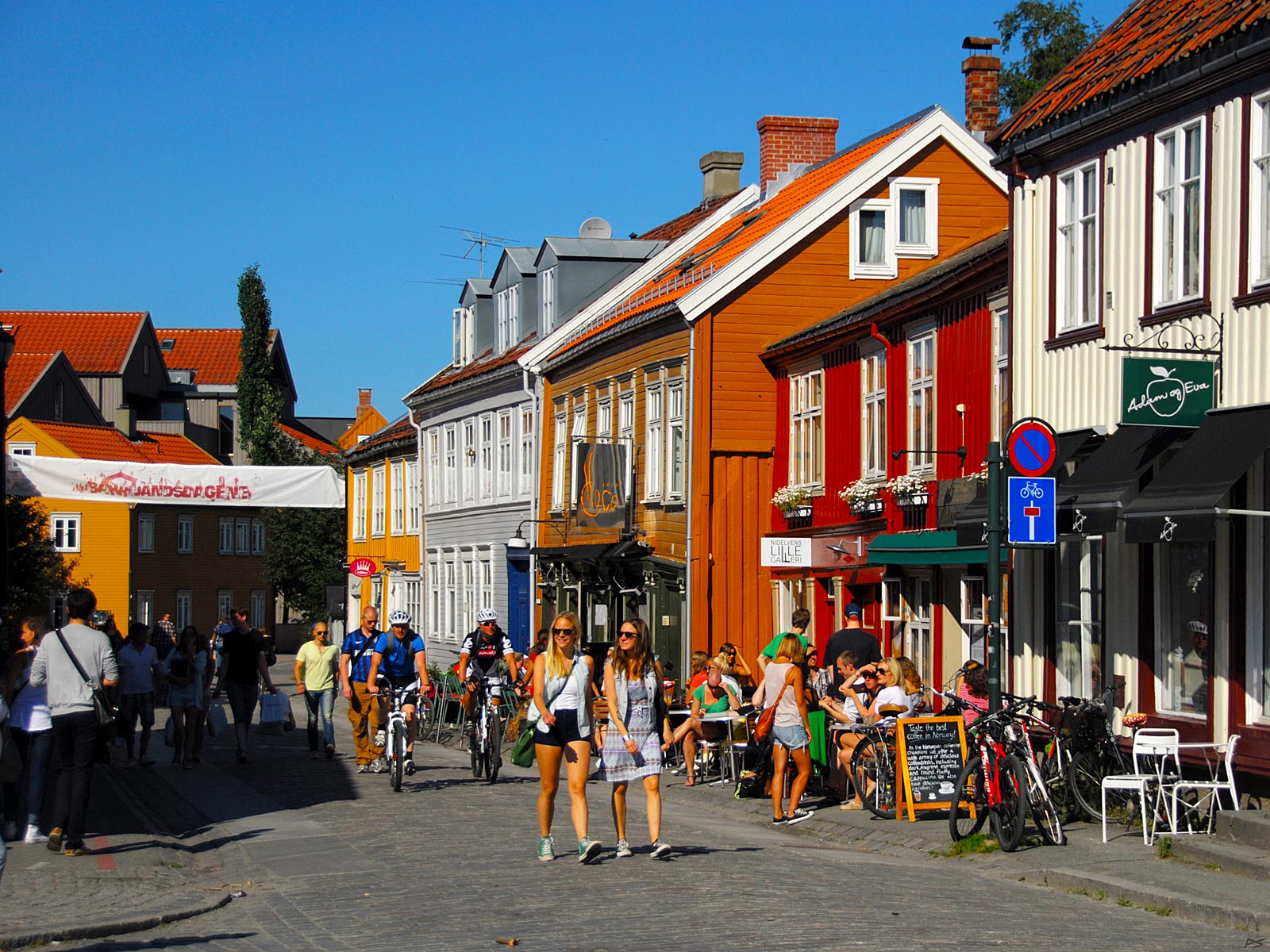
Street life on Bakklandet on a summer day. Close to the Old Town Bridge and Brubakken, actually taken from the same spot as the picture above.
(2012-08-14)
Another Bakklandet street, the steeple of the Nidaros Cathedral showing above the roofs. These are old wooden houses renewed to keep the original look. Now they've got up-to-date bathrooms too.
(2006-08-11)
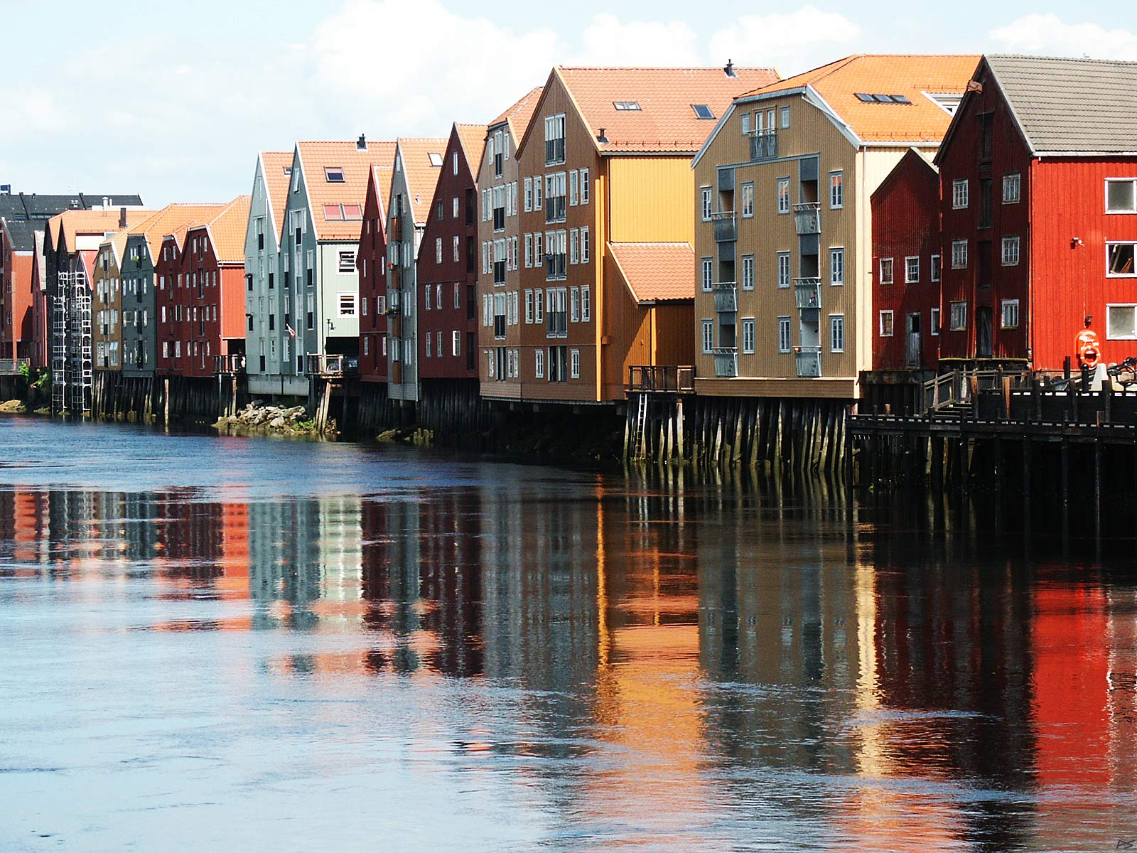
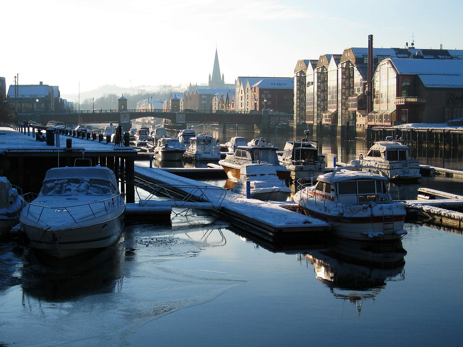
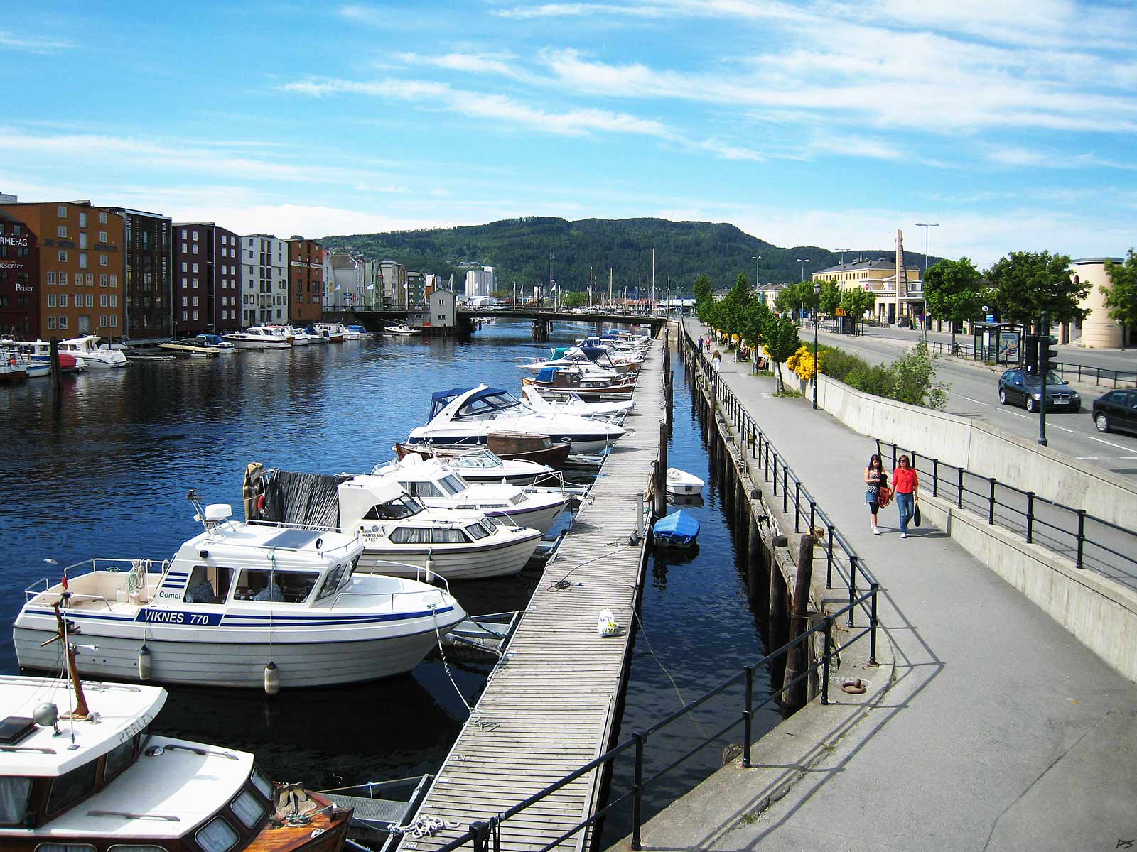
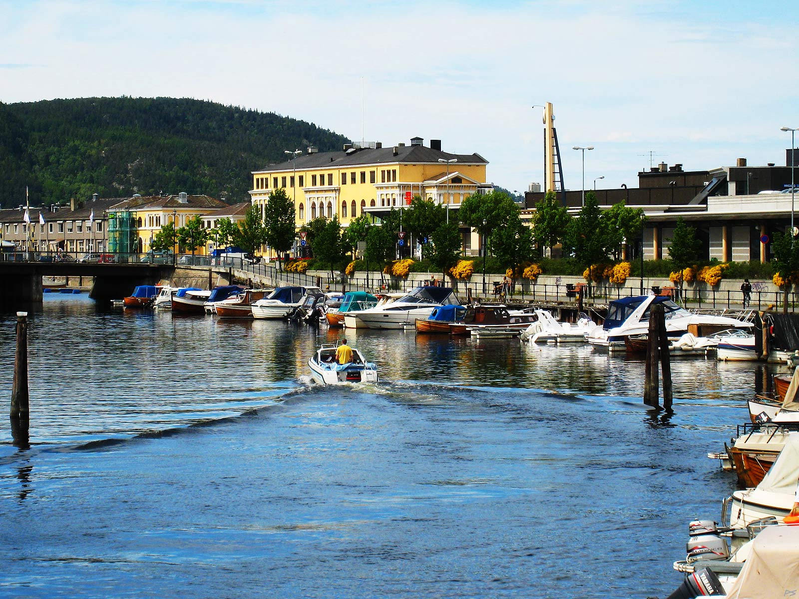
The old wharf storehouses on the shore of the river Nidelva. Once the river was deep enough for small vessels to sail up the lower part. Goods were hoisted from the ships and directly into the warehouses and also the other way. Now they have been renovated and put to a variety other uses. And some have burnt down – that wood has become very dry.
(2006-06-22)
The Royal Garden Hotel built 1984 on the shore of Nidelva. Here six wharf storehouses burnt down in 1967, which made the most spectacular bonfire.
(2006-08-11)
Nidelva in winter, downstream of Bakke Bridge. On the right bank the hotel Royal Garden and other building resembling the old wharf storehouses, and maybe a few of the real things are discernible. Beyond the steeple of the Nidaros Cathedral.
(2007-02-09)
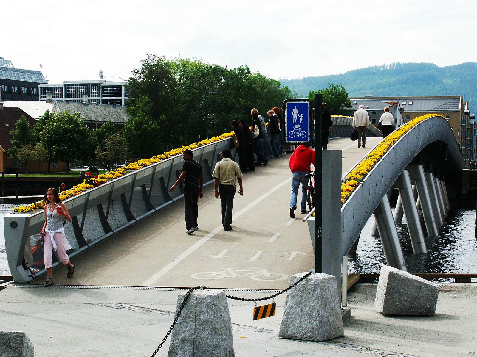
Popularly called the "Flower Bridge", Verftsbrua crosses Nidelva downstream of Royal Garden Hotel and is for pedestrians and cyclist only.
(2006-06-17)
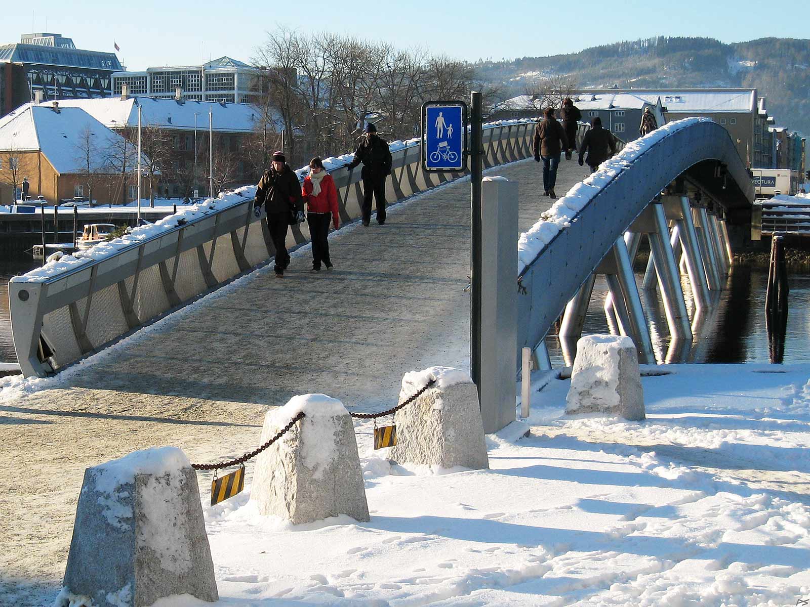
The "Flower Bridge" on a cold winter day. The latitude of Trondheim is 63°4', but winter temperatures are rarely as low as -20°C and "never" below.
2007-02-09)
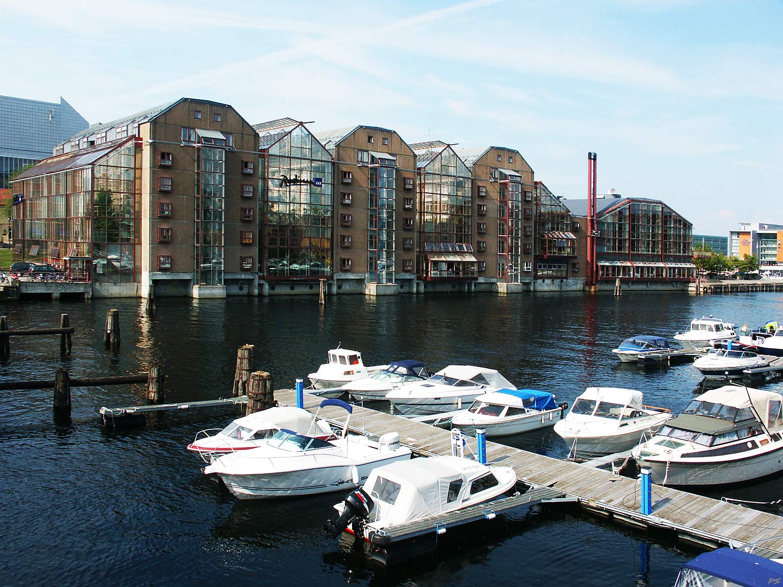
Kanalen – the Canal – at the railway station. The Canal runs from Ila eastwards to Nidelva. On the island outside the Canal you'll find the railway station and a large part of the Trondheim harbour. Before the 1850s the wharf warehouses to the left stood on the fjord shore. A breakwater was then built outside the whole long row of wharfs, forming the present canal. Later on the sea outside the breakwater was filled in, forming the present island, a process that still goes on.
(2007-06-02)
The train station on the artificial island outside the Canal. The old yellow station buildings to the left, the 'new' station to the right – seen across the Canal.
(2007-06-02)
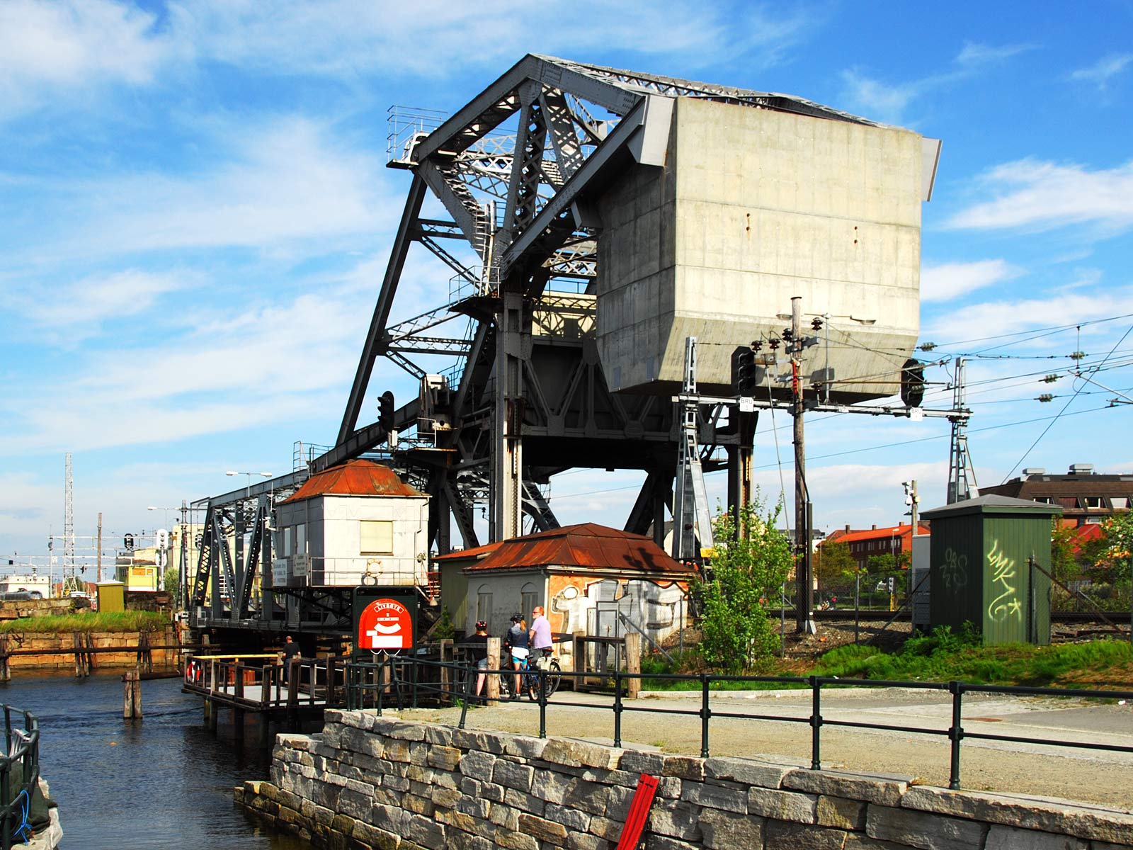
The Skansen bridge is one of the few bascule railway bridges still left in the world, and it is now conserved by the authorities. It has been used by trains south of the Trondheim station since 1918 and it still opens daily for tall vessels entering the west end of the Canal, but of course, there has been occasional trouble. The designer of the bridge was Joseph Baermann Strauss, who also designed e.g. the Golden Gate Bridge. This picture shows essentially the enormous counterweight. There is also another picture of the bridge.
(2012-05-27)
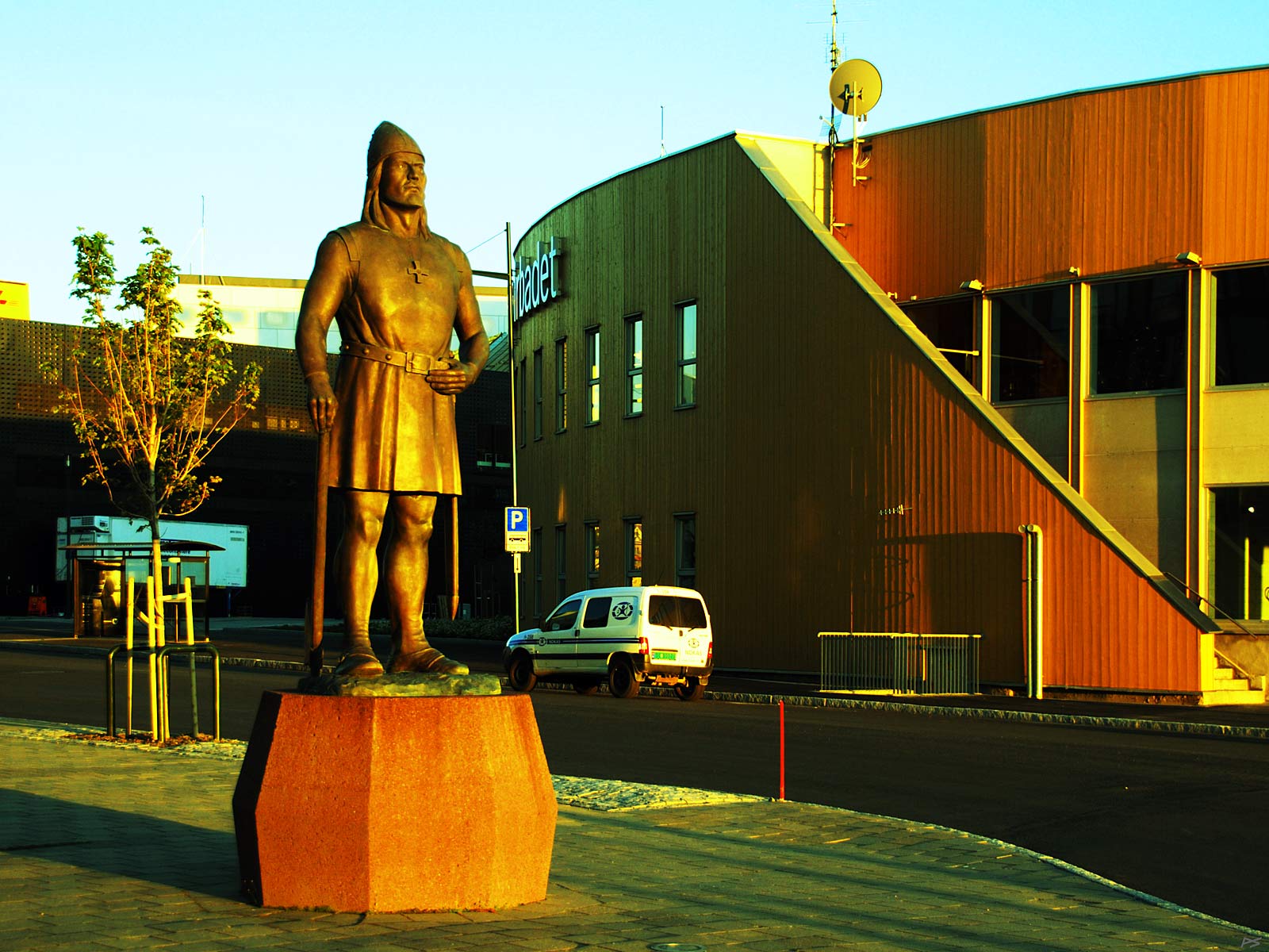
A statue of Leiv Eriksson at the waterfront looking towards the sunset. This is a replica of the statue August Werner made for the 1982 Seattle World's Fair, given to Trondheim in 1997 by Leif Erikson Society of Seattle. It is also called the Emigrants’ Monument.
Leiv Eriksson (about 970–1020) was the son of Eirik Raude and grew up on Greenland. Eirik Raude had become an outlaw because of manslaughter on Iceland (like his father before him in Norway) and had initiated two settlements on Greenland in 986. Tenty years old Leiv Erikson sailed to Norway, arriving in 999. When he sailed back the year after he had promised King Olaf Tryggvason of Norway to christen the people of Greenland (note the cross on his chest). In 986 the merchant Bjarne Herjolvsson from Iceland had seen a land west of Greenland, but hadn't gone ashore. After returning from Norway Leiv Eriksson set out with 35 men to investigate. The finally went ashore on the north end of Newfoundland (L'Anse aux Meadows) and built a settlement. This land they called Vinland, which can be translated as pastureland. For a society dependent on cattle, pasture is of highest importance. Later building permanent settlements were attempted, but they were soon abandoned, probably because of conflicts with the natives.
(2012-06-28)
Ilsvikøra, the Ila Bay. The small workers' houses have all been renovated. If it weren't for the surroundings, this would have been a very idyllic place to live. Ila is the westmost part of the town centre.
(2006-01-29)
A home at the harbour in Ilsvika. The cereal silos blocking the fjord view, were built during the years 1955–1970. I suppose they damp the cold winds from the north and northwest.
(2012-05-27)
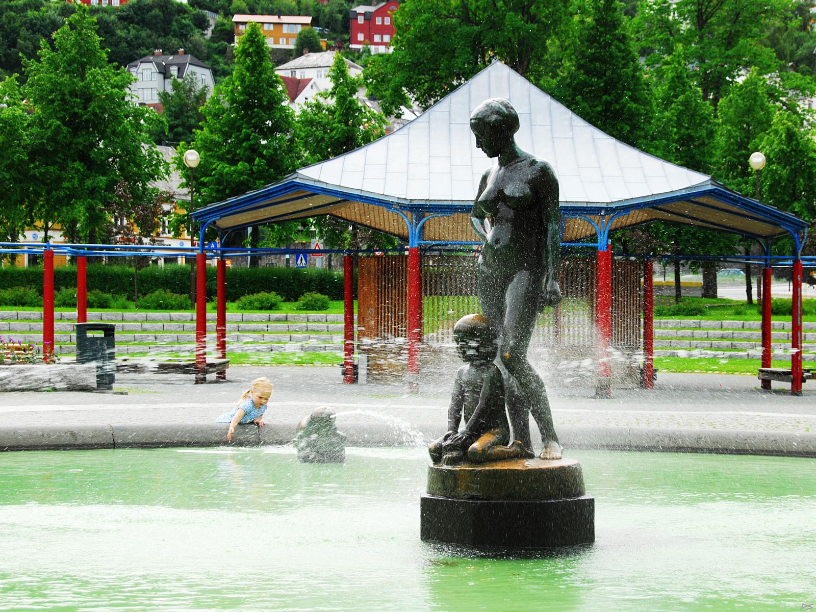
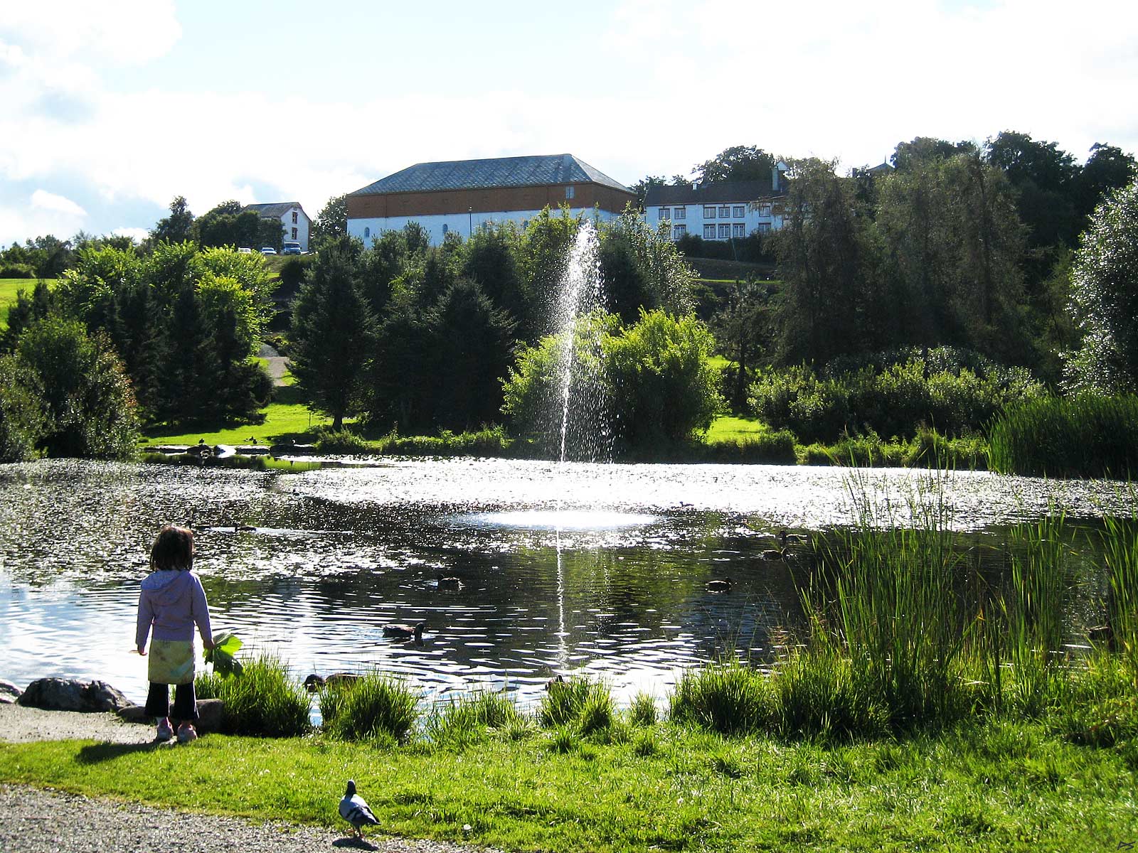
From the Ila park, a nice place, especially for small children. The artist of the fountain group (1918) is Wilhelm Rasmussen (1879–1965) and the female model was his wife. The artist worked in the architect department of the Technical University and also made the statue on the Town Square. And this one.
(2010-07-11)
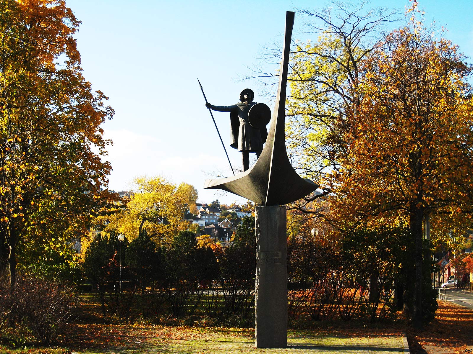
On the east corner of the Ila Park – a statue of Sverre Sigurdson, king of Norway 1177–1202. The artist (1983) is Sivert Donali (1931–2010).
(2007-10-05)
The Ilen church seen from across the river, which means Øya, the land inside the river loop. The Nidareid pedestrian bridge goes from Øya to Nidareid.
(2012-10-16)
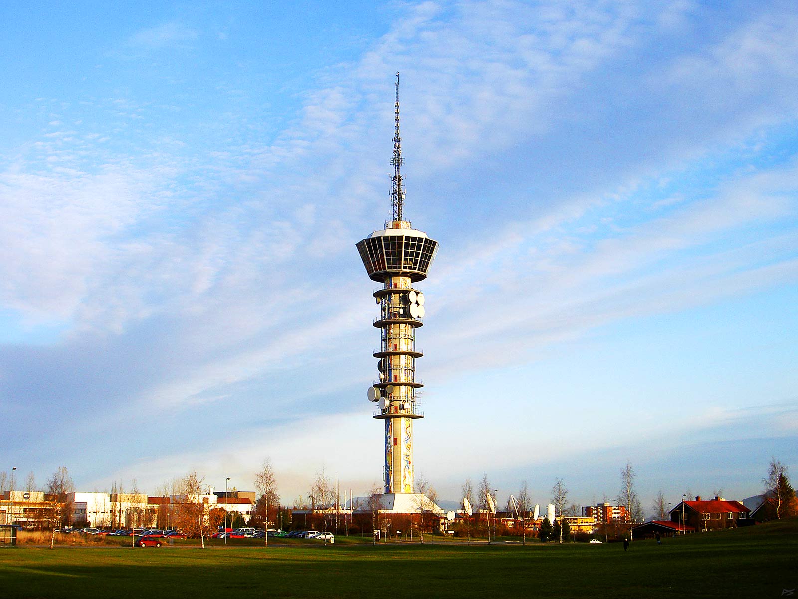
Built in 1985, the Tyholt Tower stands on the top of the hill (Tyholt) on the east side of the town centre. It is intended mainly for telecommunication, but there is also a once per hour rotating restaurant for 120 guests 75 metres above the ground. There are two lifts and two stairways with 442 steps. The top of the antenna is 120 metres above the ground.
(2004-11-10)
View from the Kristiansten Fortress. Top right the Nidaros Cathedral with the red roof of the Archbishop's Palace on its left side. Top centre Nidelva (-river), Elgeseter Bridge and the lawn of Marinen (next picture). Behind in the autumn mist Byåsen, the hills west of the town centre, and beyond that, Bymarka, the large forested recreation area.
(2005-10-19)
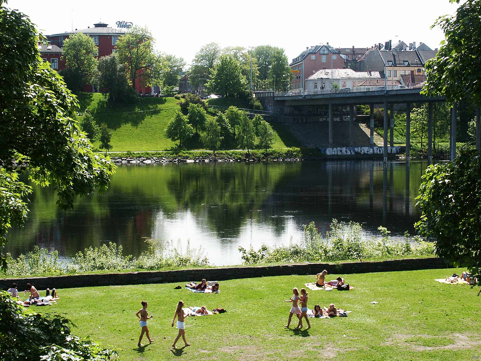
Marinen is the park on the south side of the Nidaros Cathedral: the name shows that once there was a military harbour here. The river is – as always – Nidelva, not suited for military vessels any more. On the right Elgeseter Bridge and top left 'Samfundet' ("the Society"), the students' round house. It seems that the warm weather came as a surprise to the girls – there is an old school close to the Cathedral, the Cathedral School, nicknamed "Katta" ("the Cat").
(2006-06-12)
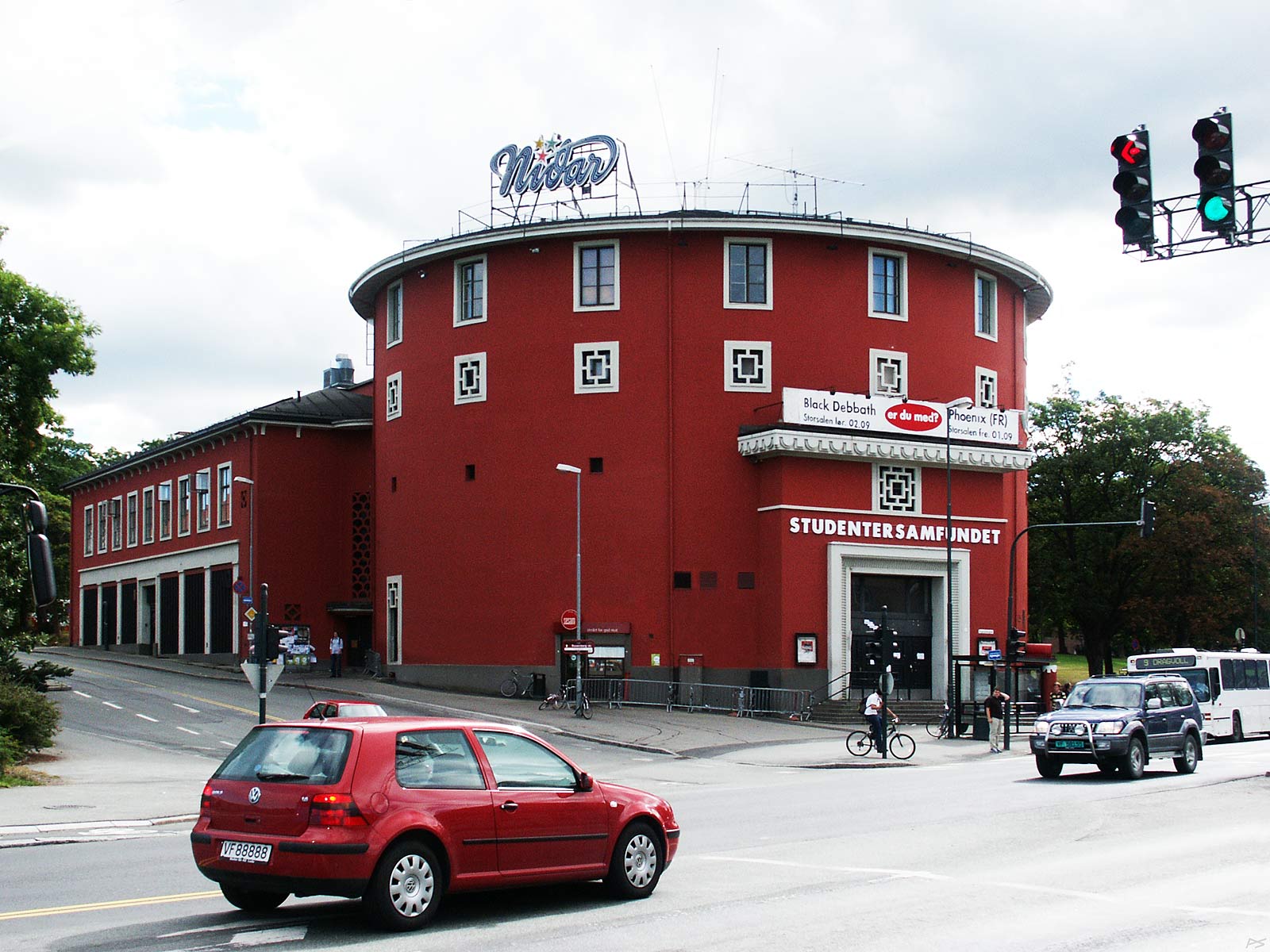
The round house, locally called 'Samfundet' is the base of Studentersamfundet (Student's Society) i Trondhjem, the local students' organisation. It was founded in 1910 and this building was ready in 1929, round as their first house, an old circus building. The great auditorium is also designed with a circus in mind
 Every other autumn since 1917 the students has arranged UKA – 'The WEEK', or 'The Student's Week'. There has always been a revue – always with (some) local themes – and festivities long into the nights, now it's advertised as "UKA: Norway`s largest cultural festival", boasting of 3 stages, 3 nightclubs and 2 pubs. It's now essentially a music festival and there are events not only in the round house. It might also be the world's longest week, 25 days to be exact.
(2006-08-30)
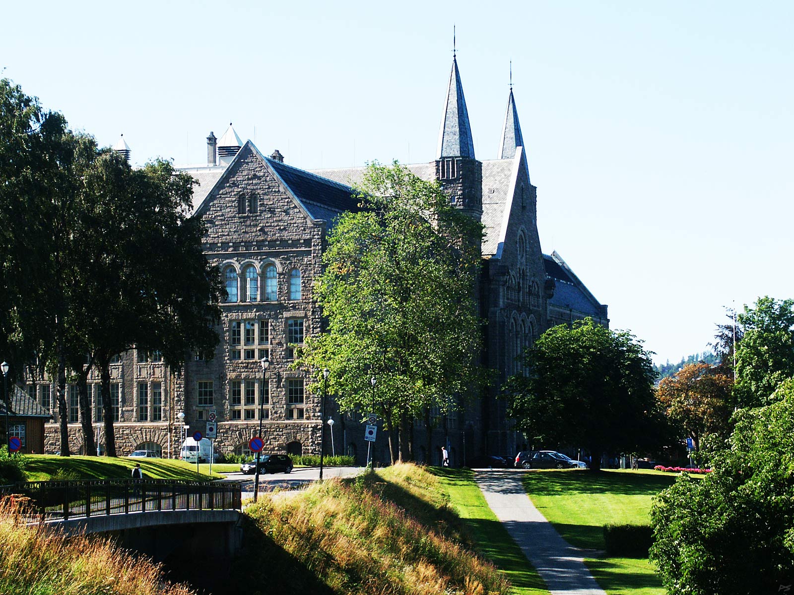
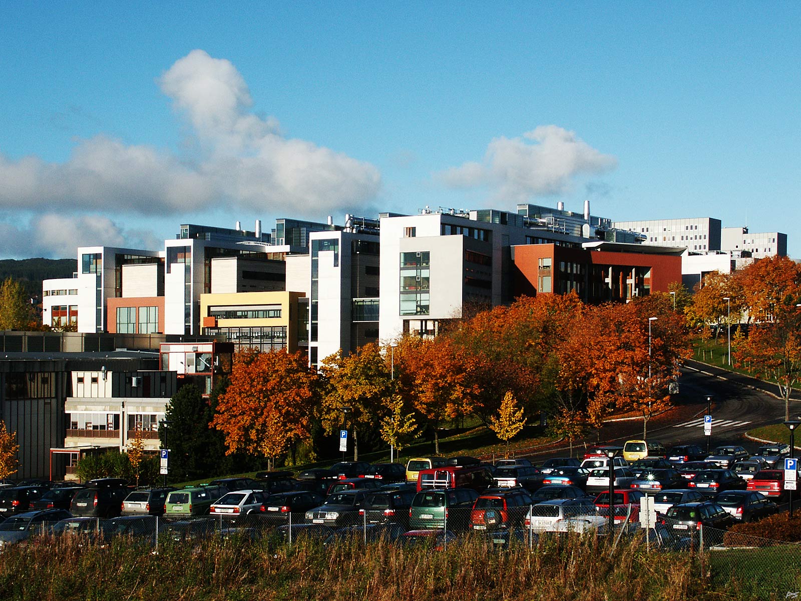
The Technical University of Norway was founded in 1910. This is the main building from those days on the north brink of the hill Gløshaugen, overlooking the city. In 1996 the Technical University and the 'softer' local university joined and the new name is NTNU – Norwegian University of Science and Technology. Now there are about fifteen thousand students at this campus, but there are several campuses and it's changing all the time. The total number of students is now (2021) close to forty-three thousand.
(2006-08-16)
The Science building on the south brink of Gløshaugen was completed in 2000. Here they teach physics, chemistry and biology.
(2003-10-13)
The Dragvoll campus lies in the outskirts of the town and the first part dates back to 1971. Here resides the institutes for most "soft sciences" like history, language, psychology etc. This was the main part of the second university (in addition to the Technical University) in Trondheim, established in 1968. In 1996 the two universities was forced to join with the name Norwegian University of Science and Technology. In the future these buildings will be sold, because it has been decided to join the campuses. Because then a psychology student or professor may happen to meet a chemistry student or professor and a brilliant idea may emerge. Well, maybe. Brilliant ideas emerge usually by coincidence when shaking the box.
2009-09-02)
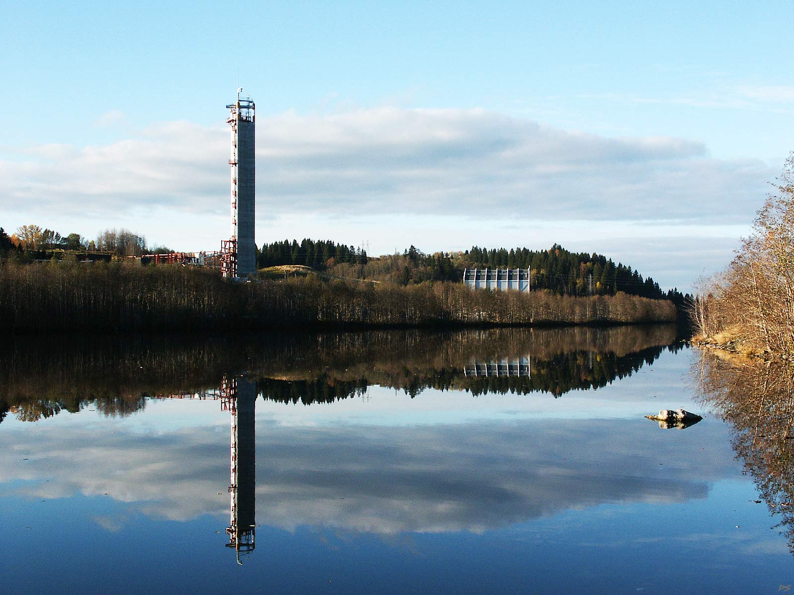
The tower is a part of the SINTEF Multiphase Flow Laboratory at the river Nidelva, established in 1982 to solve problems with transporting mixtures of oil and gas trough the same tubes, later including water and dirt. (You know, in the Norwegian Sea crude oil and gas is extracted from below the sea floor.) To the right a part of the Norwegian Fire Research Laboratory is seen. This is also a part of the SINTEF Group. Originally this laboratory resided on the campus of the (then) Norwegian Technical University, but its persistent inclination of polluting its environment forced it to move out.
![]() The SINTEF (INdustrial and TEchnical) research organization was established in 1950 by the Technical University of Norway – as a commercial extension of the university. The coexistence prove fruitful for everybody and now the employee count of the SINTEF Group is roughly 2000 and the activities also includes 'softer' fields, notably 'Health Research' and 'Technology and Society'.
The SINTEF (INdustrial and TEchnical) research organization was established in 1950 by the Technical University of Norway – as a commercial extension of the university. The coexistence prove fruitful for everybody and now the employee count of the SINTEF Group is roughly 2000 and the activities also includes 'softer' fields, notably 'Health Research' and 'Technology and Society'.
(2003-10-15)
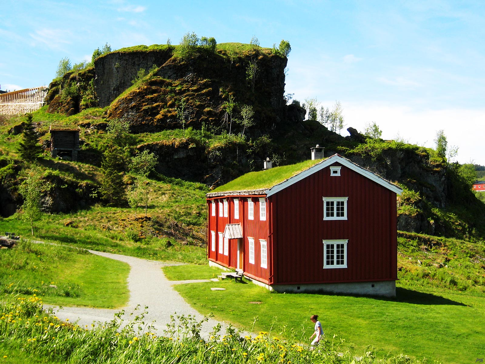
Sverresborg museum got its name from the fort Sverre Sigurdson let build on top of that rock in 1182–83, shortly before he became King of Norway. He certainly had to fight for that job. Some ruins are still there; this picture shows only signs of a restoration project top left. A statue of King Sverre stands less than two kilometres away. The red house is one of many old houses on the museum area.
(2007-06-01)
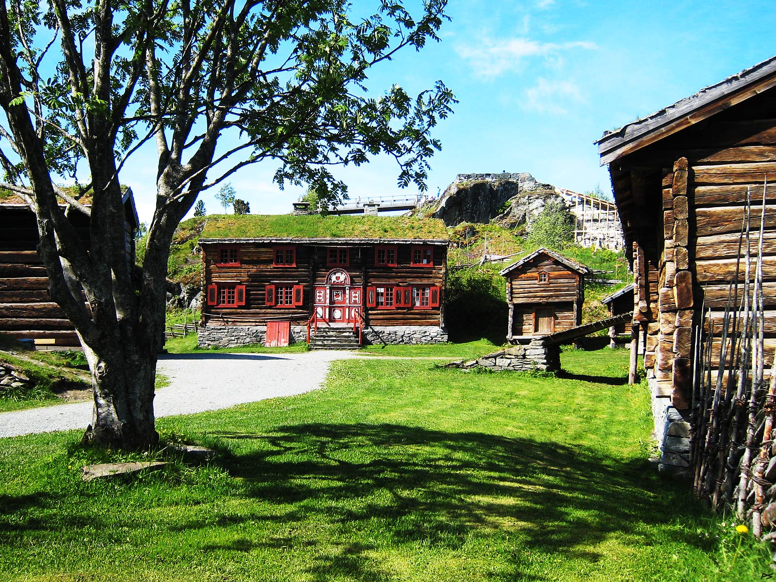
Sverresborg museum displays old houses from the surrounding area and a town section is included. There are also some splendid indoor exhibitions with various themes. These houses are from Oppdal: Centre the once grand Detli house with the inscription '1817'. On the right side of this house there are two (one only half visible) storehouses, as always standing on poles with some arrangement hindering rats and mice from gaining access. To the extreme right stands a barn, the cattle on the ground floor, hay on the second floor. The tree is a rowan (Sorbus aucuparia). On the top of the cliff remnants of King Sverre's fort may be discerned.
(2007-06-01)
 is a historic farm on the east part of he present Trondheim city. Shown here is a part of the arboretum and botanic garden run by the Norwegian Institute of Science and Technology since 1973. On the top of the hill stands the main buildings, to the right the former manor house, to the left the big barn. The former owner, Christian Anker Bachke (1873-1946) and his Russian born wife, Victoria, loved music and acquired a large collection of musical instruments and other artifacts. In 1952 the Ringve Museum – Norway's national museum of musical instruments – was established, based on the existing collection. Later on the collection has been extended considerably. The first exhibition was in the original living quarters and now the barn is also an important part of the museum.
(2007-08-31)
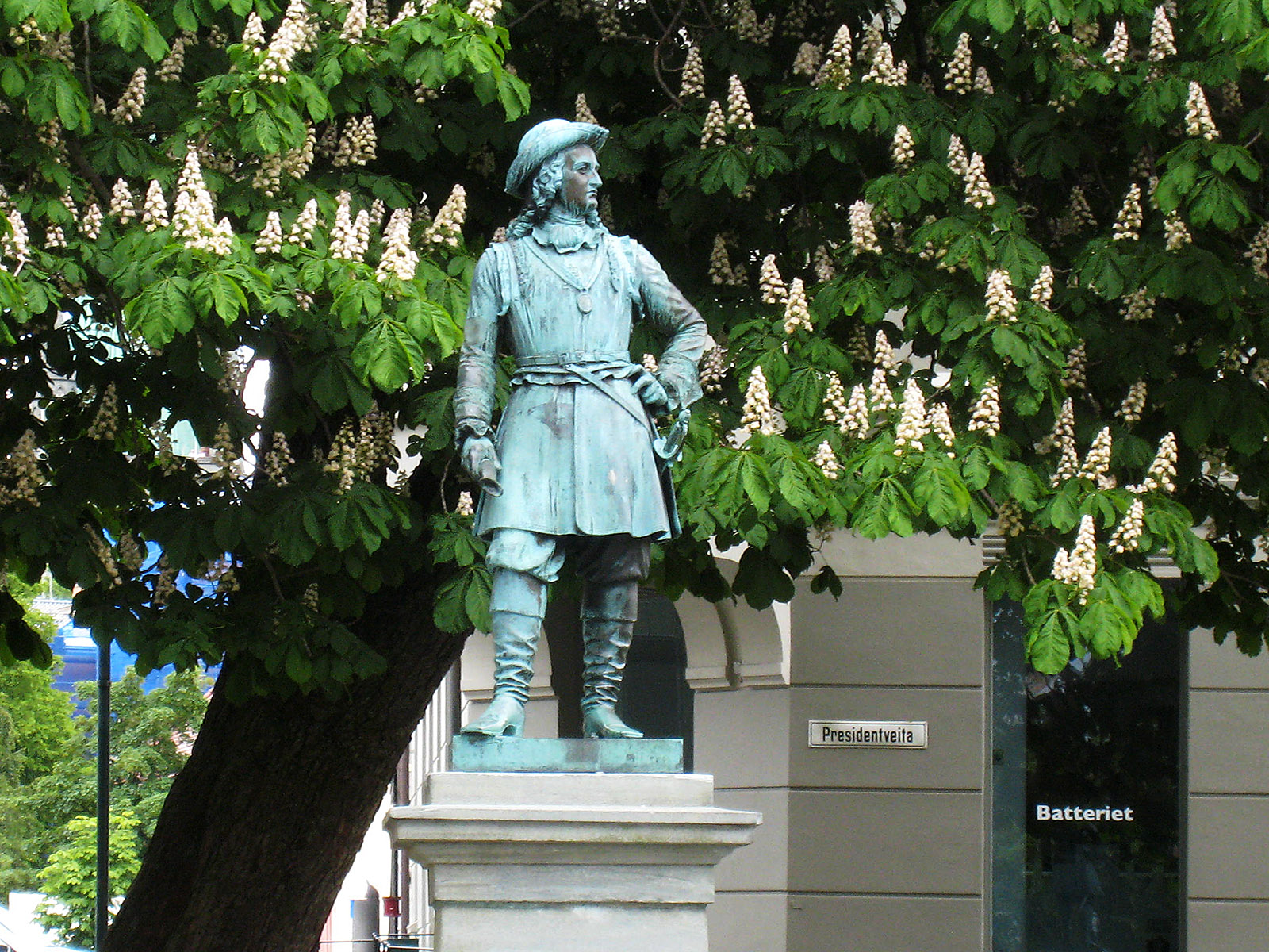
This is a statue in the Trondheim centre of Peter Wessel Tordenskiold (1690–1720). Peter Wessel was born and grew up on Ringve (above). He was quite wild, became a naval hero, was knighted with the name Tordenskiold, and lost his life in a silly duel.
(2009-06-11)
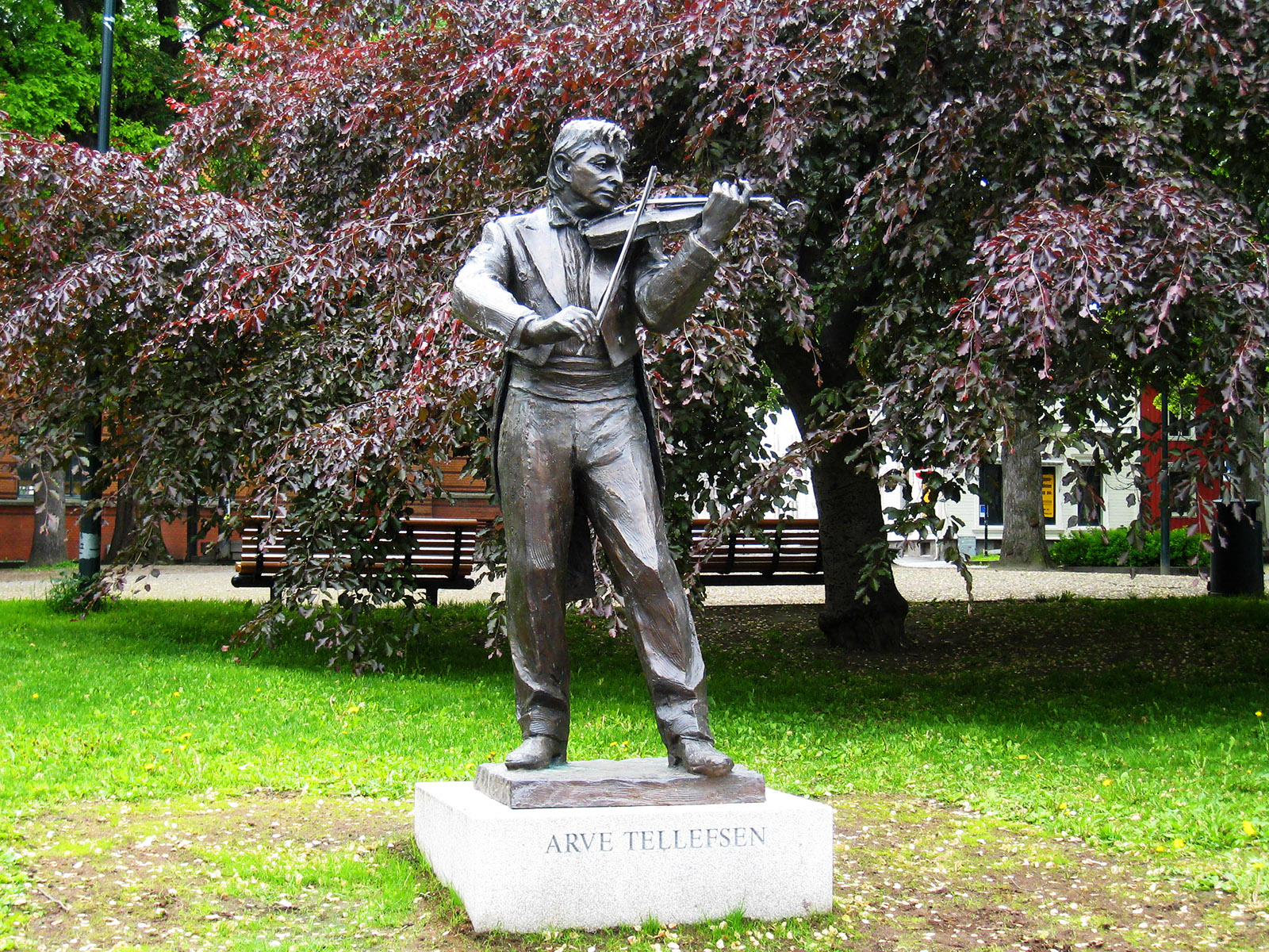
While photographing statues of famous people in the centre of Trondheim, let me add this one. It's Arve Tellefsen, born in Trondheim in 1936 and still alive and still playing the violin.
(2009-06-11)
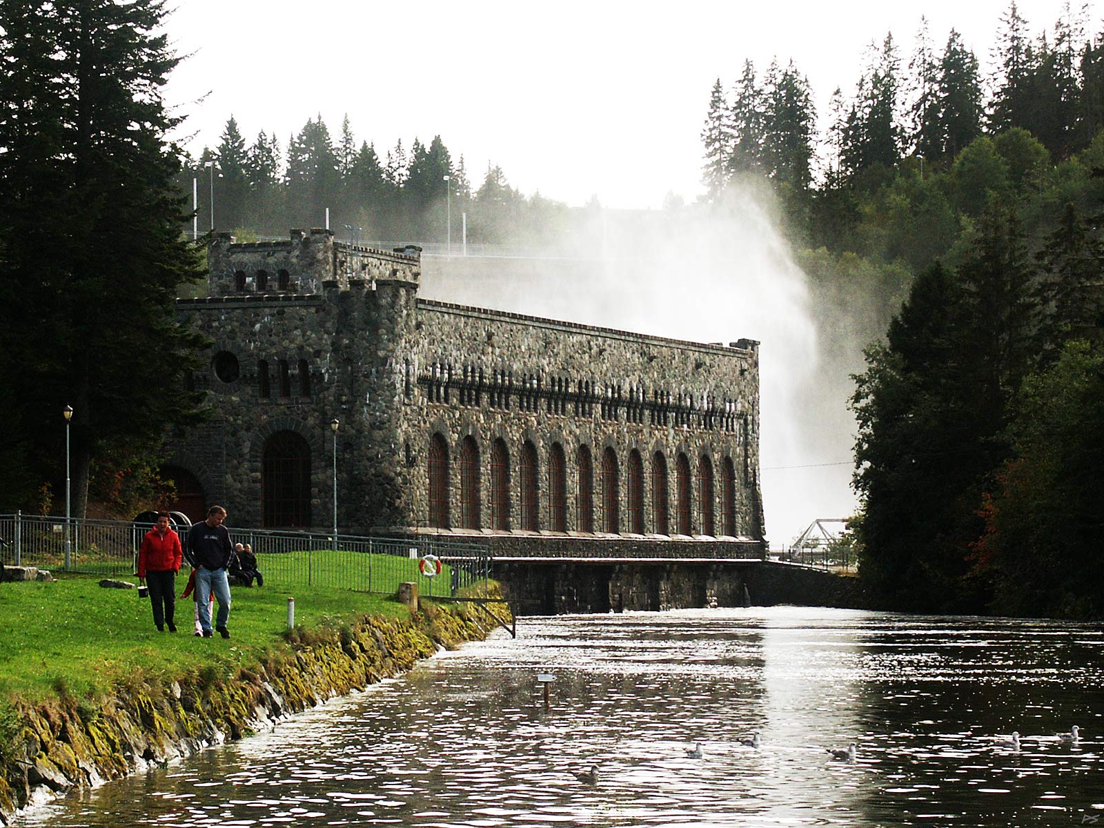
The old powerhouse built in 1910: Nedre (lower) Leirfoss, Trondheim. It has been raining heavily for weeks, therefore the dam gates behind the building are partly open.
(2004-09-26)
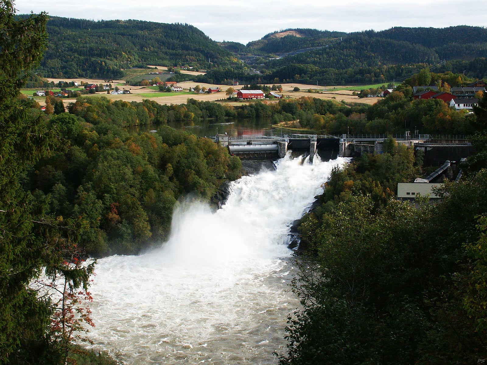
Øvre (upper) Leirfoss, Trondheim and the powerhouse from 1901 where only the roof is visible. Both the Nedre Leirfoss and Øvre Leirfoss powerhouses were replaced in 2008 by a new power station hidden in the bedrock (actually right under the camera). However, both powerhouses still produces some power to utilize the water that is required to flow in the river between the two old powerhouses. Usually the waterfall is dry, but it has been raining heavily and the lower reservoir, Selbusjøen, is full. Here the town has invaded this side, the west side of the river Nidelva, while on the east side there is still farmland.
(2004-09-26)
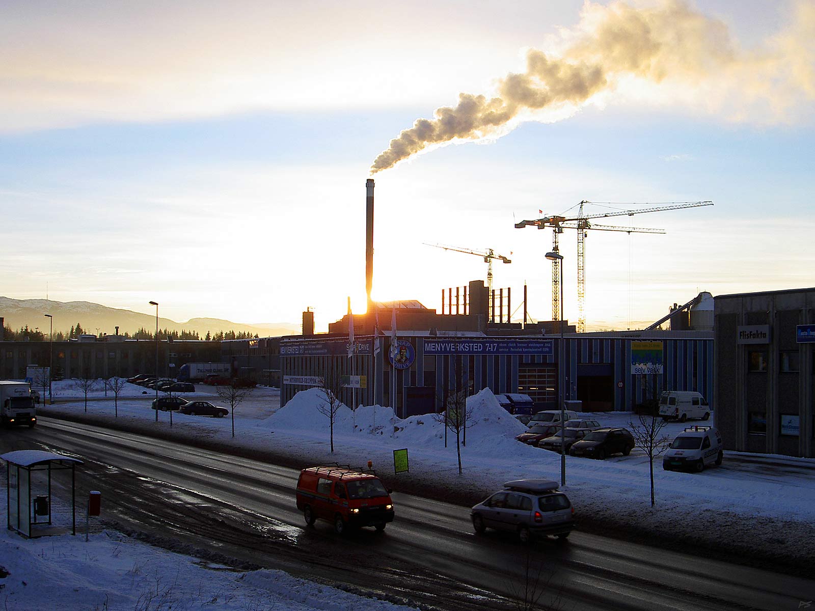
The waste combustion plant in the south outskirts of Trondheim was finished in 1986. When this picture was taken, it was being renovated and expanded. It's now heating more than a third of the town, the goal is half the town. Domestic and industrial waste is collected from a large district and the smoke is very clean, close to pure water vapor. It's three weeks before midwinter and the sun is low in the sky.
(2005-12-02)
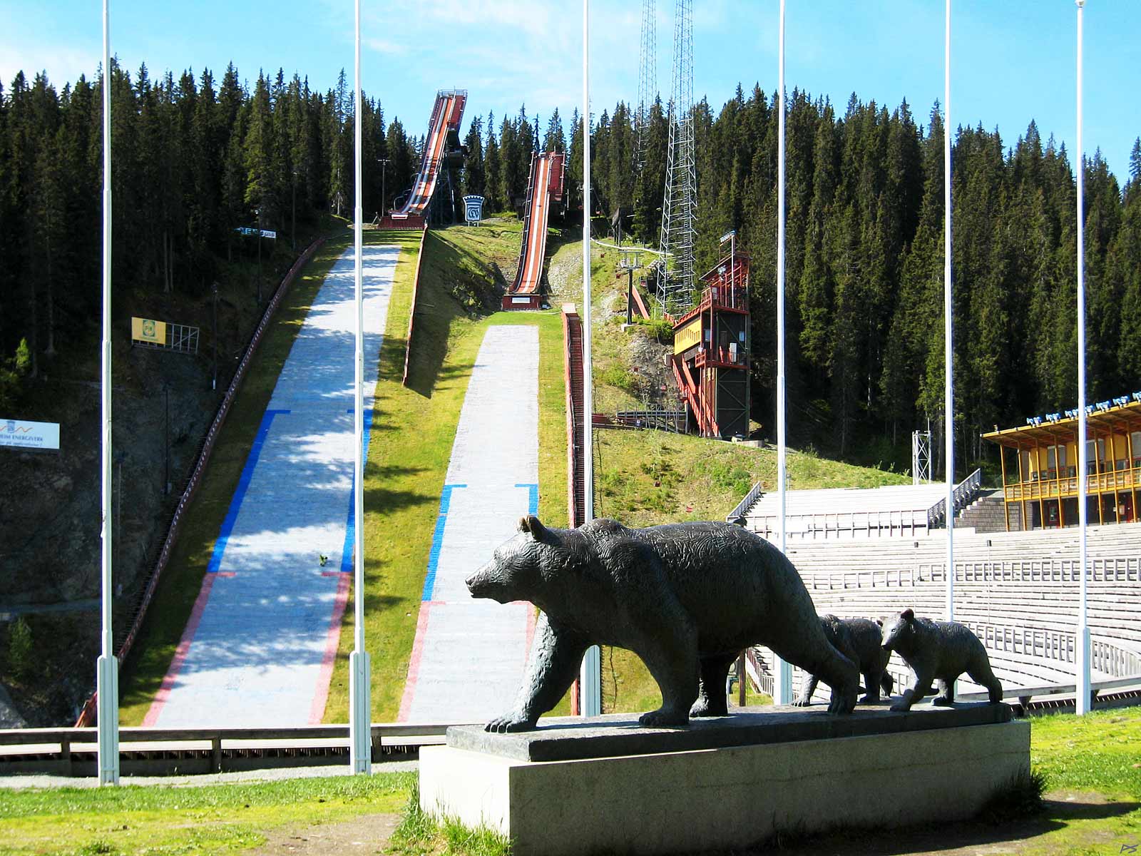
The ski jumping hill is being prepared for the summer season. The upper slope is covered with ceramic tiles (wet when in use), the landing slope is covered with plastic ribbons (also wet when in use). The bear and its two cubs were created by Skule Waksvik (1927–).
(2007-06-01)

This has been the main ski jumping hill since 1940, but there have been many changes trough all these years. National championships have been arranged here, and also the 1997 World Championship of Nordic Skiing; this championship's logo, derived from the Selbu Rose, is shown to the left. Now (2021) a comprehensive rebuilding and extension has started, to be finished before the Raw Air tournament in 2023.
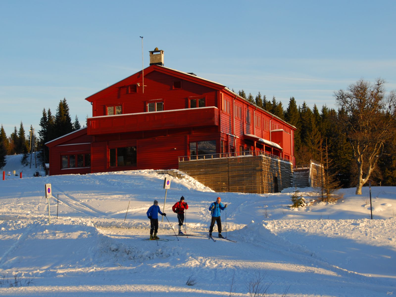
Skistua, meaning "the skiing cabin", in Bymarka contains a restaurant where supposedly open-air people go. Bymarka is a 80 km2 partly forested area west of the town centre, set apart for recreation (and forestry) only. The 5 km road to Skistua with several parkings is a popular starting point for excursions, and particularly on nice winter Sundays this surroundings may be quite crowded. Parking close to Skistua is rather limited. This picture was taken on a Thursday, sunny, but the temperature at midday was around -16 °C
(2010-01-14)
Once the Tiller church stood on the hilltop immediately right of the present road. Correct, there is no hilltop there, Thursday 7 March 1816 the hill collapsed, turning into a clay soup clogging the river Nidelva for a while. Fifty hectares of land were affected, fifteen people were killed, and of the church only a piece of the altar was found. The road now runs on a narrow ridge, this is even more pronounced for the farm road that continues straight ahead. A few metres ahead the public road turns sharply left onto another narrow ridge probably left by earlier landslides. Only clay once deposited in saltwater (marine clay), abundant in this area, may collapse. But water (combined with frost and thaw) softens all clay, and depressed road edges are common, often repaired by more asphalt. Look at the right railing and the streetlight pole, I wonder when that cable will break. [Update 2021: The pole was adjusted, so the cable didn't break, but now it has returned to the same inclination.]
The church that disappeared, the third Tiller Church, had been used for only 14 years. A new one was built close to the old site and used from 1820 on. The fifth and present Tiller church stands a couple of kilometres to the north and has been used since 1901.
(2007-03-07, by chance exactly 191 years after)
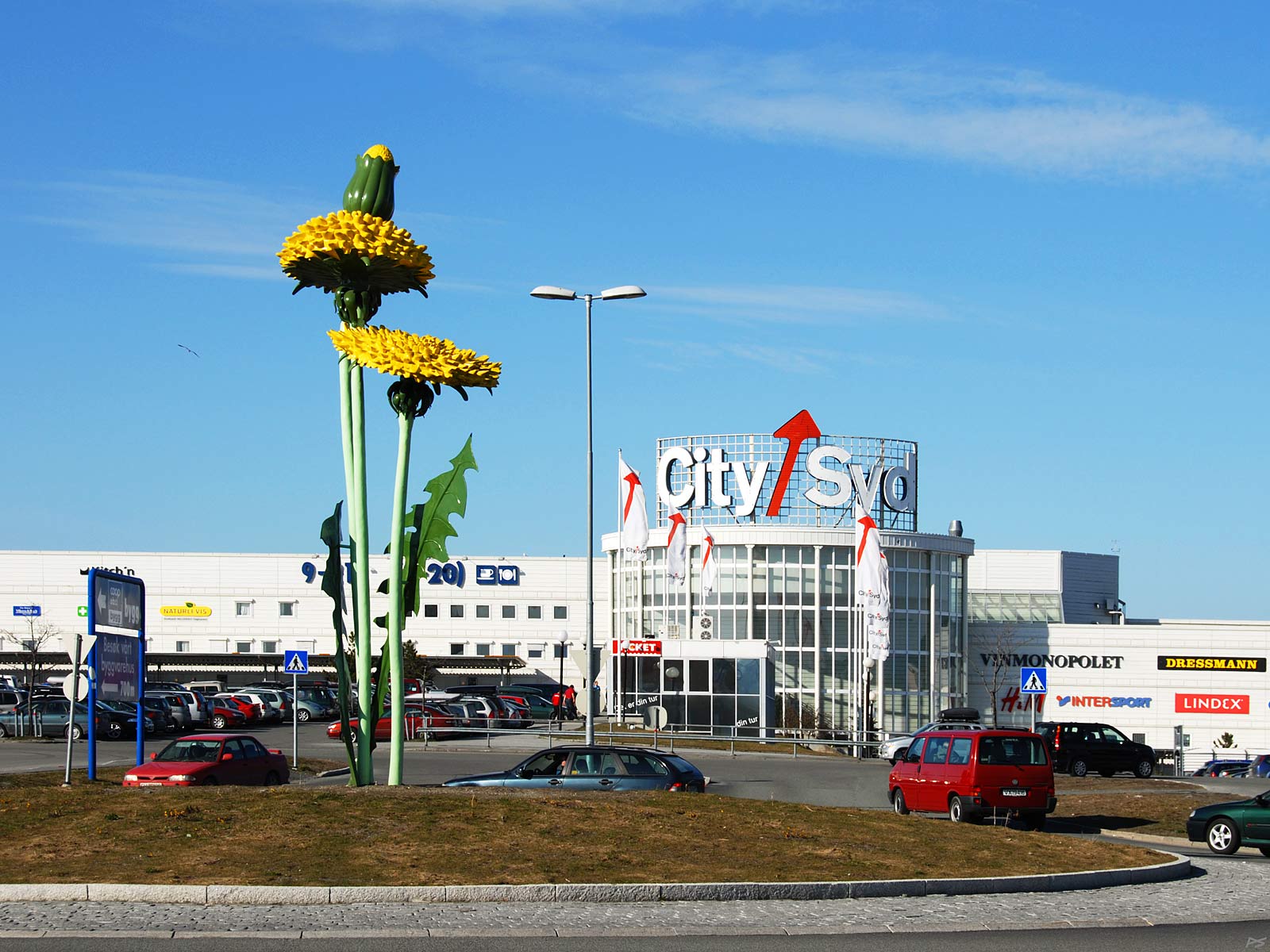
A giant 'dandelion' in the centre of a roundabout at the City Syd shopping centre in the Tiller suburb south of the city. Lately this street has been radically changed and the dandelion has been moved to s spot near by. The shopping centre opened i 1987 and is the largest one in mid-Norway.
(2008-04-23)
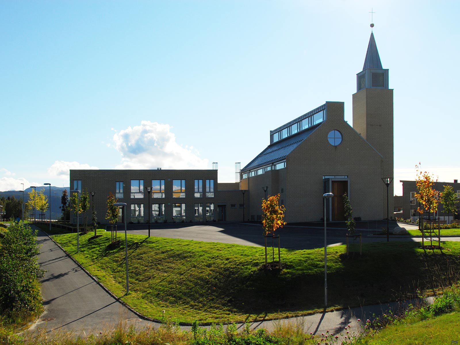
The Bridgettine Convent and its church in the Tiller suburb of Trondheim. The first Bridgettine Sisters moved in during the summer of 2009, but the church was not completed until Christmas 2010. During the summer of 2011 the preparation of the outdoor area was also finished. The Convent houses less than ten Sisters, all from other parts of the world. The Convent is also a guest house for anybody (25 beds), and the friendly Sisters take good care of their guests.
(2011-09-12)
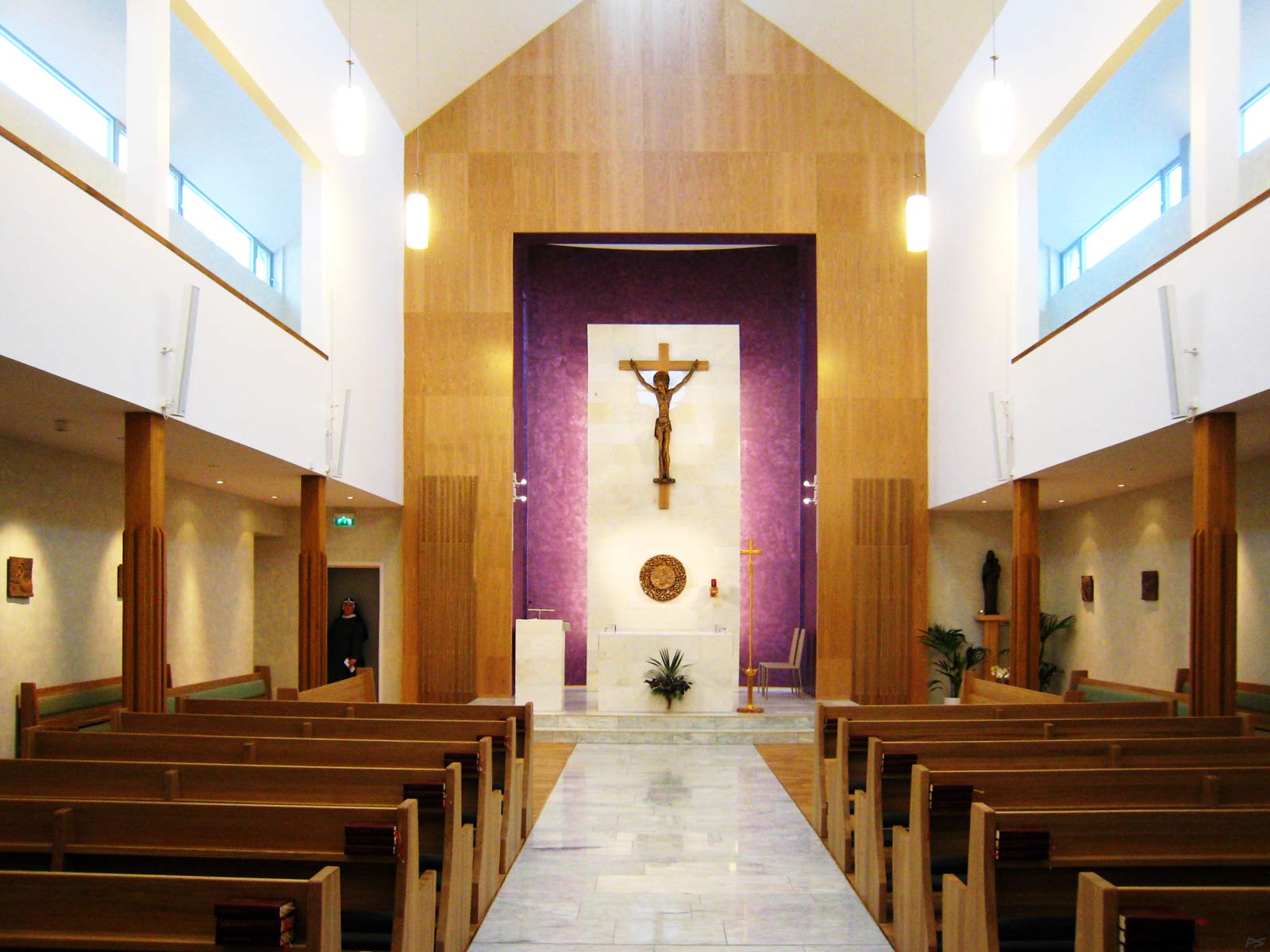
The interior of the church. On the original drawings the church was much smaller, intended for the Sisters and the guests only. However, soon the Catholic Church in Trondheim was to be rebuilt, and the bishop wanted the Bridgettine Sisters to build a church that could temporarily serve all Catholics in the town. The new St Olaf Catholic Church was finished in 2016 and its acoustic is great. In this church it is difficult to hear what the priest says.
(2011-01-12)
Autumn in Tillerbyen, a suburb south of Trondheim with some ten thousand inhabitants, shopping centres, schools and industry. This is a thoroughly planned suburb, built on nearly virgin land, actually a large and quite flat bog. The digging and building started in the early 1970s and it shows no sign of ending. Commercial buildings (shopping centres etc.) are on the west side of the north–south main internal road, dwellings, schools and kindergartens on the east side. On the east side, in the middle of the area, is also a forest, a natural recreation area. Motorized traffic and pedestrians/cyclists are largely separated; this means a lot of pedestrian bridges crossing the roads. These roads are mostly on a lower level than the houses and the pedestrian roads. Here you may also catch one of the frequent busses to other parts of the town. Downtown busses and taxis are prioritized, parking places are disappearing all the time and parking fees are frequently increased, so driving your own car isn't that tempting.
(2007-10-16)
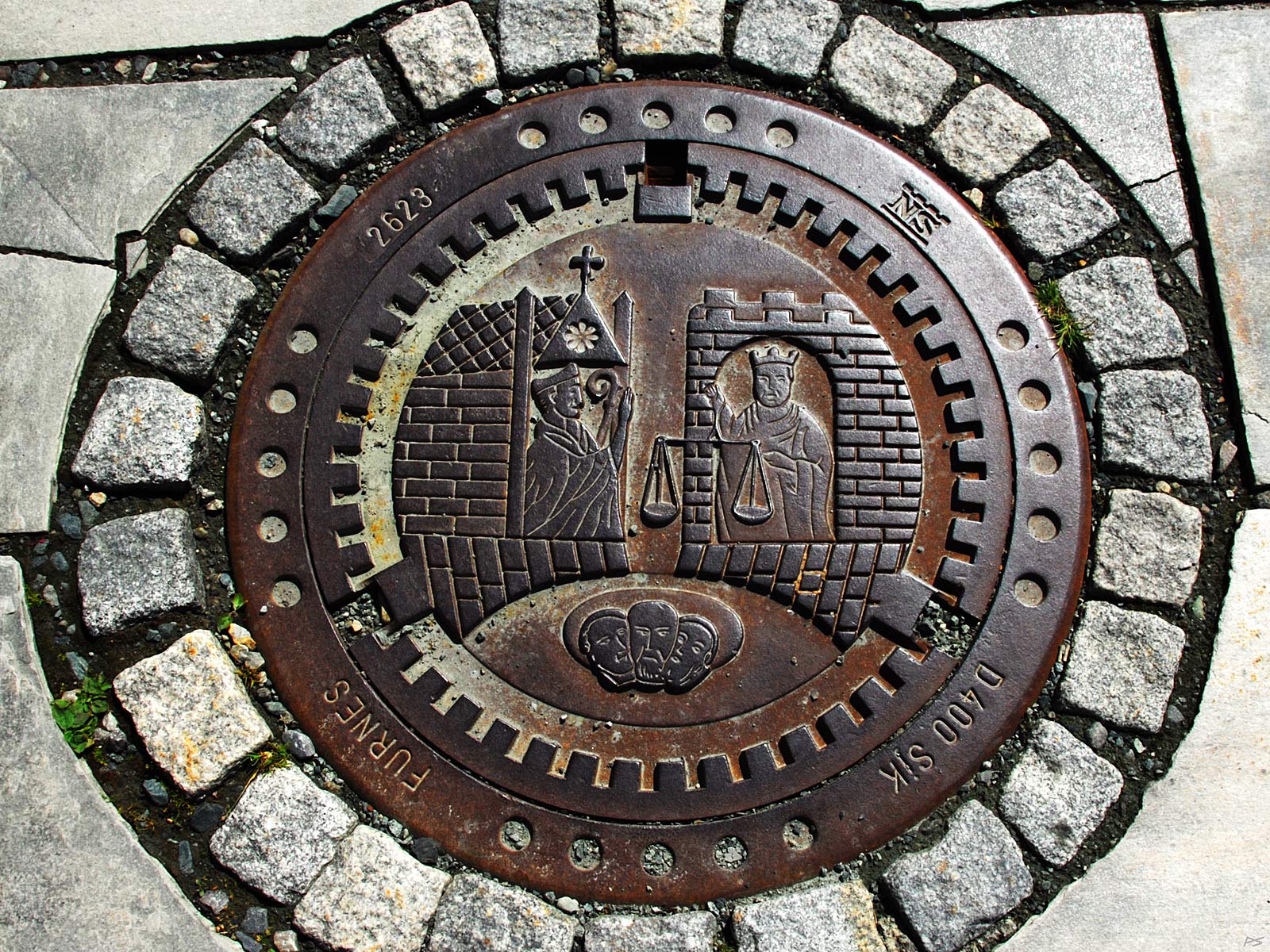
A manhole cover, cf. the town's coat-of-arms below.
(2012-07-03)
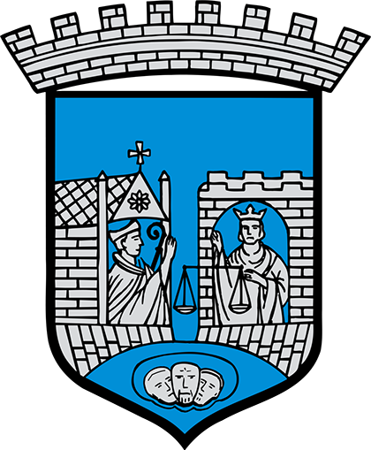
The Trondheim coat-of-arms
based on the medieval seal in the 1200s
This version dates back to 1897
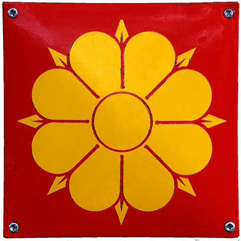
The Trondheim Rose
a variant of Olaf's Rose dating back to the 1500s
is
also found in the Trondheim flag
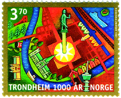
Trondheim's millennium anniversary postage stamp – 1997
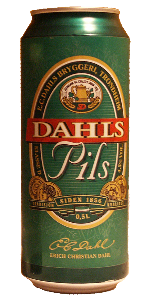
E C Dahl is the Trondheim major brewery, founded in 1856
Now all canned beer is produced in Oslo
but the taste is the same as before
So – skål, my friends!
hi little bird
don't look at me that way
I'm not going to get drunk