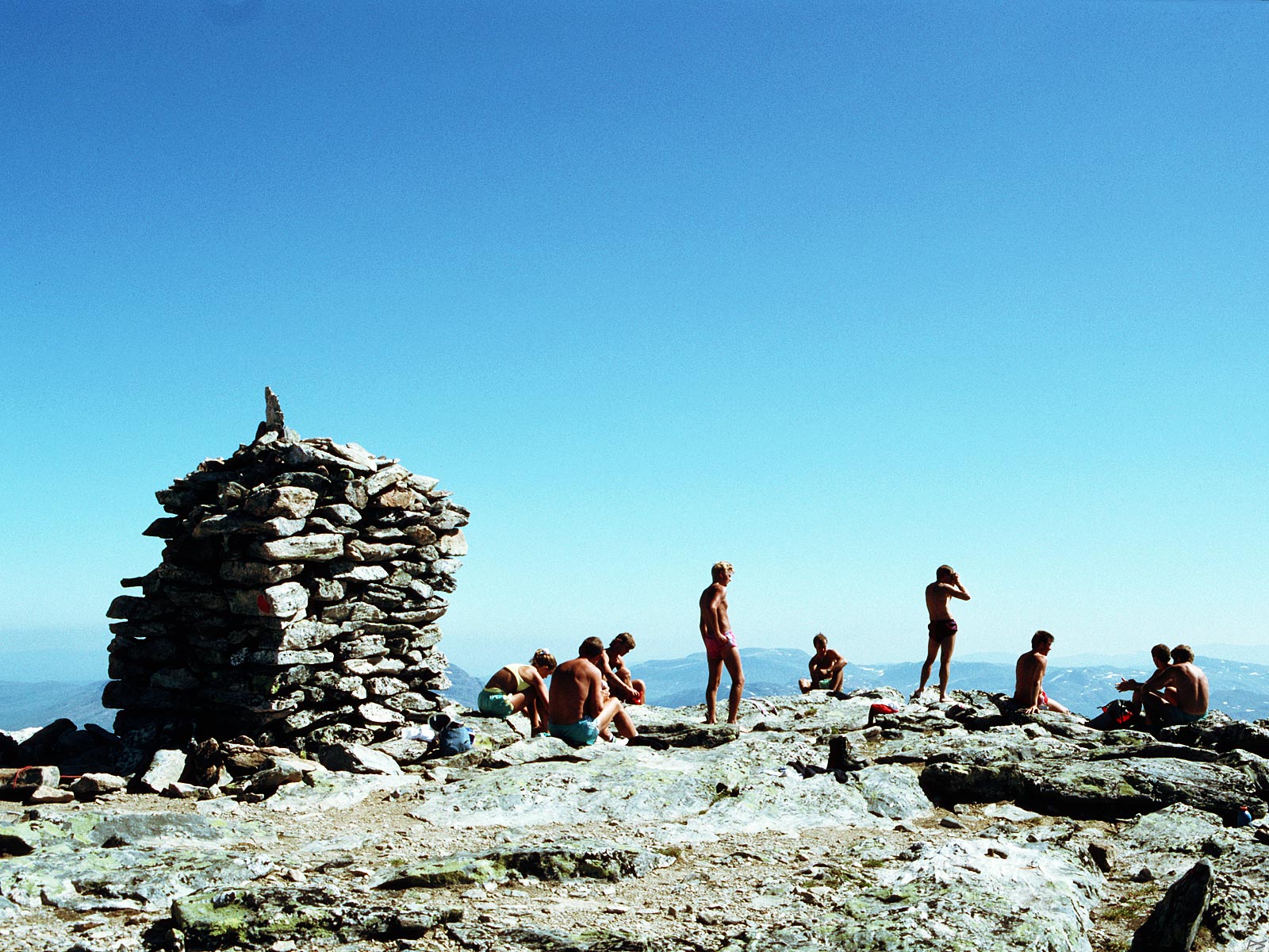
The top of Snota on a warm summer day. Nine young guys from Surnadal (and a 55 years old behind the camera). The altitude of Snota is 1668 metres and there are higher mountains further south in Trollheimen, but Snota is considered the central one. Day trips are feasible from Gråhaugen (pay road from upper Surnadal) and from Trollheimshytta (no road). Bring a water bottle (and thank me afterwards).
(July 1991)
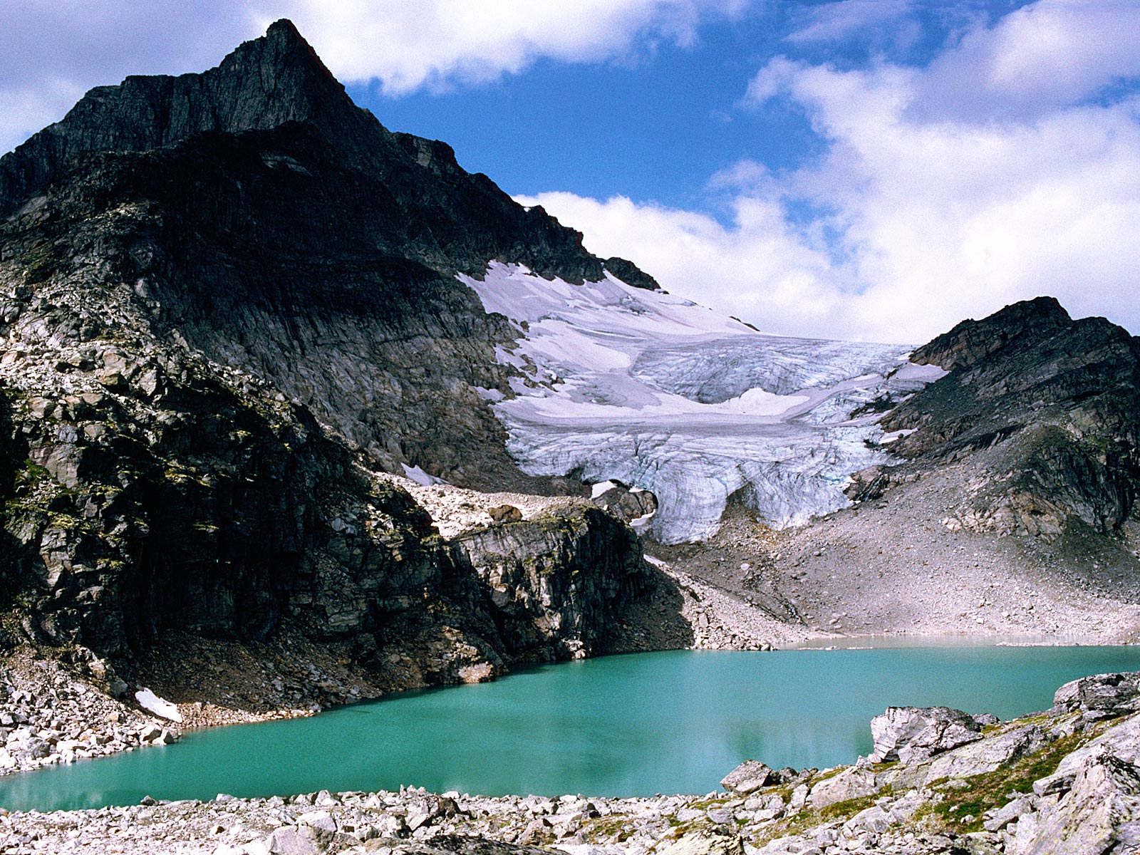
This small green lake lies 500 metres below the peak of Snota. If you go to the lake for a cold drink of water, you're likely to change your mind. Virtually suspended in the water is a myriad of tiny mica sheets, which explains the intense green colour. The mica is obviously scraped off the rock by the glacier and may split into extremely thin sheets, making them virtually floating in water. The usual route to the peak goes across this glacier. That year the glacier has retreated unusually far. I don't know how it looks now, a quarter of a century later.
(1986-08-14)
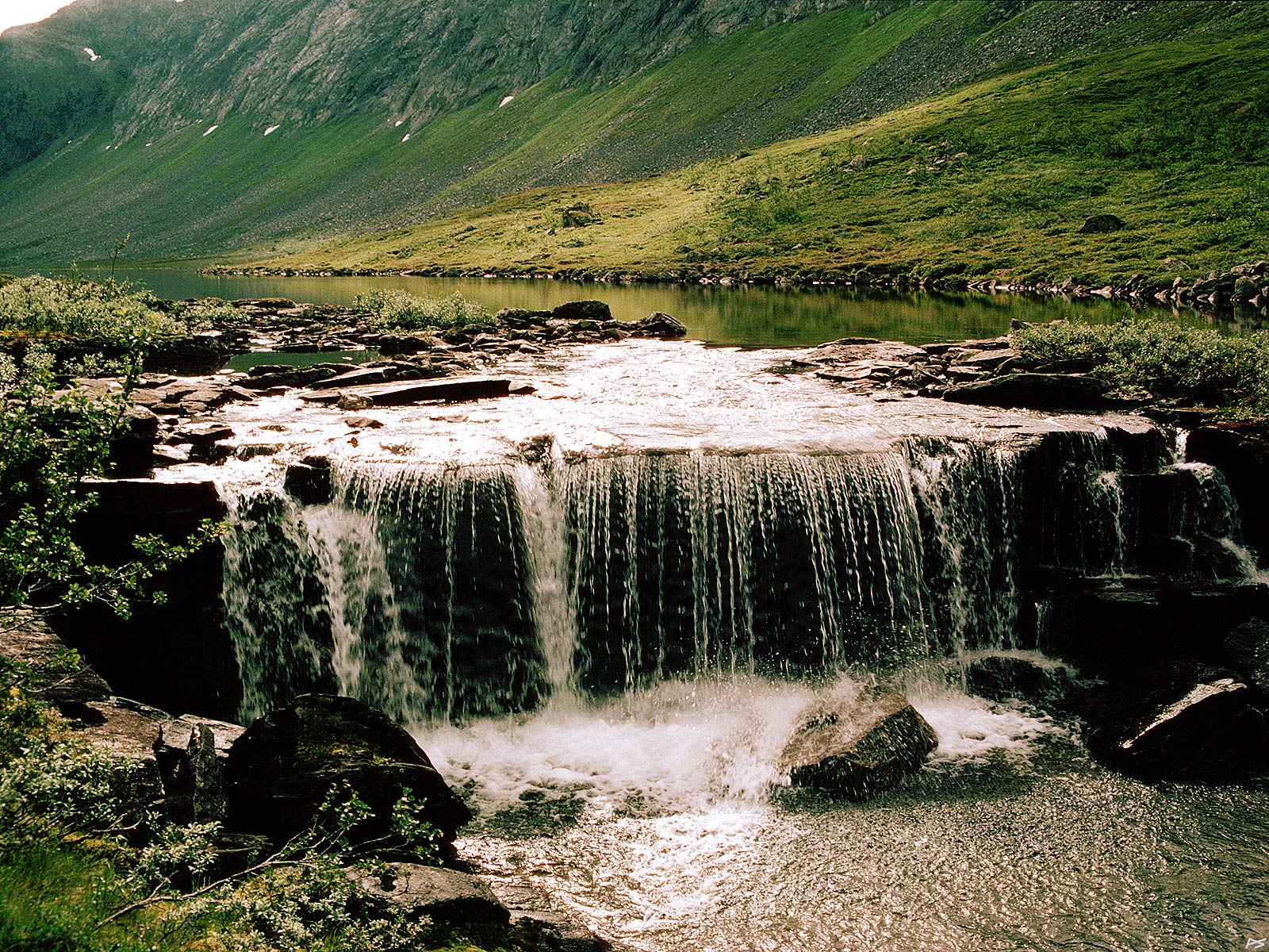
The lake Vassdalsvatnet lies close to the western steep slope of Snota at an altitude of 708 metres. It's 2.2 kilometres long and relatively narrow. The picture shows the outlet from its north end, a nearly perfect water curtain.
(1983-08-23)
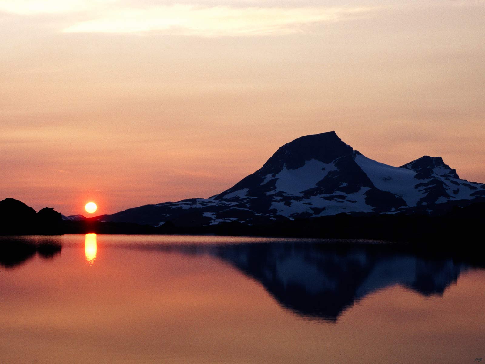
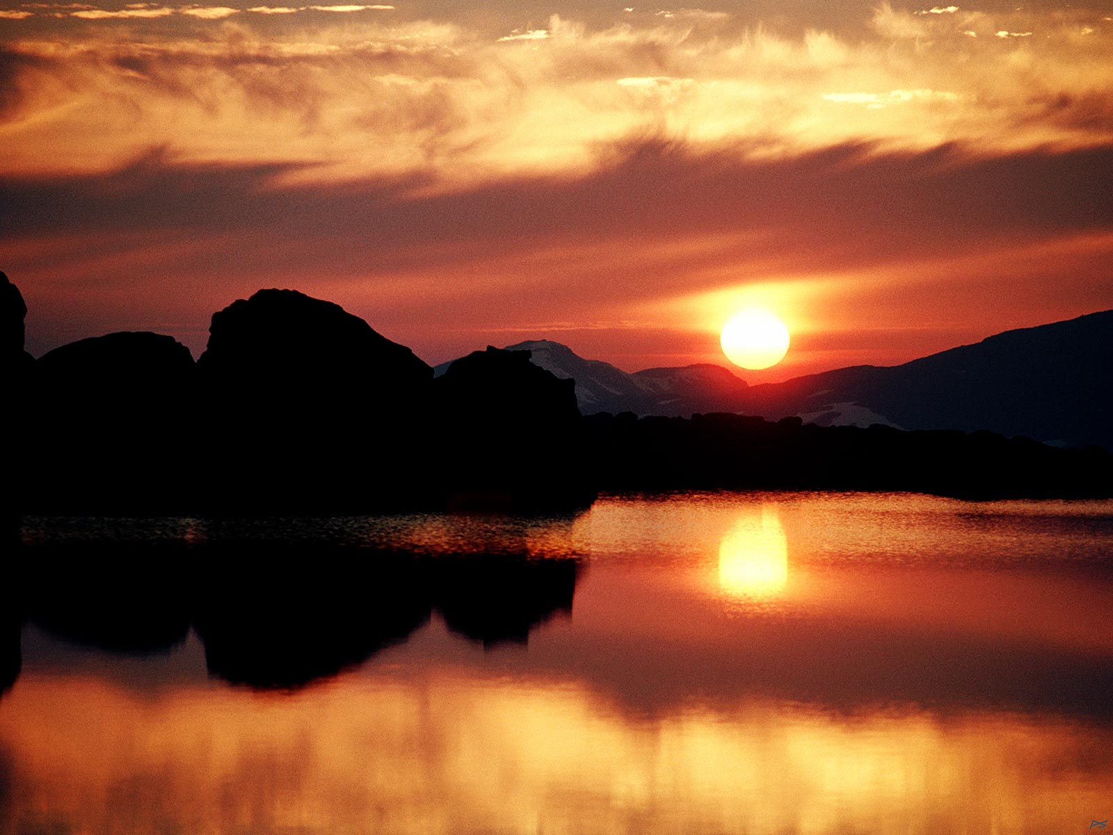
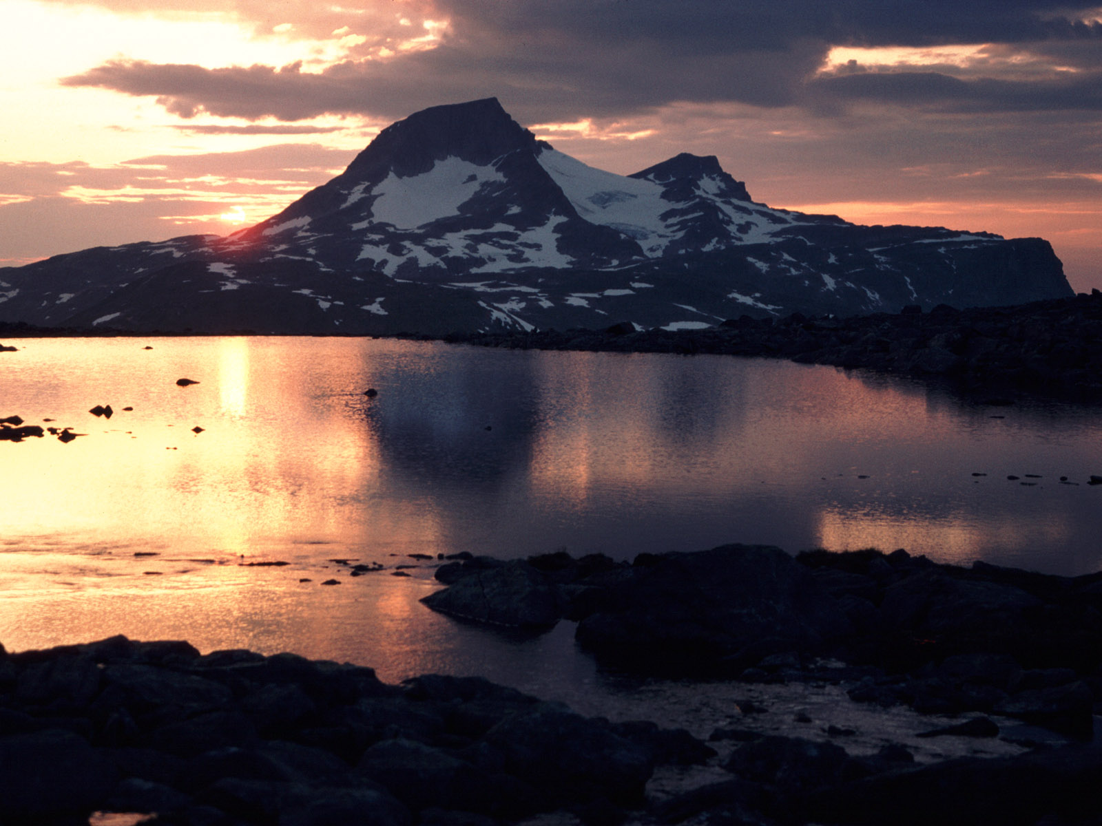
This picture and the three next ones show sunset behind Snota. They are taken from a small and nameless lake, altitude 1069 m, on the north side of the mountain Storlifjellet, 7.5 km southwest of Snota
(1989)
This lake lies in a depression on the mountain side. It's almost split in two and it has three water carrying outlets. And there is an islet, maybe 4–5,000 m2, occupying the left half of this picture (see last picture).
(1989)
Soon time to crawl into the sleeping bag.
(1989)
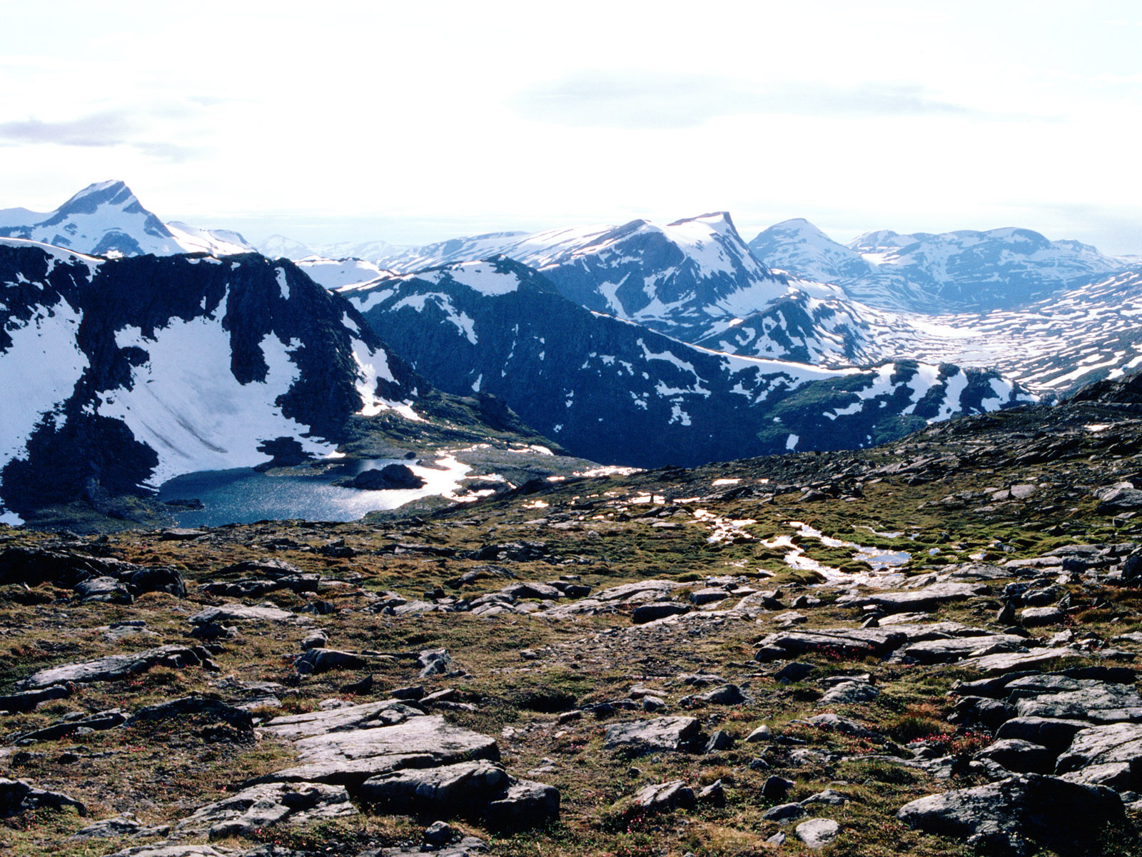
The nameless lake down left, its left part is not visible. Top left Neådalssnota and Snota is outside the picture to the right.