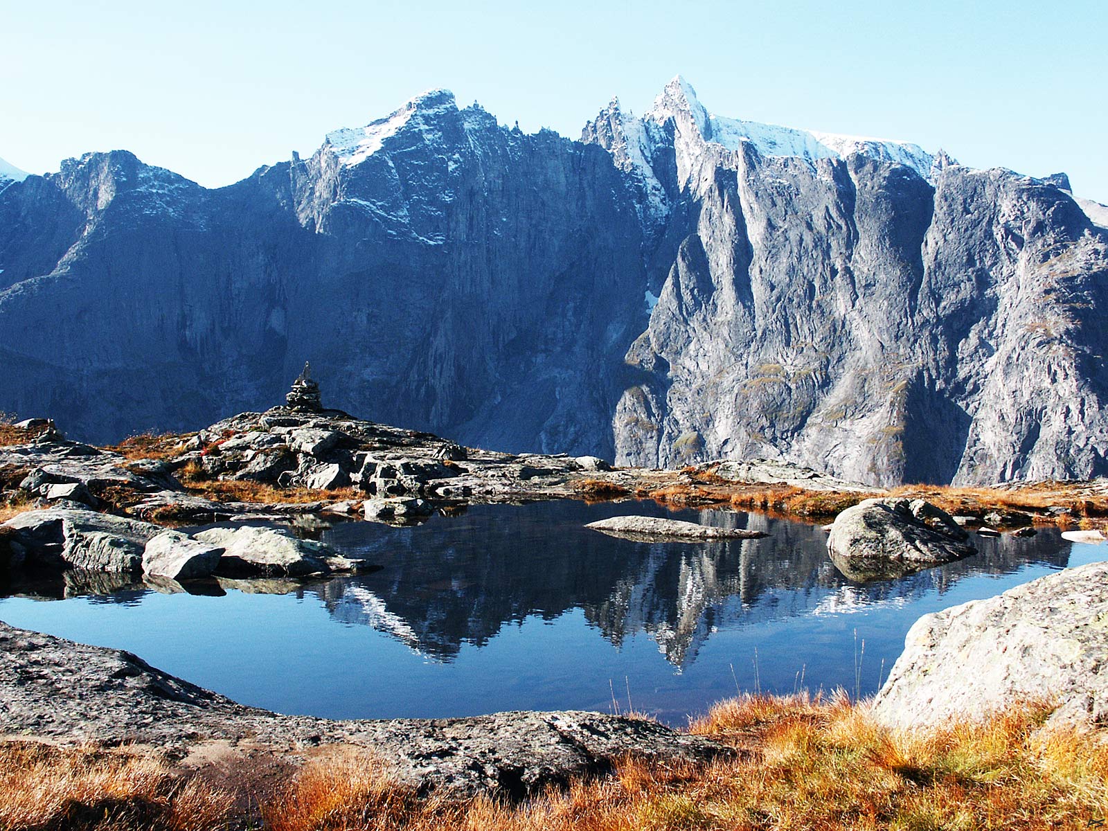
View from Litjfjellet (alt. about 750 m) across Romsdalen in Rauma towards Trolltindene. As most pictures taken on this site, the peaks are shown reflected by the small pond. The rightmost and highest peak is Store Trolltind (1788 m) and the left rounded peak mirrored is Trollryggen. It's the first day of October and snow on the peaks is normal.
(2004-10-01)
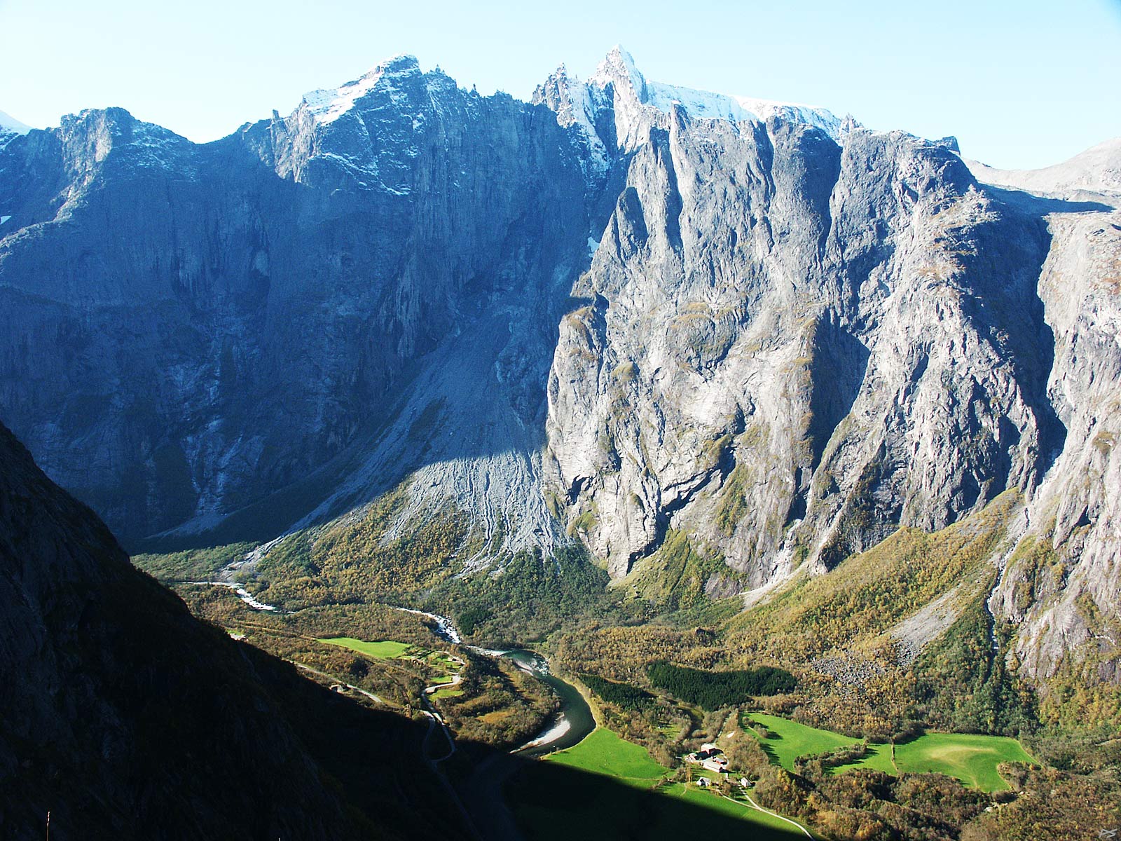
Another view from Litjfjellet, showing the bottom of the valley Romsdalen with the river Rauma, which lies close to sea level. On the opposite side of the valley resides Trolltindene and in their centre is Trollveggen (the Troll Wall), the highest vertical cliff in Europe (more than 1000 m). The rock here is fragile and dangerous, as proved by the enormous scree below. During the last Ice Age the glacier removed all debris from the valley, so this scree is formed during the last ten thousand years or so. The low gap in the middle of the picture, on the right end of the vertical wall, is called Bruraskaret (the Bridal Gap). Many years ago it was used for BASE jumping into the valley, but the winds here are treacherous and there have been several accidents. The same winds and loose rock also make helicopter rescue operations risky, therefore BASE jumping has been prohibited on this site.
(2004-10-01)
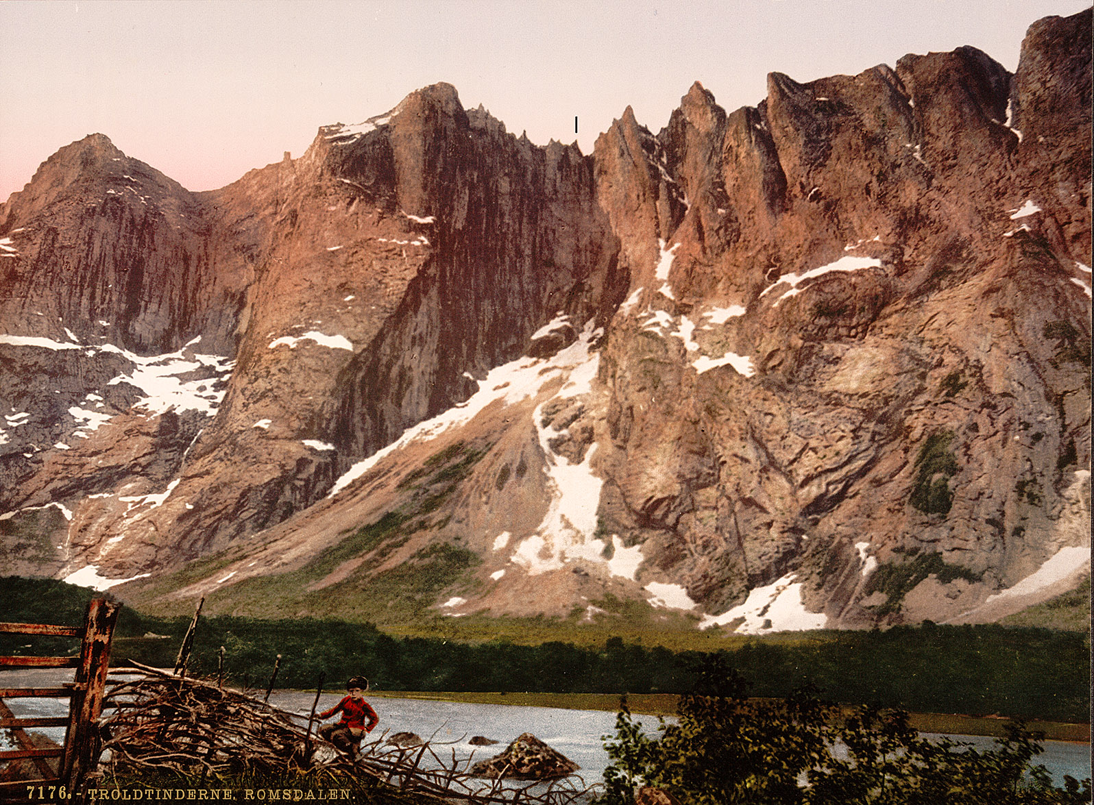
U.S. Library of Congress, Photochrom Print Collection.
Trolltindene more than a hundred years ago.
Look at the small and discreetly marked peak in the middle of the picture and compare it with the recent picture above. This is Brura (the Bride), one of the needle peaks. In the autumn of 1946 most of this nearly 100 metres tall fragile girl collapsed and ended up amidst the other debris far below.
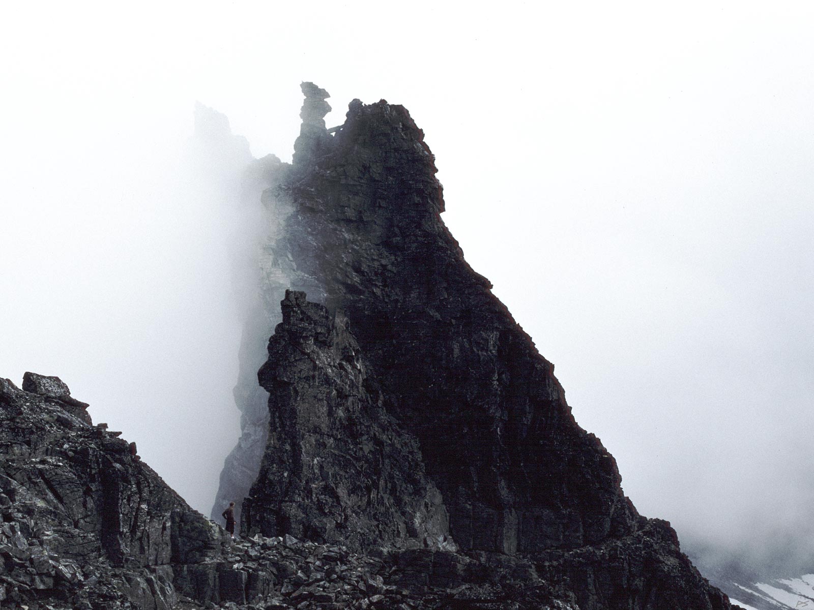
Bruraskaret ('The Bridal Gap') in Trolltindene was used for BASE-jumping into the valley Romsdalen, but in 1986 this was prohibited due to unpredictable winds, several accidents and very dangerous rescue operations. (Written on the rock: "800 m until impact"). Brura ('The Bride') is the tiny needle peak in the centre of the image (compare it to my friend standing close by). In autumn of 1946 most of her fell into Romsdalen, polluting the air with pulverized rock. The rock on the ridge looks and feels extremely fragile and the ridge is continuously "sharpened" by erosion. On the ridge are needle peaks of all sizes, some even less than a man's height, and on the top of each one lies a slab of hard rock, evidently required for their formation and continued existence.
In 1957 we threw heavy rocks into Romsdalen and measured the time till the sound of impact. Sixteen or seventeen seconds, I remember. It was safe then, but a year later some crazy guys began climbing the wall. (Arne Randers Heen and Ralph Høibakk, but that was slightly further east, up Trollryggen.)
(1990-08-19)
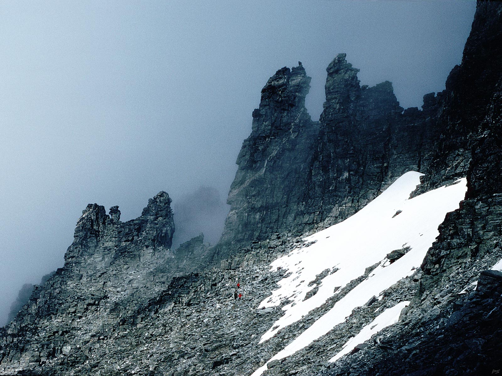
When exposed to sunlight, trolls turn to stone. This happened to Trollkjerringa and Trollgubben (wife and husband) seen top right. There are three human visitors below the picture centre.
(1990-08-19)
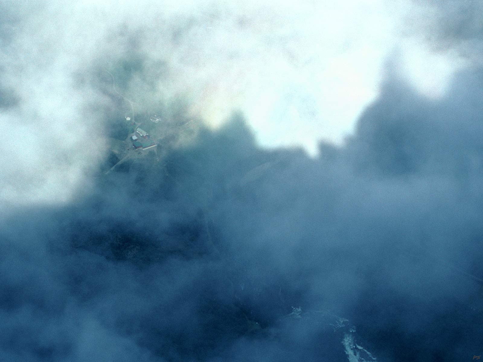
The shadow of Trolltindene and glimpses of Romsdalen. The strangely coloured region top right is a rather diffuse variant of the rainbow-like ring (halo) you see when looking down from a plane on its shadow on the clouds.
(1990-08-19)
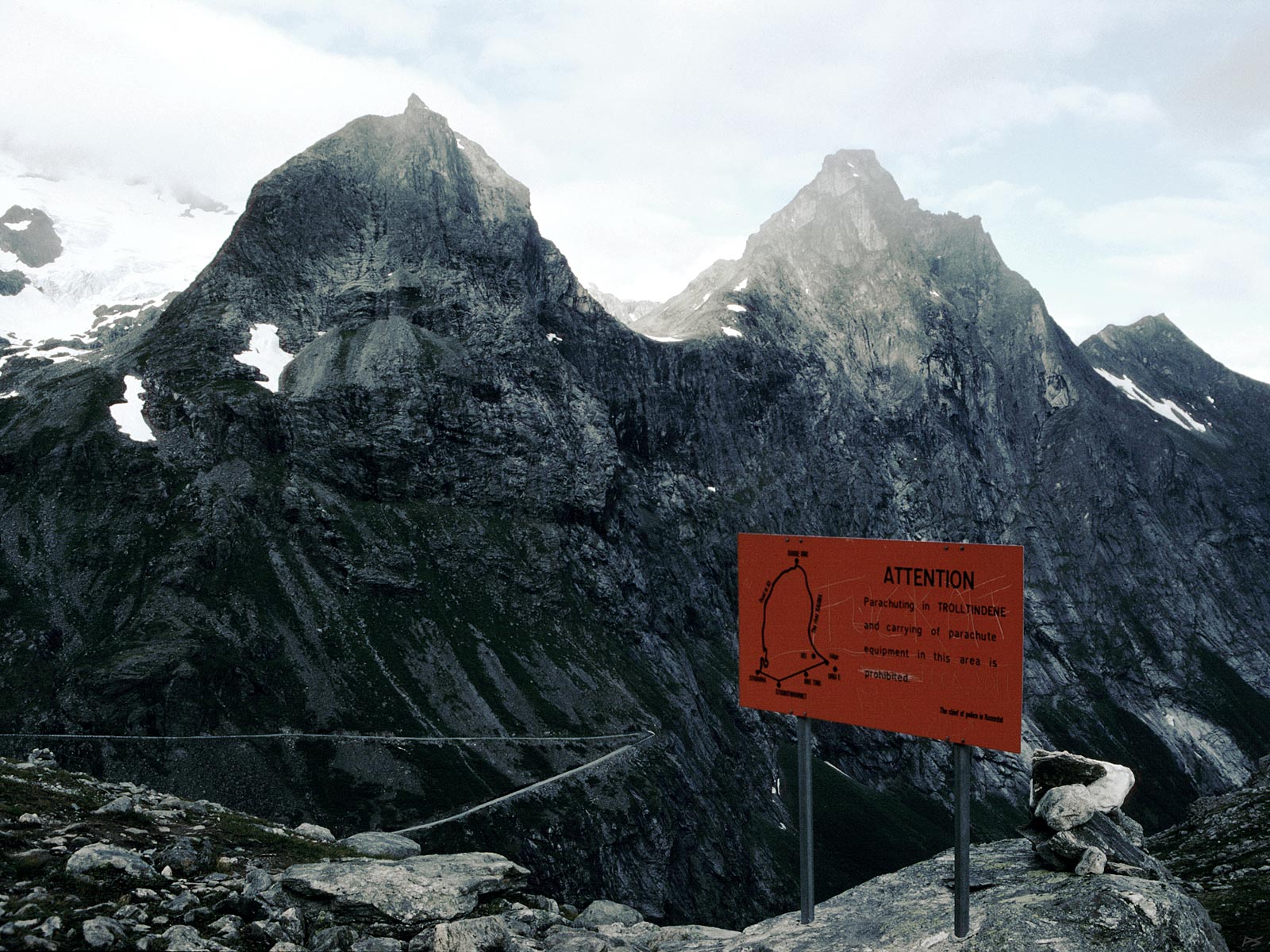
Hiking to Trolltindene: The sign says: "ATTENTION – Parachuting in TROLLTINDENE and carrying of parachute equipment in this area is prohibited", and scribbled on top of it: "FUCK OFF". The mountains in the background are Bispen (1786 m) and Kongen (1614 m). Lower left is the upper part of Trollstigen, the steep part of the road between Åndalsnes / Romsdalen and Valldal, first time opened 31 July 1936, since then opened every spring.
(1990-08-19)