– driving about in Norway
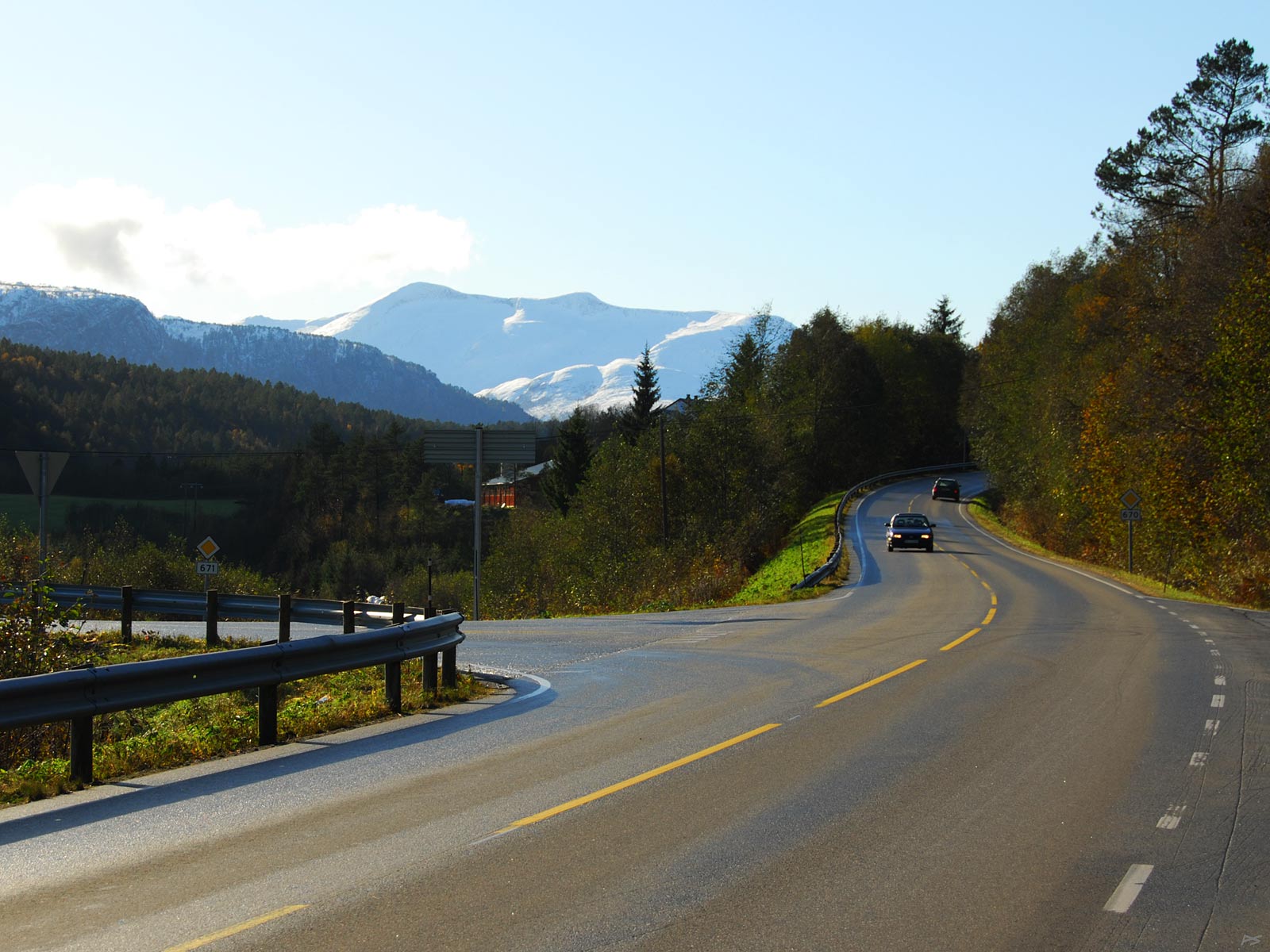
It's in the middle of October and mountains and high hilltops have got a new white carpet. Between Surnadal and Kvanne, Nordmøre.
(2009-10-13
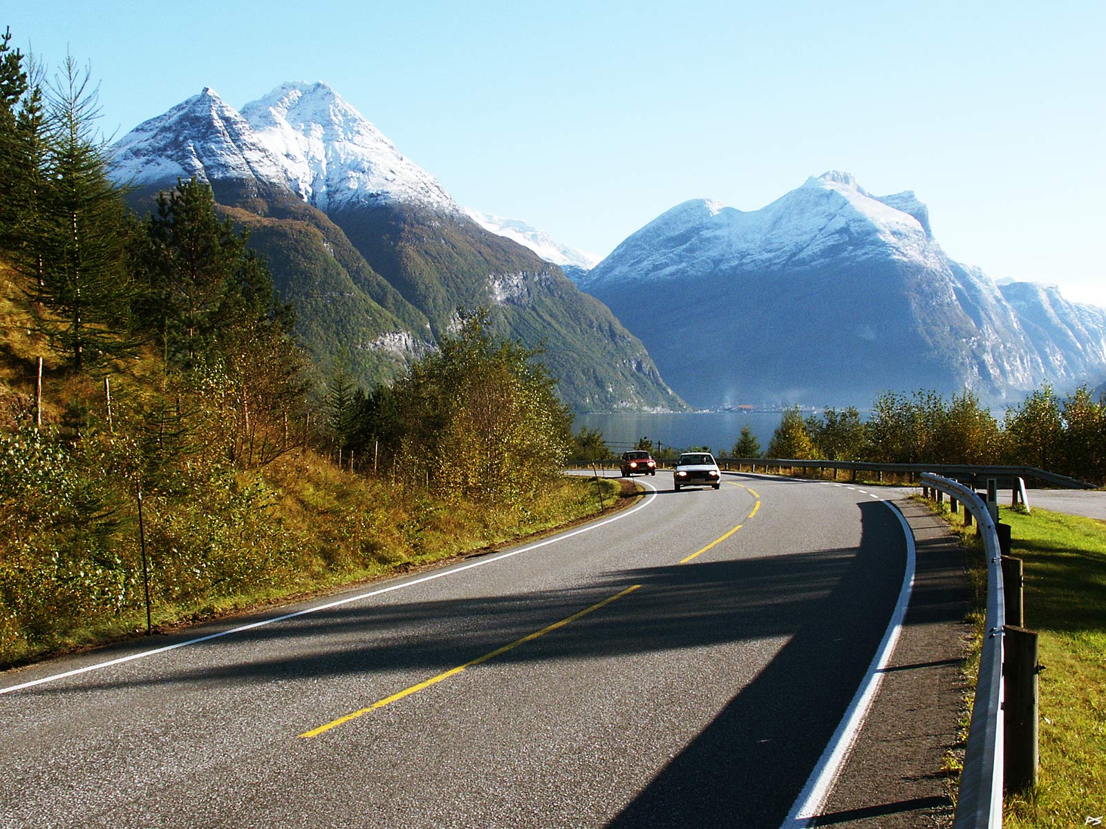
Autumn – the first snow on the mountain tops. View towards Sunndalsøra from the north side of the fjord. The smoke from the aluminium plant can be discerned.
(2003-09-28)
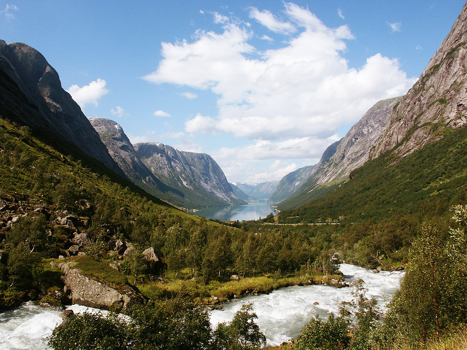
View of the east end of the lake Kjøsnesfjorden, the single branch of the lake Jølstravatnet. It is situated in Sogn og Fjordane, just west of our largest glacier, Jostedalsbreen. The brook comes directly from the glacier high up on the mountain side. The picture is taken close to the southwest entrance to the Fjærland road tunnel, which runs under the glacier.
(2007-08-10
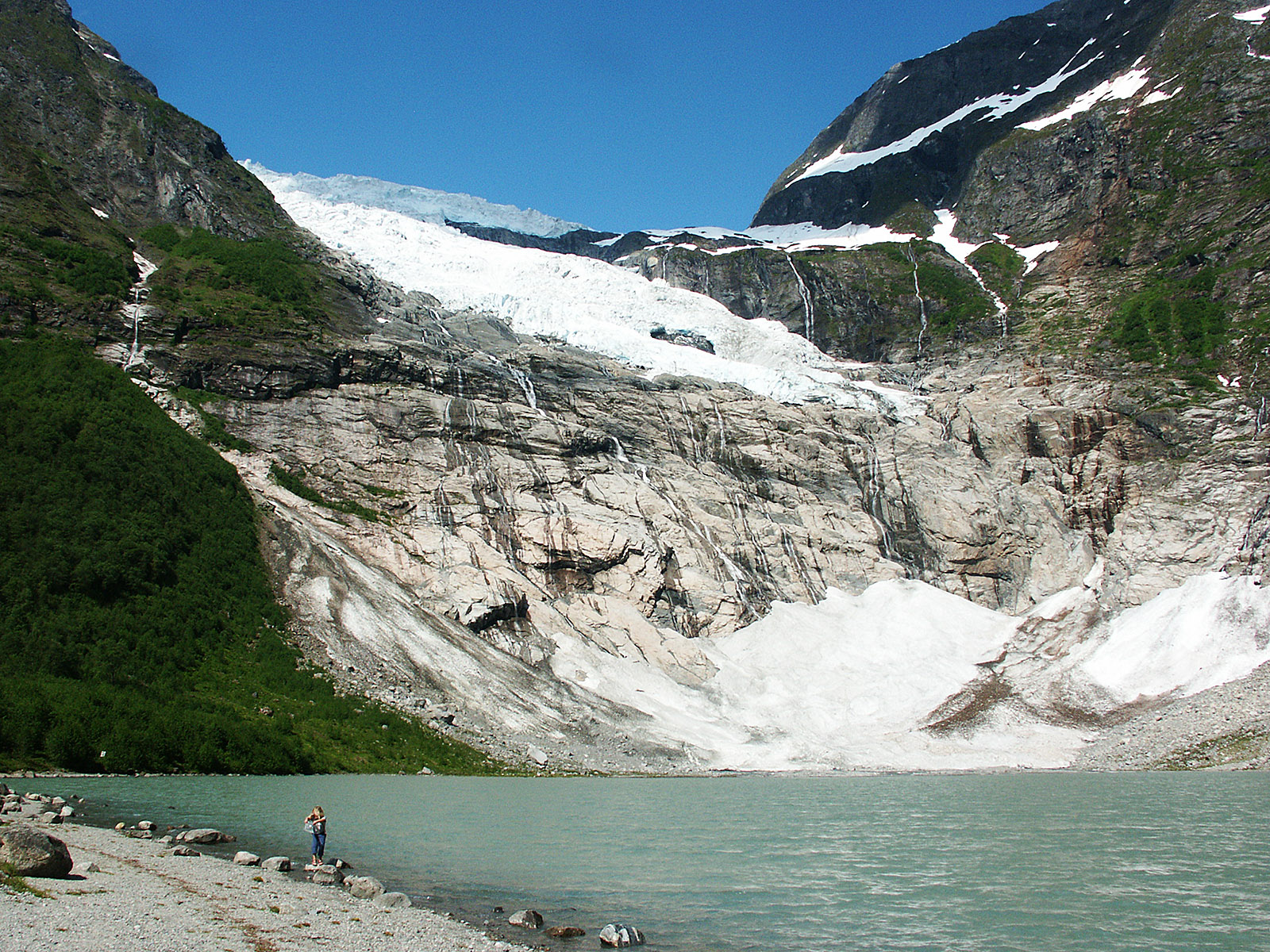
Bøyabreen (the Bøys glacier), a branch of Jostedalsbreen, and the small meltwater lake Brevatnet near the east end of the Fjærland road tunnel mentioned above.
(2007-06-18)
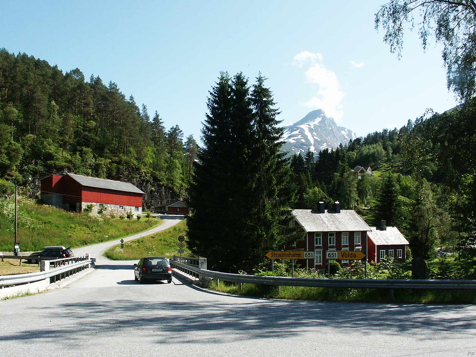
Eide, between Geiranger and Eidsdal. The bus is coming from Geiranger. There is a picture of the old bridge on the right.
(2014-09-15)
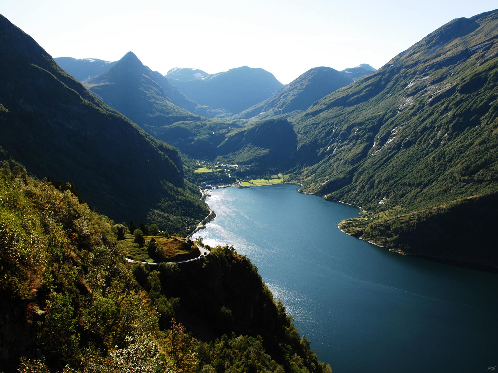
View of Geiranger from Ørnevegen, "The Eagle's Road". Geiranger is a well-known tourist destination, but now the tourist season is coming to an end and cruise ships will stop polluting the air. The cone-shaped mountain to the left is called Dalsnibba (1476 m) and there is a pay road to the splendid view on its top, opened in 1939.
(2008-09-12)
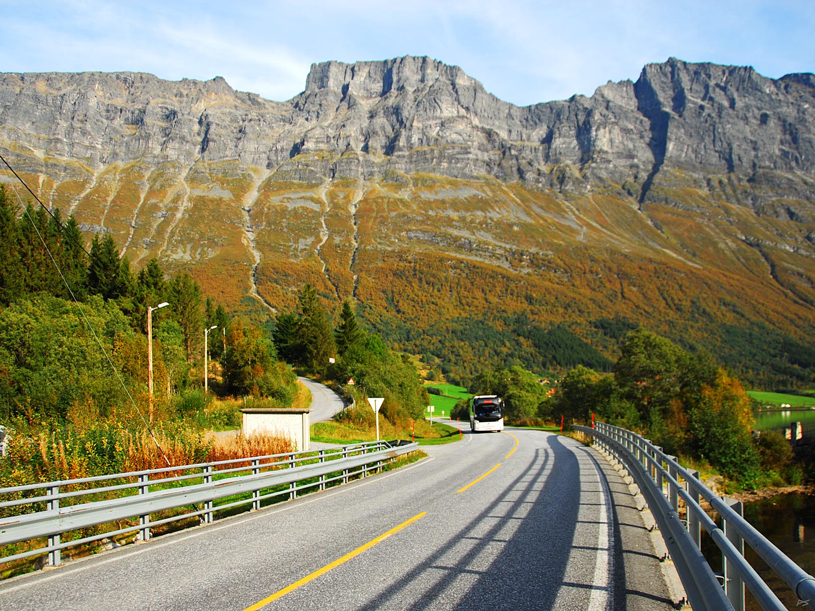
Austefjord, south of Ålesund, at the innermost end of Voldsfjorden; Volda lies some twenty kilometres out the fjord. E39, the main road through Western Norway, is less than a kilometre away. The mountain with the characteristic cloud is Sunndalsnibba (1482 m).
(2007-06-20)
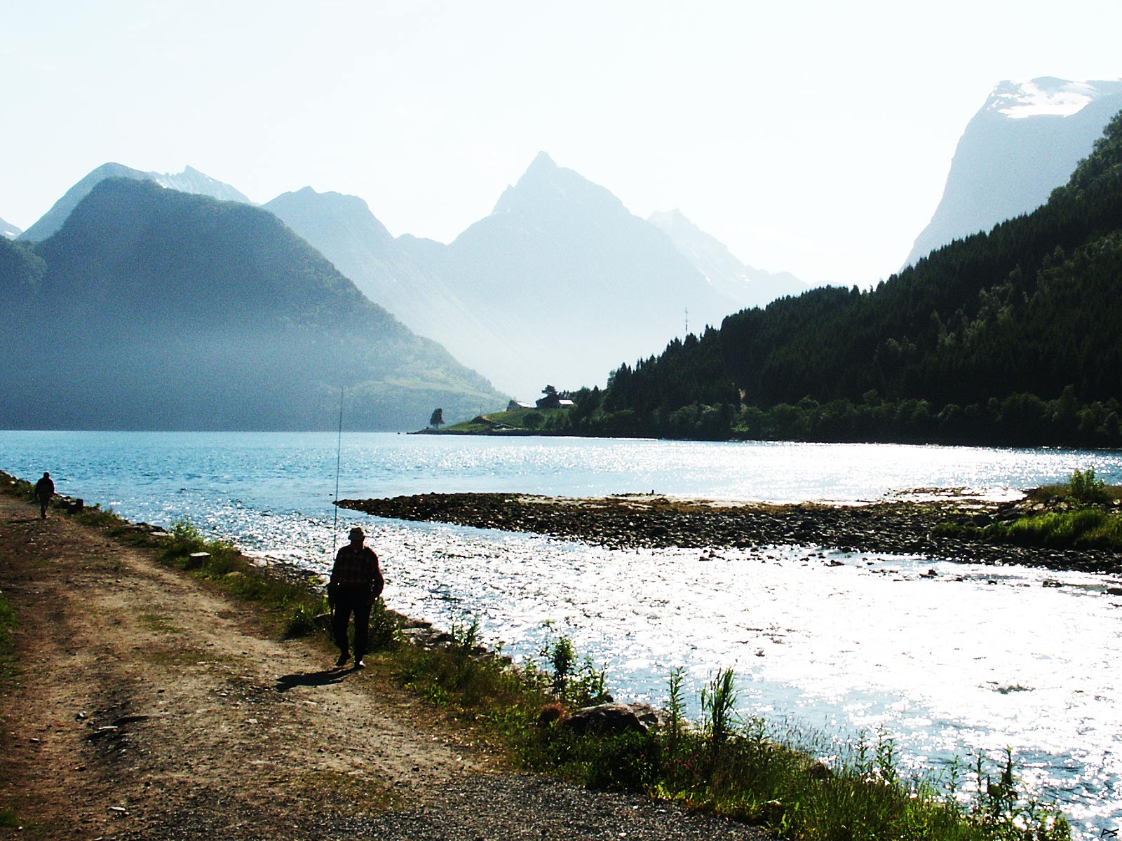
Sæbø is a small community on the west side of Hjørundfjorden, featuring a small river (Bondalselva) with salmon and trout, a hotel, a camping site essentially for people fishing in the river, a couple of shops, some industry and a big church. On the east side of the fjord and the picture centre – in the morning mist – the mountain Slogen (1564 m). This mountain has been a popular climbing target and is overlooking the wild and narrow valley Norangsdalen and Hotel Union in Øye, an old hotel trying to conserve the style from the times when English noblemen were the most common tourists. The picture shows a sport fisherman at the mouth of the river.
(2007-06-21)
Refvik – where you may swim in the Atlantic Ocean – when the weather is favourable, it's open to the ocean towards northwest. It's situated on the island Vågsøy southwest of Ålesund some ten kilometres north of the Måløy town. There is a camping site close to the beach. To the right is a freshwater lake.
(2007-06-19)
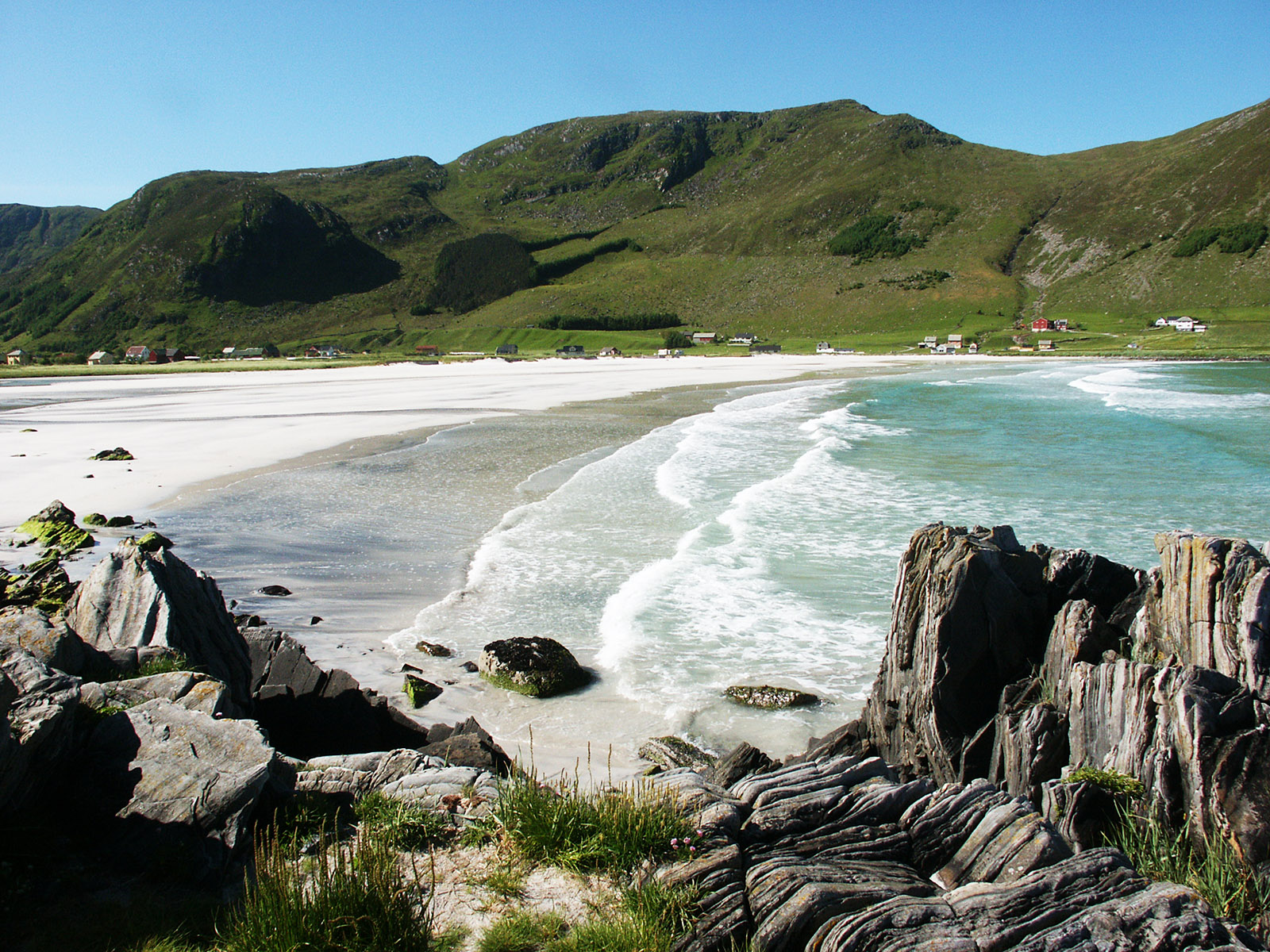
More from Refvik – They say that this picturesque beach is popular as a background for bridal photos.
(2007-06-19)
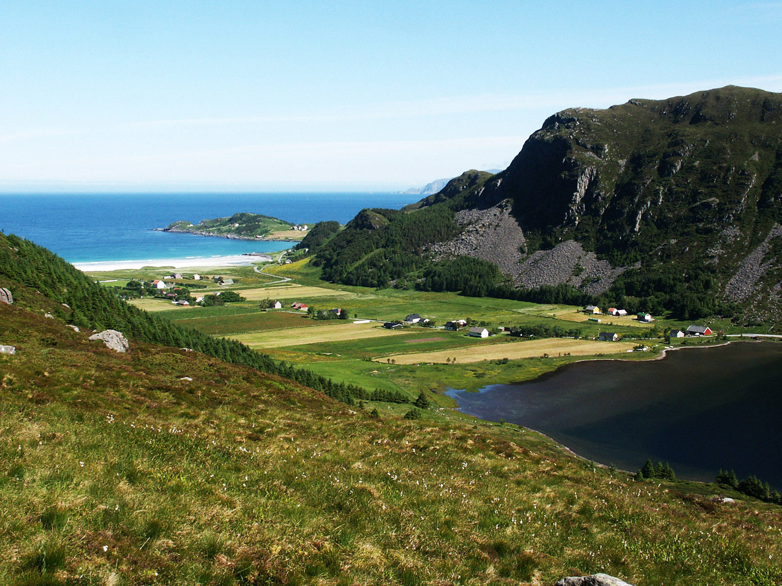
Byrkjelo, in Sogn og Fjordane, south of Ålesund, north of Skei at the lake Jølstervatnet. With this strange mountain virtually in the middle of the valley.
(2007-06-18)
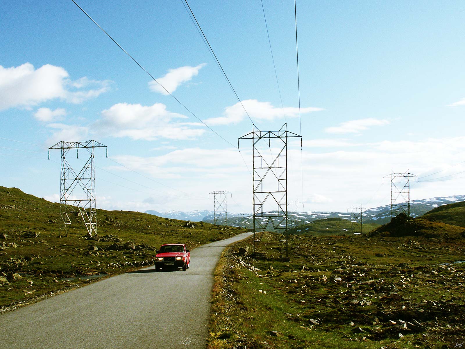
Power lines and a road across the mountains between Øvre Årdal and Turtagrø in the south part of Jotunheimen. The altitude is about 1300 metres and it's close to the mountaineer's El Dorado, Hurrungane.
(2005-08-10)
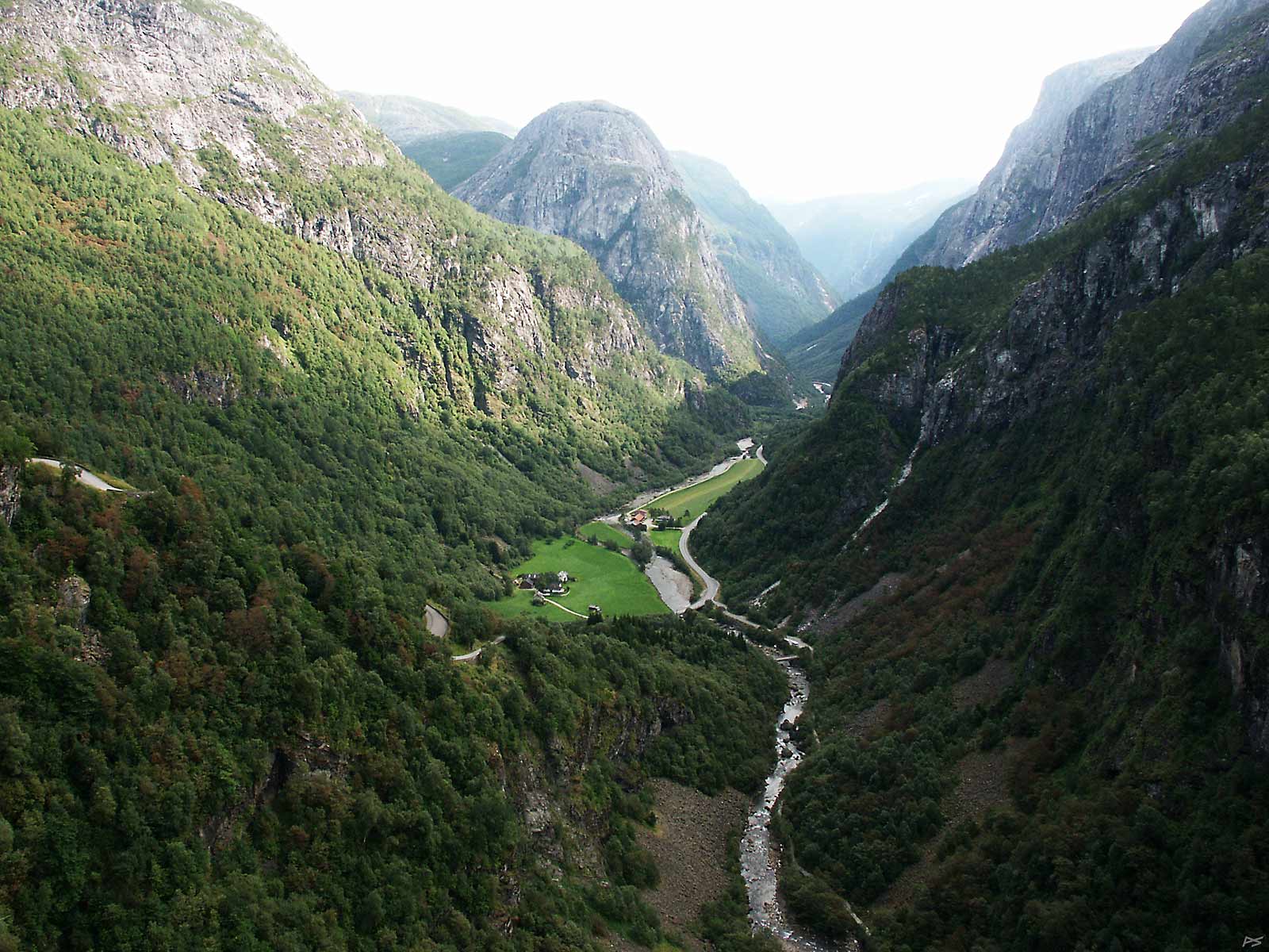
View of the valley Nærøydalen from the Stalheim Hotel. On the left glimpses of the old road (Stalheimskleiva) zigzagging down to Nærøydalen. It is narrow and has a maximum inclination of 18.5 percent, but it's safe to drive there. Now (2021) there are rumours that the old road will be closed, because it has been damaged by a number of tourist busses. Those young tourist bus drivers seem to do their best to impress the tourists. The main road now descends through a tunnel. This is one of the most photographed views in Norway. And painted.
(2005-08-10)
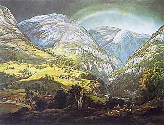
In Norway well-known painting by J C Dahl: From Stalheim (1842)
U.S. Library of Congress, Photochrom Print Collection. |
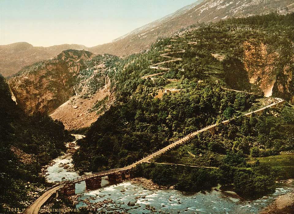
The old road more than a hundred years ago. The new road comes out of the tunnel and crosses the river further upstream. |
(2008-07-03)
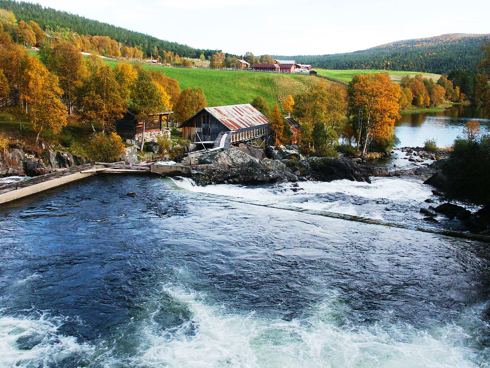
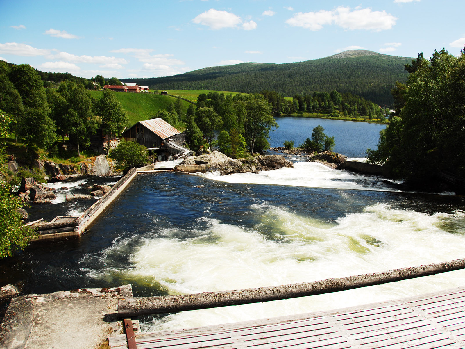
Atnbrufossen Vannbruksmuseum (the Atna bridge waterfall water use museum), originally an old sawmill.
2006-09-24
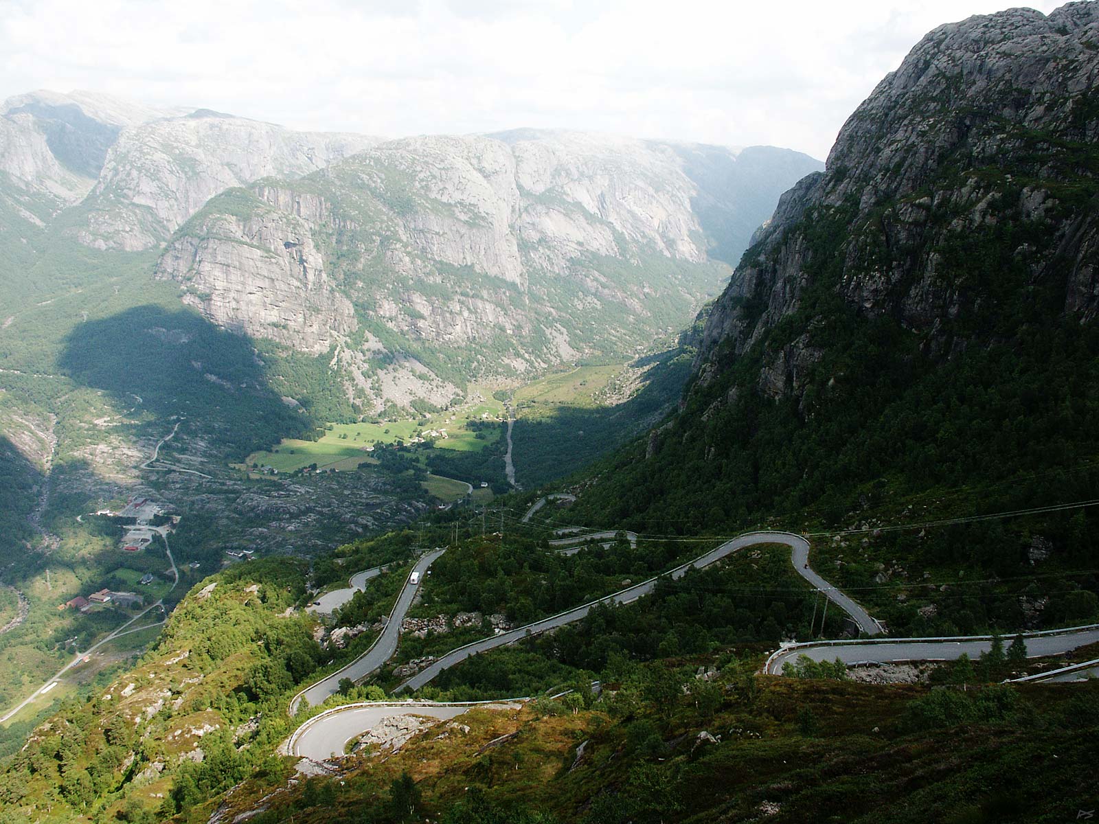
The Sirdal–Lysebotn road descending to Lysebotn through 32 hairpin bends and a tunnel with a 340 degrees bend. This is the only road, and it's closed during the winter, so they rely on boat transport to the other end of the forty kilometres long and quite narrow and wild Lysefjord (east of Stavanger). Every summer this road has been used for roller ski contests. From the top of this road BASE jumper and some fearless tourists hike five kilometres to the mountain Kjerag.
(2004-08-07)
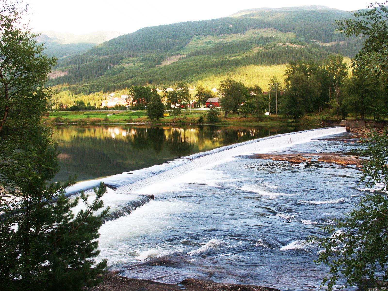
Evening at the river Otra in Valle, Setesdal. It seems that river water has been used to produce electric power and a threshold is used to maintain a water mirror.
(2004-08-06))
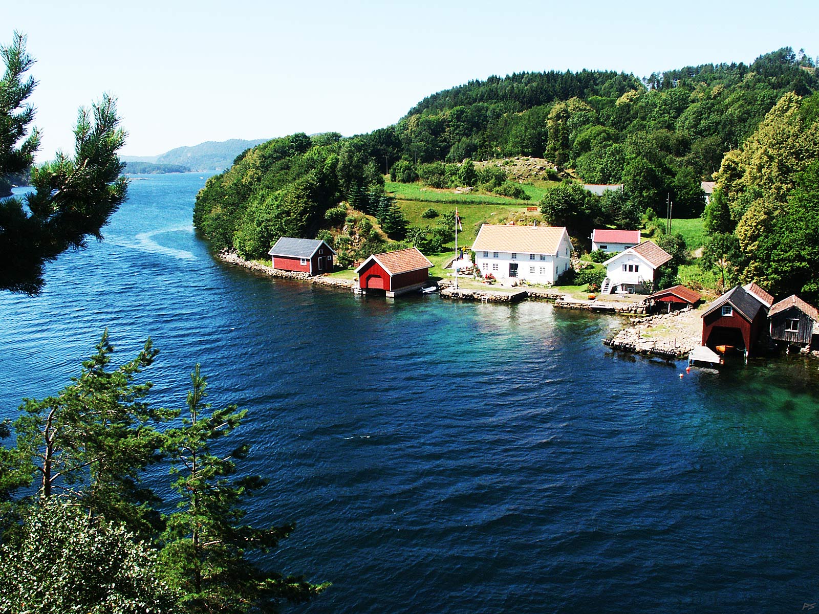
From the bridge across Jåsund, north of Lindesnes, on the road Spangereid–Lyngdal. Two (three?) of the boathouses typical of Sørlandet are seen. Here the difference between high and low tide is very small.
(2006-07-25)
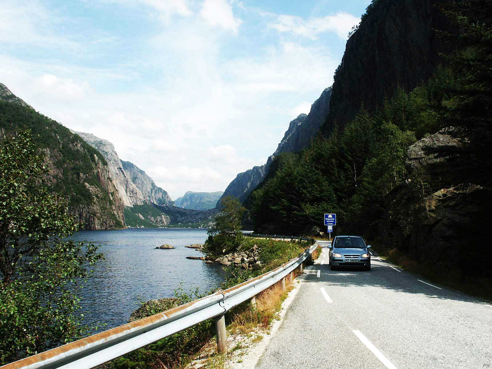
This is the valley Gloppedalen southwest of Stavanger. Do you know what a 'scree' is? A scree – or talus, as our friend the geologist calls it – is "a sloping mass of loose rocks at the base of a cliff". Behind the far end of the lake is one of the greatest screes in Scandinavia, Gloppedalsurda, filling the bottom the valley.
(2007-08-06)