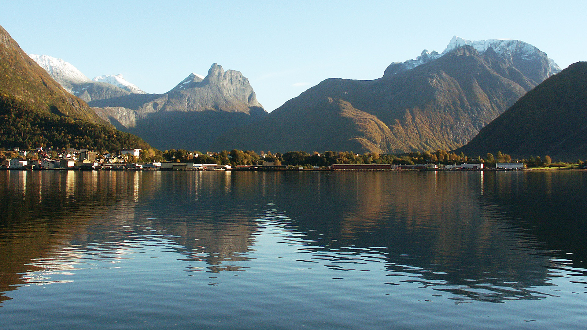
The town Åndalsnes in the Rauma municipality seen from the north side of the fjord (Isfjorden). The mountain left of the centre is Romsdalshorn and on the right side the ragged ridge Trolltindene can be seen above the closer and less spectacular mountain Norafjellet. Between Romsdalshorn and Trolltindene runs the main valley Romsdalen and to the right, in front of Norafjellet, is the mouth of the valley Isterdalen leading to Trollstigen.
(2004-10-01)
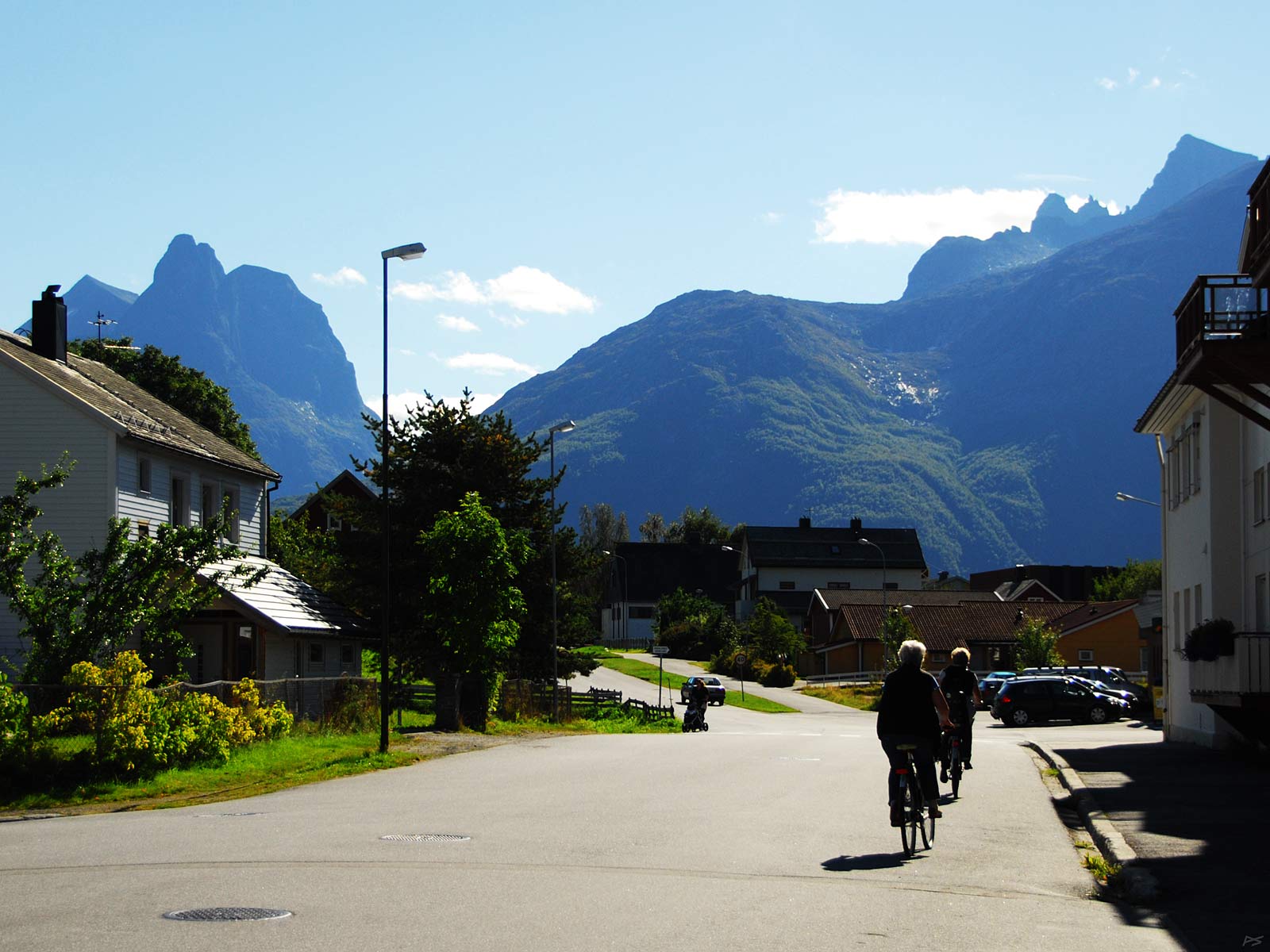
A street in Åndalsnes with the mountain Romsdalshorn to the left and a glimpse of Trolltindene top right. The town itself has about 2500 inhabitants, while the total number in the municipality is about 7500, but during the summer tourist season these numbers may increase considerably. The town itself is quite tranquil and spacious, and there is free parking everywhere.
(2010-09-09)
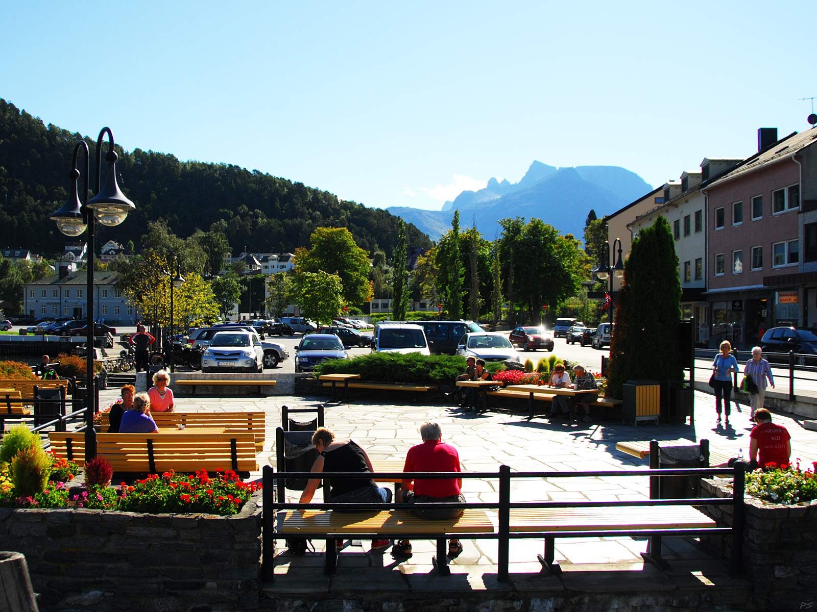
A sunny day in September at the harbour and town centre. The train station is discernible on the left.
(2010-09-09)
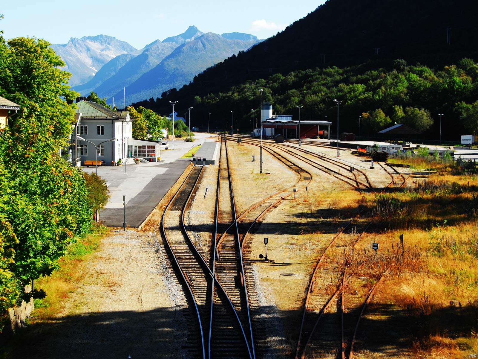
The Åndalsnes train station, passengers to the left, freight to the right. The railway down the valley Romsdalen to Åndalsnes, Raumabanen, was opened in 1924. This 114 km extension from the main line between Oslo and Trondheim was never electrified. Most extension lines have been found uneconomical and are closed down, but this one is a tourist attraction. As the picture implies, freight traffic had been terminated for some time, but now (2021) it has been taken up again.
(2010-09-09)
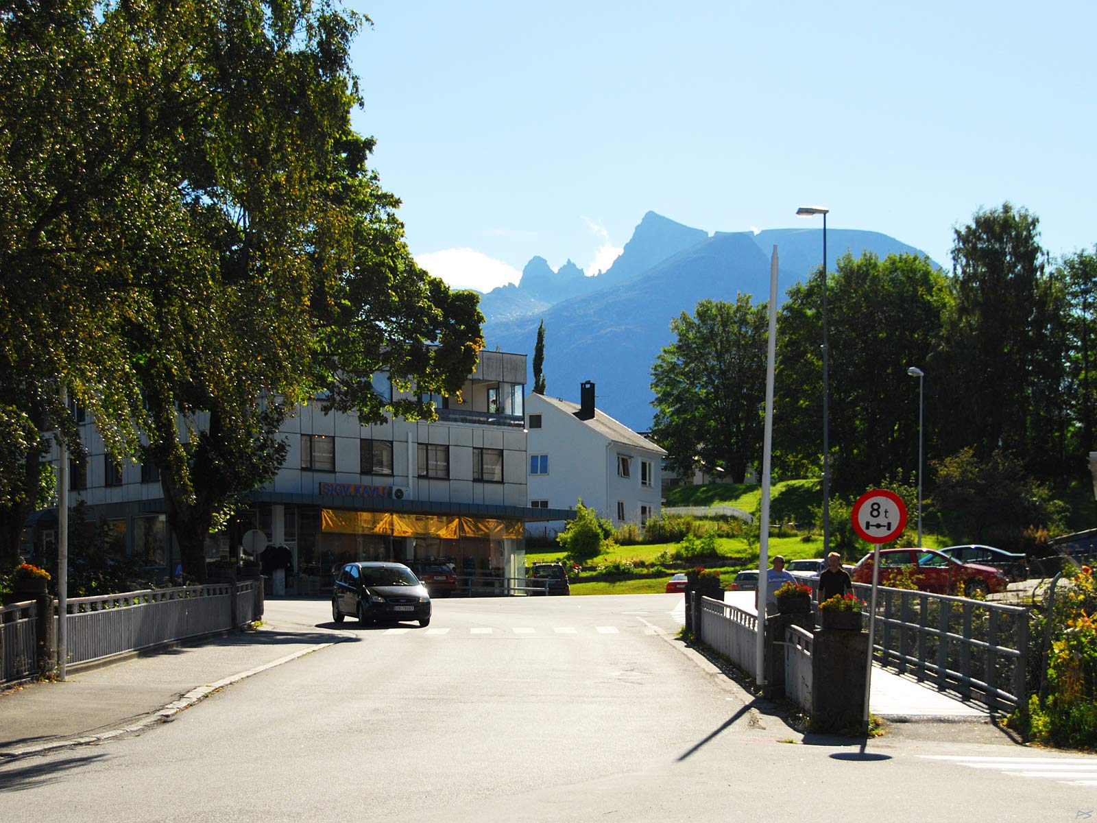
Åndalsnes town, the bridge across the railway.
(2010-09-09)
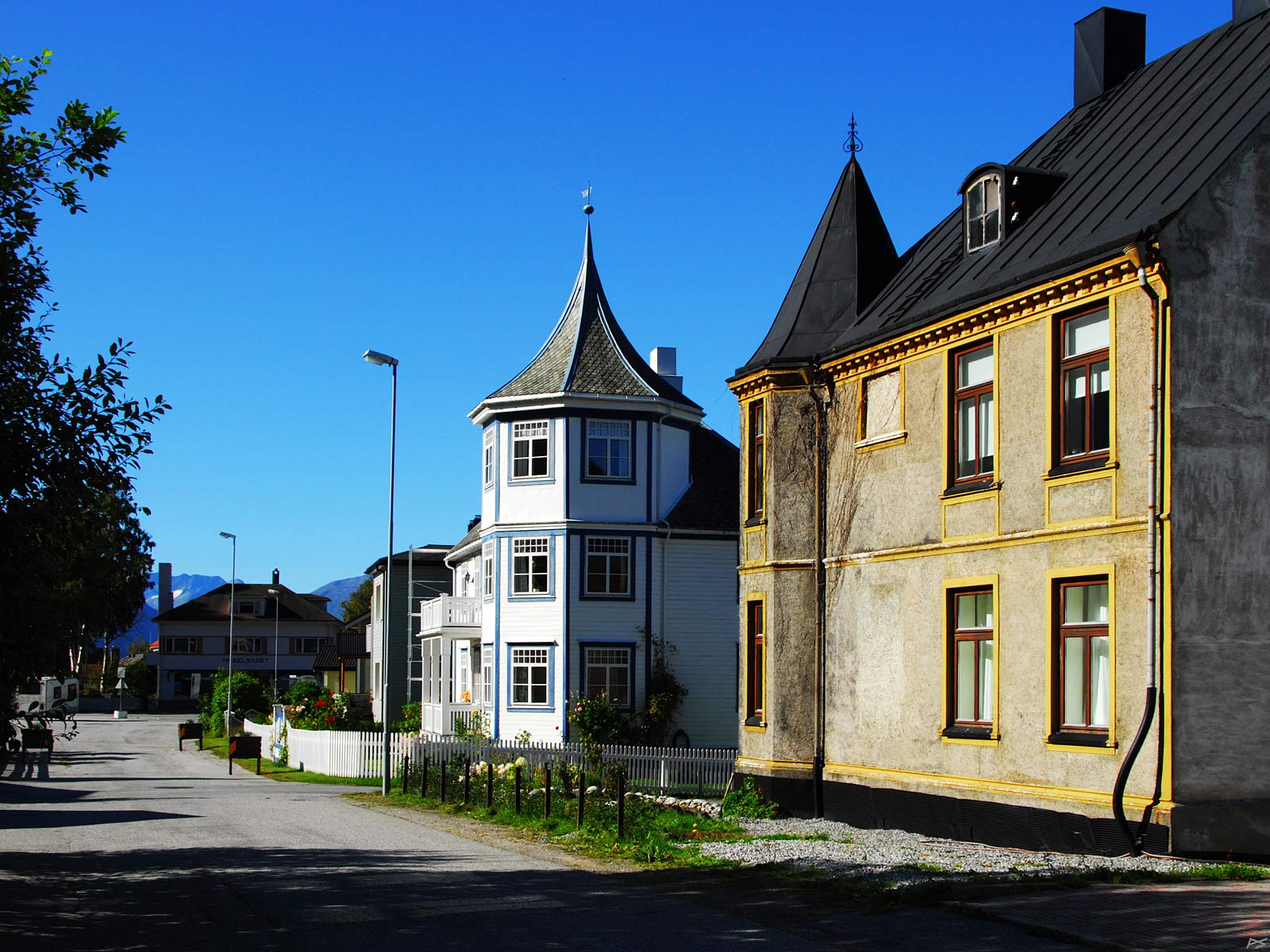
Another street in Åndalsnes and some old houses with style
(2010-09-09)
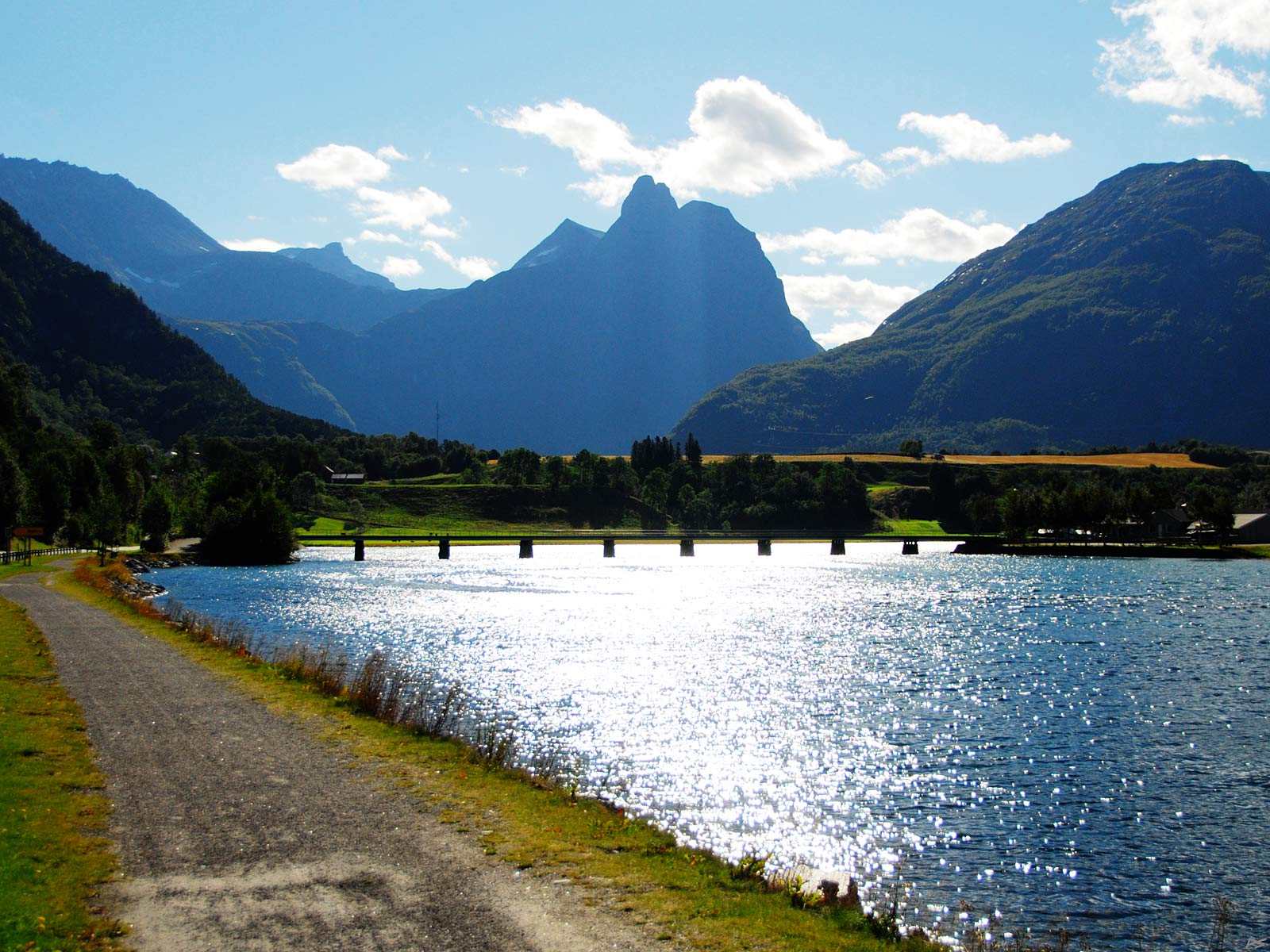
The name of the river flowing down the valley Romsdalen is Rauma. It might not be evident, but the name of the valley was once derived from the name of the river. The name of the river was also taken as the name of the municipality. The mountain in the middle is Romsdalshorn (alt. 1550 m). Although surrounding mountains are higher, Romsdalshorn is very conspicuous and the natural trademark of this district.
((2010-09-09)
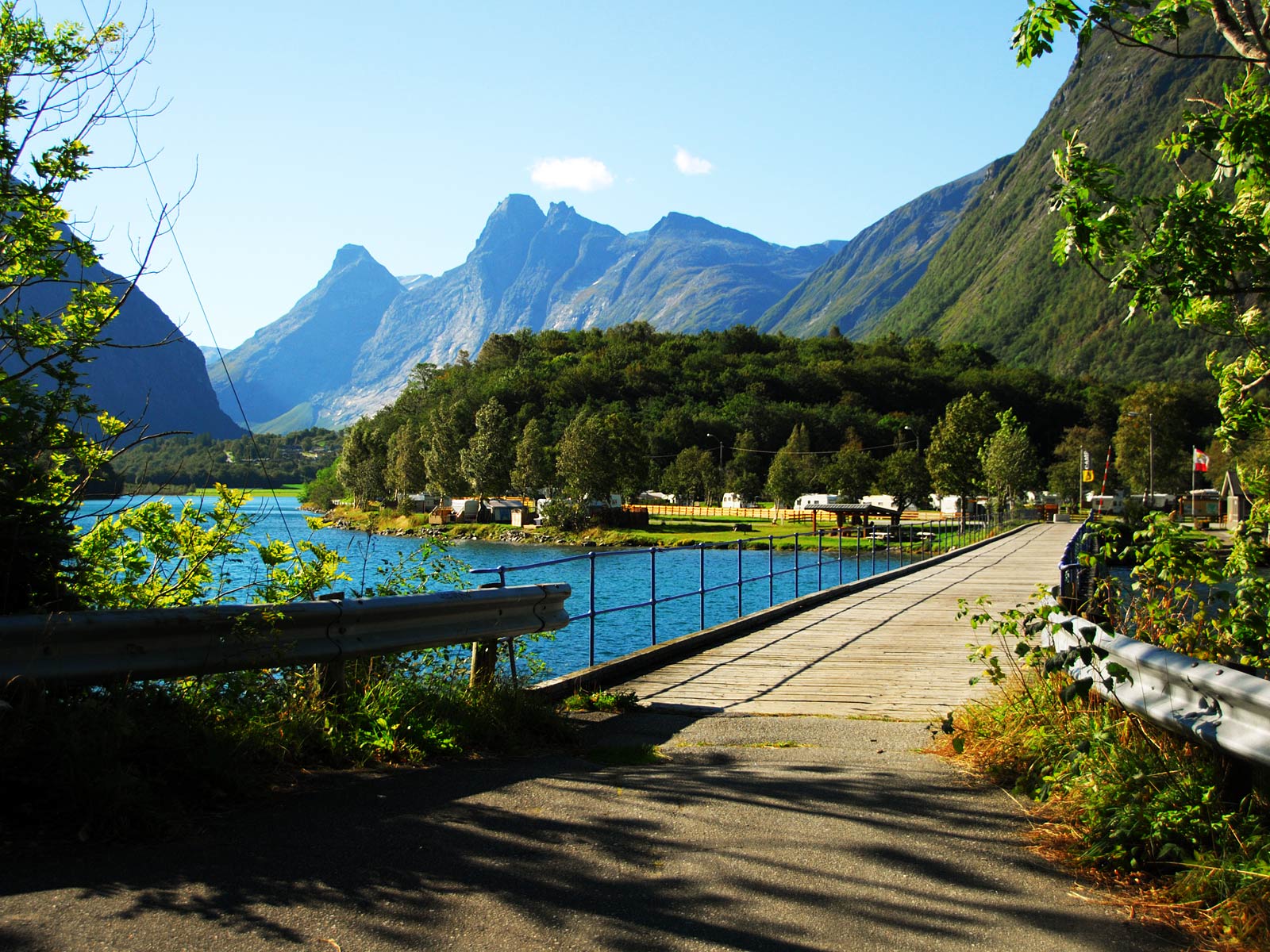
The footbridge seen in the previous picture leads to one of the tourist camps in the area. We are looking up the valley Isterdalen, but the river comes from the left down Romsdalen.
With the risk of adding to the name confusion, it should be mentioned that Romsdal used to be the name of a much larger administrative district extending all the way to the coast. Less formally the district Romsdal still exists and its "capital" is Molde, but it's just a part of a larger administrative unit Møre og Romsdal.
(2010-09-09)
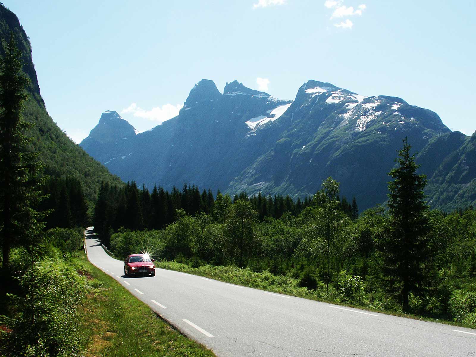
Going up the eight kilometre long Isterdalen. The mountains on the right (west) side of the valley are (from the left) Bispen (the Bishop – 1462 m), Kongen (the King – 1614 m), and at a peak-to-peak distance of three hundred metres, Dronninga (the Queen – 1544 m). Next comes the less often mentioned Karitinden (1356 m). Isterdalen has an abrupt end, which is climbed by the part of the road called Trollstigen (The Troll Climb).
(2010-09-09)
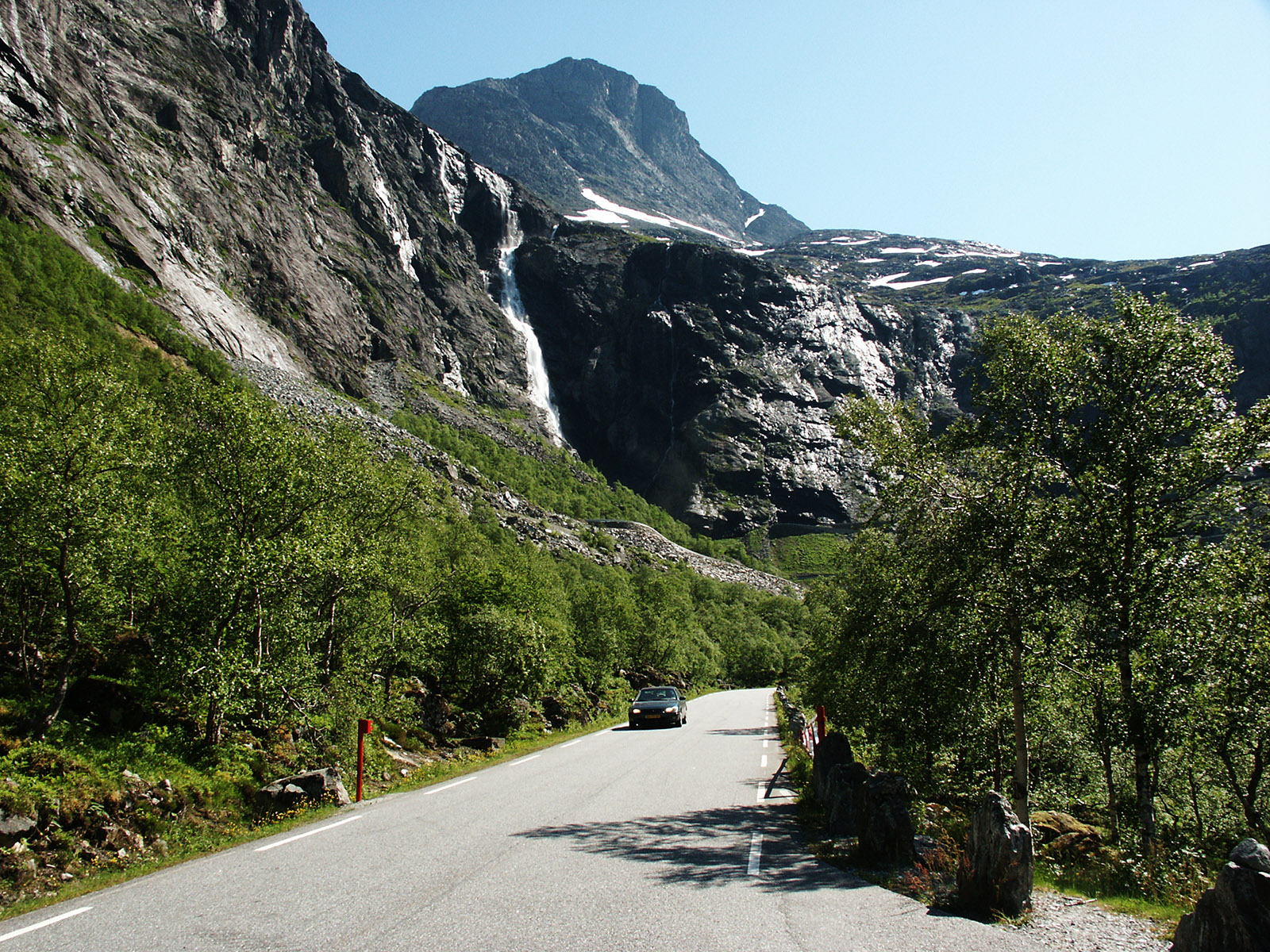
 Up the lower part of Trollstigen. This road was opened in 1936. Since then it has been opened every spring as soon as the snow situation permitted. Originally this was a narrow dirt road, but because of the steadily increasing tourist traffic, it has year by year been improved to the standard indicated. There has also been a large effort to prevent rockslides, especially above the lower end. In the autumn of 2005 the lowest part of the road was rebuilt to reduce the risk of rocks hitting travelers. However, many tourist feel rather uncomfortable driving here, in particular on the upper part. The picture to the left was taken back in 2004 and the sign was removed long ago. The waterfall in the centre is not the same as Stigfossen in the next picture.
(2007-06-21)
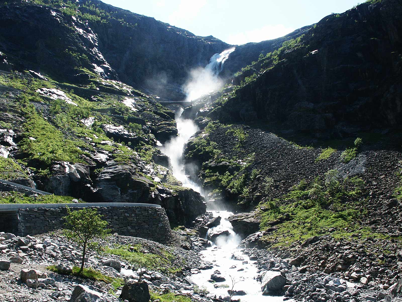
Trollstigen is climbing the mountain through eleven hairpin bends. This waterfall is called Stigfossen (The Climb Waterfall, Trollstigen is often for short called "Stigen"). The old (1936) stone bridge across the brook can also be seen.
(2007-06-21)
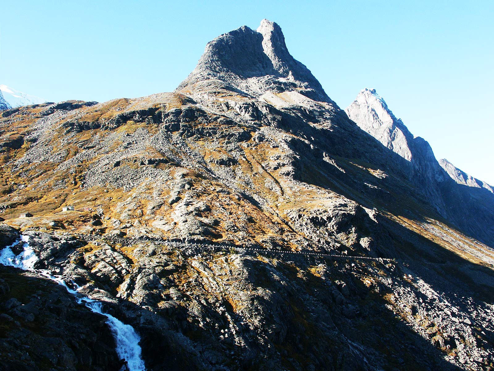
The mountain Bispen with the uppermost stretch of Trollstigen. Behind Bispen stands Kongen and Dronninga. To the left the upper part of the waterfall Stigfossen. It's autumn and the sun doesn't shine on lower parts of Trollstigen.
(2004-10-01)
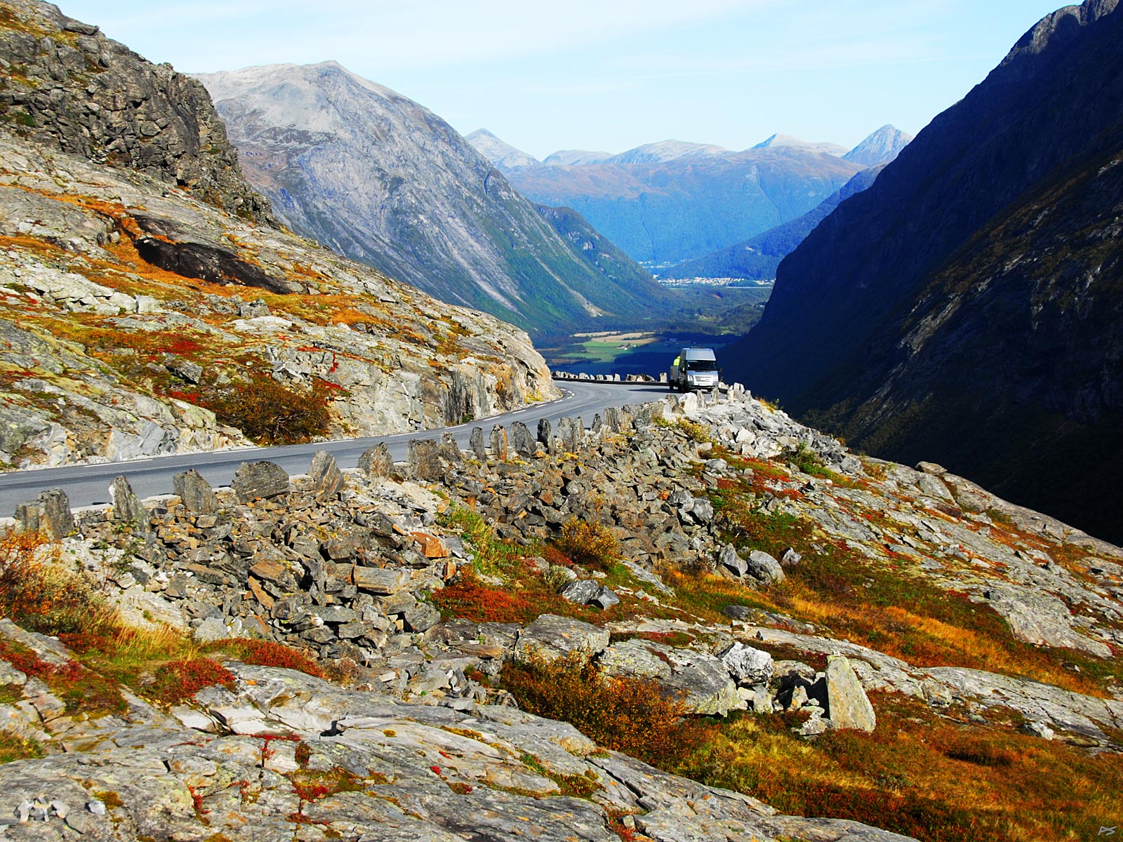
The upper part of Trollstigen and the valley Isterdalen down there in the autumn shadows. The town of Åndalsnes 12 kilometres away can be discerned.
(2014-09-16)
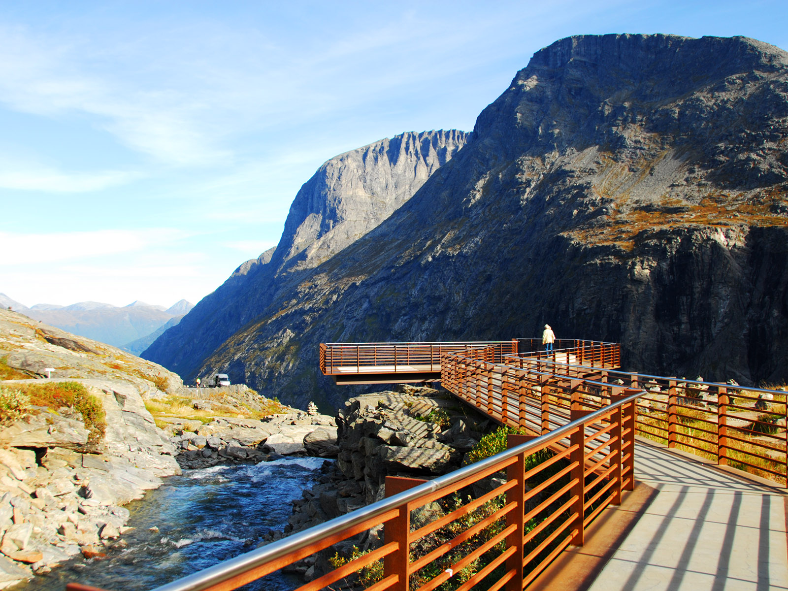
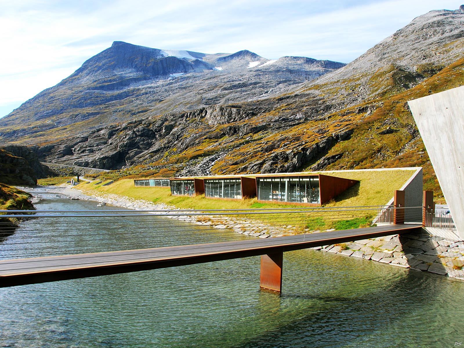
Lately new facilities for the tourists on the top of Trollstigen have been provided, like parking, kafé, toilets, footpaths (also suited for wheelchairs), and two platforms overhanging Trollstigen, one visible in the centre of the picture, another one off to the right. The brook continues as the waterfall Stigfossen shown above. Behind the closest mountain is (the 'backside' of) the famous ridge Trolltindene and the usual route there starts here.
(2014-09-16)
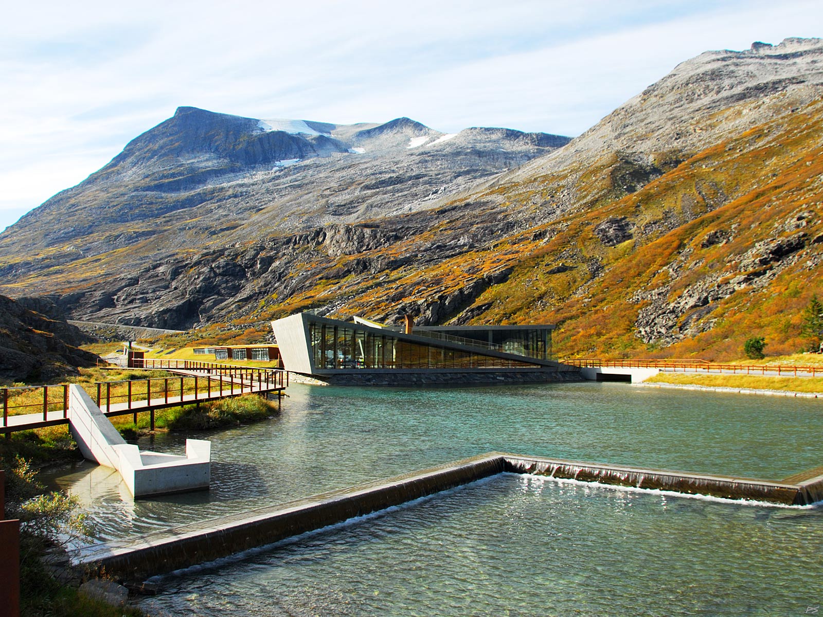
View towards south, the Trollstigen tourist centre. Closest the café. The parking lot, hidden behind the buildings, is quite large, but probably not large enough when the big hordes arrive.
(2014-09-16)
The Trollstigen tourist centre. Virtually half buried, the souvenir shops.
(2014-09-16)
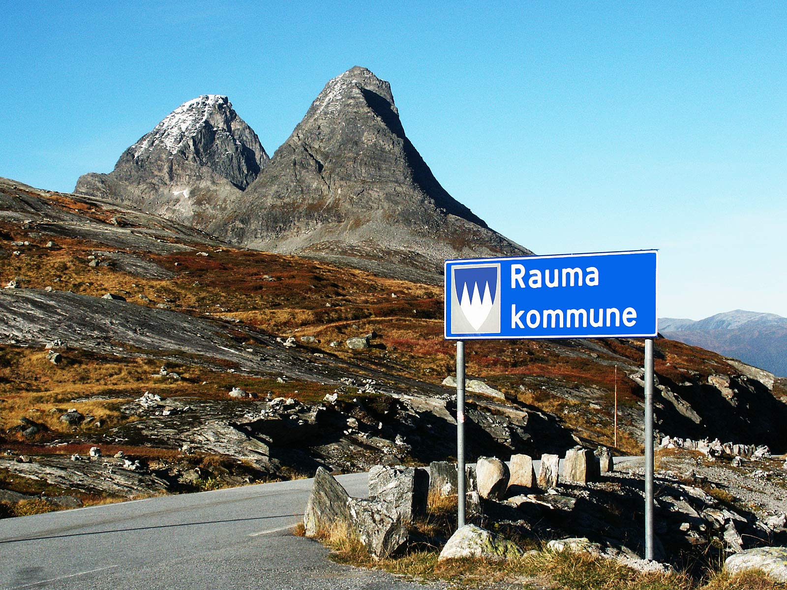
Entering the administrative district of Rauma on the road Valldal–Trollstigen–Romsdal (Åndalsnes), a bit beyond the top of Trollstigen. The district Rauma is characterized by high and jagged mountains as the coat of arms indicates. The mountains shown are (from the right) Bispen (1462 m), Kongen (1614), and I believe a tiny bit of Dronninga (1544 m). This road is closed during the winter season. Poles like the one seen below the sign are useful when the snow is cleared away in spring. It's the first of October, the autumn colours have turned less vivid, and the tourists are gone.
(2004-10-01)
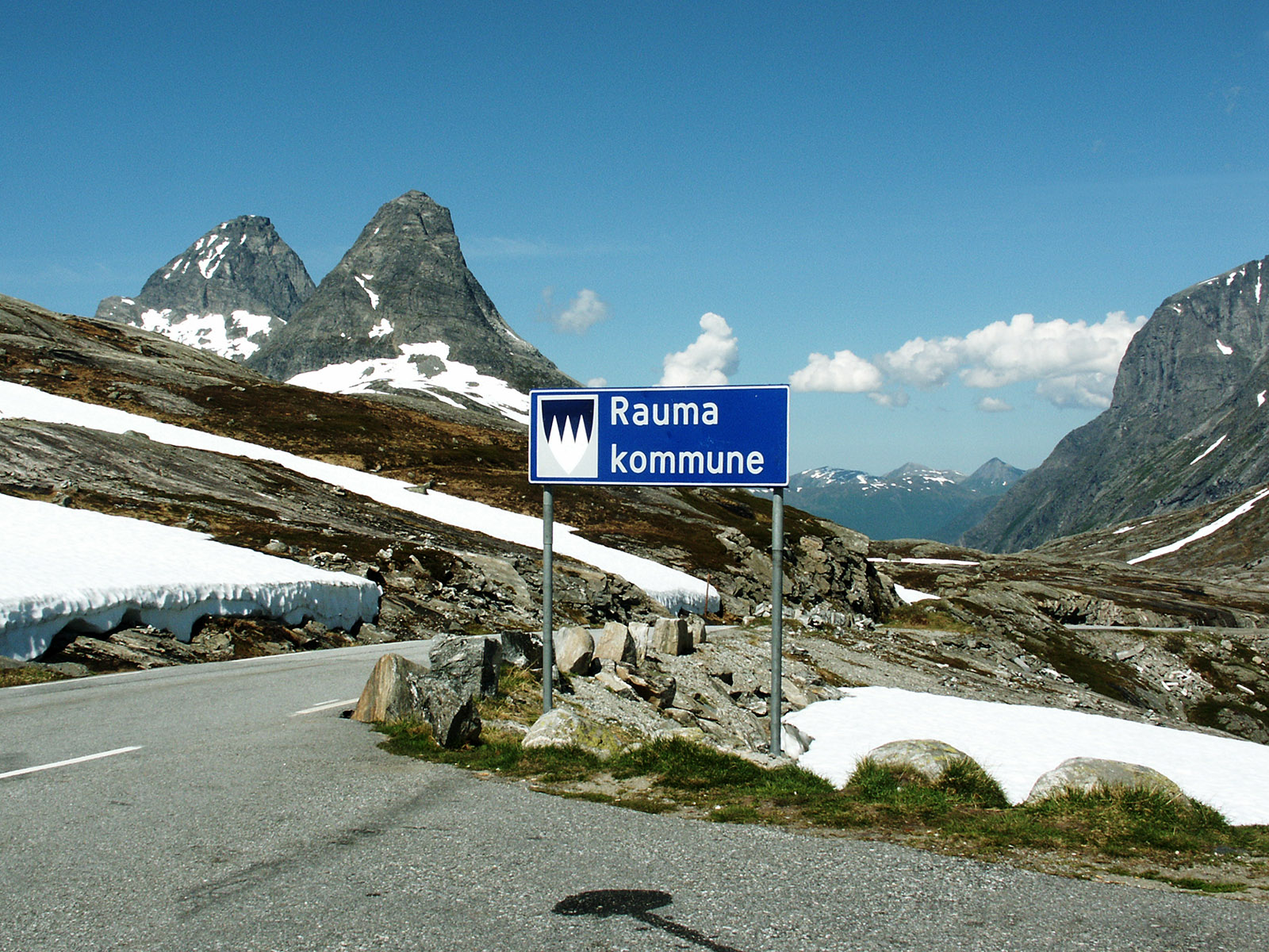
The same motive as above, but exactly midsummer – and springtime up here. Ready for new tourists.
(2007-06-21)
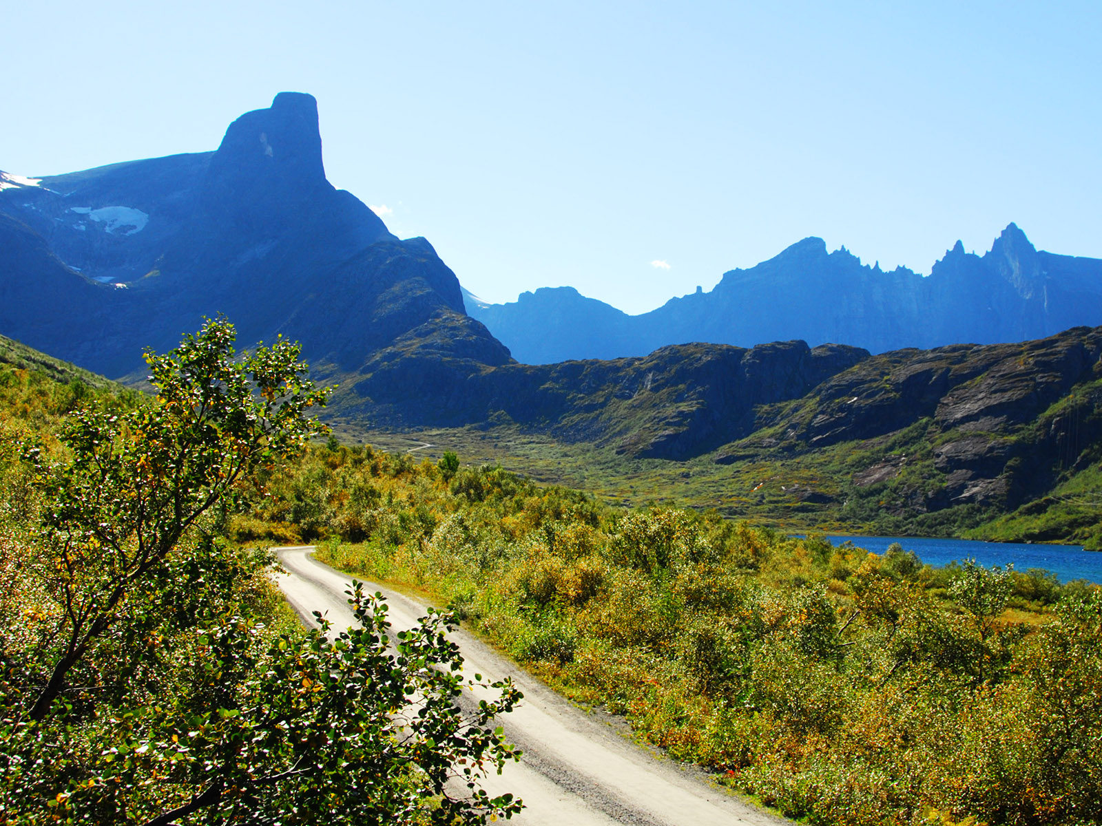
Venjedalen, a short valley east of Romsdalen at attitudes 5–600 m. Nobody lives there, but we can drive there on a narrow road. On the left is the well-known Romsdalshorn (1550 m). For an experienced climber it is not difficult to reach the top. To the right Romsdalshorn ends in a low ridge called Litjfjellet (see also the next picture), and beyond that the Trolltindene ridge is seen. The highest of those peaks is Store Trolltind to the far right, 1788 m.
(2010-09-09)
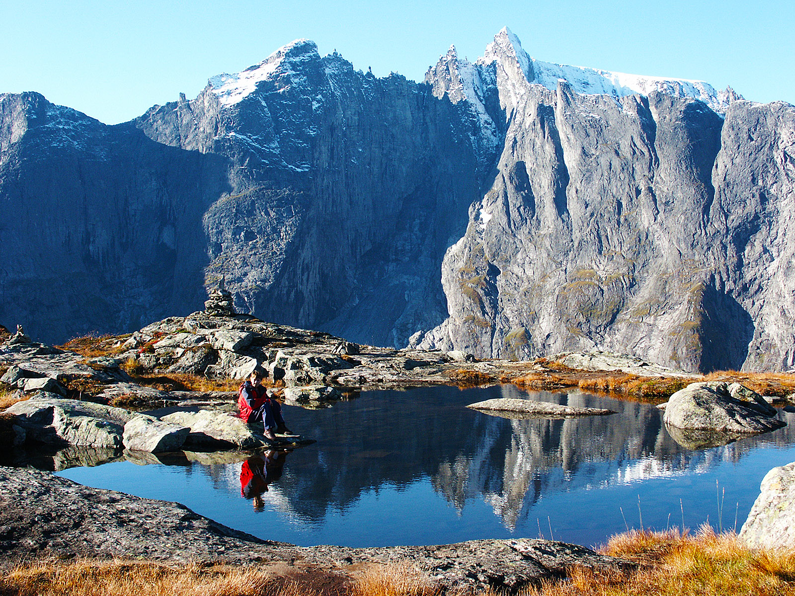
On the top of Litjfjellet, the most rewarding mountain hike for the lazy ones. Which includes obvious photo subjects. A few metres beyond the pond you can look down into Romsdalen.
(2004-10-01)
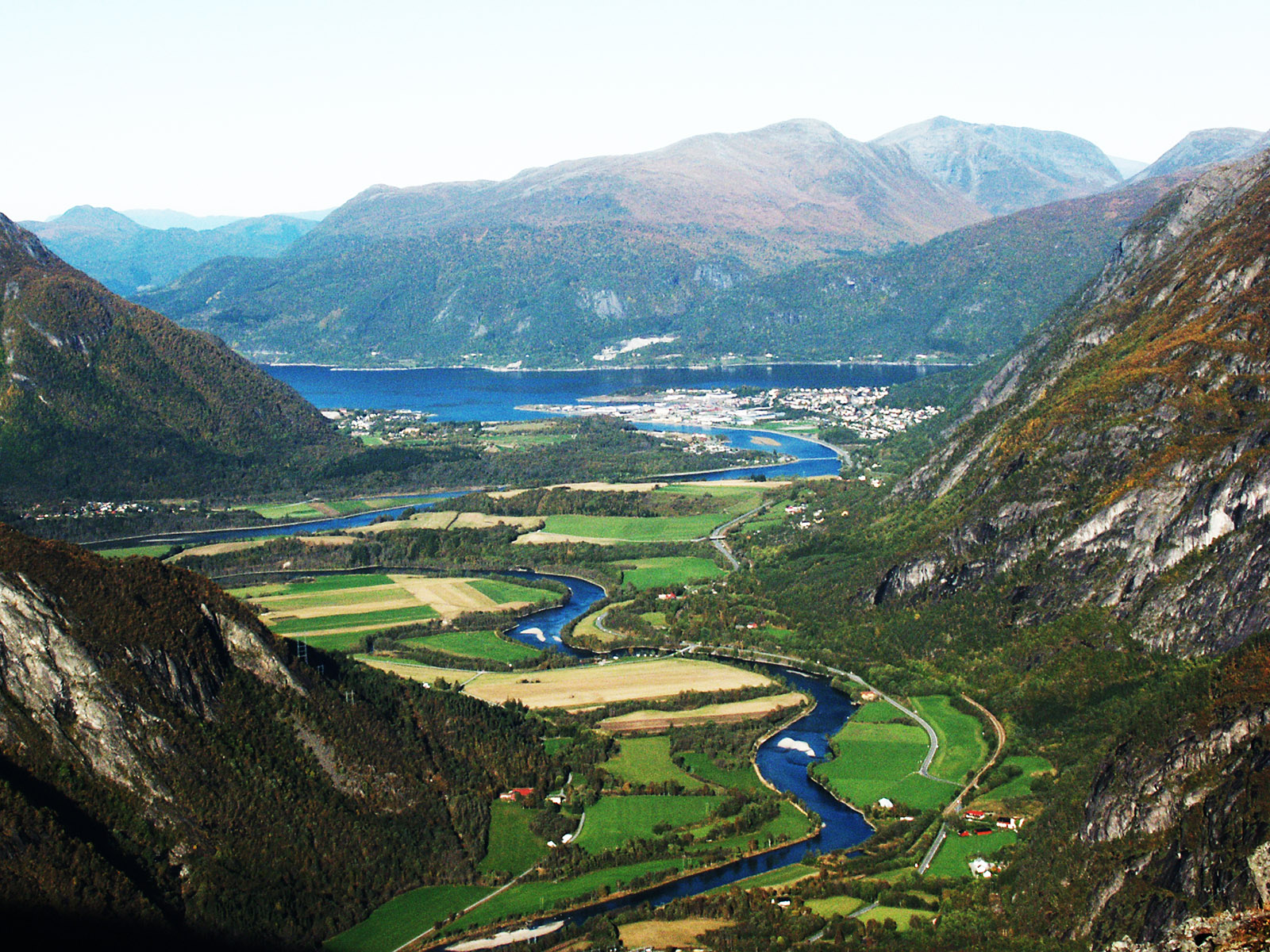
View from Litjfjellet towards Åndalsnes and the river Rauma. The entrance to Isterdalen on the left side.
(2004-10-01)
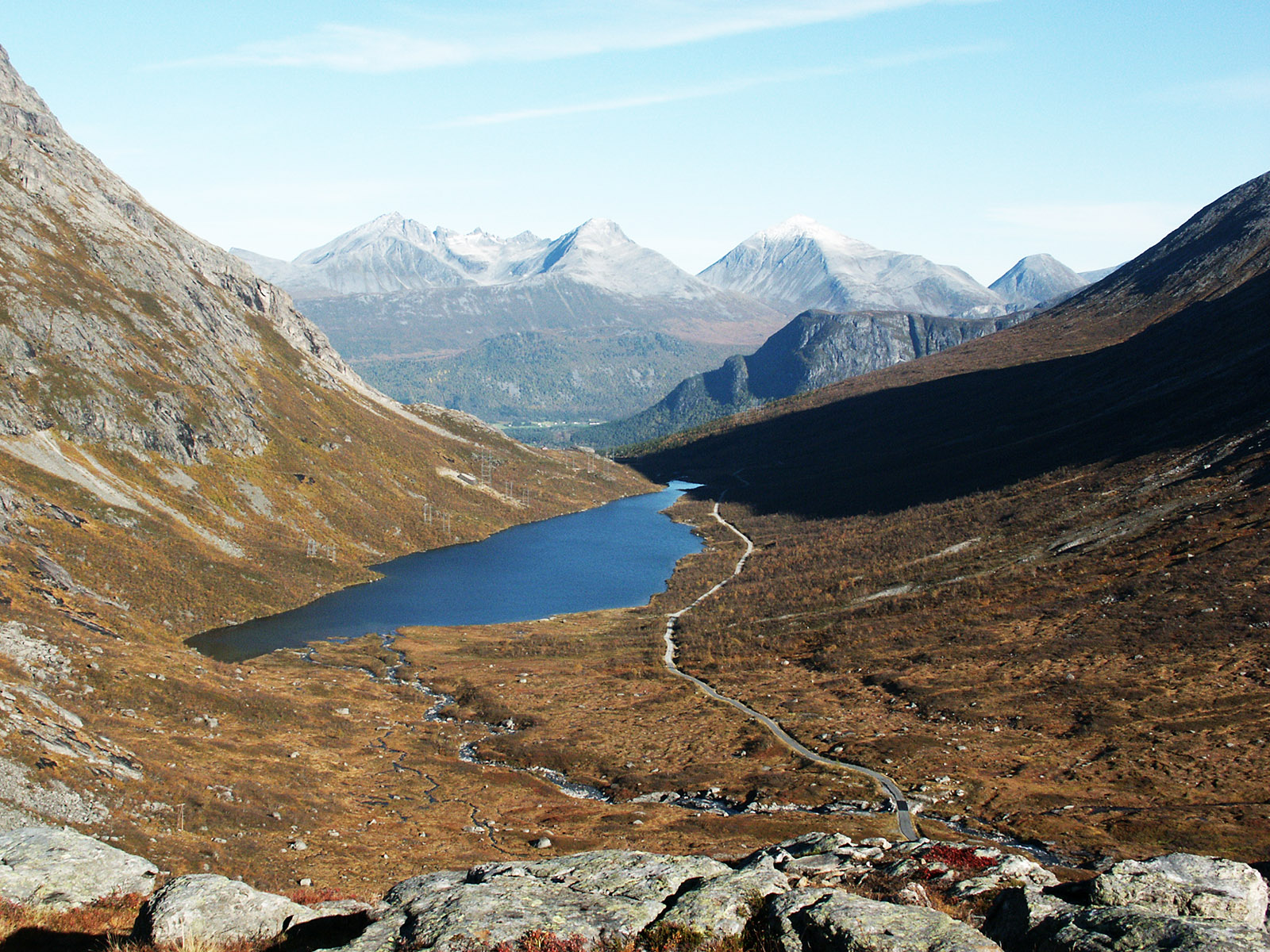
Looking back to Venjedalen where we came from
(2004-10-01)
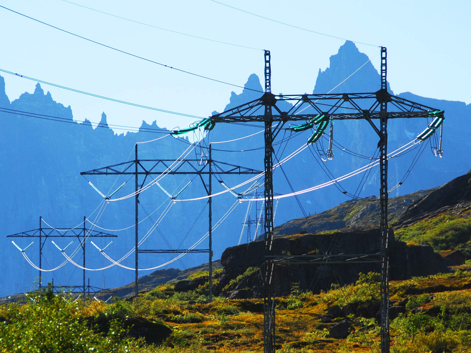
Power lines crossing Litjfjellet. I suppose this picture will irritate a lot of people. Store Trolltind to the right.
(2010-09-09
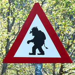
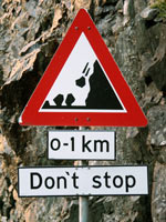
The foot of Trollstigen has for many years had this warning sign. It has even been replaced because tourists tagged it. Authorities tend to be very serious, so we wonder what happened to them.
But of course, here are trolls everywhere. Like in Trolltindene where we have the peaks Trollryggen, Trollspiret, Trollkjerringa, Trollgubben, and Store Trolltind. Those are all examples of the carelessness of trolls exposing themselves to sunlight, which inevitably make them turn into stone.
We don't know how living trolls look, therefore the representations of them vary a lot. All we know is that they are big and ugly and quite stupid, and that they in many ways resemble us.
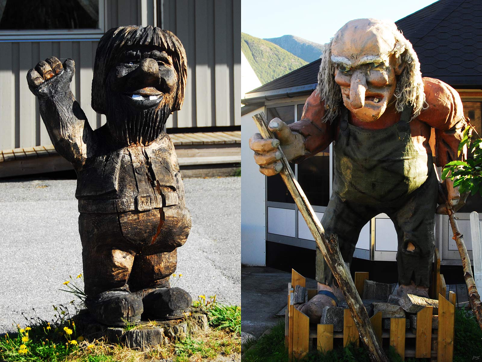
Two trolls in Rauma. To distinguish trolls from men, note that all trolls have four fingers.
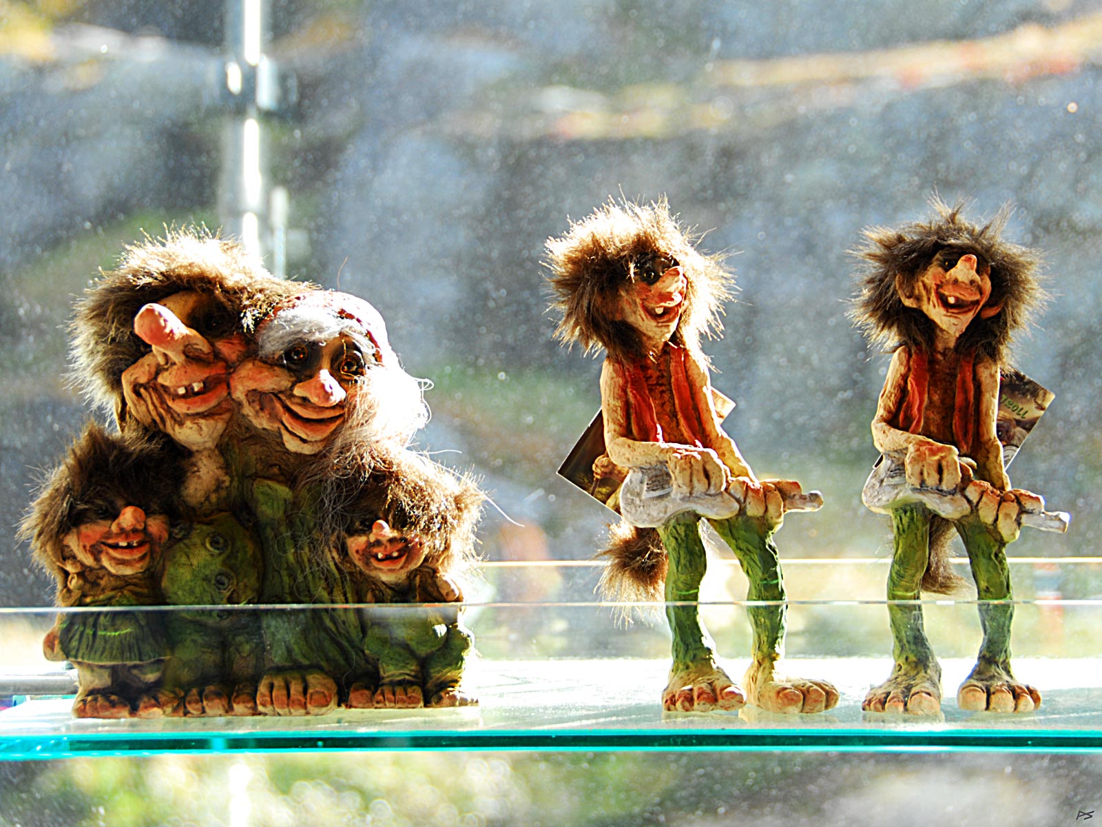
From a souvenir shop on the top of Trollstigen. Happy trolls sell better than grumpy ones.
(2014-09-16)

The Rauma coat of arms