– suited for 16:9 aspect ratio screens up to 1440p or QuadHD, typically a 27" desktop screen, probably the largest size recommended for common use.
Most wallpapers here are made from originals of the 4:3 pictures on this site that could be adapted to the 16:9 aspect ratio
Please note that the (large) thumbnails are links to JPEG images, not to pages containing the images as elsewhere on this site
Download all wallpapers contained in zipped folders:
wall-norway.zip wall-iceland.zip
down to the Iceland section
|
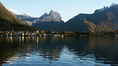
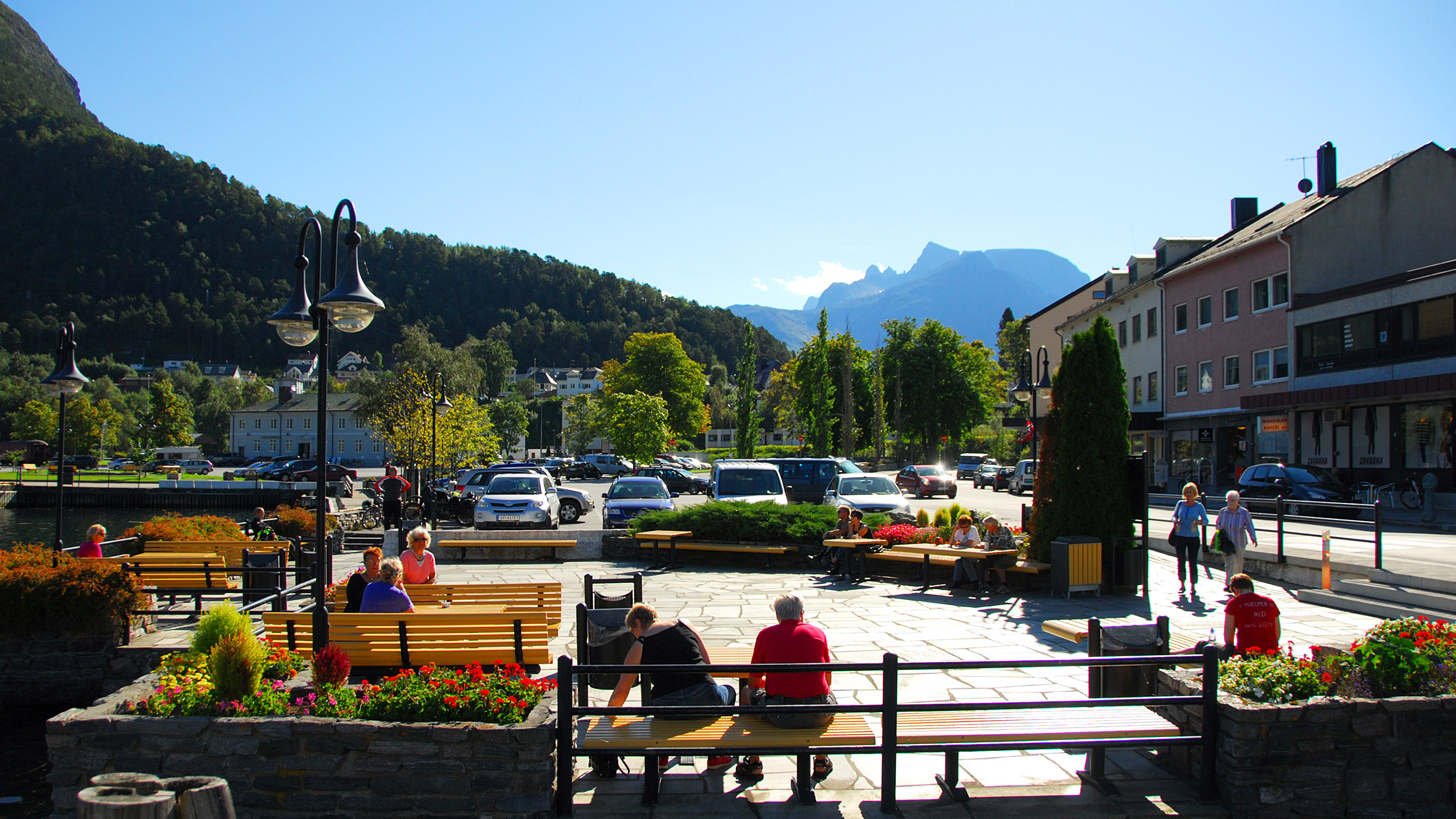
The town Åndalsnes with Romsdalshorn behind, and also tops of Trolltindene top right
|

|
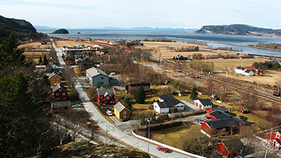
Åndalsnes – the train station behind left.
|

|
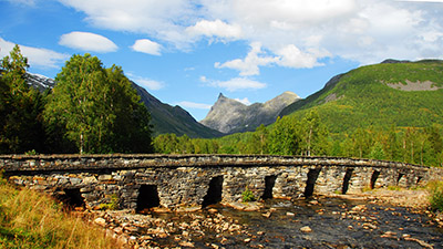
A pedestrian bridge across the river Rauma and the mountain Romsdalshorn behind.
|
|
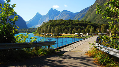
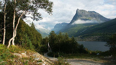
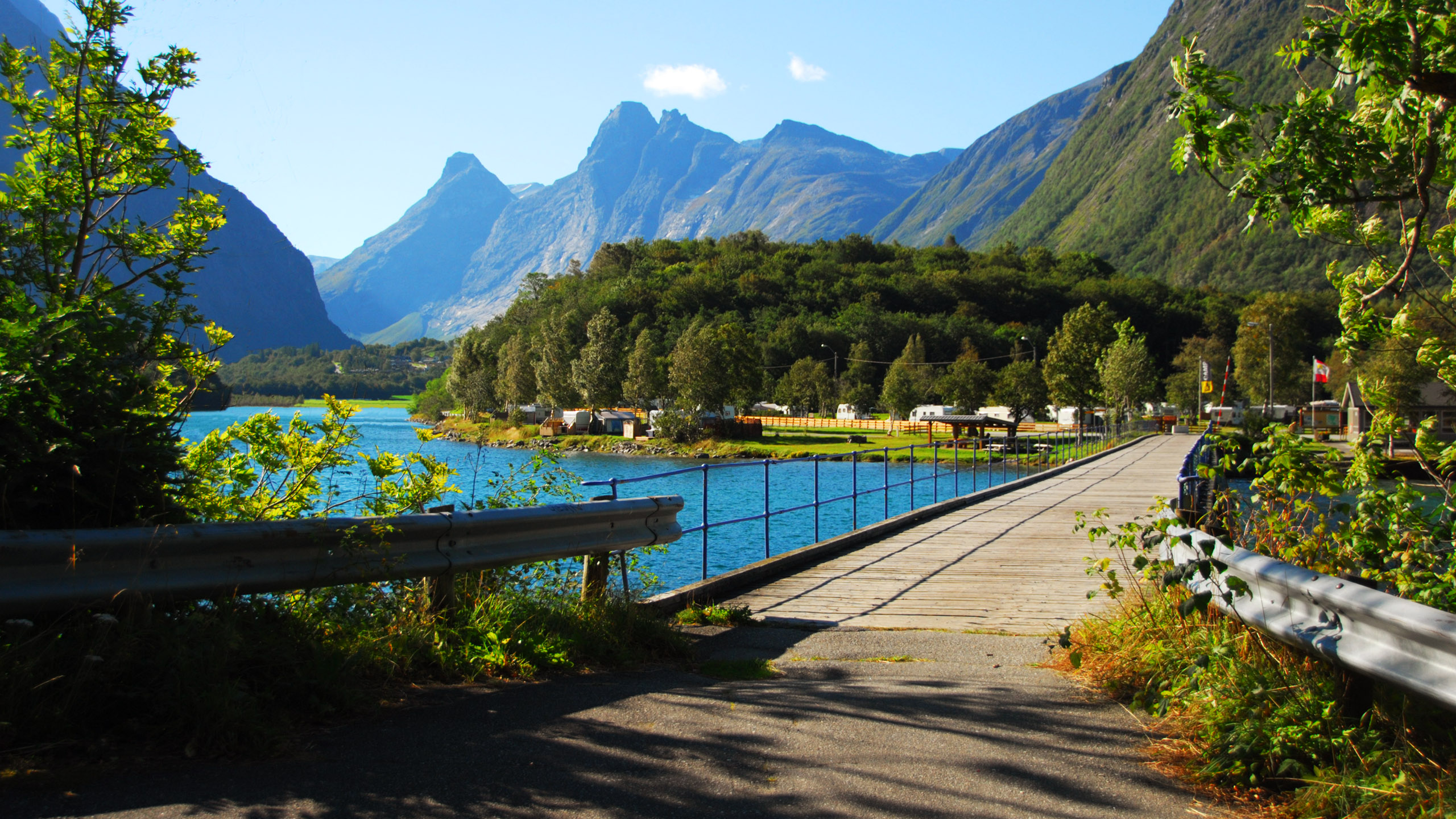
The same pedestrian bridge as above, leading to a tourist camp. Behind the valley Isterdalen where Trollstigen is found. The mountains are Bispen (the Bishop 1462 m) and Kongen (the King 1614 m), Dronninga (the Queen 1544 m) and Karitinden (1356 m)
|

|
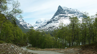
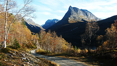
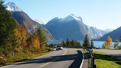
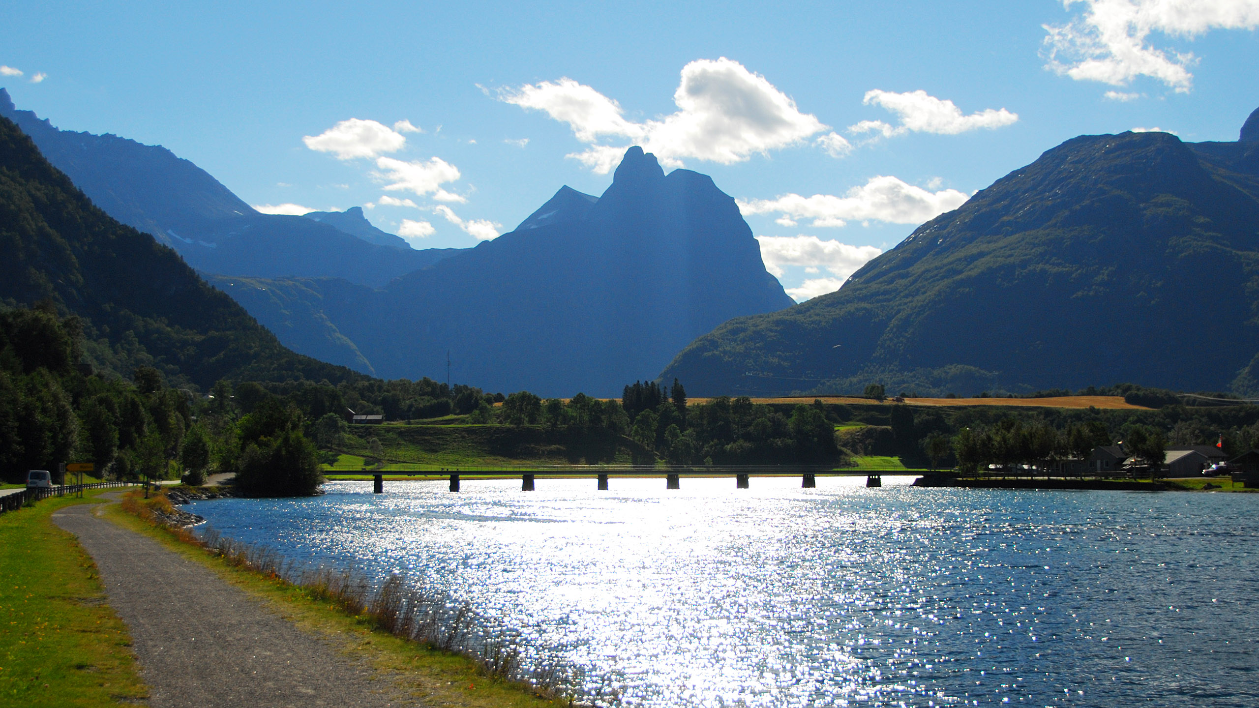
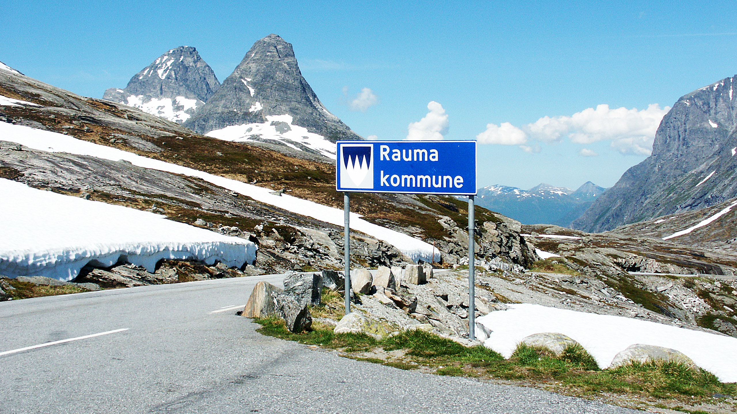
Entering Rauma from the south (Valldal). Rauma is an administrative district with the same name as the river running through the valley Romsdalen. Left the mountains Bispen (the Bishop) and Kongen (the King), Dronninga (the Queen) hiding behind. Ahead, at Bispen, Trollstigen and the upper end of the valley Isterdalen.
|
|
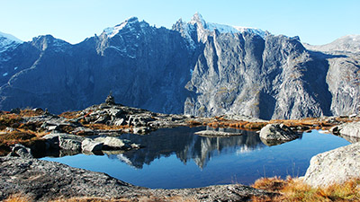
The ridge Trolltindene on the south(-west) side of Romsdalen seen from the low ridge Litjfjellet on the opposite side.
|
|
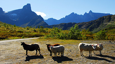
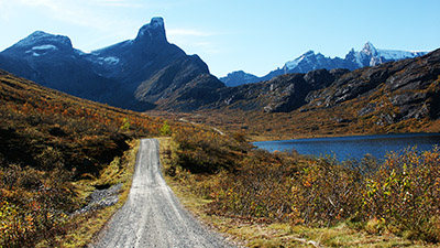
Sheep in Venjedalen, a short valley north(-east) of and parallel to Romsdalen. Left Romsdalshorn and centre the ridge Litjfjellet. Behind, on the other side of Romsdalen, Trolltindene.
|
|
Venjedalen, Romsdalshorn and Trolltindene.
|
|
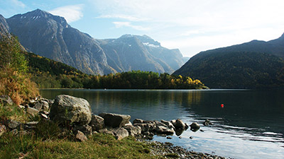
The lake Eikesdalsvatnet, found in the administrative district of Molde.
|
|
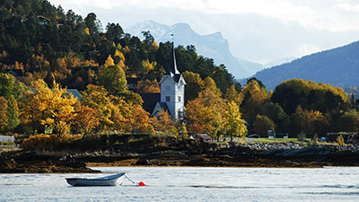
Summer morning in Sæbø on the south side of Hjørundfjorden (southeast of Ålesund). The mountain Slogen to the right of the centre.
|
|
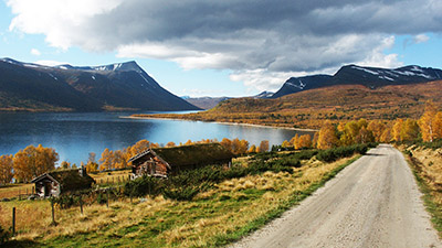
The lake Gjevilvatnet, Oppdal, Trøndelag. The mountains are Okola (left) and (Gjevilvass-)kamman (right). In the centre the beach Raudøra. In early summer the water level is usually low, and a wide beach stretcher for nearly 40 kilometres around the lake. Nice for picknic and sunning and it's never crowded, but the water temperature is far too low.
|
|
Entering the valley Innerdalen in spring (north of Sunndalsøra, east of Molde and Kristiansund). The mountain Innerdalstårnet, or just Tårnet (the Tower), is still snowy.
|
|
Entering Innerdalen in summer, the lower lake visible. You'll have to walk to get there, and this is the top of the steep part of the road
|
|
Entering Innerdalen in autumn. TIt is claimed to be "Norway's most beautiful valley".
|
|
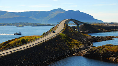
The crazy bridge (Storseisundbrua) on Atlanterhavsvegen – The Atlantic Road.
|

|
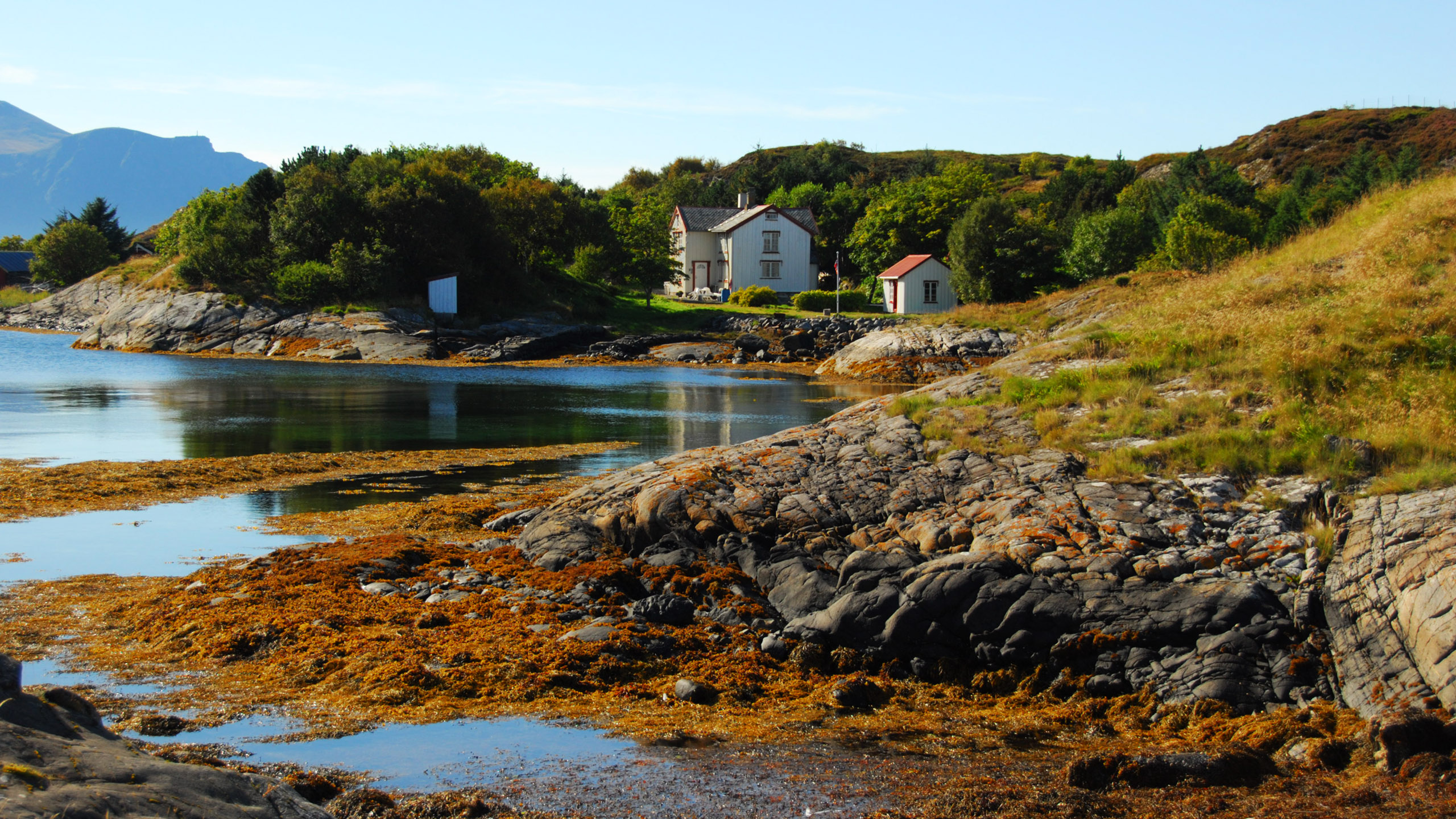
A home on the tiny island Eldhusøya. The Atlantic Road passes by just behind the low hill.
|

|
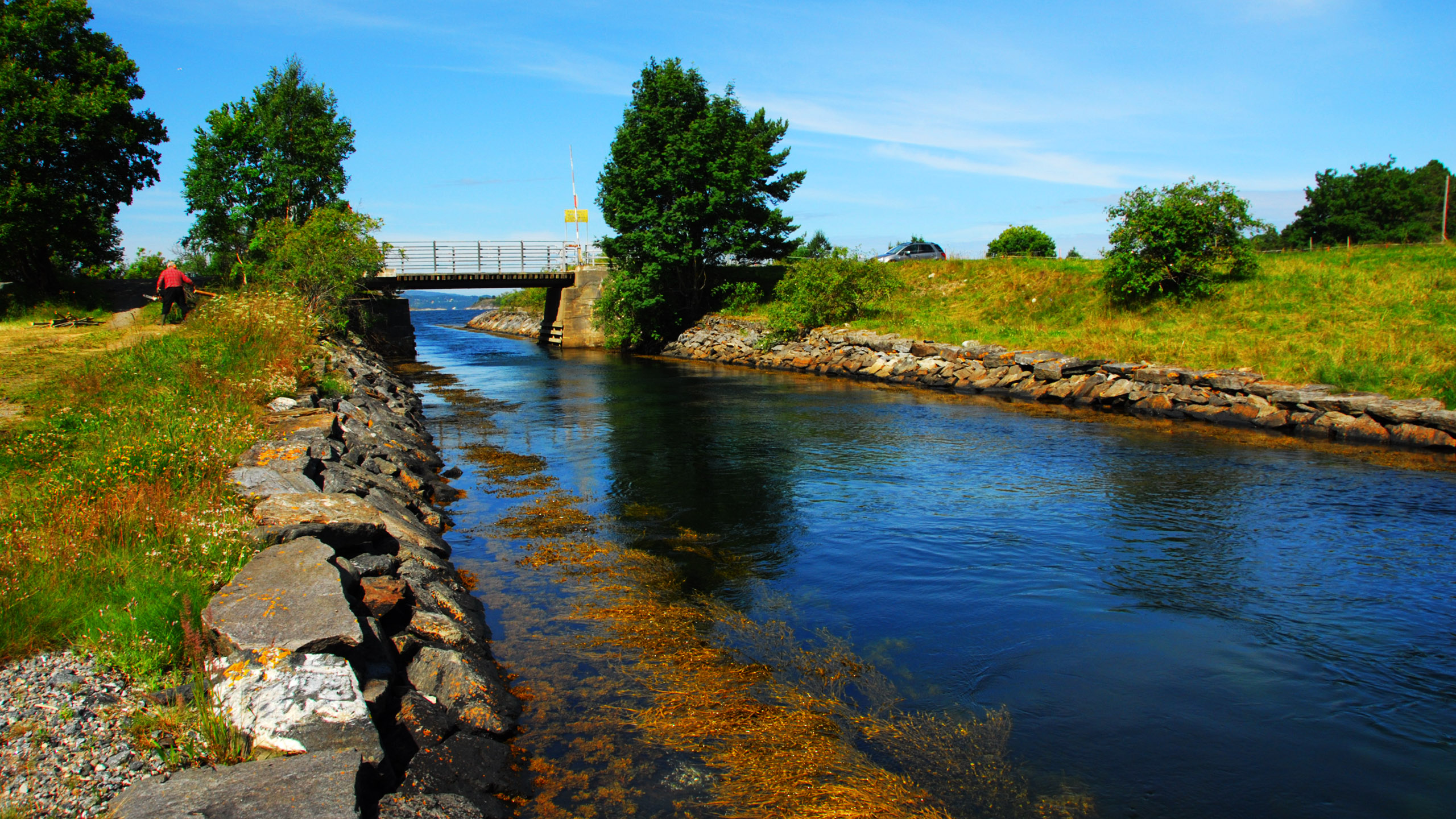
Nålsundkanalen, a 150 metres long canal that can be said to make the peninsula Aspøya an island. It is for small vessels only and was opened in 1901. Across the fjord from Kristiansund.
|

|
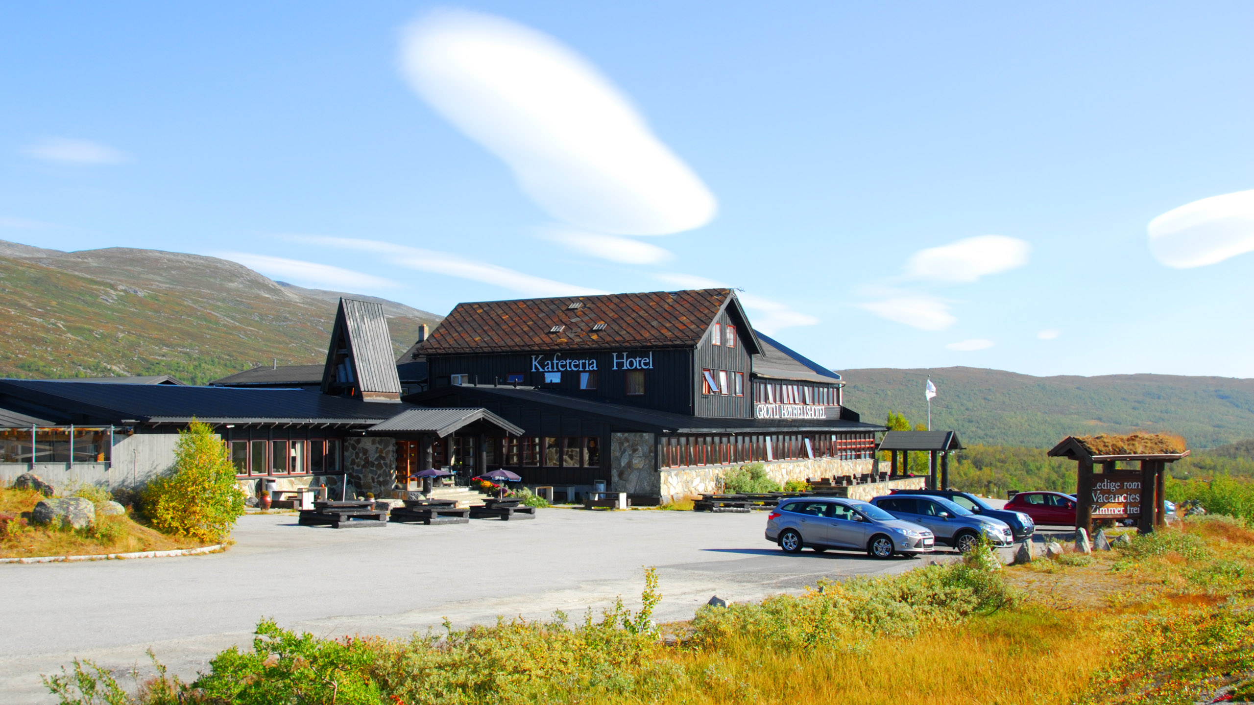
Grotli, a crossroad on the route Otta–Skjåk to Stryn or Geiranger.
|

|
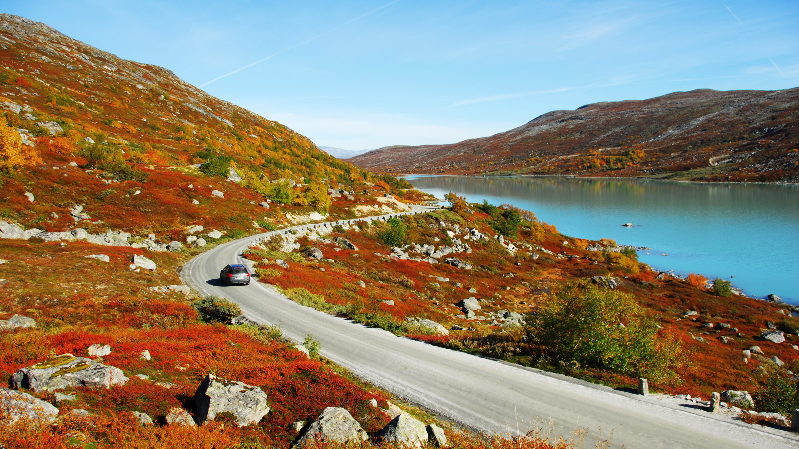
Middle of September on the old Strynnefjellet road from Grotli to the east end of Stryn.
|
|
The old Horndøla bridge and the mountain Hornindalsrokken. Some kilometre north of the centre of Stryn.
|
|
The village Hell east of Trondheim, early spring. The train station may be seen above the picture centre.
|
|
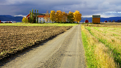
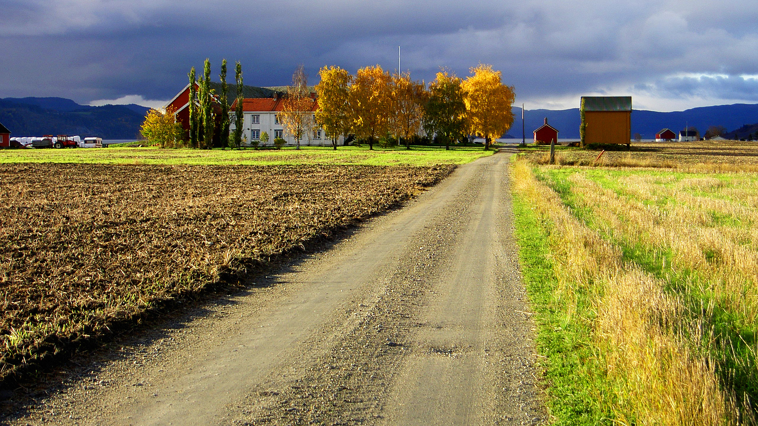
A farm in Trøndelag in autumn.
|
|
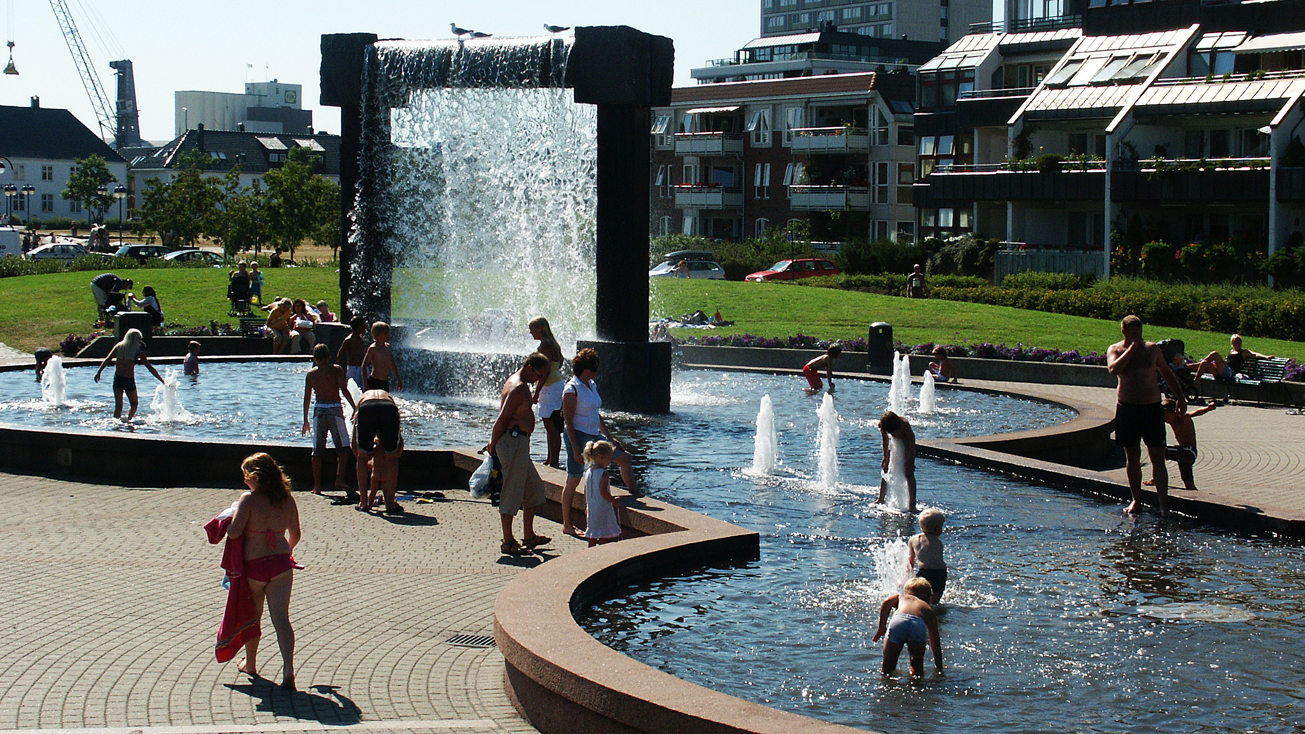
The Kjell Nupen park in Kristiansand
|
|
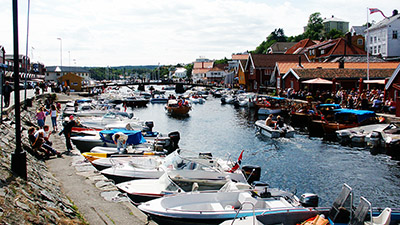
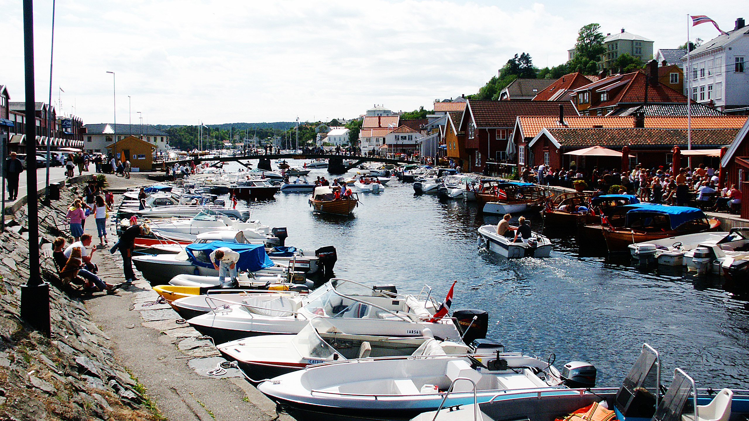
Blindtarmen (the "Appendix") n Kragerø. The landing outside the outdoor restaurant to the right is reserved for the noble (or old-fashioned) wooden boats.
|
|
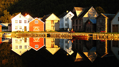
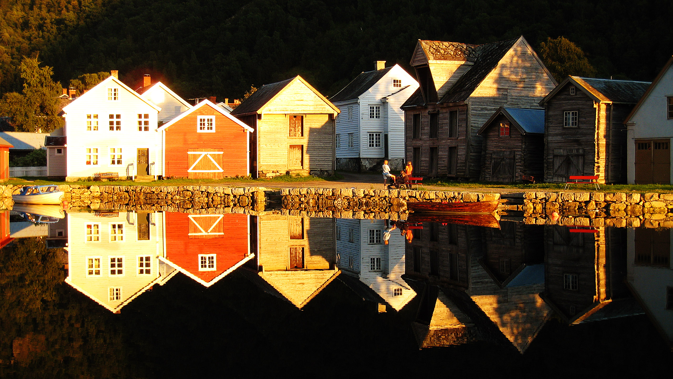
Lærdalsøyri at the inner end of Sognefjorden with some of the old and protected wooden buildings. The mirror is a remnant of an old river course; the present river runs some three hundred metres to the north.
|
|
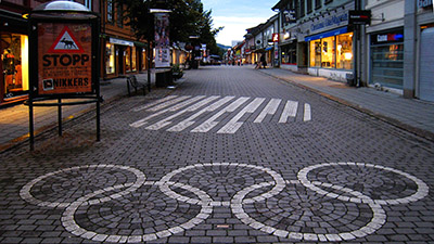
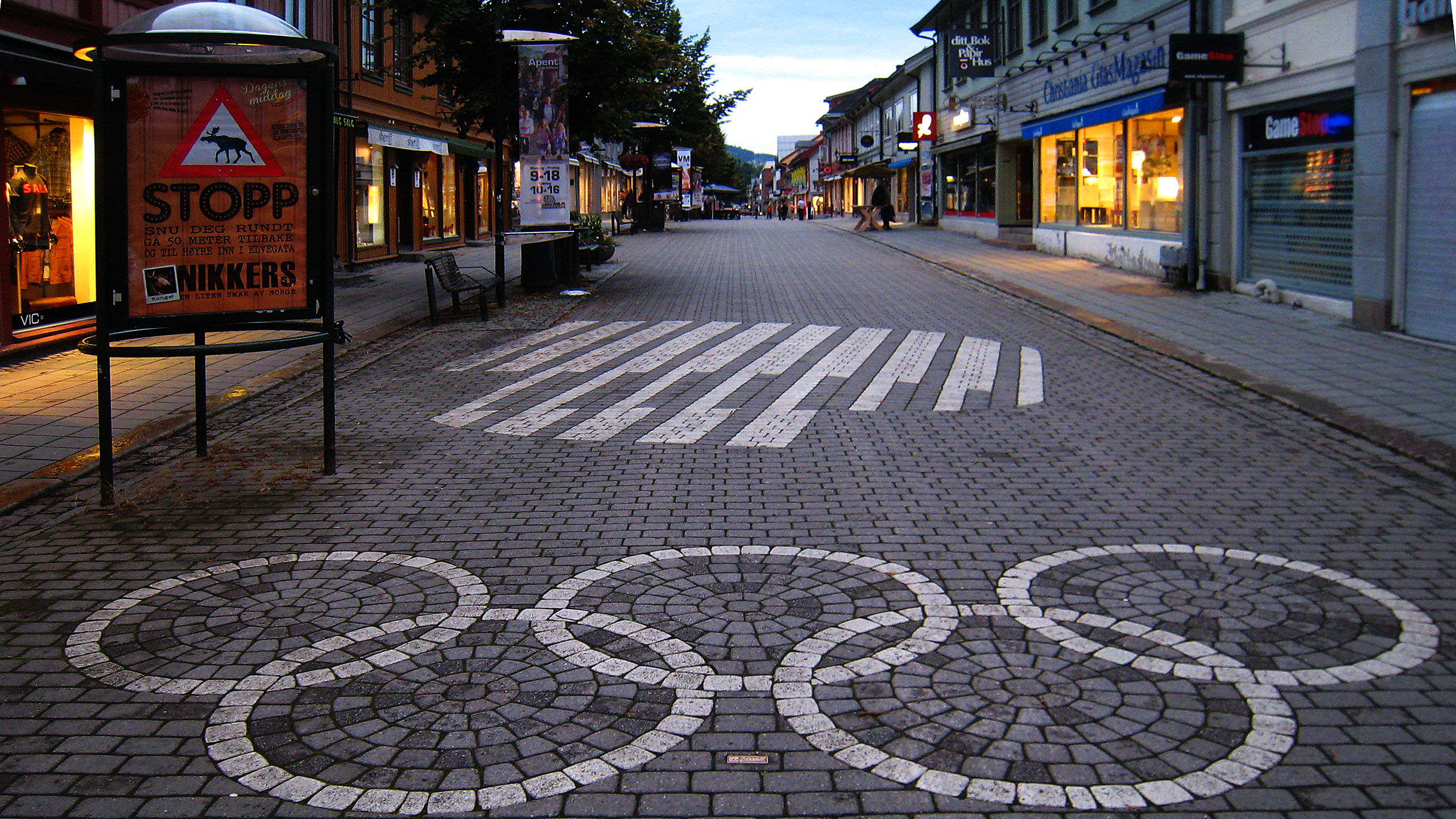
The Lillehammer town hosted the 1994 Winter Olympic Games, which is not forgotten. This is the long pedestrian street where you find most shops etc.
|
|
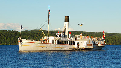
The paddle steamer "Skibladner" that has been in service on lake Mjøsa since 1856, at first as an extension of the railway.
|
|
The road to Sunndalsøra (east of Kristiansund). Smoke from the aluminium plant can be discerned.
|
|
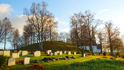
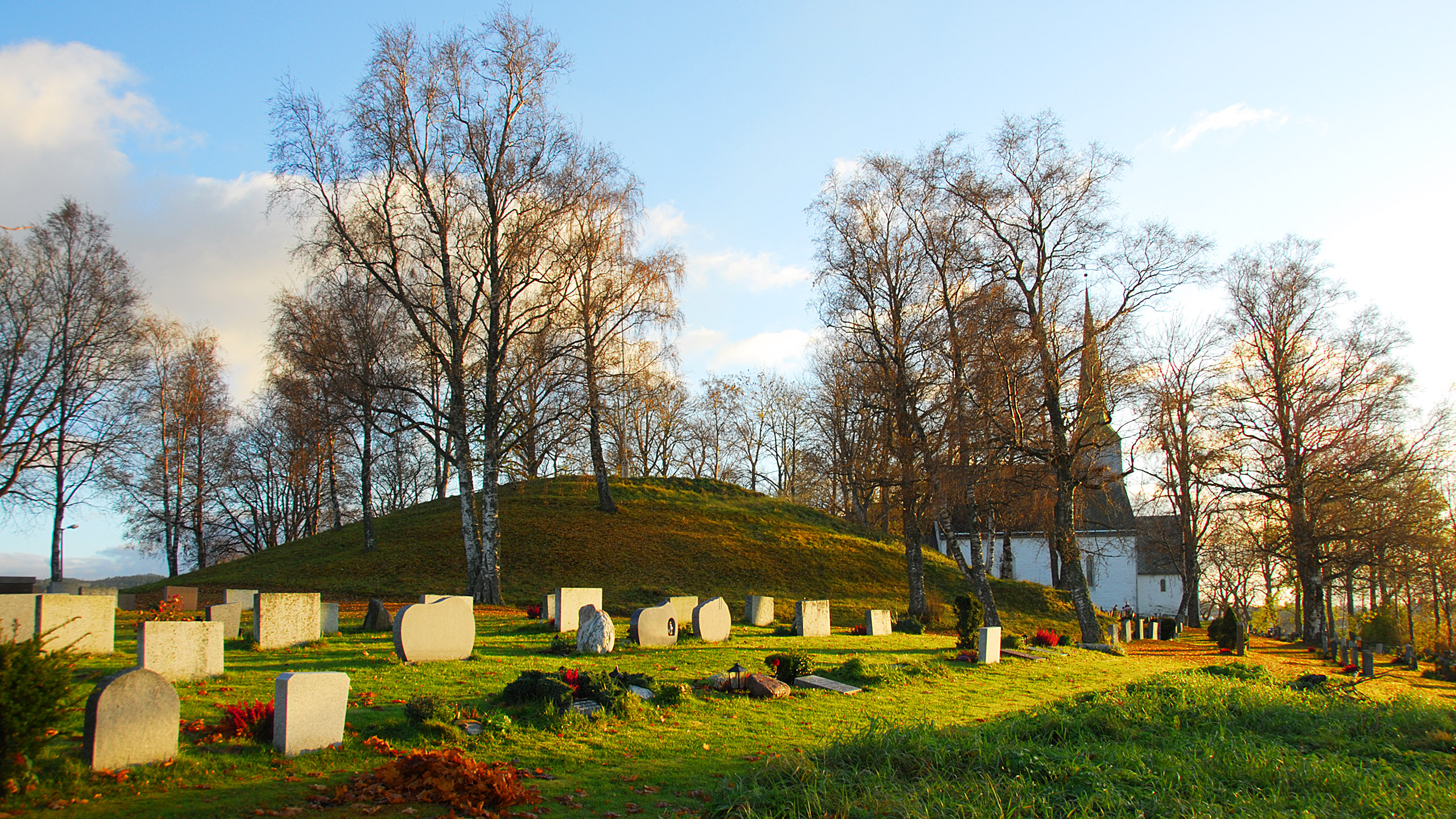
Alvir's mound was here long before Christianity and the church. Alstadhaug, Levanger, north of Trondheim.
|
|
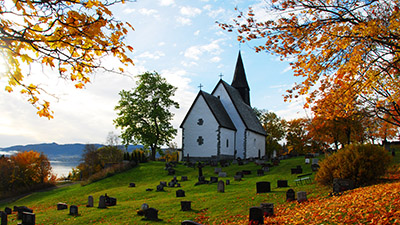
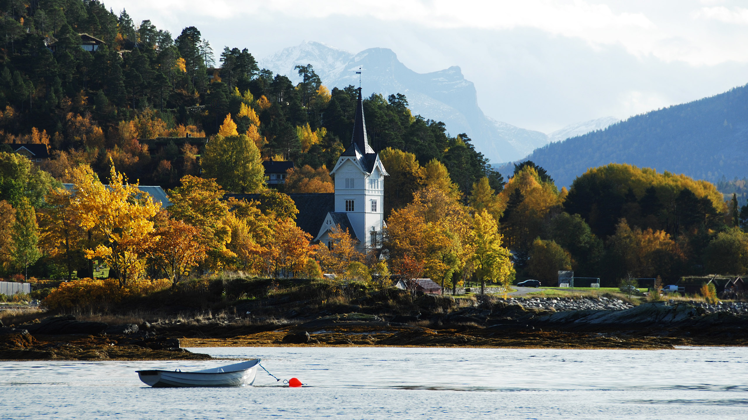
The Stangvik Church (1897), now in the district of Surnadal (east of Kristiansund).
|
|
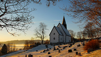
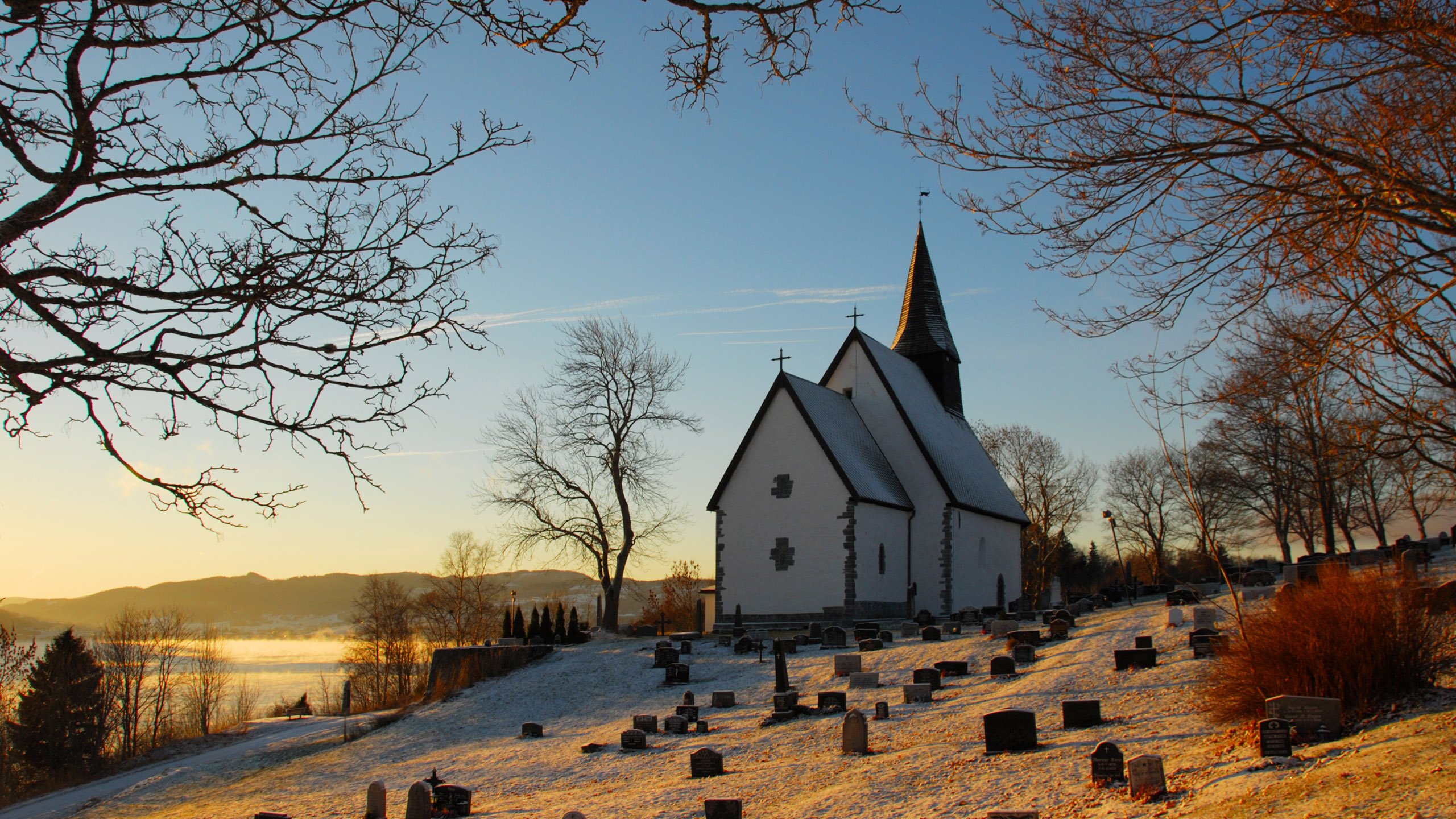
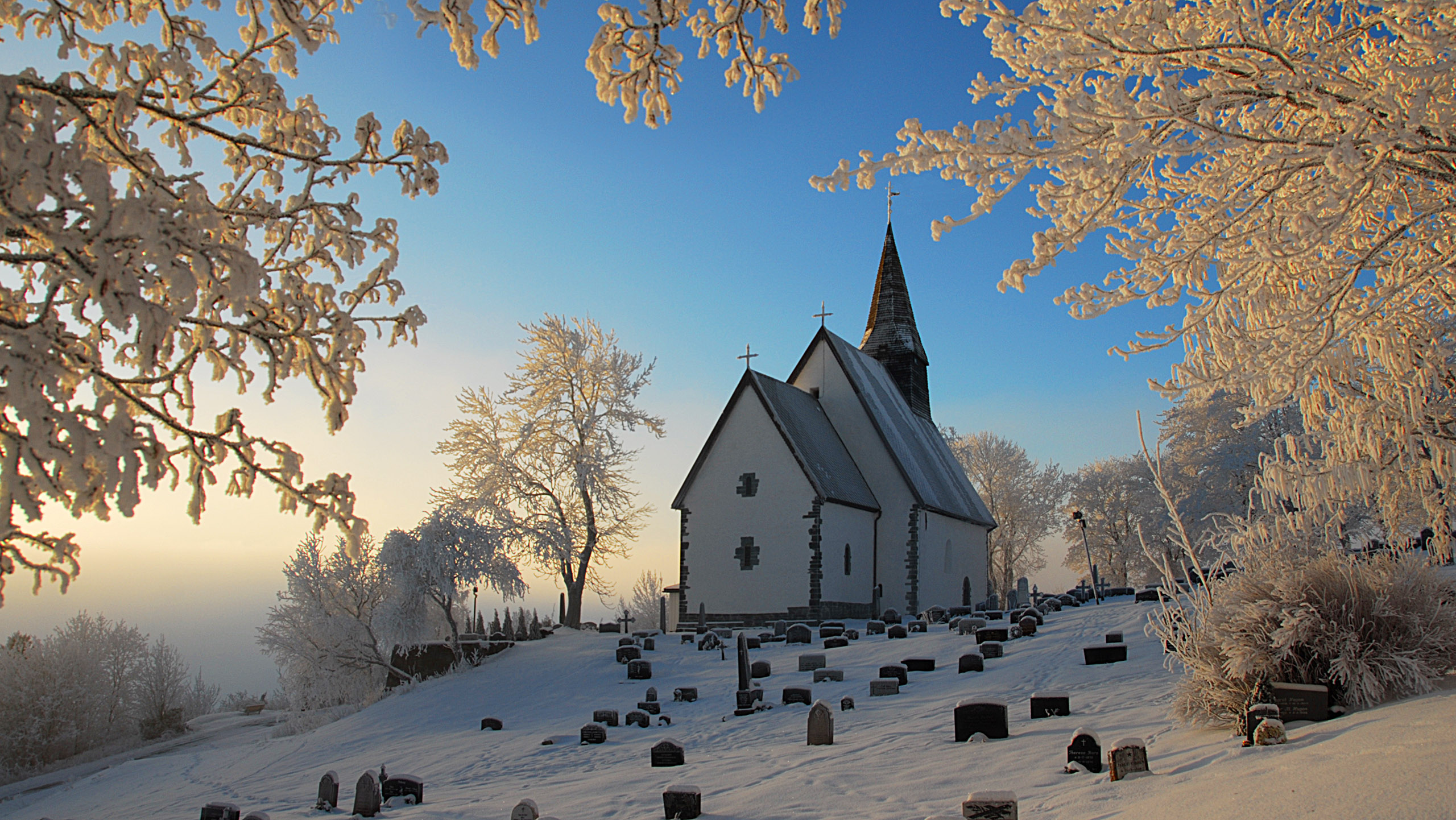
The Byneset church, Trondheim – originally St. Michael's Church on Stein (Sancti Michaeli de Steini). Built by Archbishop Eystein probably 1170–80 – Autumn.
|
|
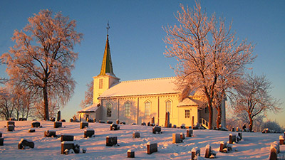
The Byneset church, Trondheim – Winter
|
|
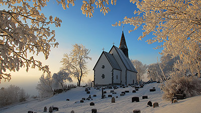
The Byneset church, Trondheim – Winter and frost fog from the fjord
|
|
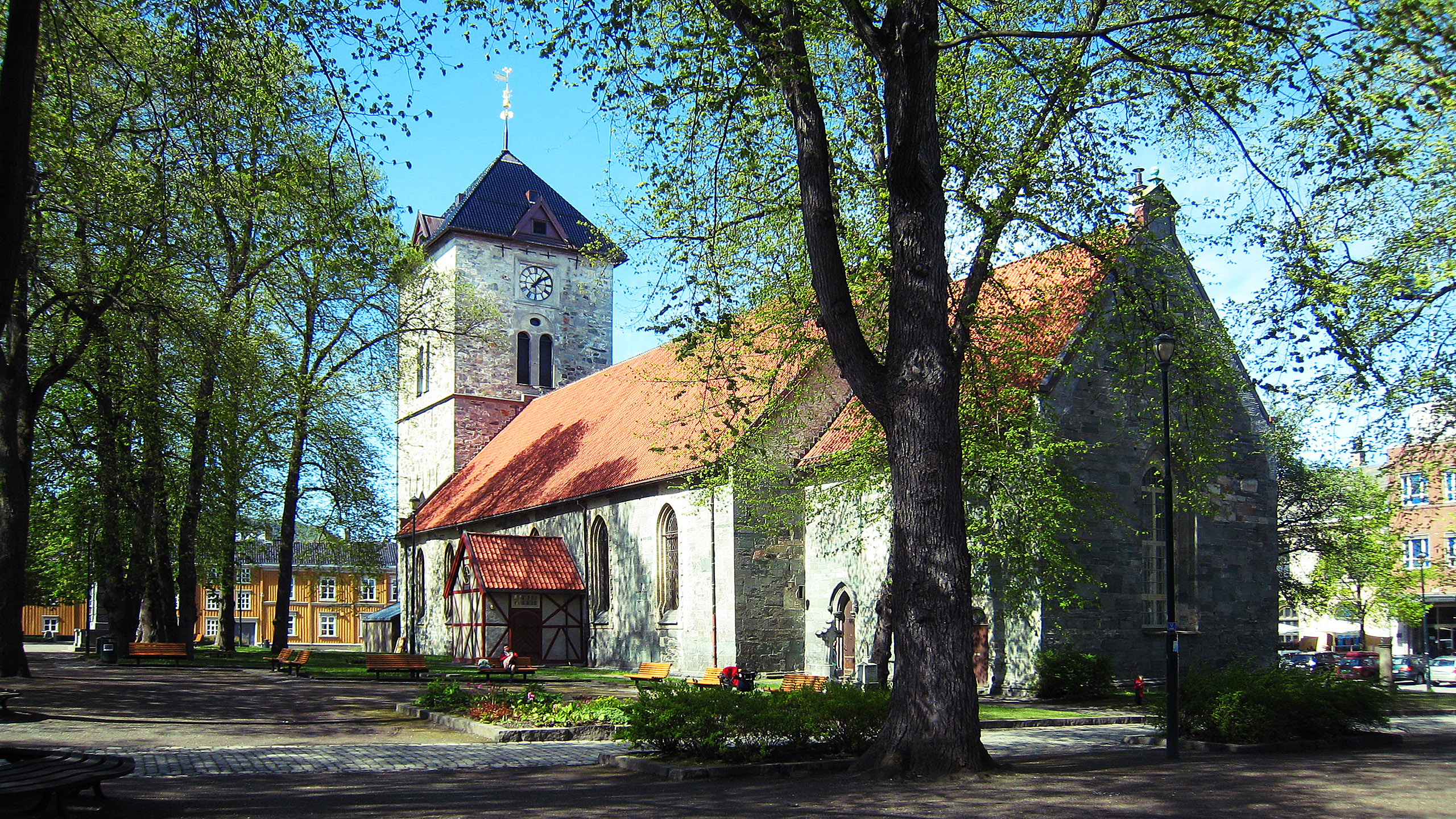
Vår frue kirke (Our Lady Church) in the centre of Trondheim. The present choir and half the nave is identical to the Younger (Virgin) Mary Church built around 1200. The rest of the church was built in the 1600s and 1700s, the tower in 1739.
|
|
The Tiller Church in Trondheim stands in a suburb south of the city.
|
|
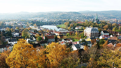
The centre of Trondheim seen from the Kristiansten Fortress. In the centre the river Nidelva with the Elgeseter Bridge, and right the Nidaros Cathedral.
|
|
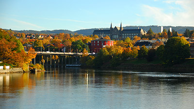
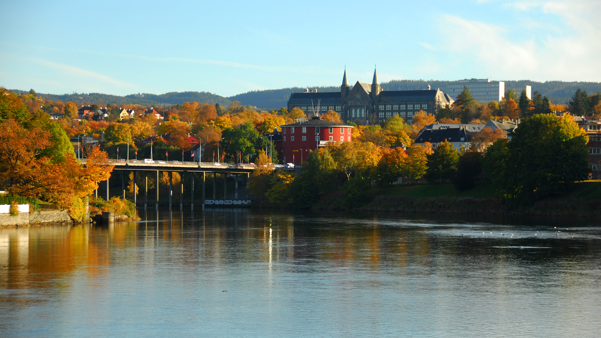
The river Nið (Nidelva), Elgeseter bridge, the Students' Round House (Studentersamfundet), and the the old main building of the Norwegian University of Science and Technology on the hill Gløshaugen.
|

|
Trondheim – the Old Town Bridge across Nidelva. In the old days small ships could sail up the river, but the bridge cannot be opened for passage any more. The river is too shallow anyway (and the ships too big).
|
|
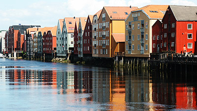
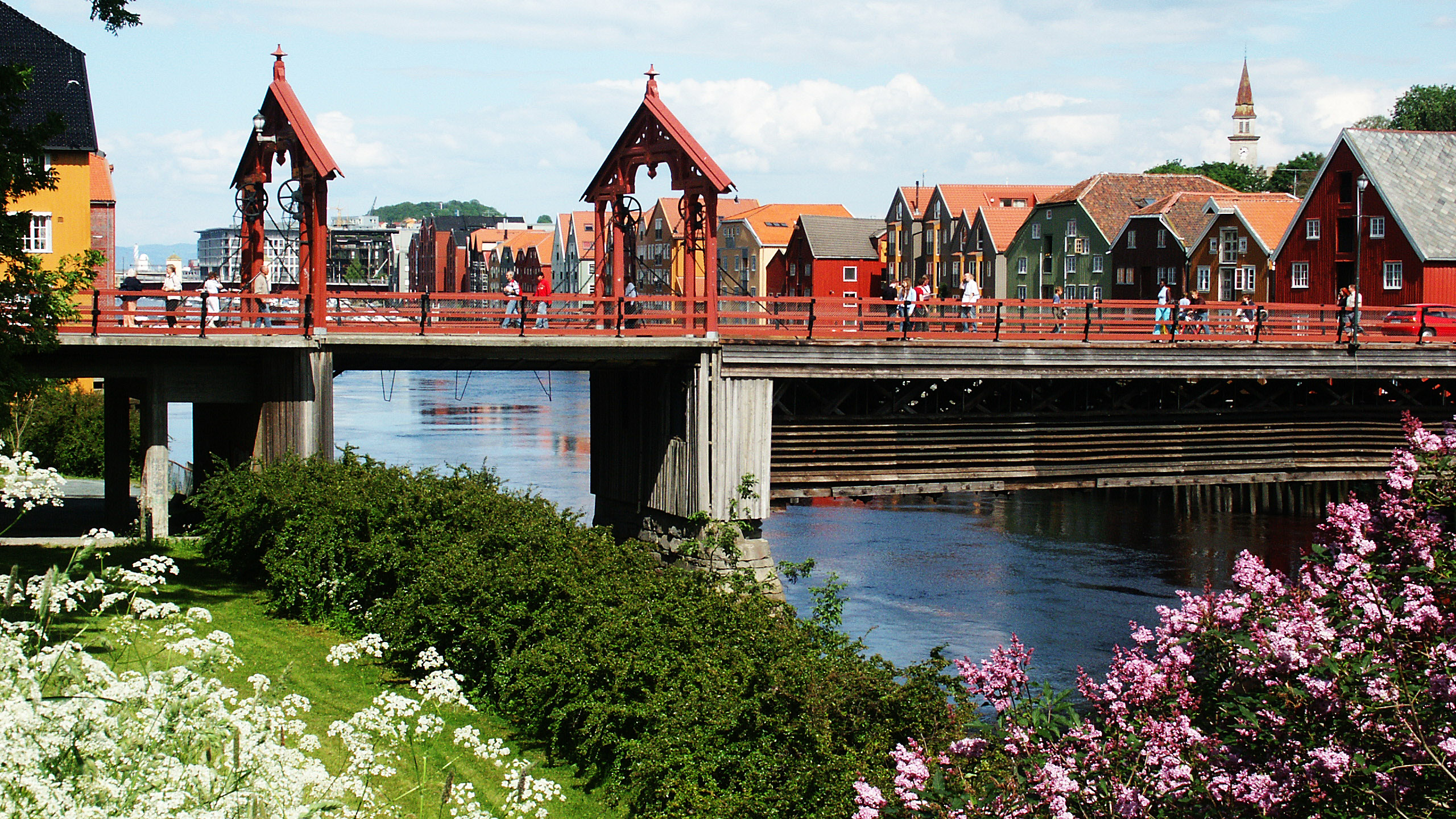
Trondheim – some of the old wharf storehouses on the shore of the river Nidelva, seen from close to the left end of the bridge above.
|
|
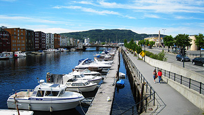
Trondheim – the Canal. Until the 1850s the wharf warehouses to the left faced the open and rather wide fjord. To alleviate the wind and wave problems, a breakwater was built outside the whole long row of wharfs, forming the present canal. Later on sea outside the breakwater was filled in, forming the present island. Here you'll find the Central Train Station and much more.
|
|
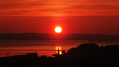
The sun rising in the north-northeast above the hills north of the Trondheim fjord, which at this latitude (63½°) means close to midsummer.
|
|
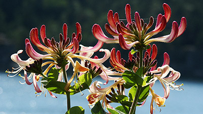
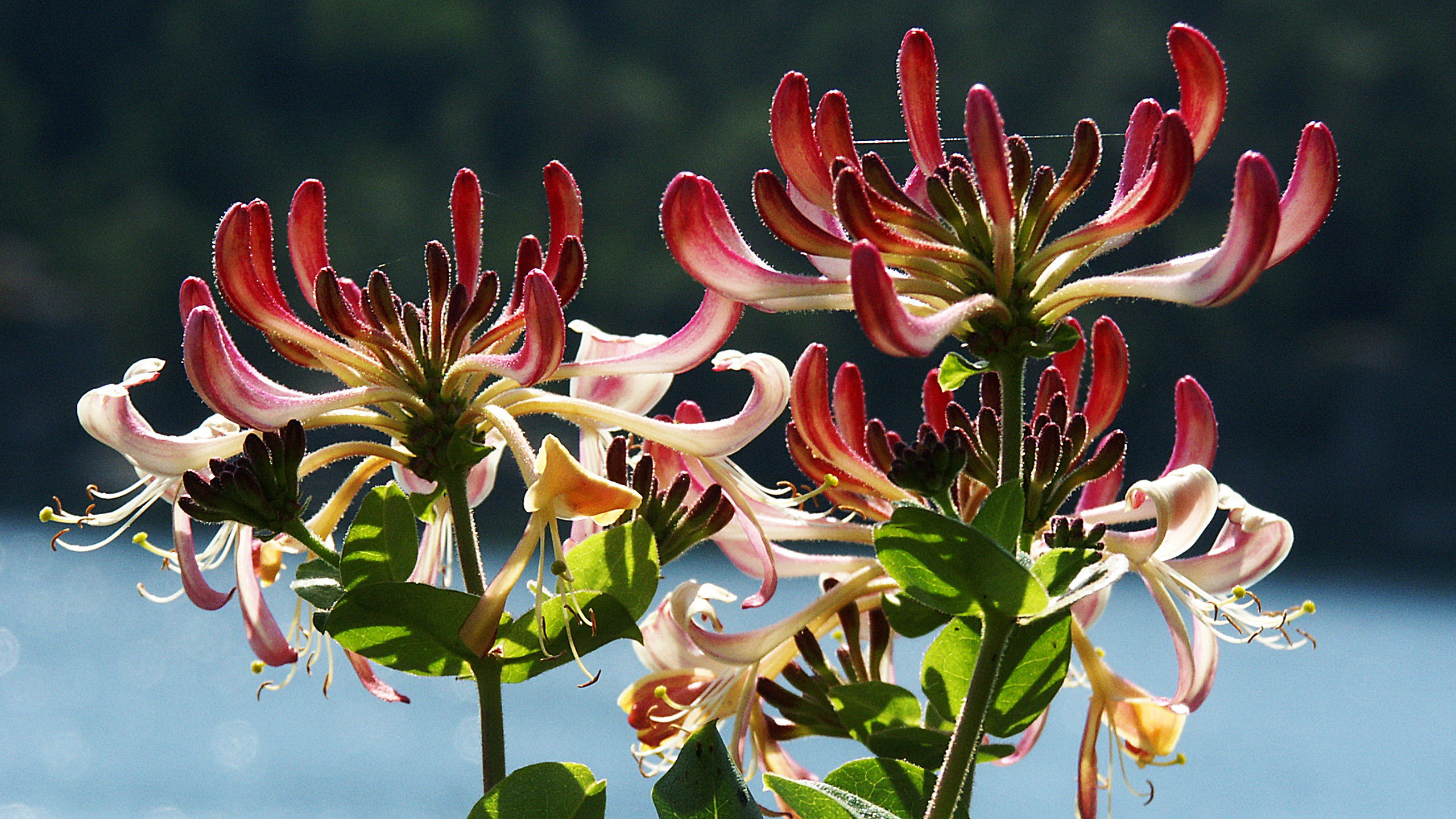
Woodbine, Honeysuckle (Lonicera periclymenum) grows in the woods near the coast of the southern part of Norway, climbing trees and shrubs and whatever stands still. During the dark hours the flowers have a pleasant odour, attracting insects that fly at night, like the Elephant hawk-moth.
|
|
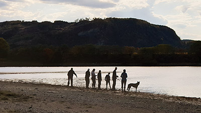
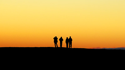
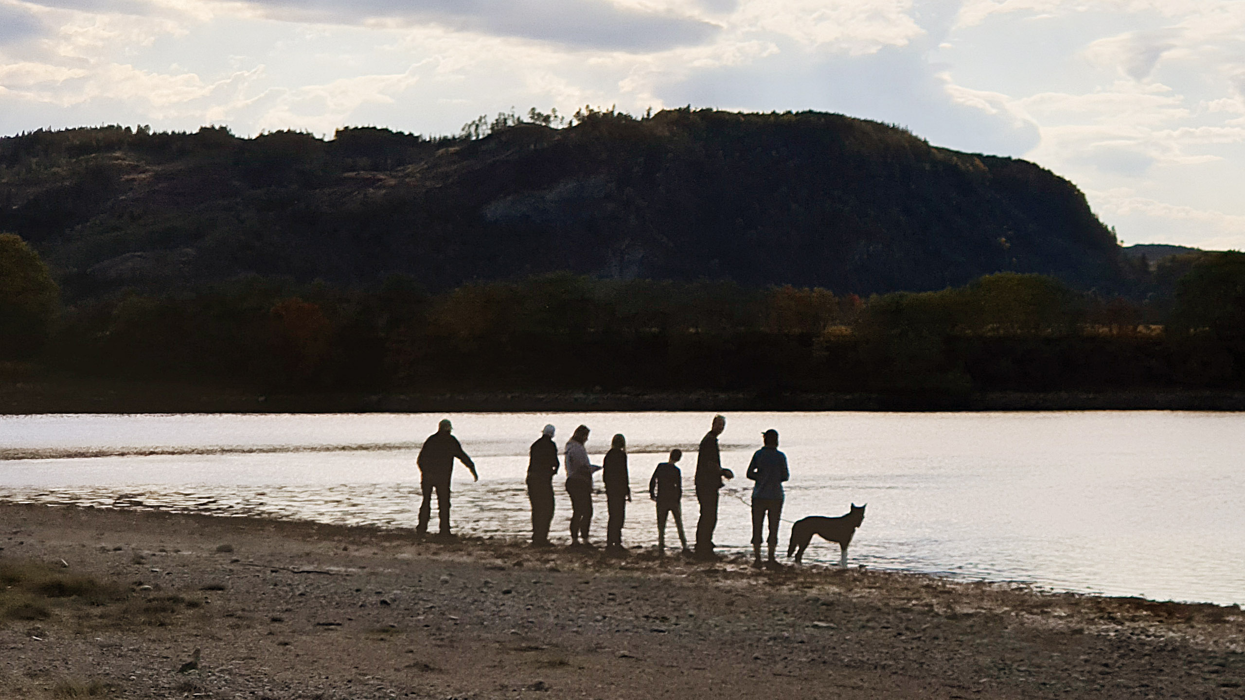
Evening stroll. I have that book somewhere, Manwatching by Desmond Harris (1979). A great hobby for some, but I suppose it's best enjoyed in public places. This wallpaper is meant to be a substitute.
|
Wallpapers – Iceland section

|
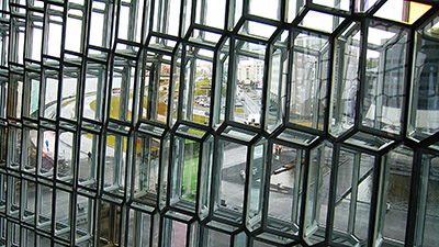
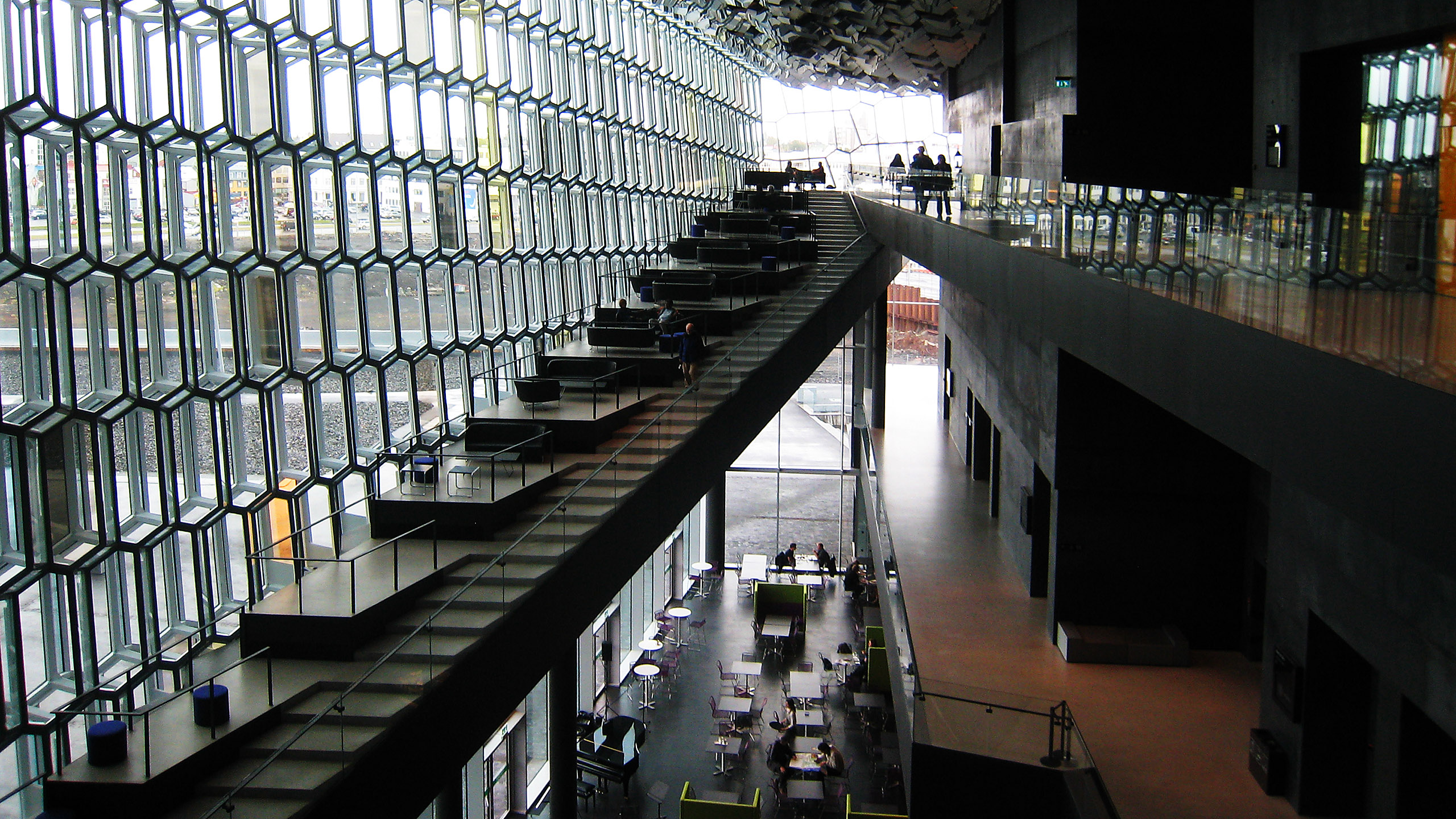
Harpa, the Reykjavik concert hall and conference centre. This is the entrance hall. The building is inspired by Icelandic volcanic nature: Black cliffs and hexagonal basalt columns.
|
|
Harpa was designed by the Henning Larsen Architects in Denmark, but the very special glass facade was designed by Olafur Eliasson (1967–), an international artist of Icelandic origin.
|

|
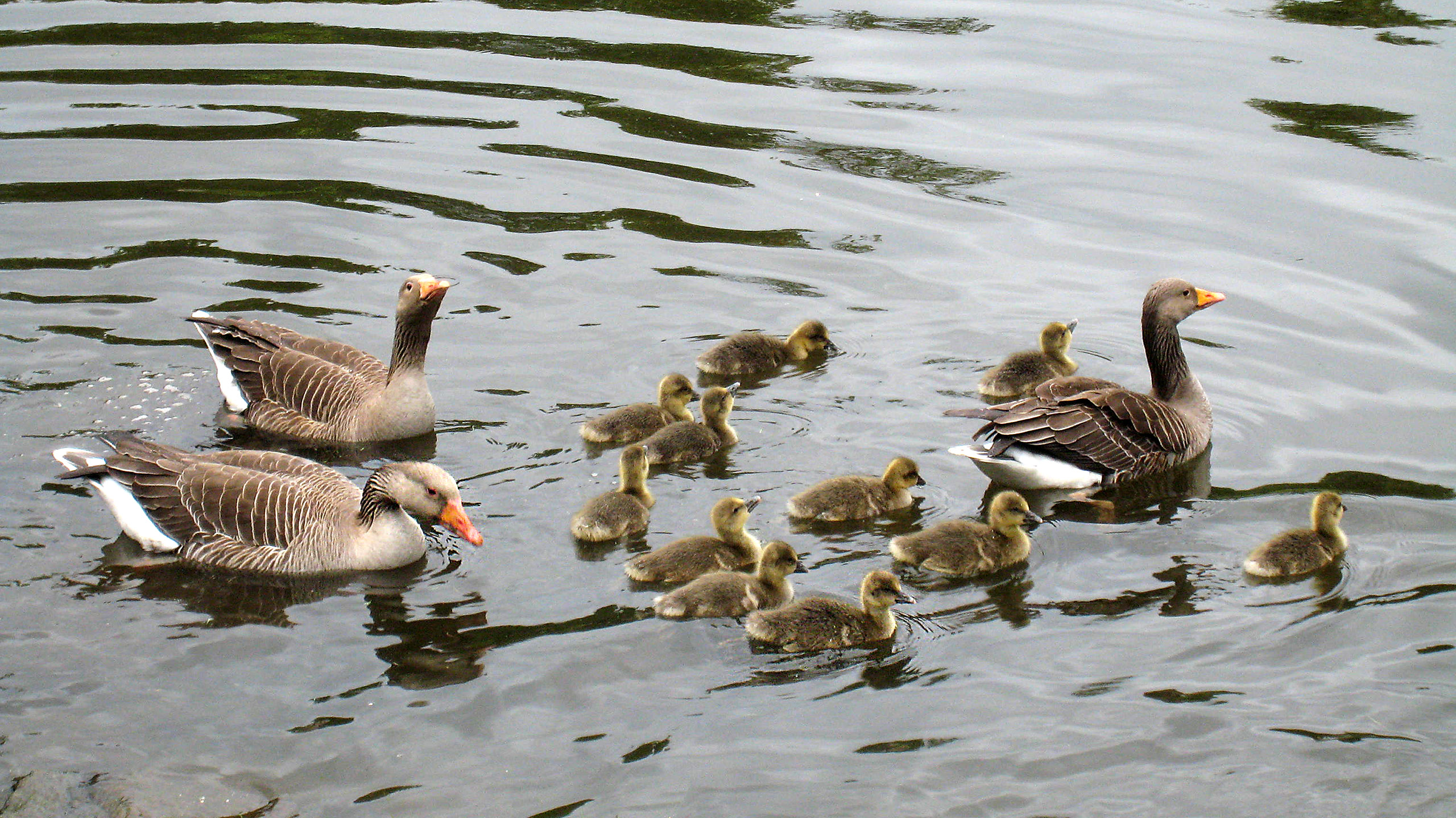
Laugardalur (Bath valley) lies on the north side of Reykjavik. Here you'll find the sport facilities, a park, a botanic garden and a kind of zoo for children. The picture shows wild greylag geese in one of the ponds.
|

|
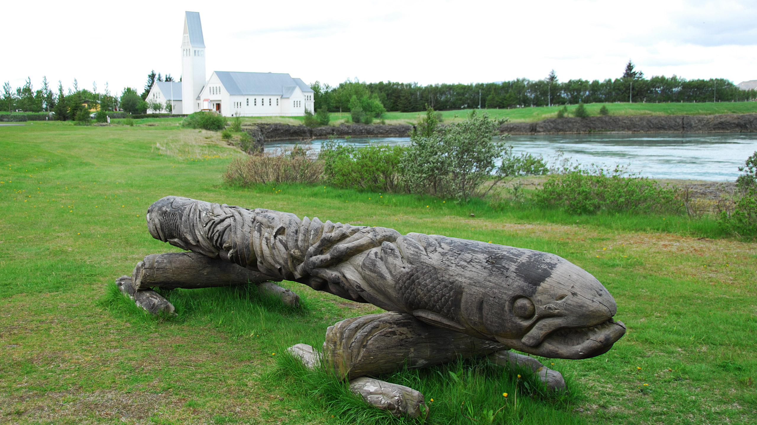
The Selfoss church east of Reykjavik and the river Ölfusá where the waterfall where seals may be spotted (Sel-foss) is further downstream. In the foreground some driftwood.
|
|
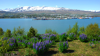
Akureyri seen from the east side of the fjord Eyjafjörður. This is the second largest city of Iceland, "the Capital of North Iceland".
|
|
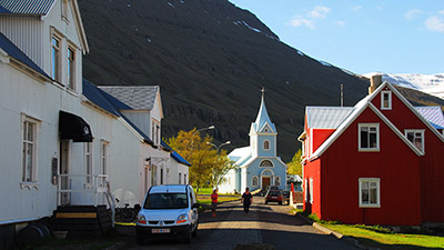
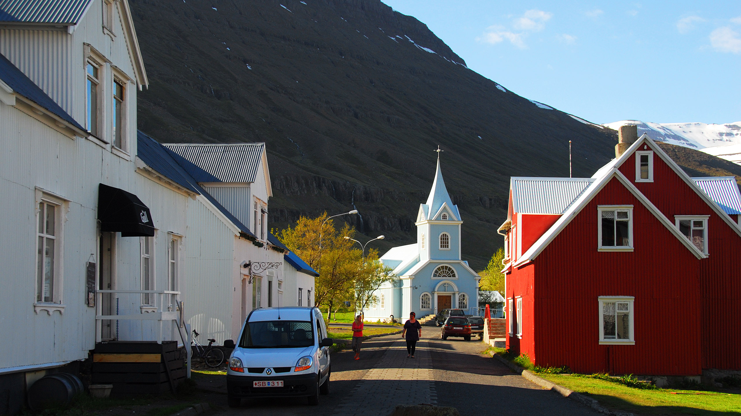
Seyðisfjörður on the east coast. The town was built by Norwegian fishermen immigrating from 1848 on, bringing timber to build their houses. There is a weekly car ferry Hirtshals, Denmark – Torshav, Faroe Islands – Seyðisfjörður, and the town can accommodate a lot of tourists. Shown Bláa kirkja (Blue church) or, formally, Seyðisfjarðarkirkja,
|
|
The coast at Lækjavík (between Höfn and Djúpivogur).
|
|
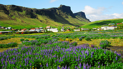
Vík í Mýrdal – seen from the shore. It's early June and the imported Alaskan (or Nootka) lupins (Lupinus nootkatensis) are flowering.
|

|
North of Vík lies the glacier Mýrdalsjökull and under the glacier lurks the feared volcano Katla. Eruptions under the ice inevitably results in ice melting and jõkulslaup (flooding). Nobody knows where the flood will hit. If it happens to be Vík, the inhabitants are to grab the children and other valuables and run to the church. They seem to believe that will be safe.
|
|
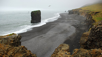
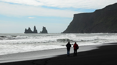
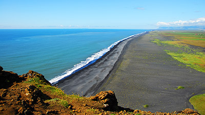
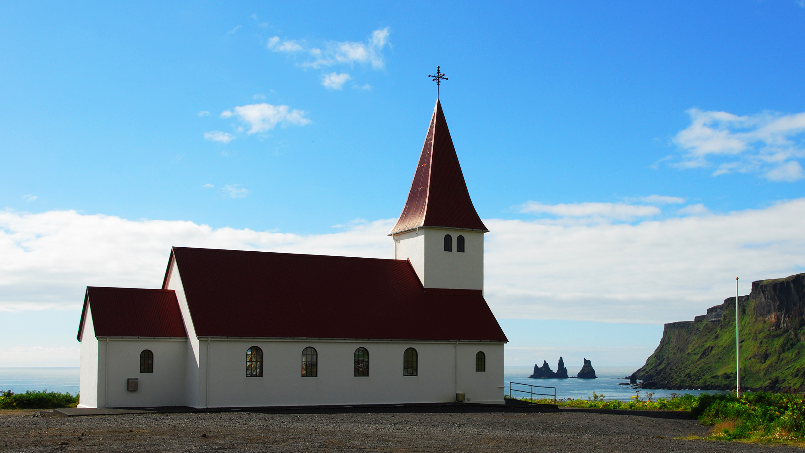
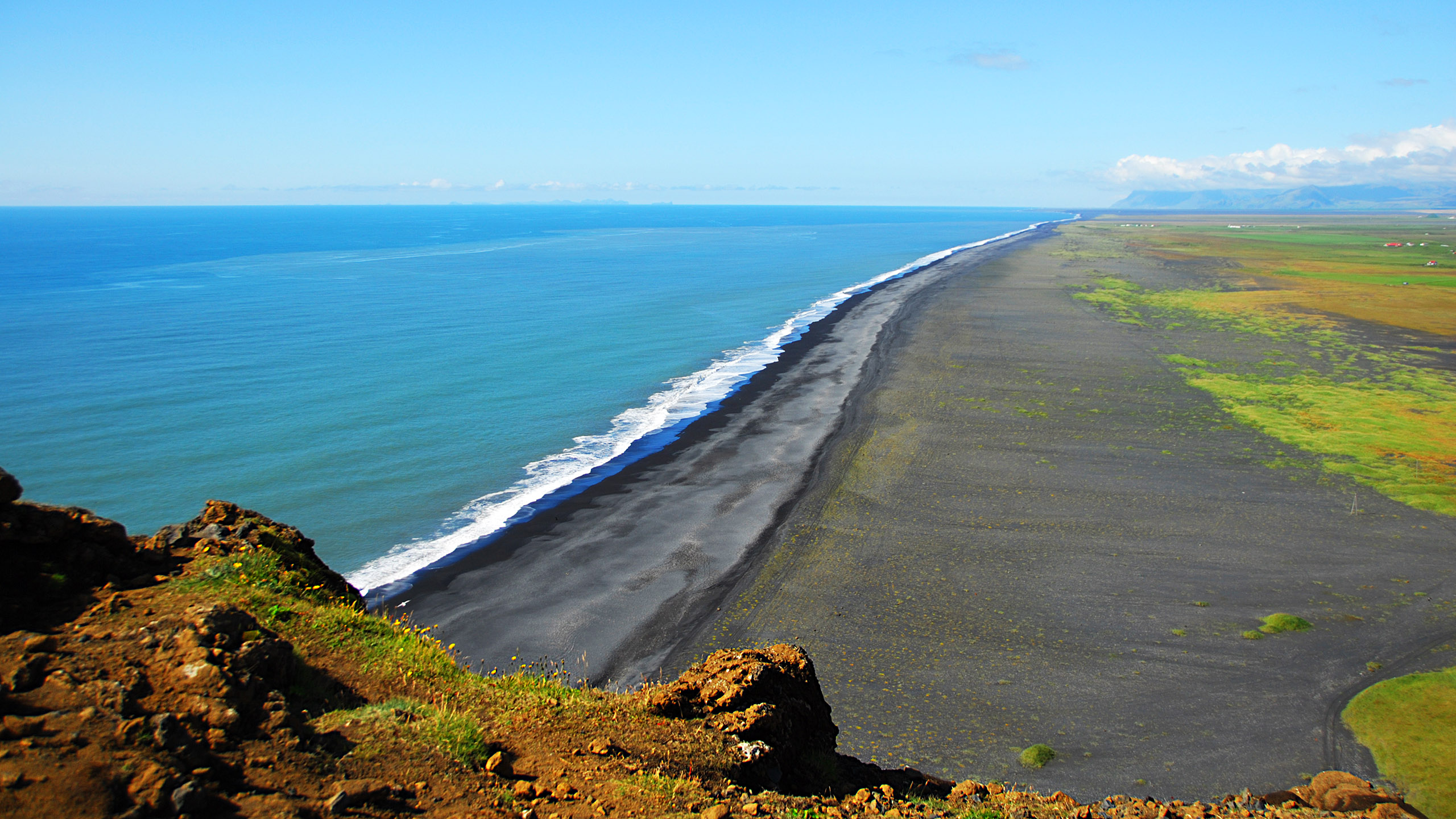
The black beach of Vík í Mýrdal. The Ring Road runs through Vík, and a stroll on the beach is a must for the tourists. Right the mountain Reynisfjall and in the sea the rock pillars Reynisdrangar,
|
|
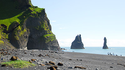
Reynisfjara (fjara=beach) on the west side of Reynisfjall. The rock pillars on the previous picture seen from the opposite side.
|

|
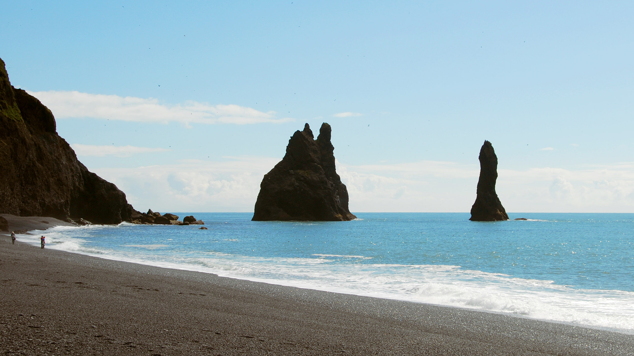
A closer look at the rock pillars from Reynisfjara.
|
|
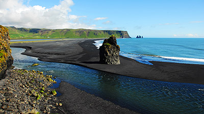
View towards east from Dyrhólaey (=door-hill-island). Far away the rock pillars, and then the black sand of Reynisfjara. Close to the camera the tidal river from the lagoon inside Reynisfjara and Dyrhólaey.
|
|
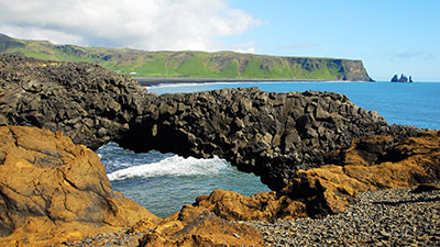
On the peninsula Dyrhólaey, a rock formation.
|
|
View towards west from Dyrhólaey. Left of the picture centre, 55 km off, the volcanic island group Vestmannaeyjar may be spotted below its accompanying clouds.
|
|
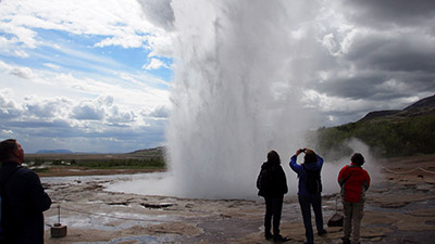
Strokkur, the only geyser that spouts at short intervals.
|
|
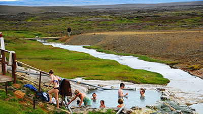
Primitive outdoor bath at the hot springs on Hveravellir (= hot-spring-fields). It is found near the bumpy highland route (35) across Kjölur, starting at Gullfoss and ending on the Ring Road halfway between Blönduós and Varmahlið.
|
|
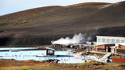
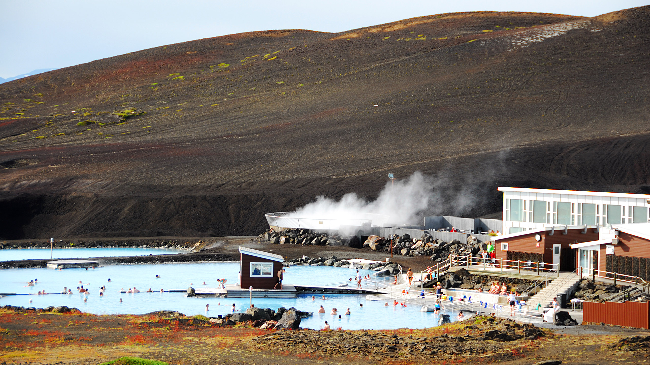
Jarðböðin, an outdoor bath a couple of kilometres east of Mývatn. It gets its warm water from the geothermal power plant Bjarnarflag. It does feel a lot less commercial than The Blue Lagoon near the road to Keflavík.
|

|
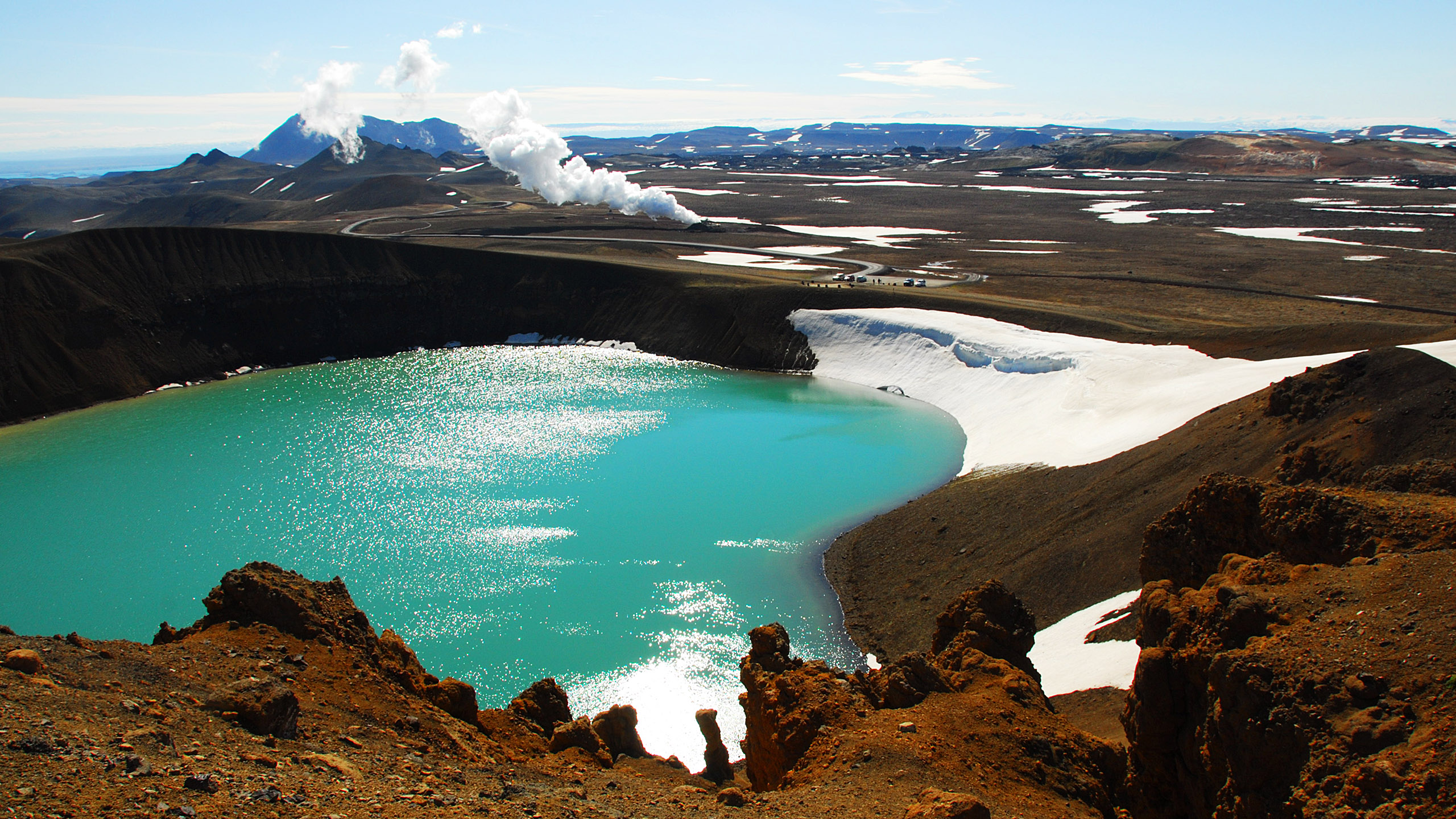
Northeast of Mývatn (discernible top left) lies the Krafla volcanic area. In 1724 Mývatnseldar (the "Mývatn fires") started with an explosion that created this 320 m wide crater, Víti (=Hell). The smoke above the picture centre is water vapour from a bore-hole for the geothermal power plant further to the left. The parking is seen beyond the crater. As this was early June 2010, shortly after the eruptionn under Eyjafjallajökull, there were few tourists.
|
|
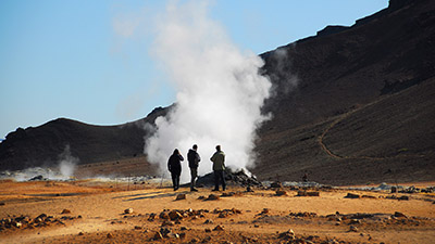
A few kilometres east of Mývatn, close to the east side of Namafjall and just south of the Ring Road, busloads of tourist come to see Hverir. Here they can see steam vents like this one, and boiling mudpots. This is a few kilometre south of Víti and a part of the same Krafla area.
|
|
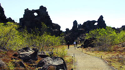
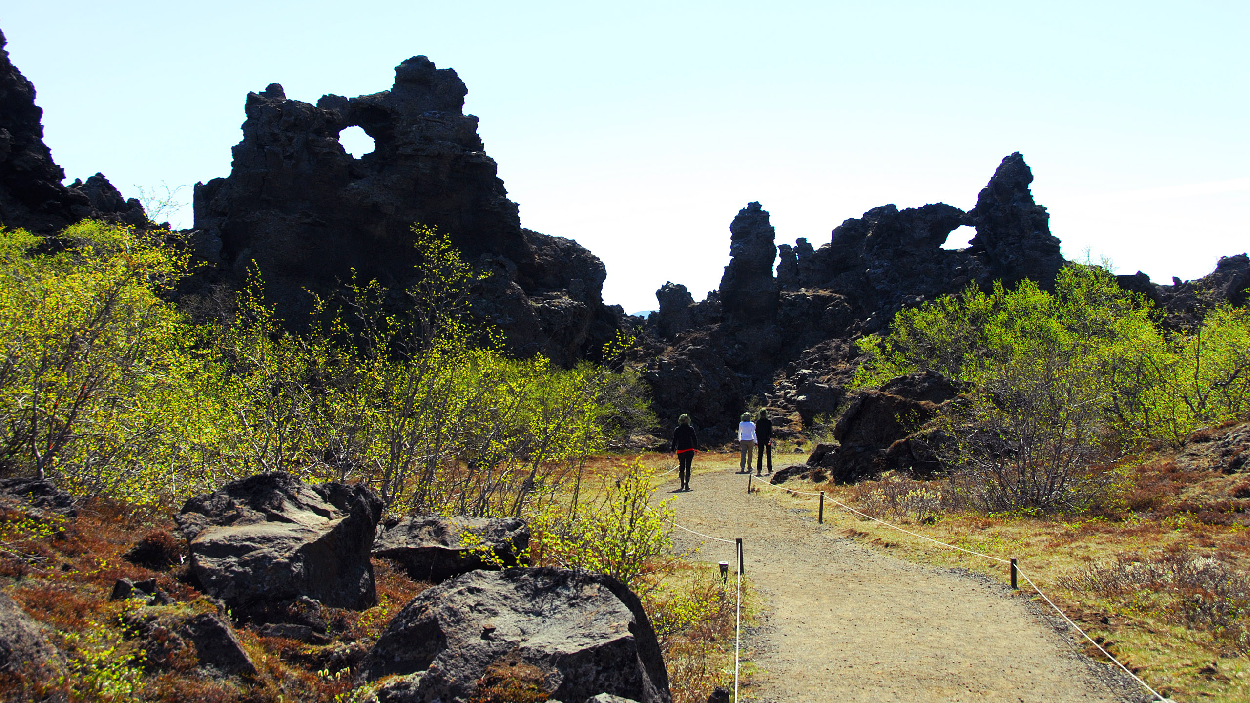
Dimmuborgir (=dark-castles) south of Mývatn. Some 2300 years ago lava from an eruption to the east flowed through a small lake causing intense boiling and leaving a large field of crazy rock shapes when it continued to lower grounds.
|

|
There are also strange lava formations at Mývatn west of Dimmuborgir, here called klasar. The picture is taken from the small peninsula Höfði where a former owner spent his summer holidays planting trees and herbs. Roughly fifteen kilometres towards the south, Bláfjall (1222 m), one of those plateau mountains created by a volcano under 2–3 thousand metres of ice.
|

|
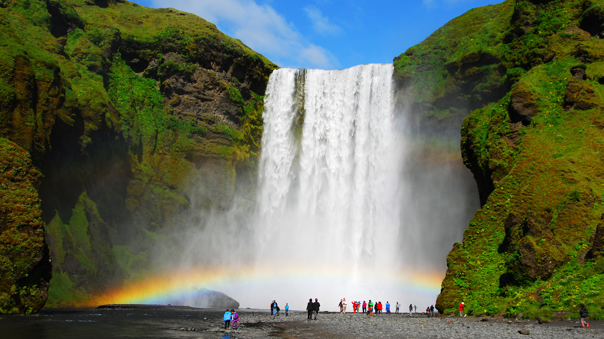
The waterfall Skógafoss is 60 meters high. It's found in Skógar immediately south of the glacier Eyjafjallajökull, known from the volcanic eruption and the ash clouds in 2010, and now in August it's melting.
|
|
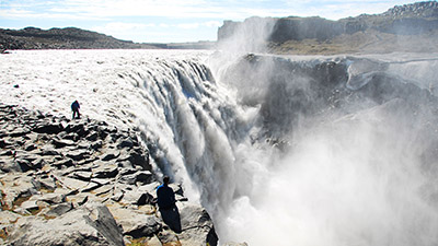
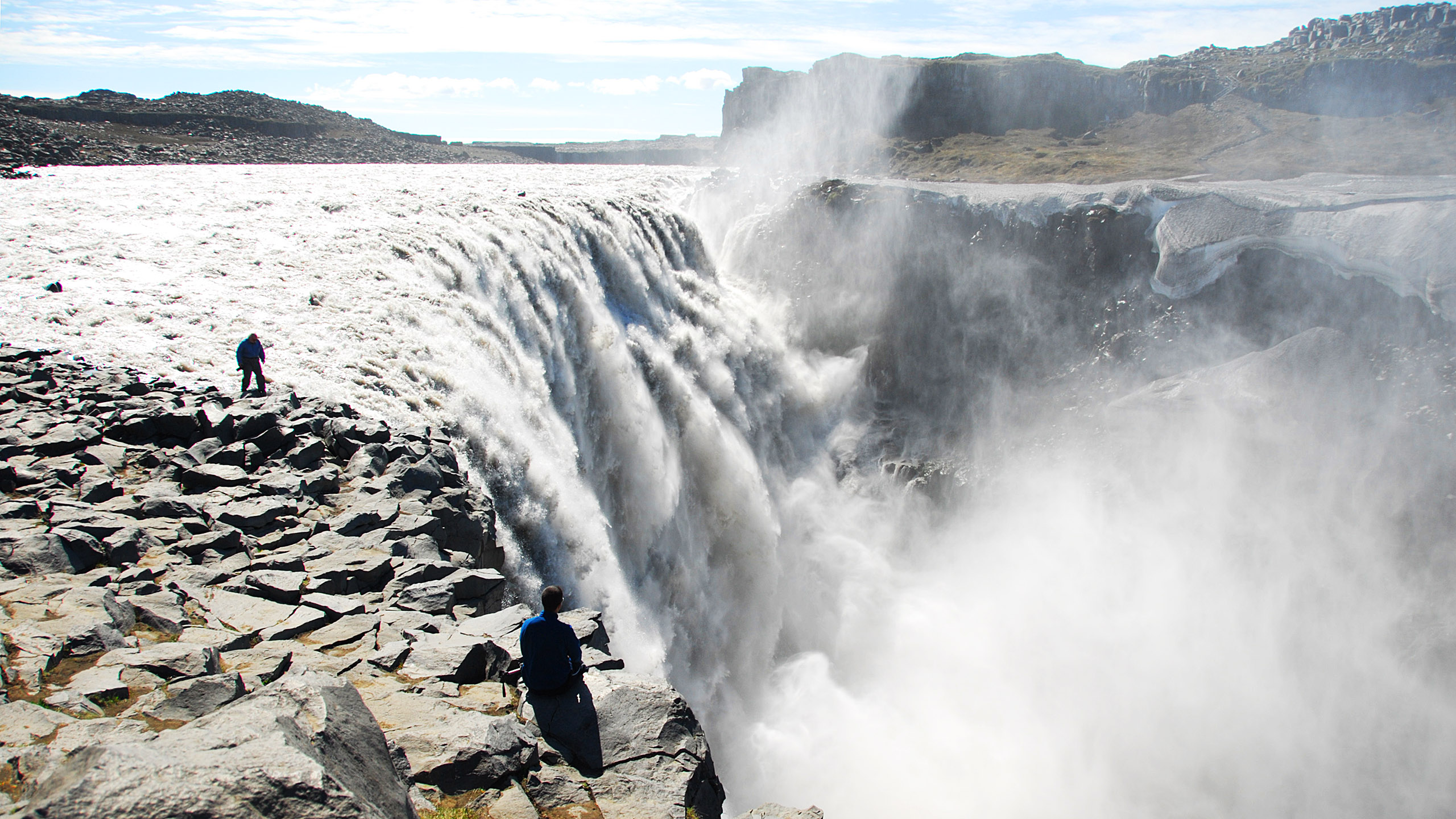
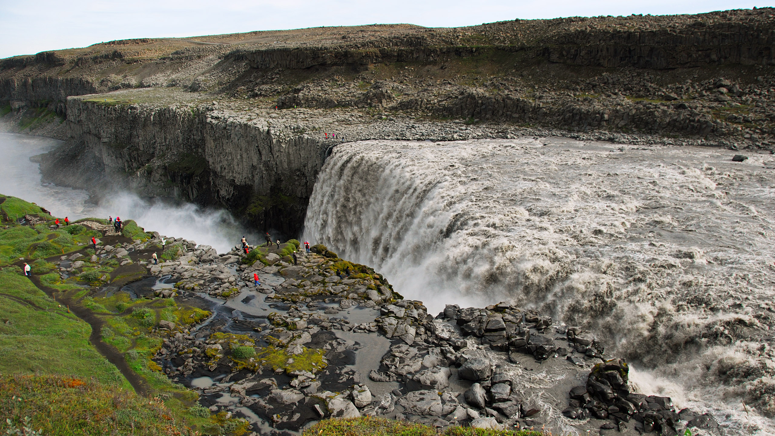
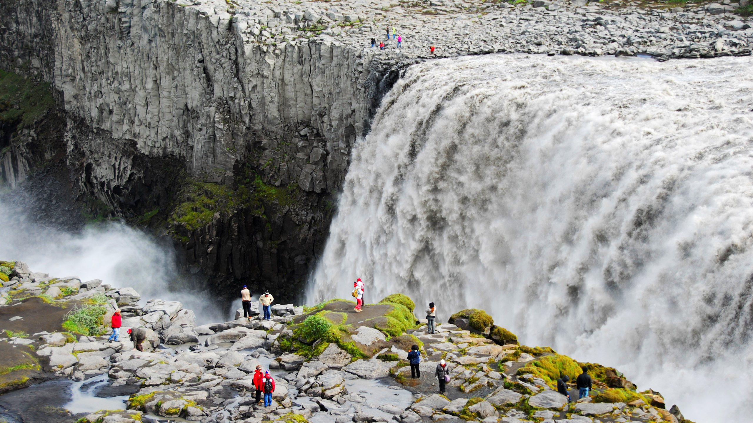
Dettifoss in the river Jökulsá á Fjöllum in North Iceland, the most powerful waterfall in Europe. Viewed from the east side of the river.
|

|
Dettifoss viewed from the west side of the river.
|

|
Dettifoss – a closer view.
|
|
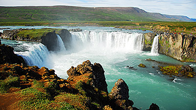
Goðafoss in North Iceland. On the annual Alþingi (parliament) in Þingvellir the summer of 1000, lögmaður (lawspeaker) Þorgeir Ljósvetningagoði obtained a resolution that made Iceland Christian. After returning home he threw his figures of the Norse gods into this waterfall, and this is the origin of its name.
|
|
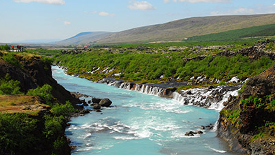
Hraunfossarar (=lava-waterfall), a series of waterfalls emerging from under the lava of Hallmundarhraun. It's situated in West Iceland, east of Reykholt.
|
|
The planted 740 hectares forest Hallormsstaðaskógur, west of Egilstaðir, at Lagarfljót, the lake featuring the monster serpent Lagarfljótsormurinn.
|

|
View towards north from Jónasarlundur in Öksnadalur. This is a grove planted in honour the celebrated Icelandic poet Jónas Hallgrímsson (1807–1845) who was born near by. Behind the next valley the incredible peak Hraundrangi, claimed to have inspired Hallgrimskirkja in Reykjavik.
|
|
At Reykjahlið on the east side of Mývatn.
|

|
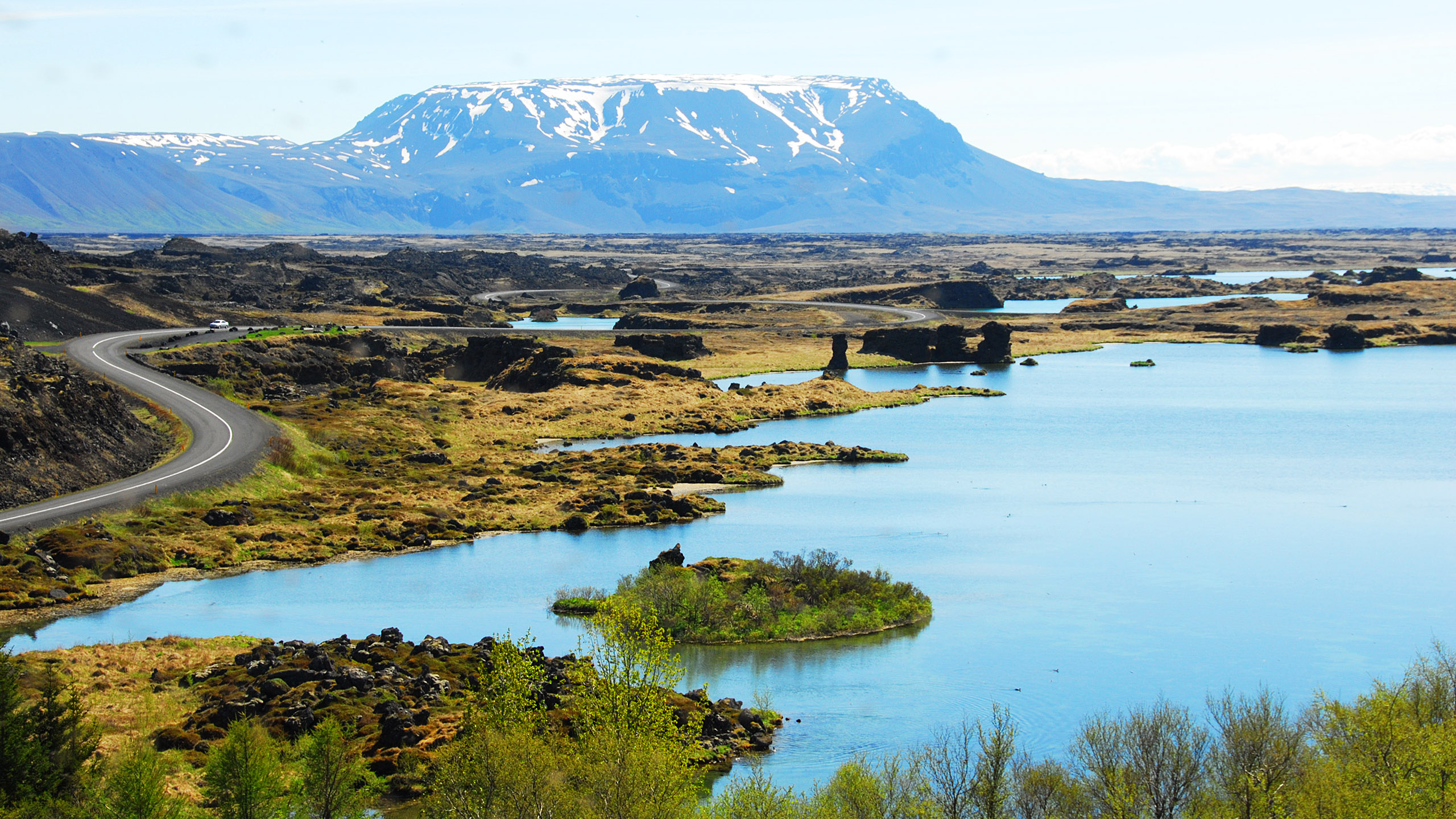
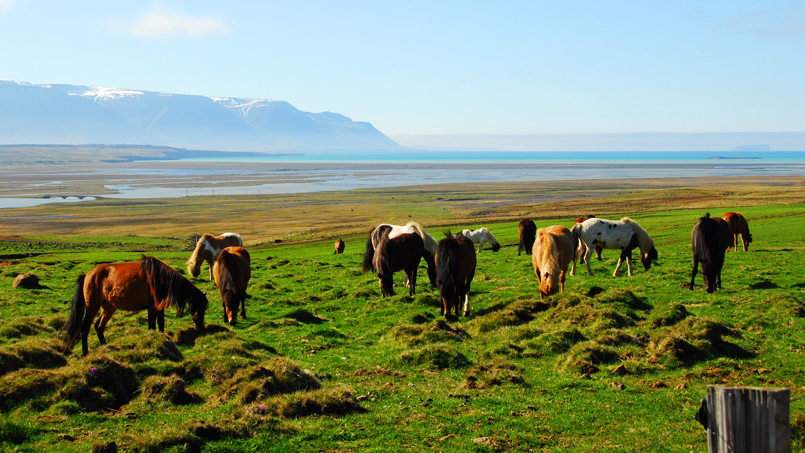
The Héraðvötn broad river valley (or river delta) and the fjord Skagafjörður. Discernible through the mist out there, on the right, the very special islet Drangey.
|
|
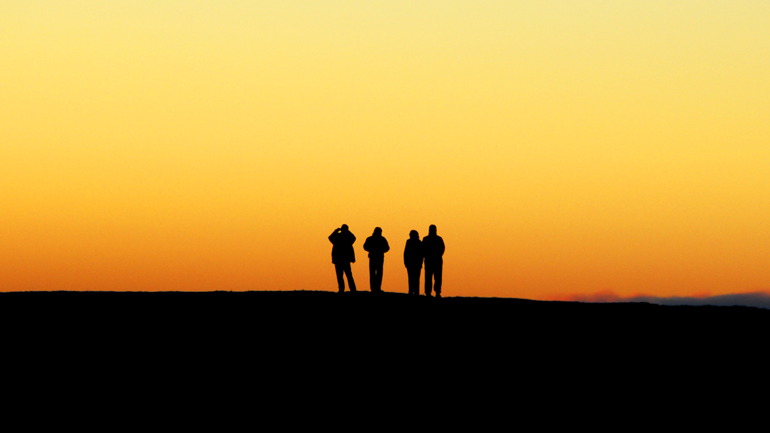
Tourists at midnight – Mývatn in June; it's only 110 kilometres south of the Arctic Circle.
|