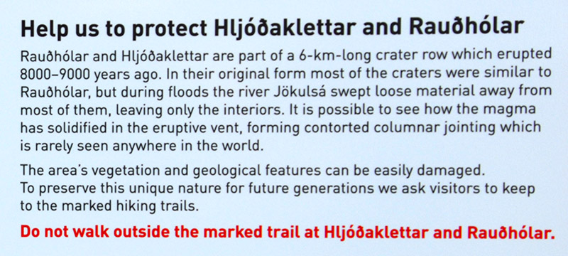
literally 'sound-cliffs'
because they make
confusing echoes
(2013-08-09)
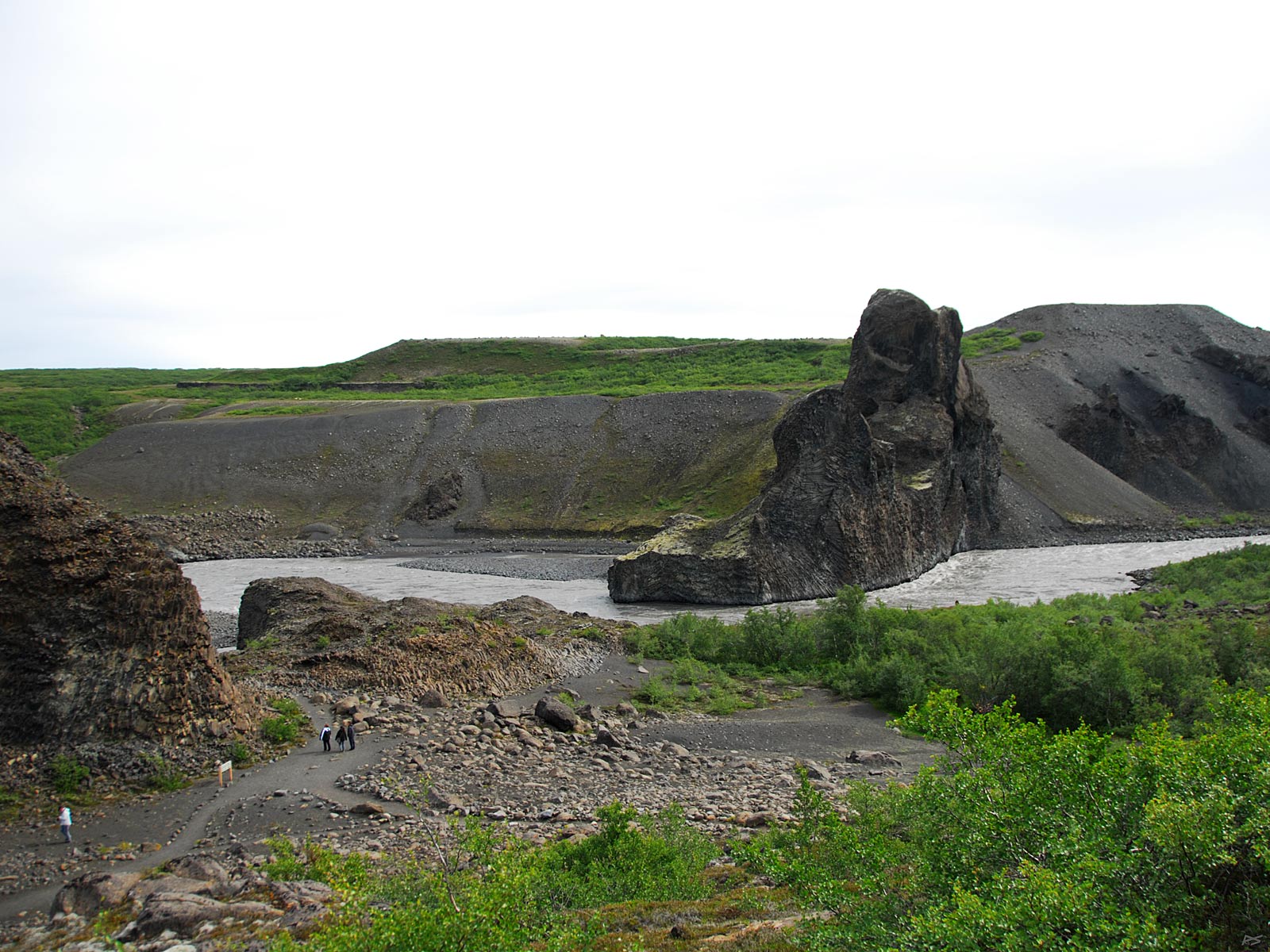
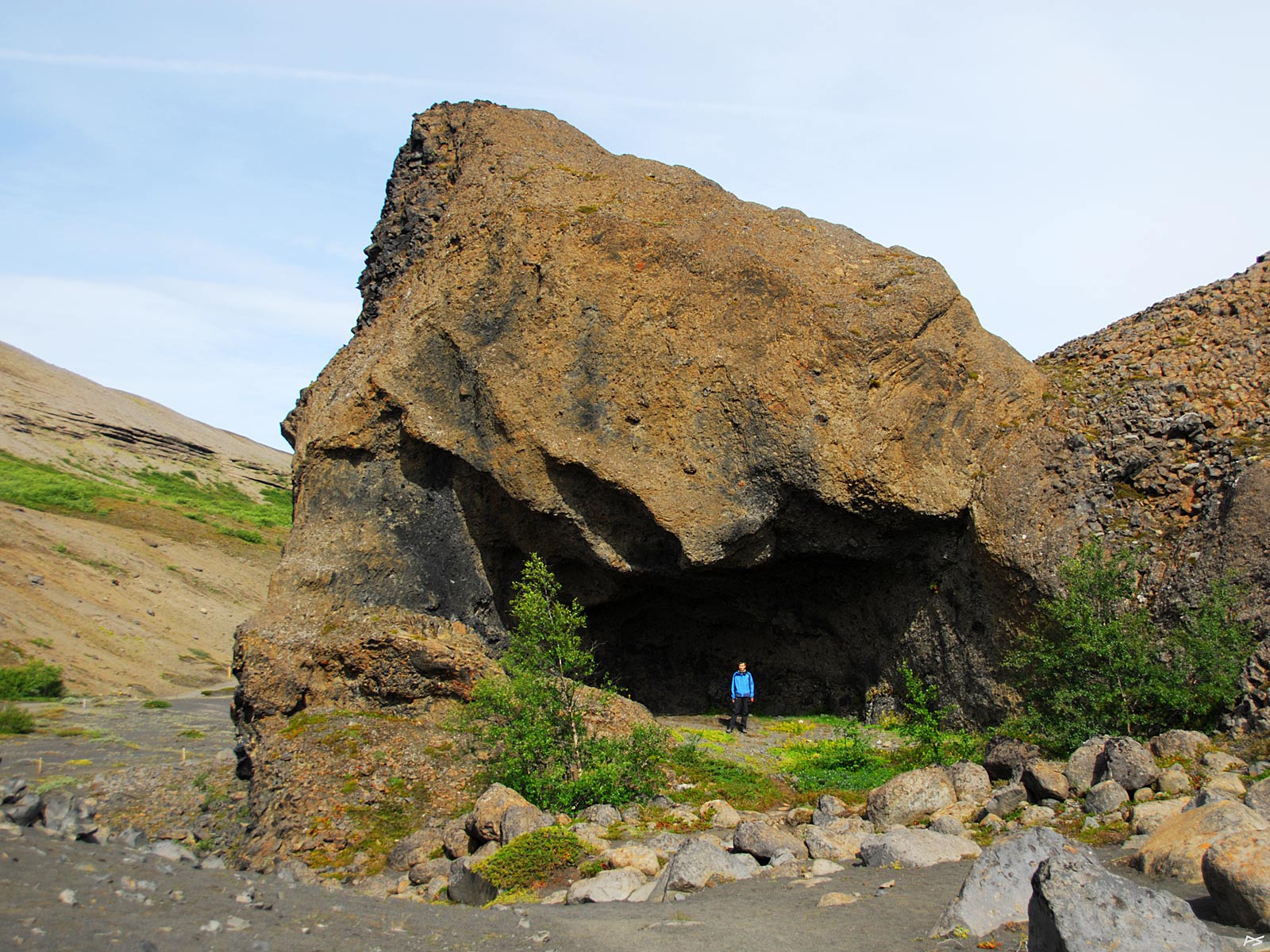
This is Tröllið (=the troll), on the east side of the river Jökulsá á Fjöllum.
(2013-08-09)
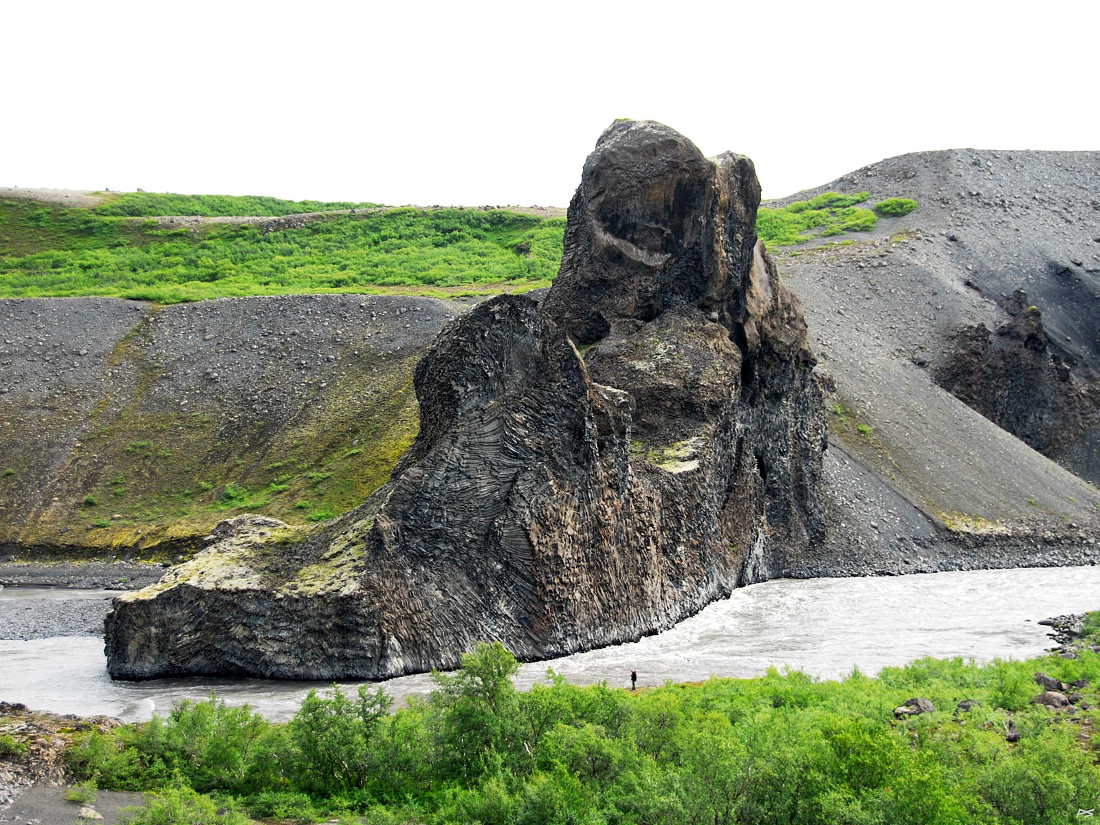
Tröllið, a closer look. This area is a 8000–9000 years old crater row, modified by floods in the river.
(2013-08-09)
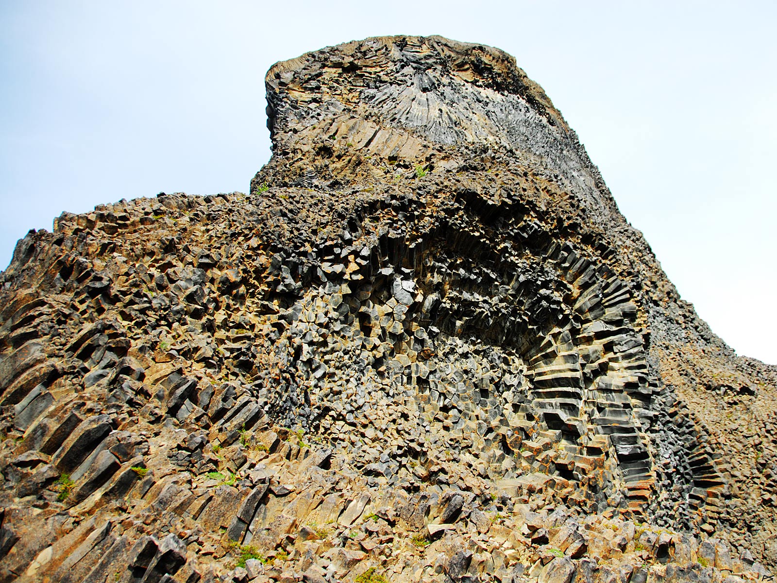
Twisted basalt columns is characteristic of Hljóðaklettar.
(2013-08-09)
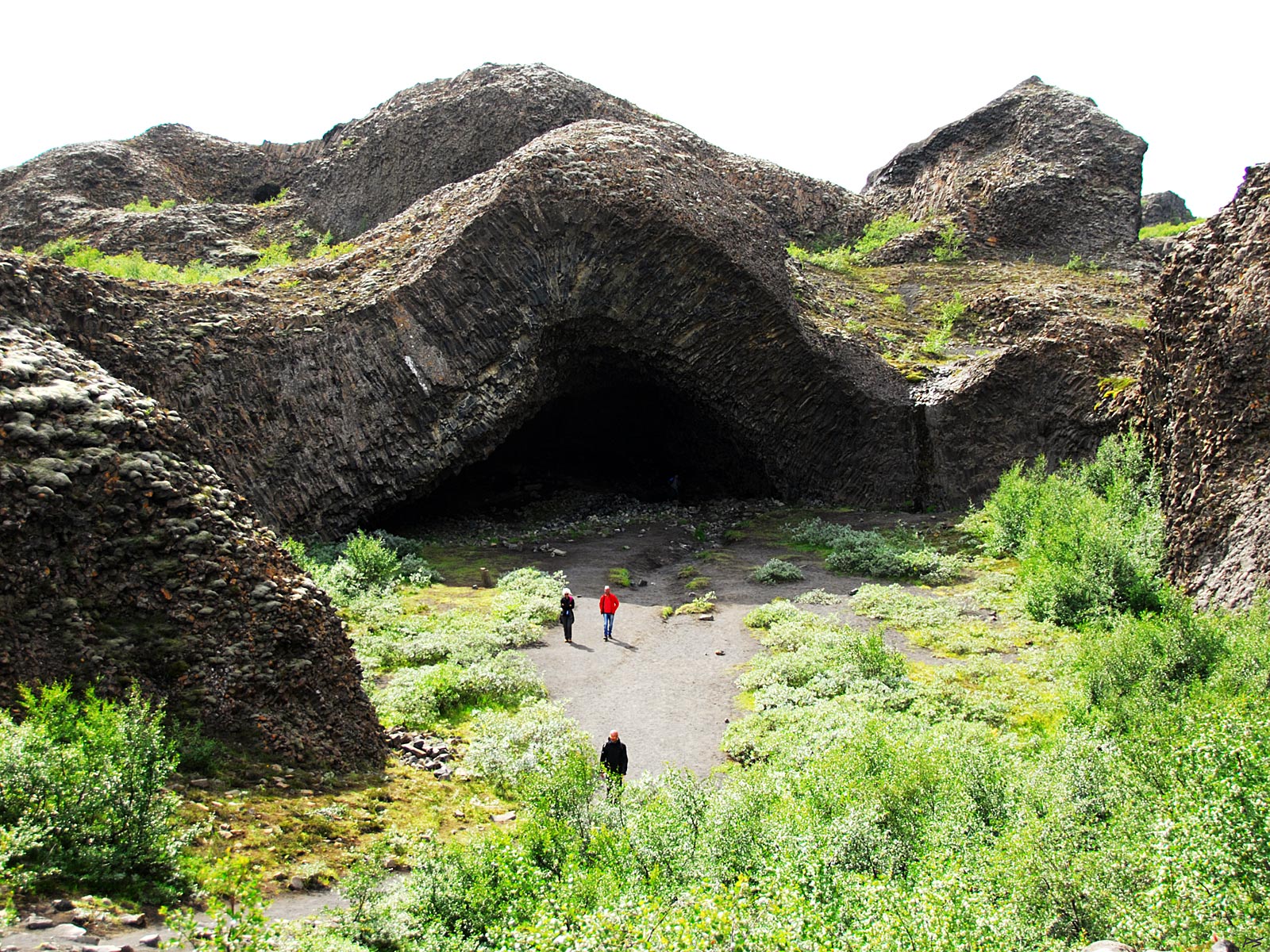
One of the caves.
(2013-08-09)
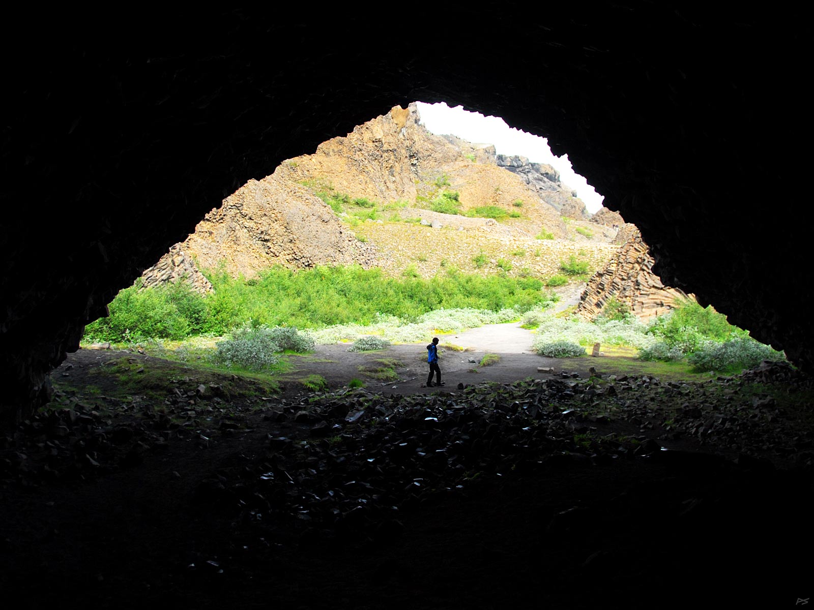
Kirkjan, the best known cave.
(2013-08-09)
View from within Kirkjan.
The Jökukulsárgljúfur National Park is situated essentially west of the river Jökulsá á Fjöllum from Dettifoss and north to Ásbyrgi. It can be reached on foot from Ásbyrgi, else parts of it further south can be reached by car from route 862 (parts of which is rather bad).
Spending a few days here, investigating it on foot, is actually a very good idea, if you got the time (and a sleeping bag and preferably a tent).