The "Mývatn fires" 1724–29,
a geothermal power station
– and hot stinking things for the tourists
(2010-06-05)
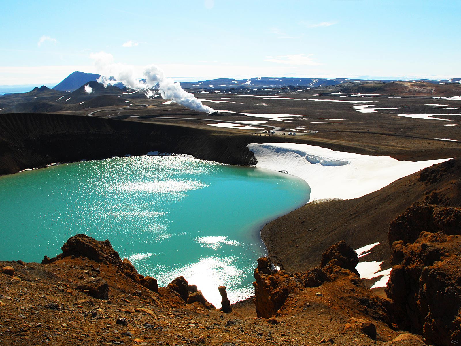
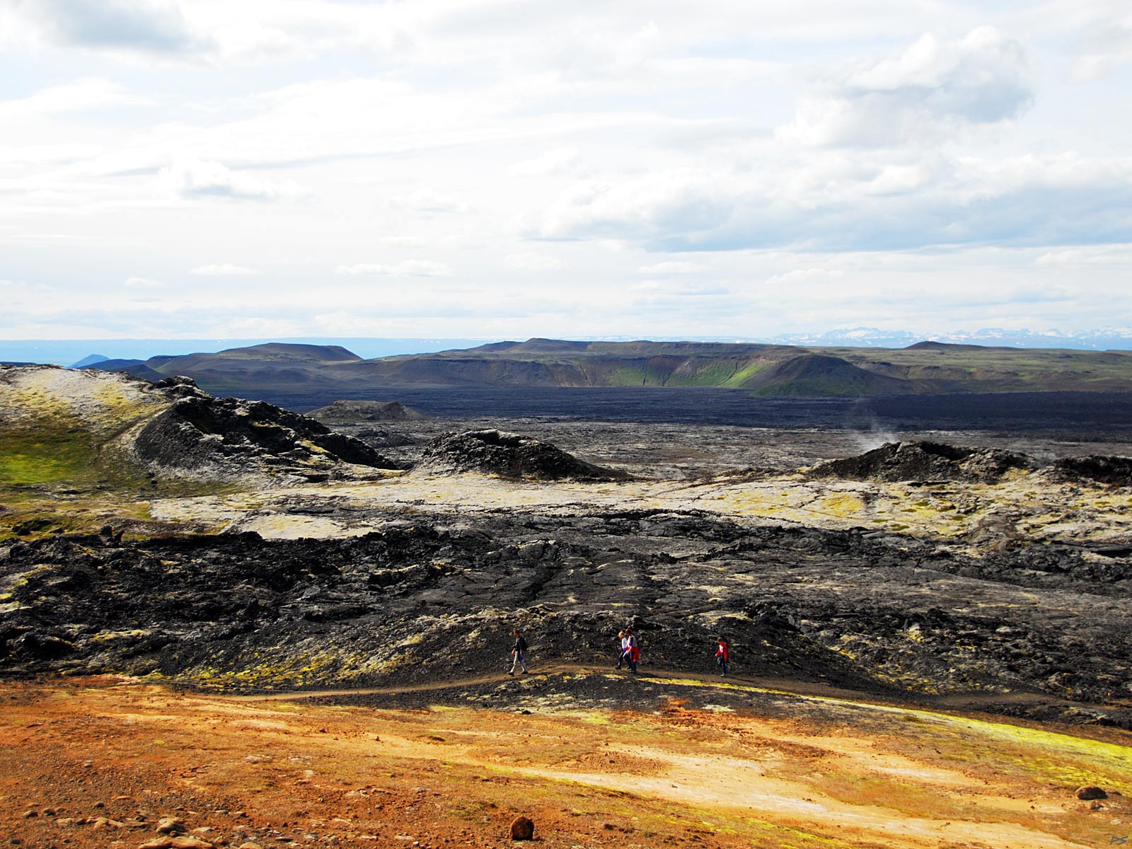
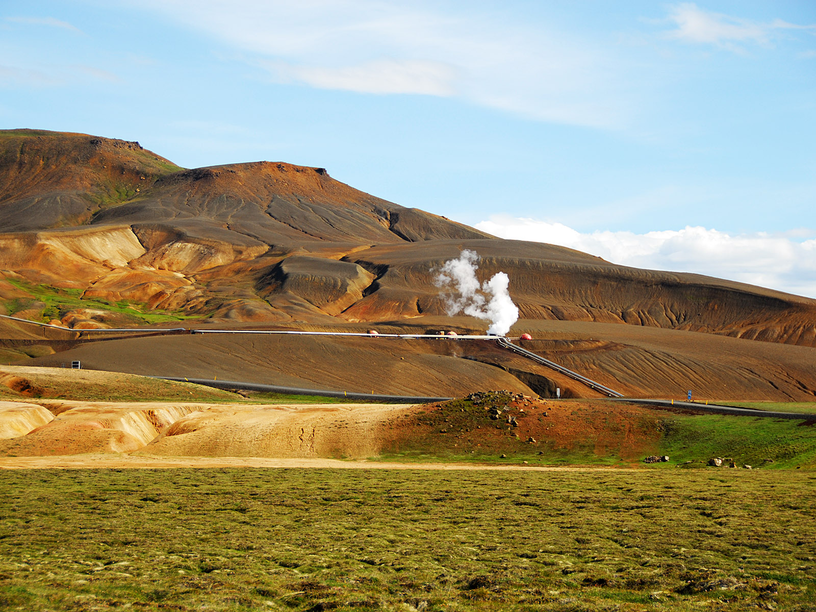
Northeast of Mývatn (discernible top left in the large picture) lies the Krafla volcanic area. In 1724 Mývatnseldar (the "Mývatn fires") started with an explosion that created this 320 m wide crater, Víti (=Hell, also Stóra Víti =Big Hell). Víti lies on the foot of the 818 meters high mountain Krafla which is not an active volcano any more, but lends its name to the whole active area. Later the volcanic activity continued on the opposite or west side of the shallow valley, in the Leirhnjúkur area seen at the top in the picture.
(2010-06-05)
The steam seen in the picture above is coming from a bore-hole for the geothermal power station (see below). It sounded like a jet engine at full throttle.
(2013-08-07)
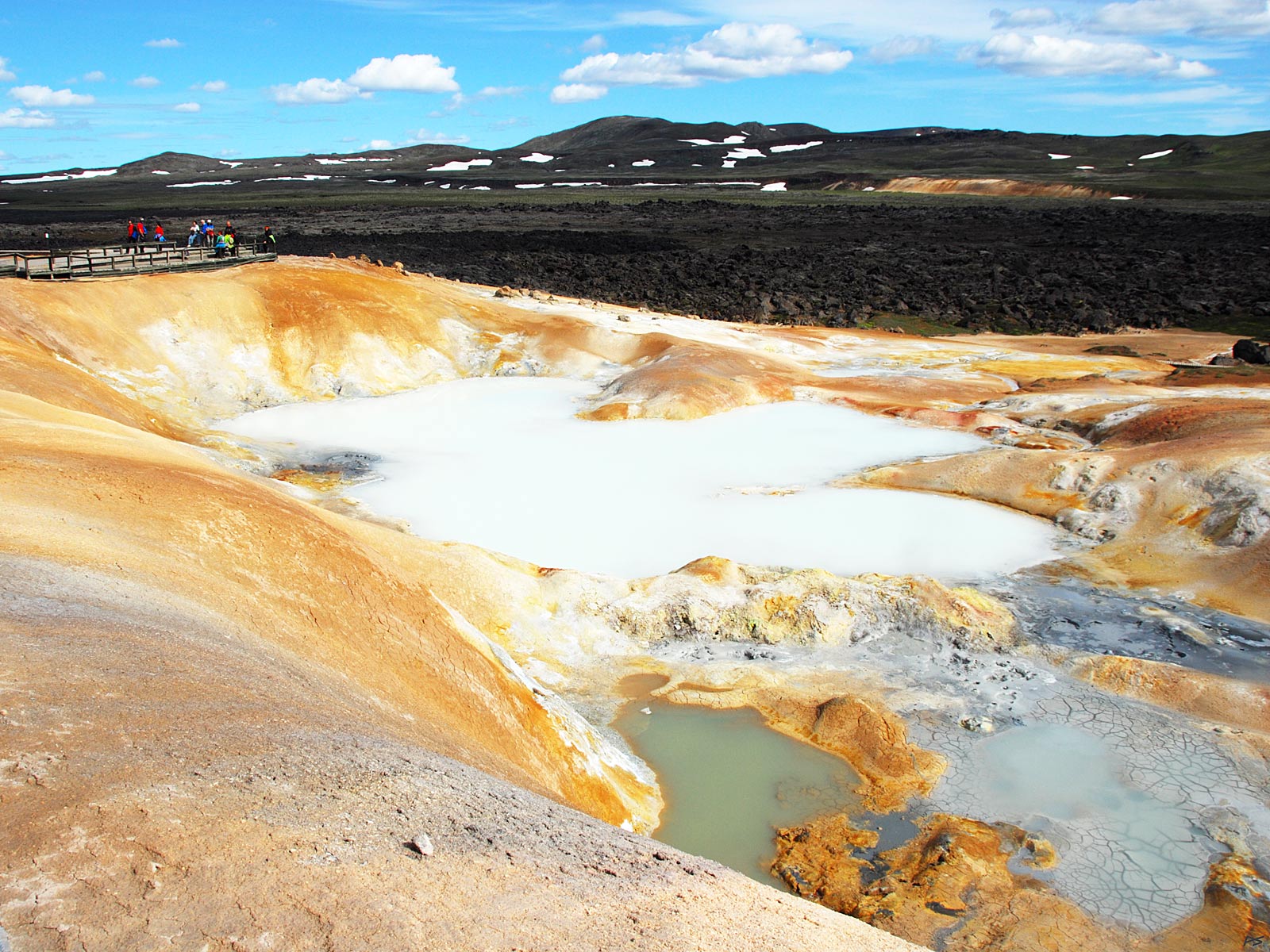
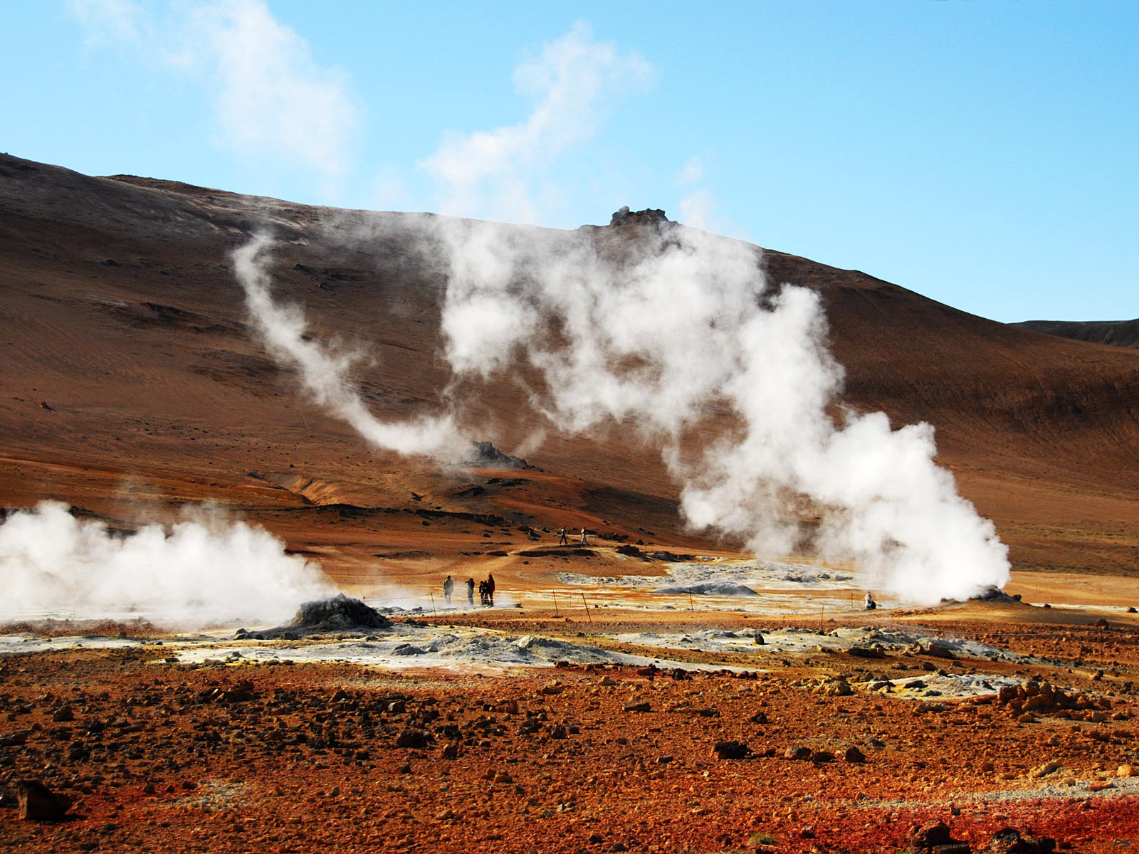
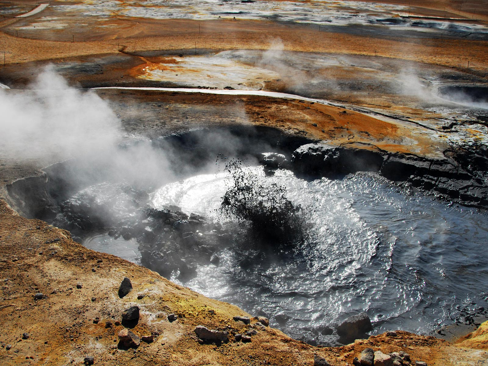
From the Leirhnjúkur area where tourist now can walk safely among steaming and stinking pools etc. Severe burns are possible, so don't leave the track or absolutely not the boardwalk.
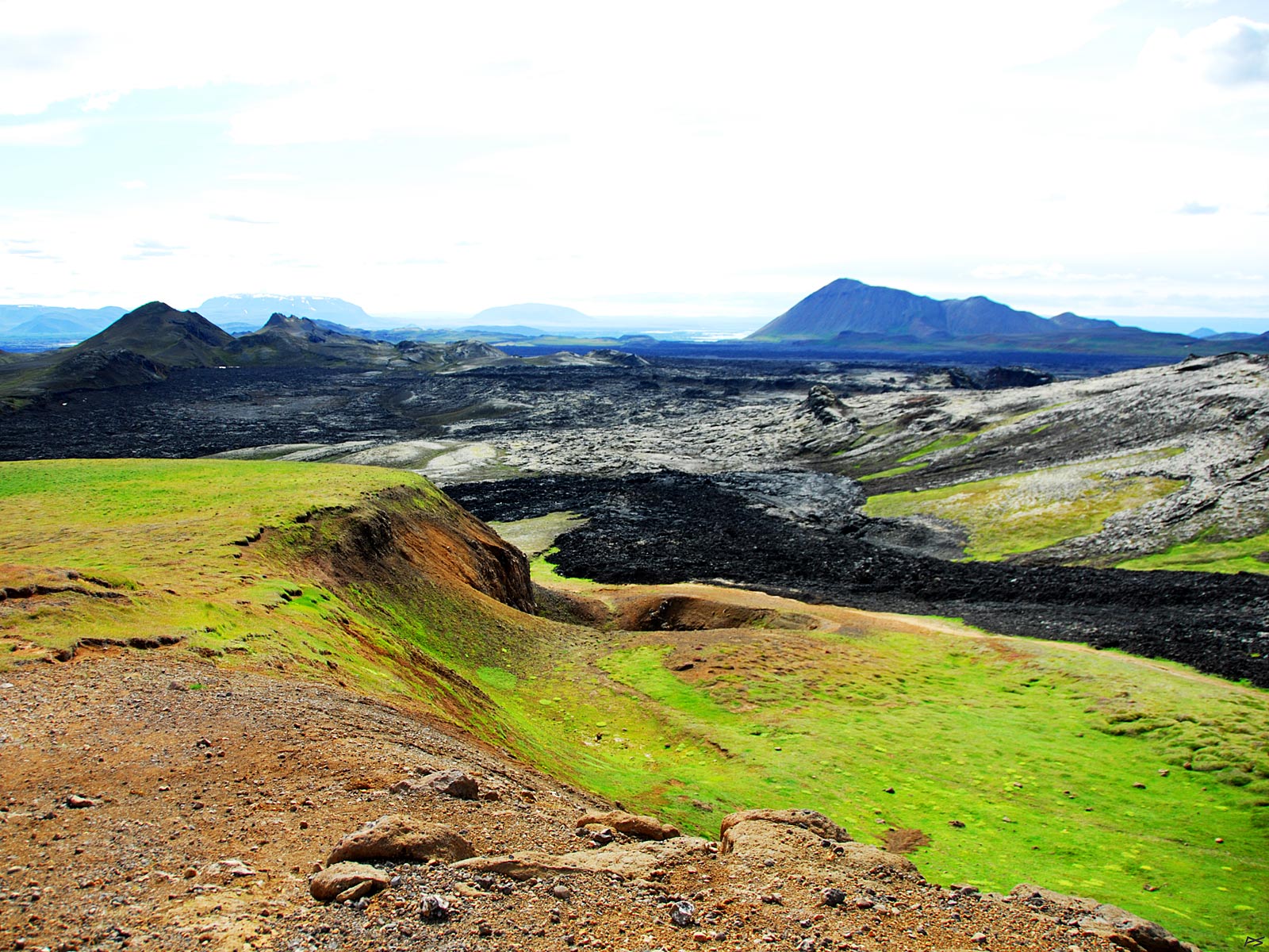
The main activity of Mývatnseldar took place here and to the left (west, southwest). It ended in 1729 when lava covered the farms where the village Reykjahlið now lies. It was there the lava flow divided and spared the church.
(2013-08-07)
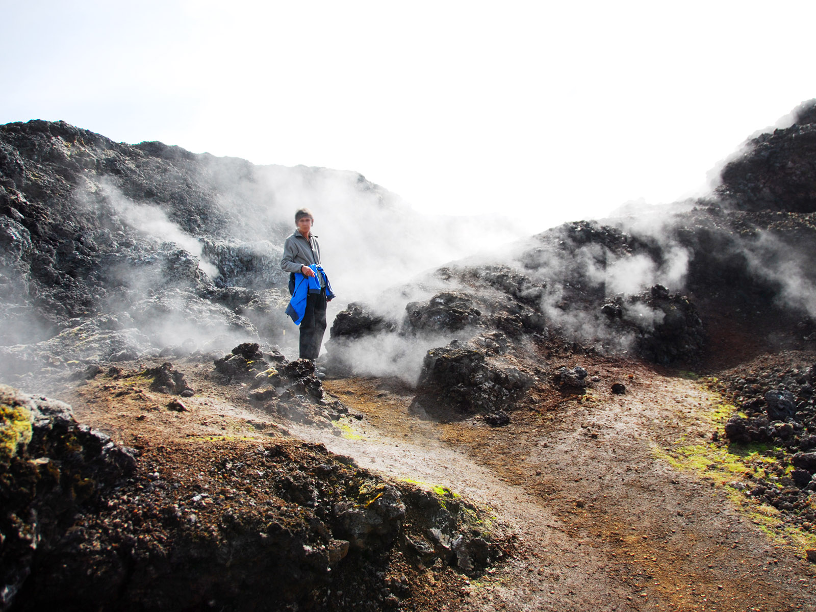
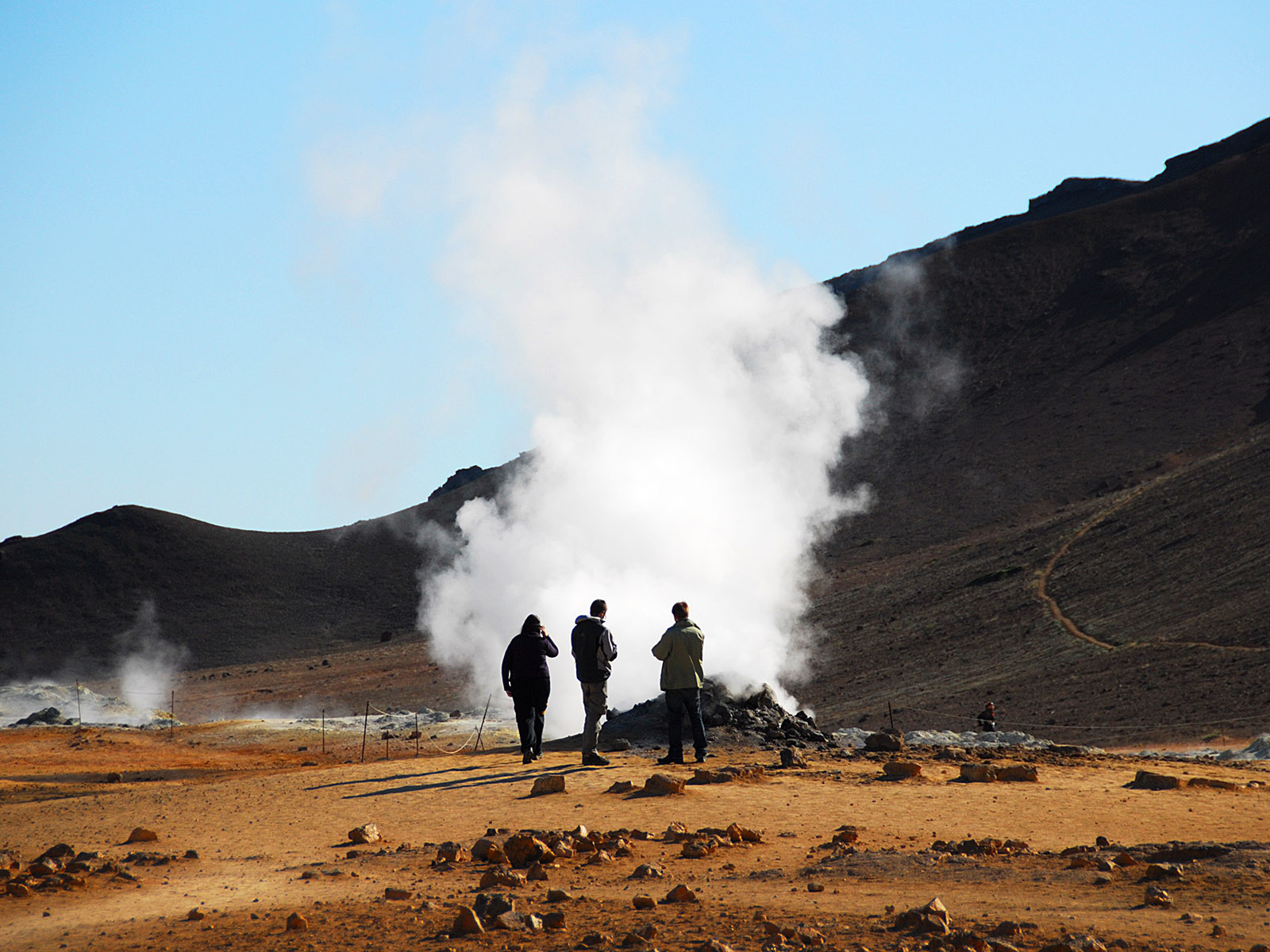
Leirhnjúkur area continued. Steam is leaking out, but in small quantities, so it is safe to walk here.
(2013-08-07)
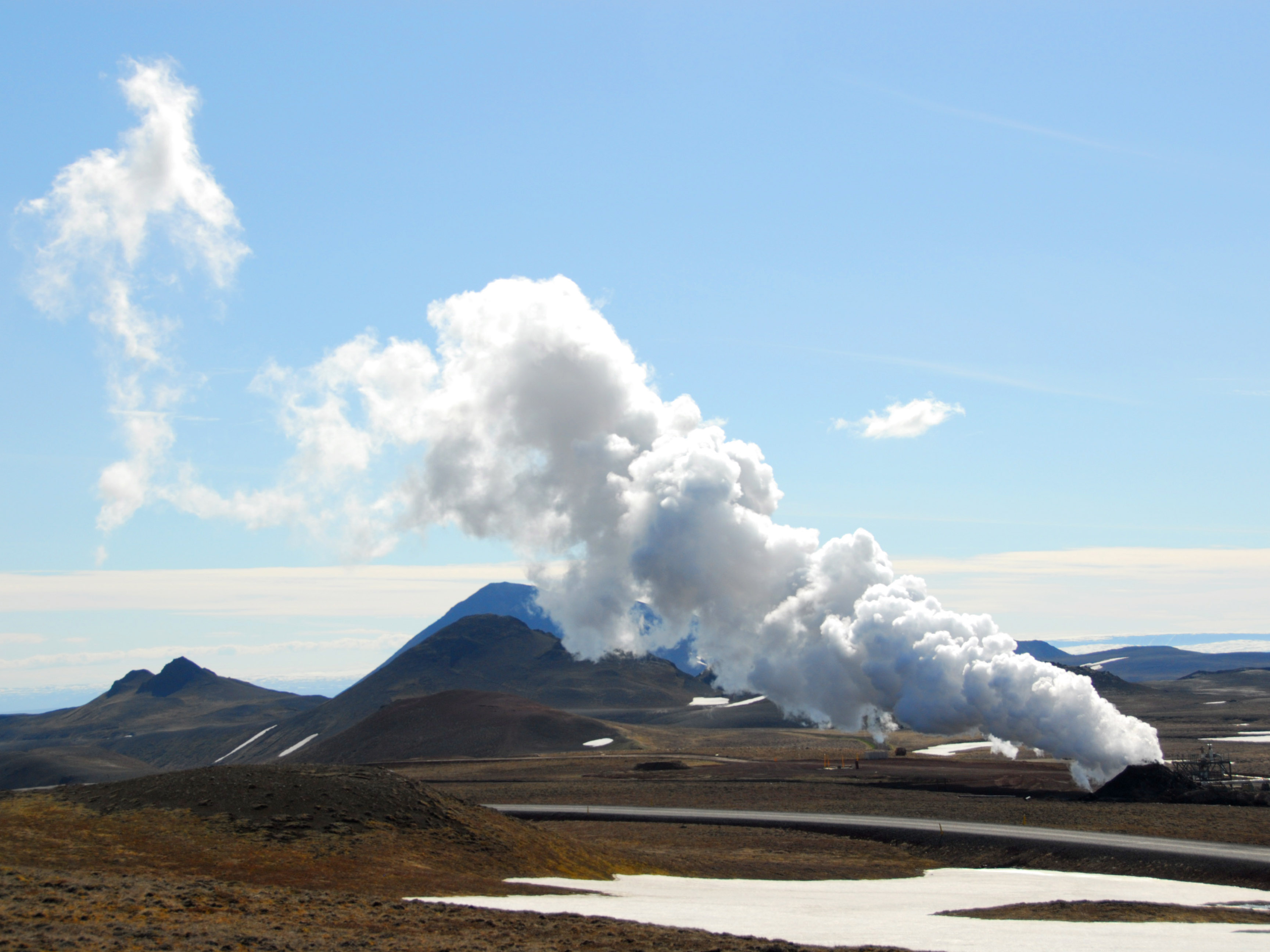
Leirhnjúkur area continued. The last eruptions here was during 1975–84, called the "Krafla fires". Spectacular lava fountains left lava on top of the Mývatnseldar lava, while the work on and around the Krafla power station close by (below) continued.
(2013-08-07)
Leirhnjúkur, view towards Mývatn.
(2010-06-05)
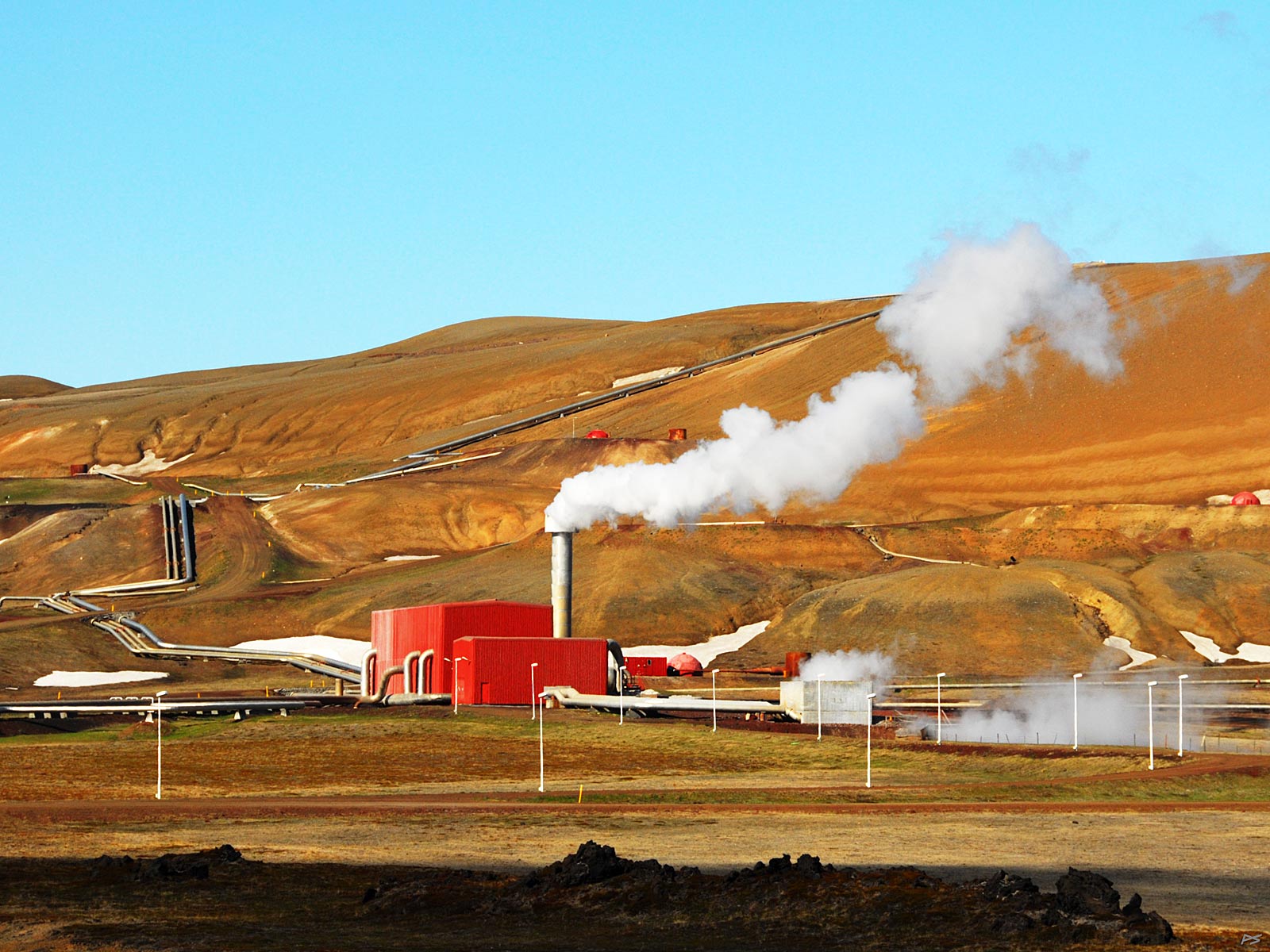
Construction of a geothermal power station (Kröflustöð) started in 1973, and holes were drilled to a sufficient depth (about two thousand meters). The most spectacular part of the story is the explosion in a bore-hole; pieces of the drilling rig was found as far as three kilometres away. Nobody was injured, and the resulting crater was named Sjálfskapar Víti (=Self-created Hell).
(2010-06-05)
The 1975–84 eruptions ("Krafla fires") close by caused boreholes to cave in, but the first power station started operating its 30 MW (megawatts) turbine in 1978. In 1996 more boreholes and a second turbine (also 30 MW) was added. They had several problems to solve on the way, one was a water temperature of 350 °C, much higher than expected, another was the corrosion of metals caused by sulfur dioxide and carbon dioxide.
(2013-08-07)
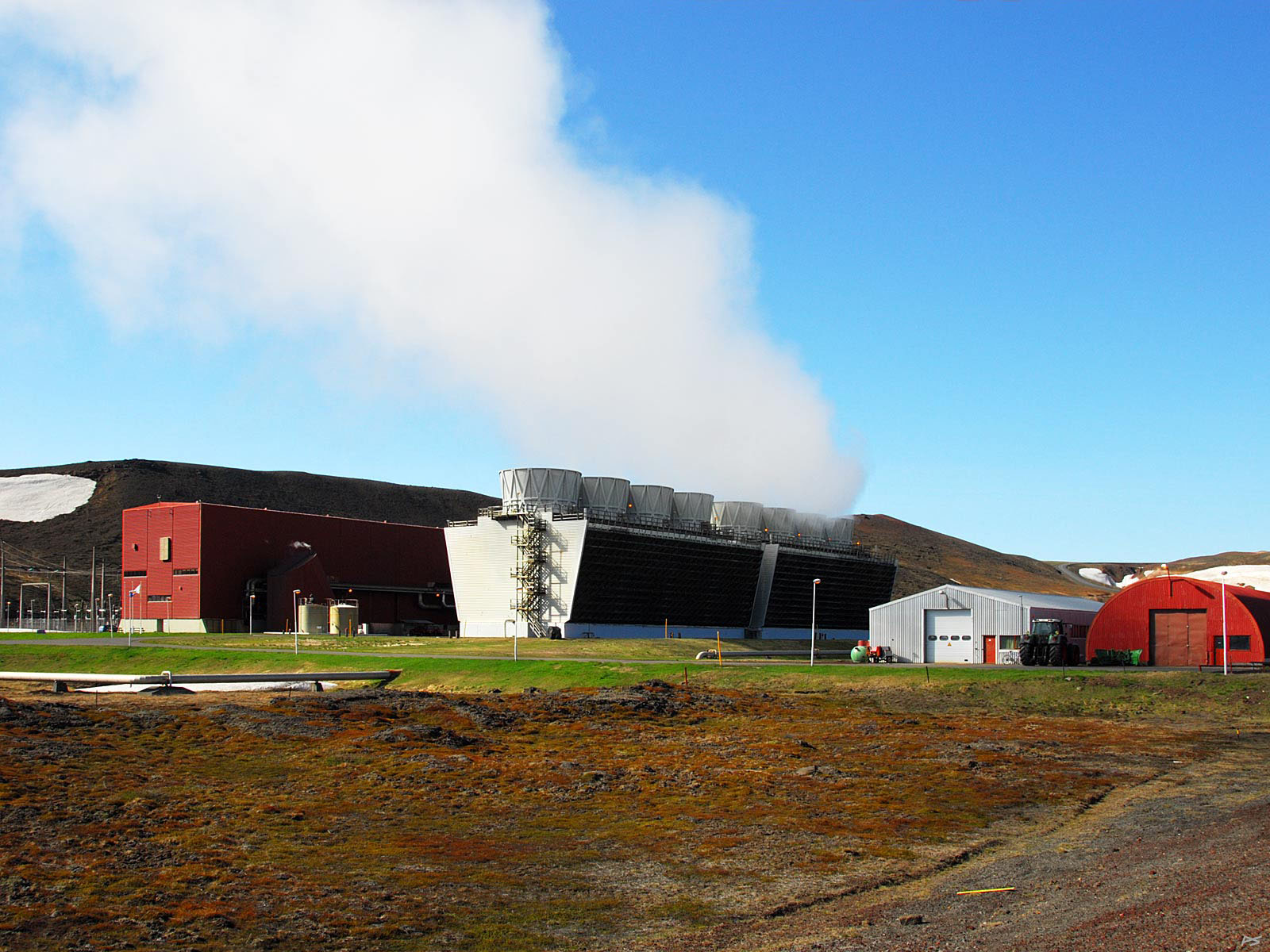
Steam for the power station is taken from boreholes all over the valley
There are several geothermal power stations in Iceland supplying more than a quarter of the electric power. After going through the turbines the water is distributed for heating houses, hot water, swimming pools, pavements (sidewalks) etc. Water from natural hot springs and bore-holes are used for the same purposes, thus some 85 percent of the houses have geothermal heating.
(2010-06-05)
Hverir may bee seen as an extension of the Krafla geothermal area. It is found at the east slope of the low mountain ridge Námafjall (shown), east of Mývatn, a few kilometres south of Krafla, only metres south of the Ring Road and easily reached by the tourists. Among other hot and stinking attractions it contains many steam vents as shown.
(2010-06-05)
Hverir – busloads of tourists are let loose here in the season. This picture was taken a few weeks after the 2010 eruption under the glacier Eyjafjallajökull, the one that produced enough ashes to stop air traffic. Then there were few tourist here, but shortly after the tourist traffic started increasing fast (but slowed down by a corona virus in 2020).
(2010-06-07)
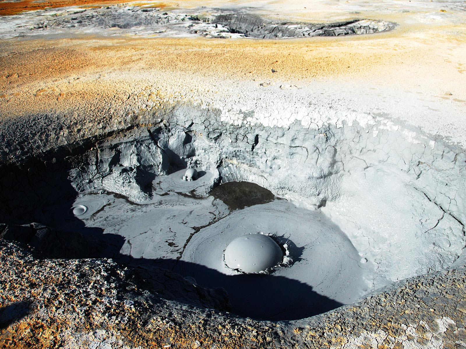
Hveir also exhibits these boiling mudpots. It's an excellent idea to watch your steps.
(2010-06-07)
Another mudpot.