A very special lake in North Iceland:
Area: 37 square kilometres
Average depth: 2.4 meters – maximum depth: 4.5 meters
Hiding
the very rare Marimo balls
and an enormous quantity of insect larvae (especially midges)
The larvae and insects
are food for lots of freshwater fish and many species of birds
(2013-08-08)
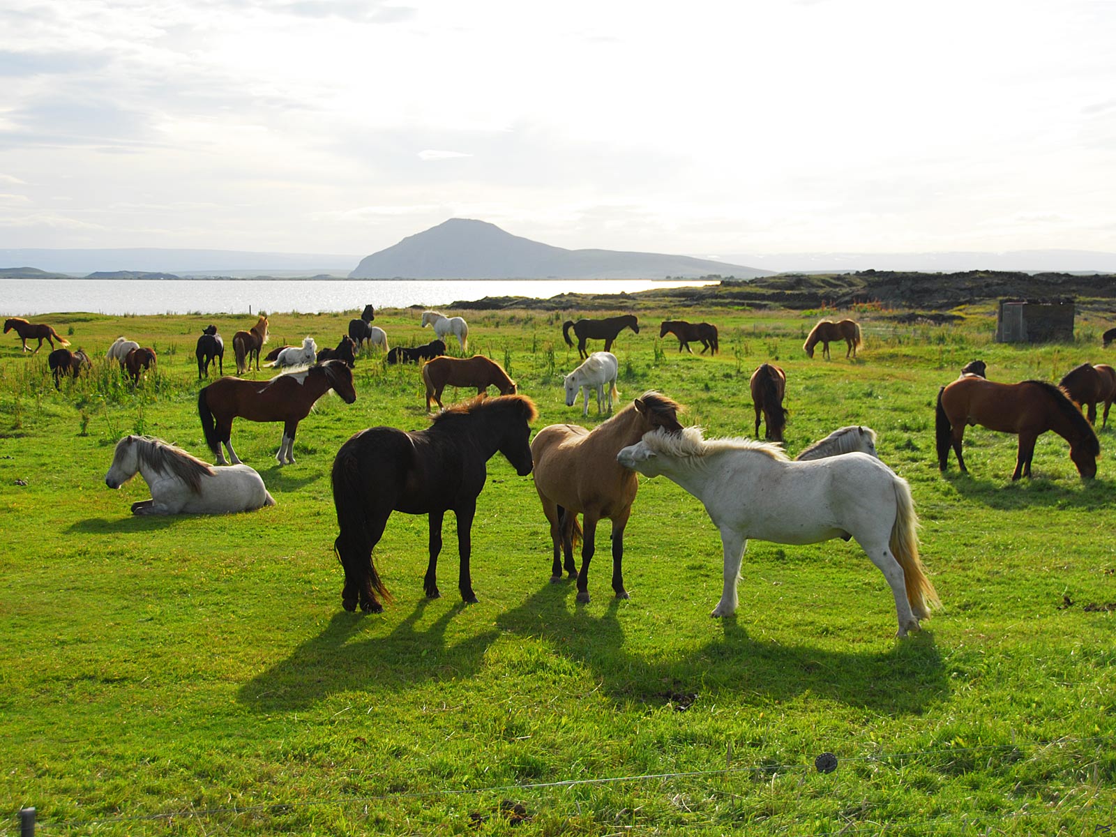
Horses grazing at Reykjahlið on the (north)east side of the lake Mývatn. The lake and the small mountain Vindbelgjarfjall behind.
(2010-06-06)
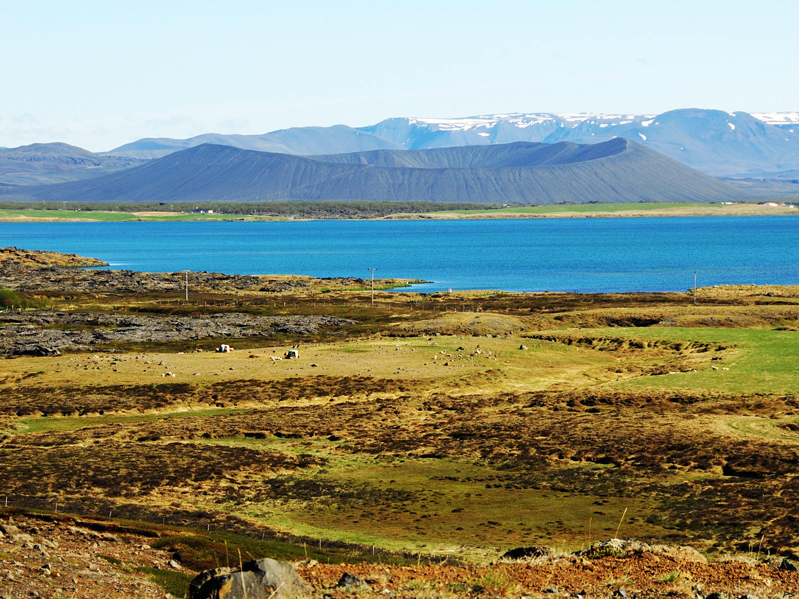
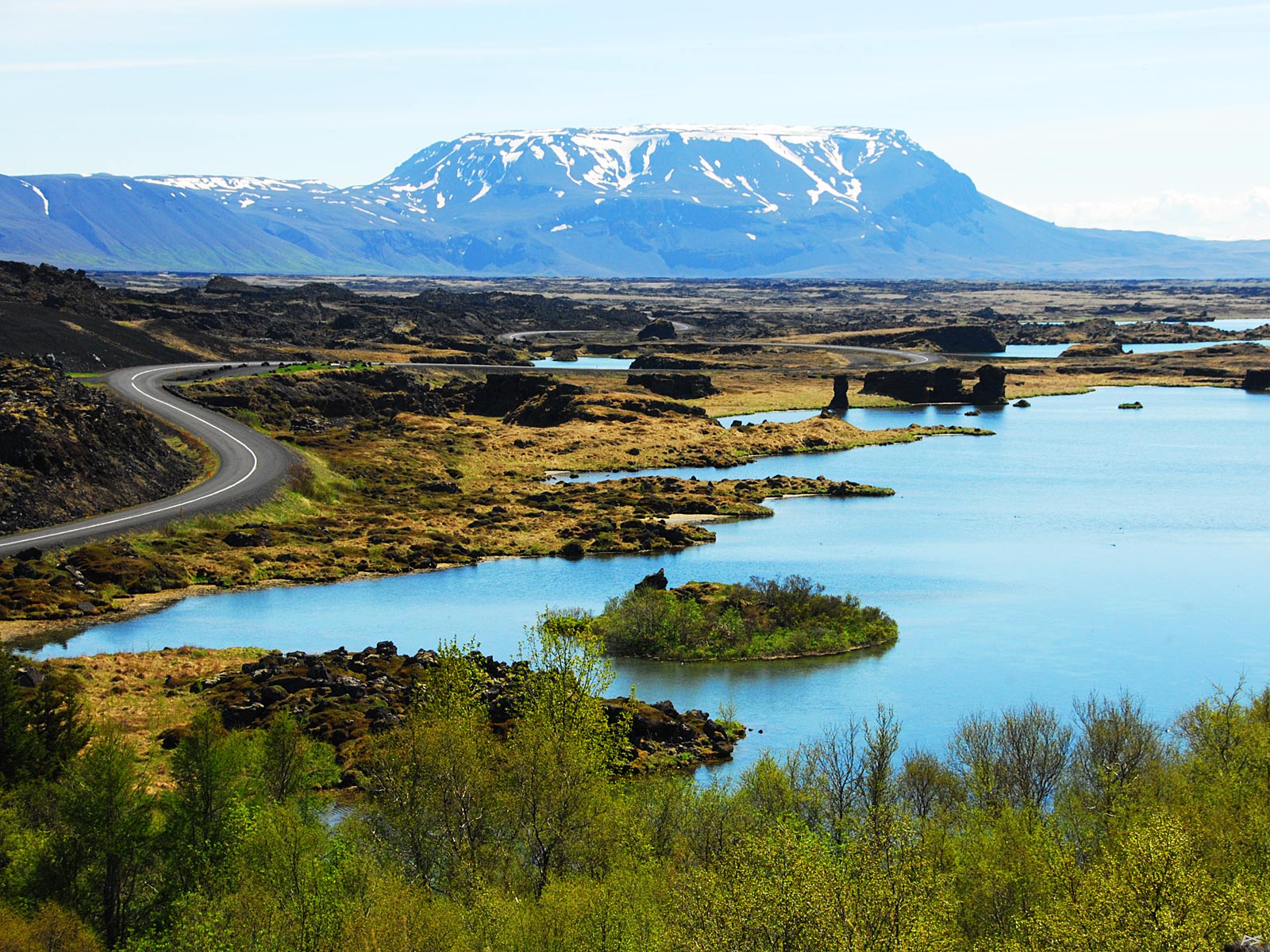
View from the north side of Mývatn towards southeast. Beyond the other shore Hverfell or Hverfjall is an evident landmark. It's a roughly 2500 years old tephra cone or tuff ring, more then a kilometre wide, rising some 460 metres above the surrounds. One of the two tracks to the rim of the crater (which we are required to use) may be seen in the picture.
(2010-06-06)
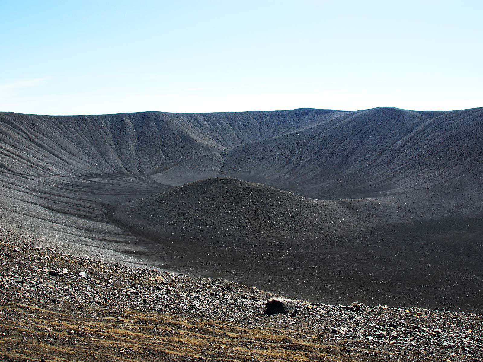
The inside of Hverfjall or Hverfell viewed from the southwest peak. It looks like being made of loose gravel, both outside and inside.
(2010-06-06)
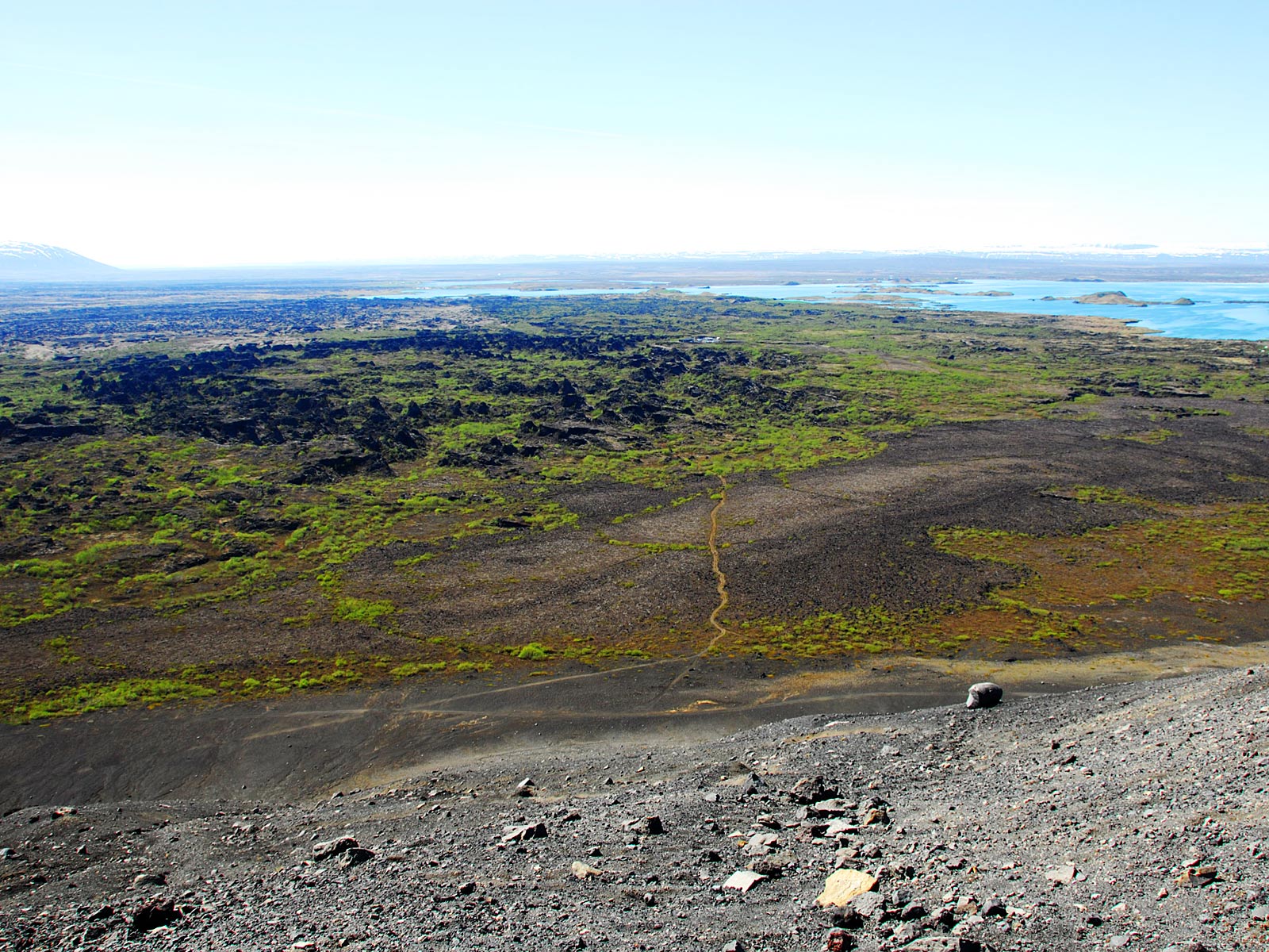
View from the southwest peak of Hverfell towards northwest. The distant lake is Mývatn and to the left the dark lava field of Dimmuborgir is visible
(2010-06-06)
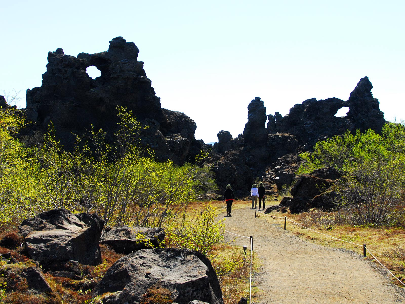
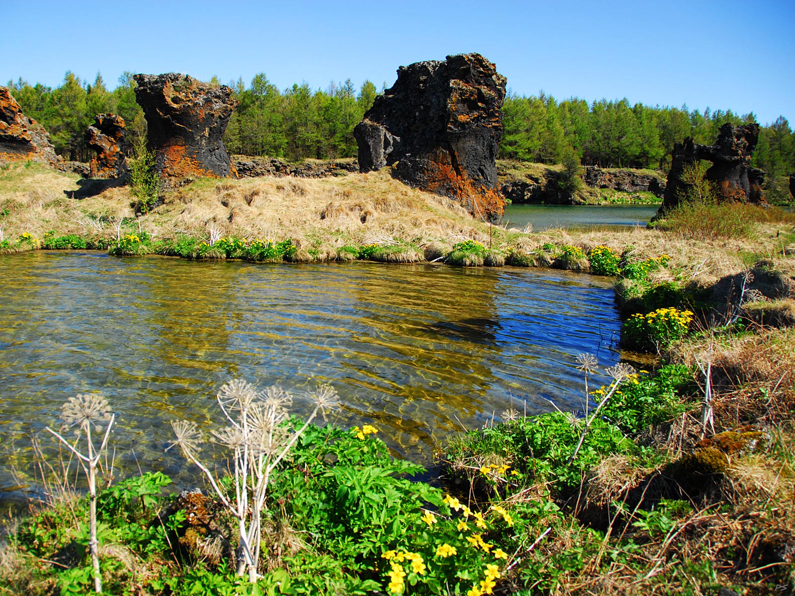
Dimmuborgir (=dark-castles), an unusual lava field on the east side of Mývatn. It was created 2300 years ago when lava from an eruption to the east flowed through a small lake causing intense boiling and leaving solidified pillars when it continued to lower grounds. A network of footpaths runs through this area, and you may spend hours here if you want to see most of it.
(2010-06-06)
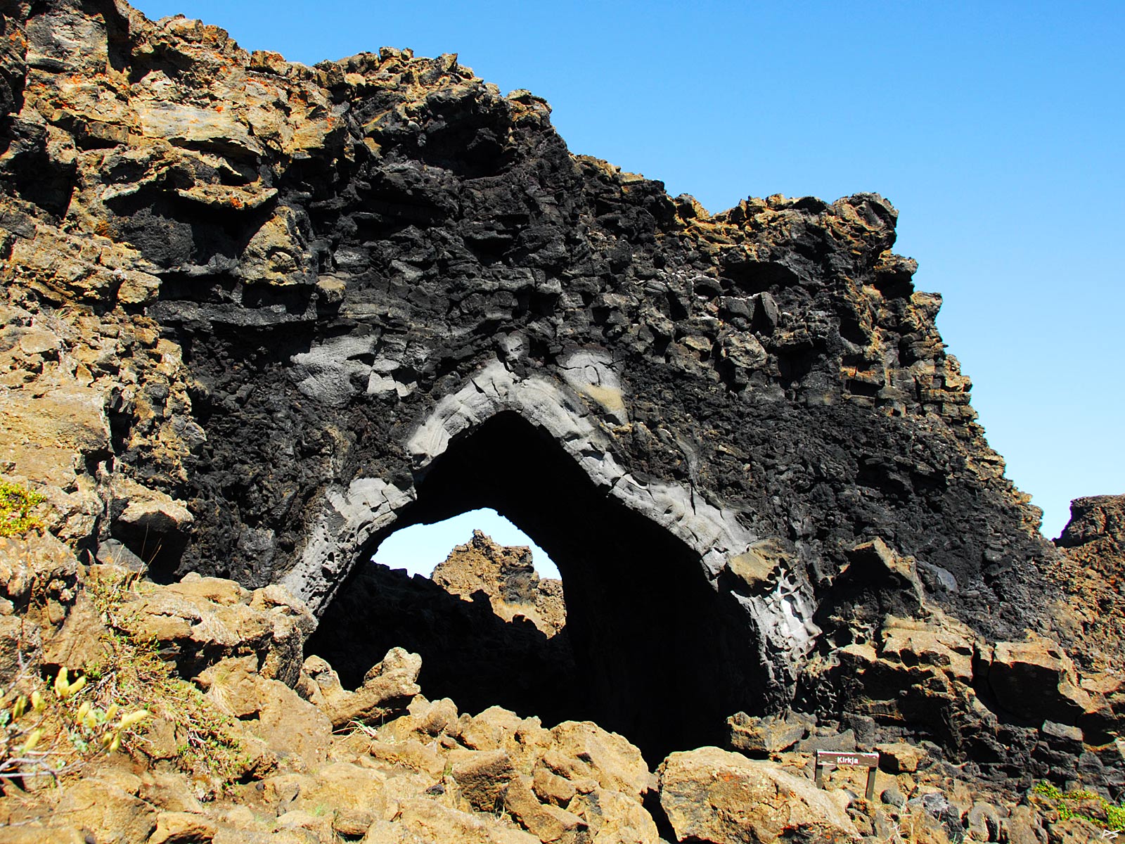
Kirkjan (the Church) is the most famous lava formation in Dimmuborgir.
(2010-06-06)
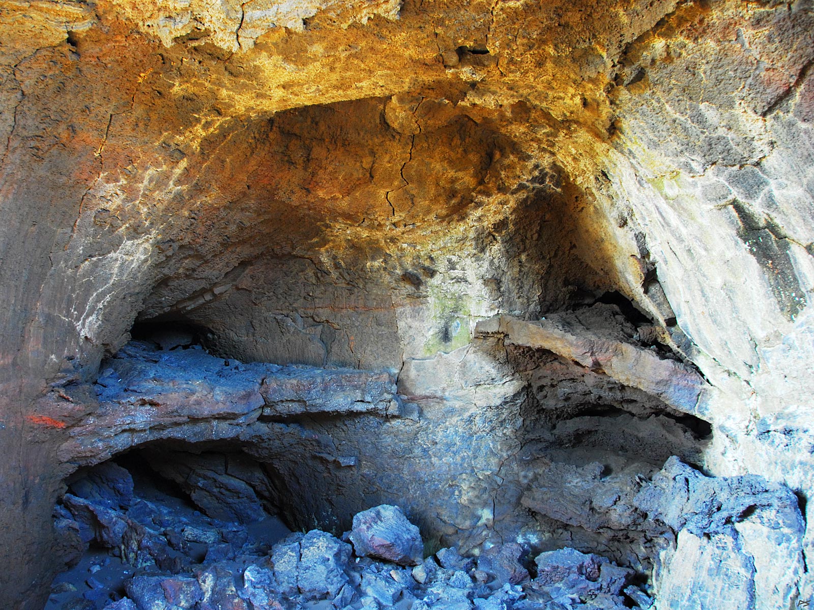
Inside Kirkjan. It should be possible to hold a Mass for a congregation of at least half a dozen here, without organ music though.
(2010-06-06)
 There are also strange lava formations at Mývatn west of Dimmuborgir. The picture is taken from the peninsula Höfði (=head[land]). A former owner of the peninsula spent his summer holidays planting trees and herbs here, and his widow donated it to the county. Paths run through the forest and you can enjoy trees, flowers, birds, lava formations and great views – if the midges aren't too annoying (Mývaten means midge-lake, you know). Roughly fifteen kilometres towards the south, Bláfjall (=blue-mountain), altitude 1222 m, one of those plateau mountains created by a volcano under 2–3 thousand meters of ice during some ice age. The road used to be the Ring Road running on the south side of the lake; now it runs on the north side of the lake, but the south route is still the most interesting one.
(2010-06-06)

You may watch lava pillars (Icelandic: klasar) if you take the path around the part of the Mývaten shore called Kálfaströnd (=calves-shore). Höfði park is seen on the other side of the bay. At the water edge the yellow spring flowers Kingscup or Marsh Marigold (Caltha palustris) and the dry stalks of last year's Garden Angelica (Angelica archangelica).
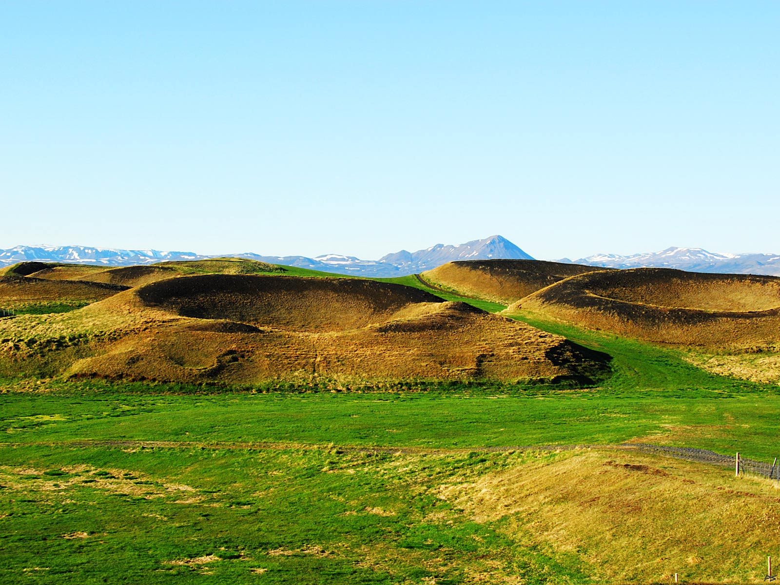
The lava flow that caused the pillars in Dimmuborgir and elsewhere in the area, also dammed up the present Mývatn, in a way replacing a previous lake.
(2010-06-06)
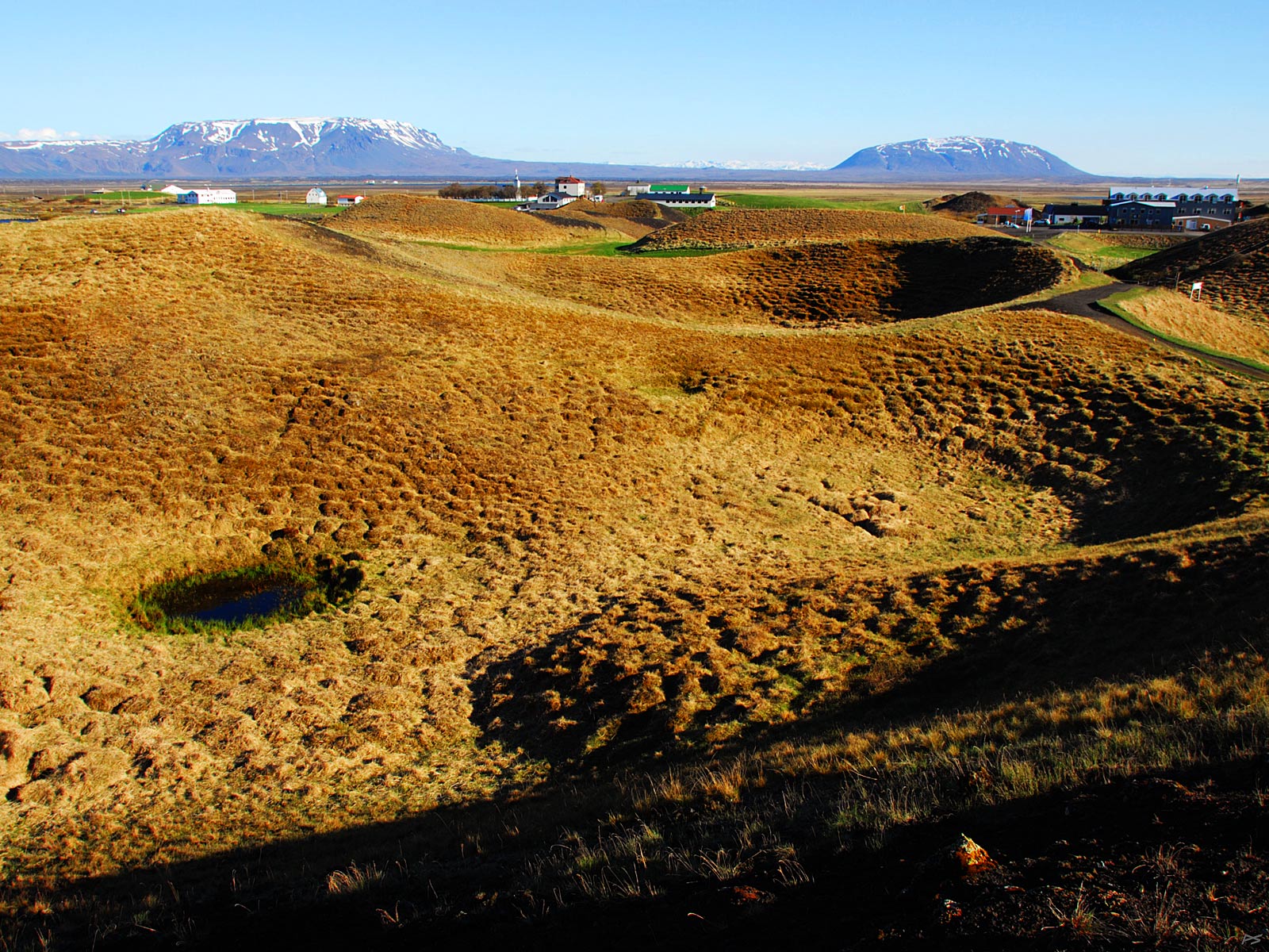
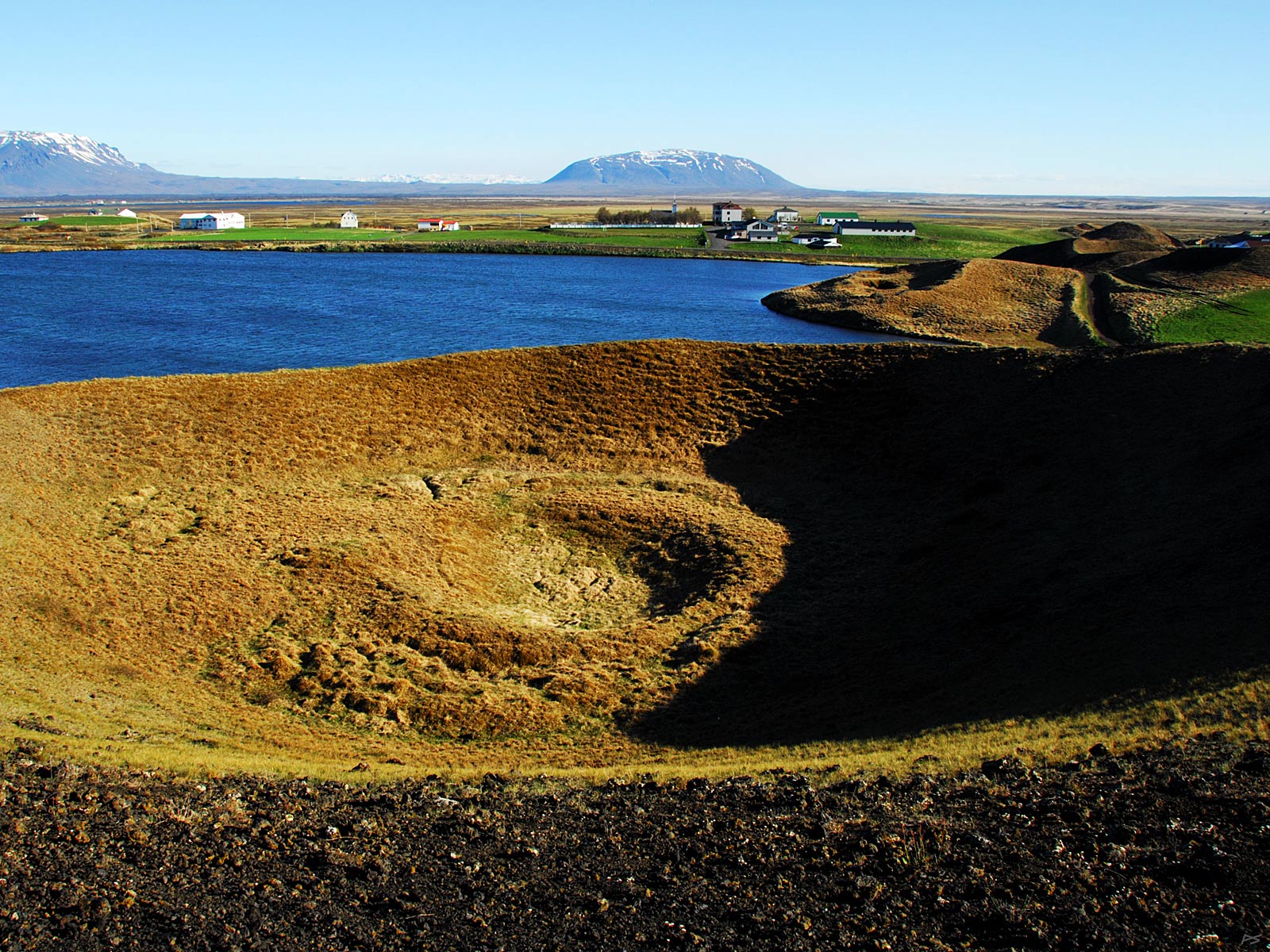
The picture shows a few of the pseudocraters of Skútustaðagígar (Skútustaðir Craters), the largest crowd of them at Mývatn. Like Dimmuborgir they were created 2300 years ago by trapped water that exploded under the hot lava flow mentioned above. They come in assorted sizes and may be seen in various places near the lake. In the background the Skútustaðir village and the mountains Bláfjall (1222 m) (left) and Sellandafjall (988 m)
(2010-06-06)
Another picture of pseudocraters in Skútustaðir, showing also a bit of the lake.
(2010-06-06)
Pseudocraters seen from the Skútustaðir village. Soon also the craters will be greener.
(2010-06-06)
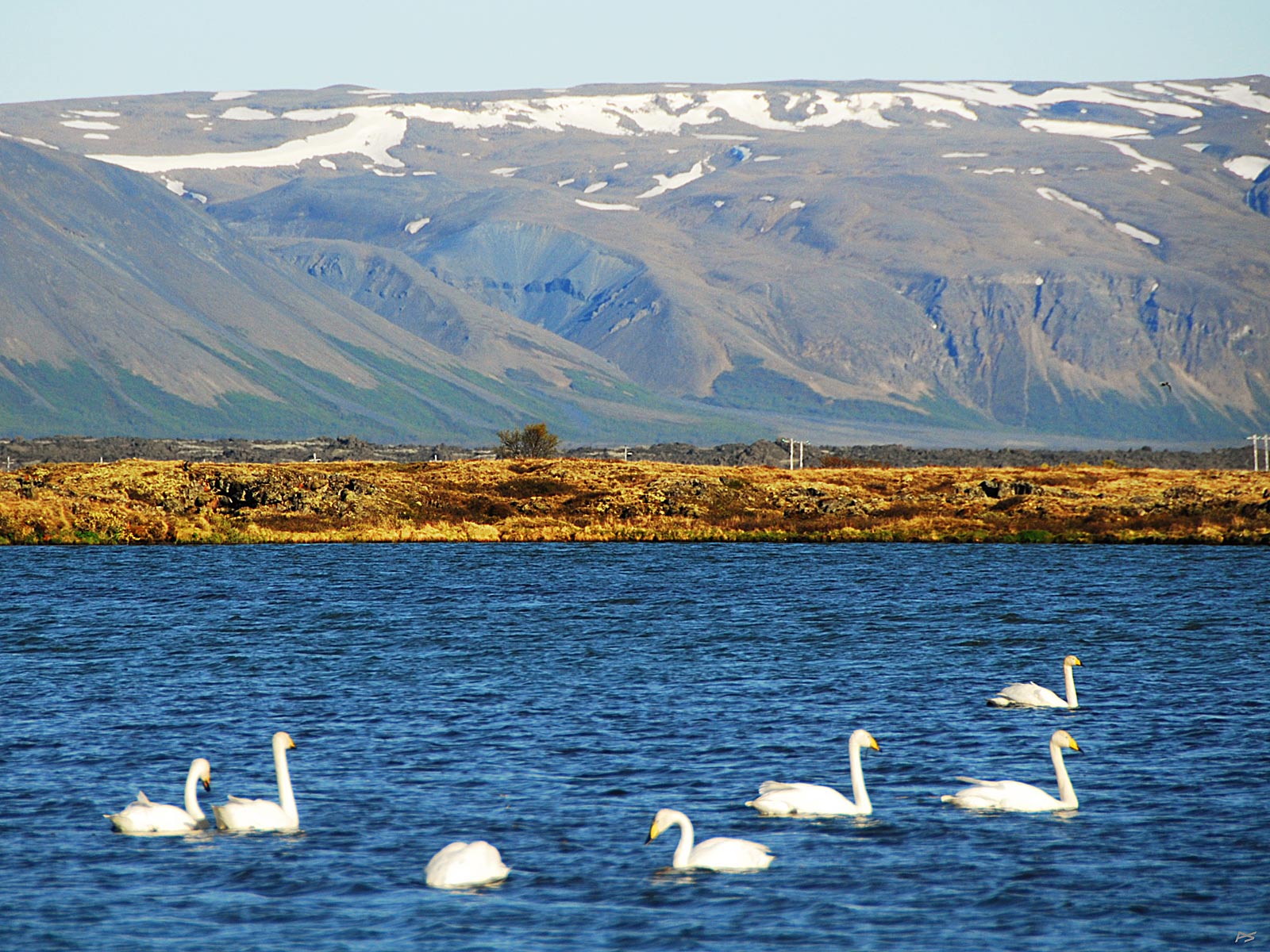
The Whooper Swans (Cygnus cygnus) come to Iceland to breed and are then seen all over the country. Late in autumn most of them migrate to the British Isles, but a few remain here in Mývatn where geothermal water prevents parts of the lake from freezing over. For these large birds it's often a close race getting the offspring airborne before ice prevents their access to food.
(2010-06-06)
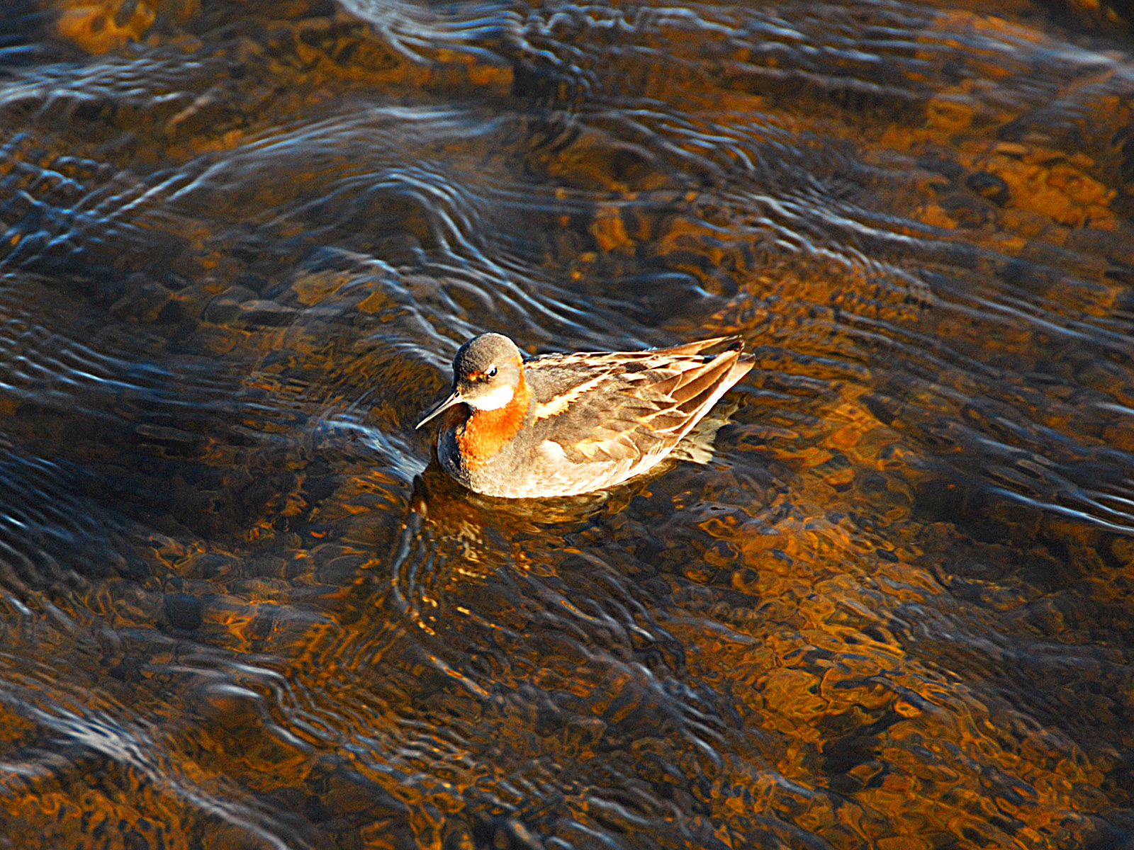
Mývatn is an unusually fertile lake, the main reason being the ten tons of silica brought to the lake every day by the groundwater. This lead to a rich one-cell algae flora, the first link in the food chain. Another factor is that it's shallow (plenty of light for photosynthesis everywhere), and it even hides warm springs that keep some of it free of ice all year. The name Mývatn means 'midge lake' and it's given for a very good reason. Therefore the trout in the lake is well fed, and it's a paradise for insect and larva eating birds. Also vegetarian birds thrive here, and the wet area beyond the northeast shore is the nesting ground for a great many species and individuals. This is also where a lot of those telescope and tripod carrying guys go. Shown here is the small charming no-telescope-needed Red-neck Phalarope (Phalaropus lobatus) swimming in circles to stir up goodies on the bottom. It stays here during the breeding season, but migrate out to warmer regions during winter.
To us those insects might be somewhat annoying. One of them ('bitmý') sucks blood, causing some swelling and itching, another one – oh, not one, zillions – crawl into your hair, eyes, ears – but they don't bite. Don't worry though, the souvenir shop sells nice mosquito head nets. Else you'll have no problem if you stay in the wind. Then you can walk on a path at the lake and enjoy the sight of low clouds of agitated rykmý (=dust-midge) almost hiding your shoes (predominately at the beginning of June and beginning of August). We stayed two nights here in the beginning of June and had to wash the car twice.
More about Mývatn: We saw them only in an aquarium, the Marimo balls, or kúluskítur (=ball-shits). They are dark green, somewhat fluffy looking balls of the algae Aegagropila linnaei (renamed 2002 from Cladophora aegagropila), in Mývatn growing to a maximum size of a grapefruit. They appear in colonies, but are free floating and are rolled by waves on the bottom (Mývatn is very shallow). Although this algae is found in many lakes, colonies of this large spherical form are found only in two lakes: Mývatn in Iceland and Lake Akan in Japan.
(2010-06-06)
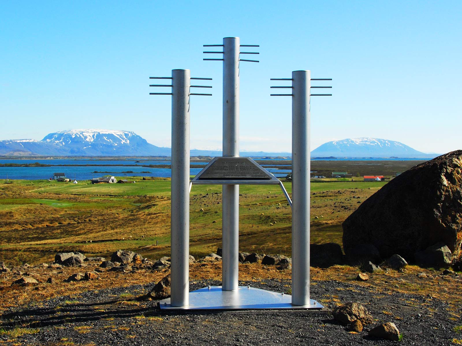
On the north side of the lake Mývatn, a memorial of three men that drowned in Mývatn 26. October 1999 when laying fibre optic cables (ljósleiðara). Raised by two telephone and communication companies. In the background Mývatn and the mountains Bláfjall (left) and Sellandafjall.
(2010-06-06)
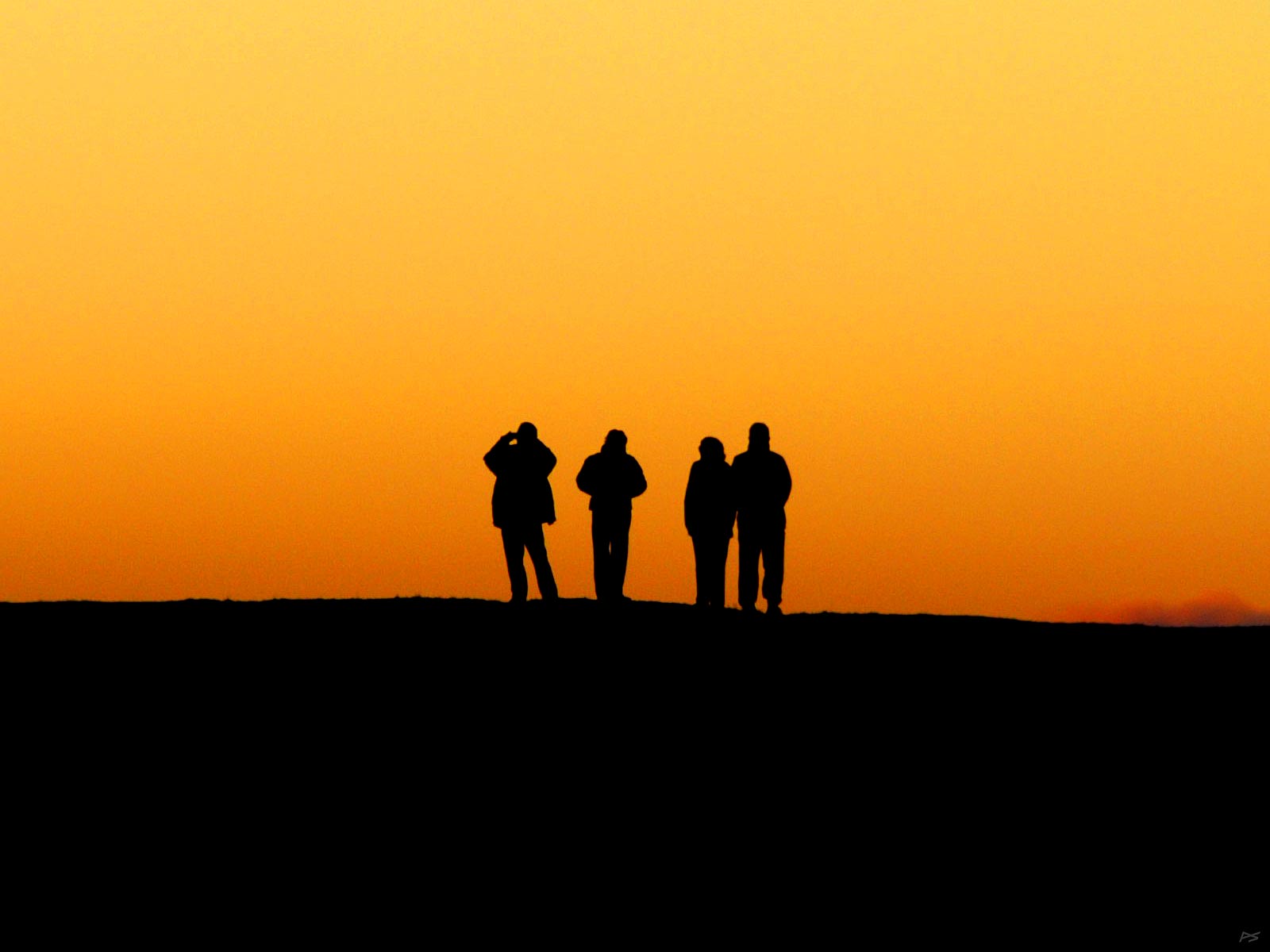
Tourists at midnight on one of the pseudocraters at Skútustaðir. It's close to the Arctic Circle, you know, and the summer nights are bright. Note also that this region tends to be in the rain shadow of the great Vatnajökull glacier and may delight you with frequent nice weather.
This also makes northeast Iceland suitable for Aurora Borealis watching in winter, as the whole island is situated in its most intense band around the Magnetic North Pole. Unfortunately the northern lights, and the Iclandic weather, in unreliable, and Iceland is rather expensive.
[Another easily accessible area is the Norway mainland from Tromsø and up. Possible sites for Northern lights watching are also found in Northern Canada and Alaska, but there it's usually much colder.]