– a small island called 'the pearl of the Trondheim Fjord'
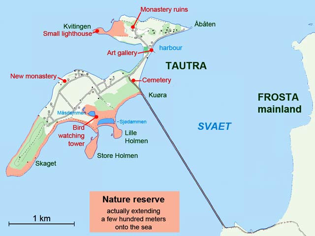
Map of the beautiful island Tautra and the road/bridge to the mainland, situated about twenty kilometres northeast of the Trondheim harbour (and four times that by road). Here we find ruins of an old monastery, a brand new monastery, a café and a souvenir shop for the tourists, interesting flora and fauna, and wonderful recreation areas – among other things. A road has been built across the shallow strait; it looks like a straight line on the map. In the days of the old monastery, 6–800 years ago, Tautra was two islands. Since then the land have risen 3–4 metres, and the land is still rising after being weighted down by the ice more than ten thousand years ago.
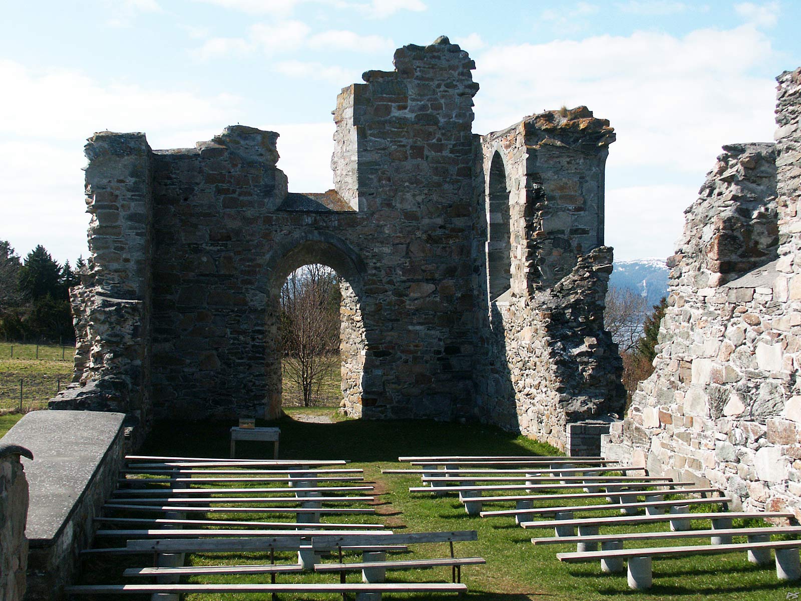
Ruins of the Cistercian monastery on Tautra. Founded 25 March 1207 this monastery became rich and important; this was terminated by the Protestant Reformation in 1537. Later on the abandoned monastery was used as a source for building stones, only a part of the church was saved from further willful destruction in 1846. Now people come to visit the ruins (and the rest of the island), not in great numbers though, on a summer Sunday there may be 20–30 cars parked near the ruins.
The ruins are situated on a farm – Klostergården – now with a small restaurant in the old living room (and in the yard), a dining hall for parties in the old barn; and in a new building, overnight accommodation and a shop, which sells souvenirs, special (mainly local) products, garden plants and vegetables from the farm.
(2005-04-24)
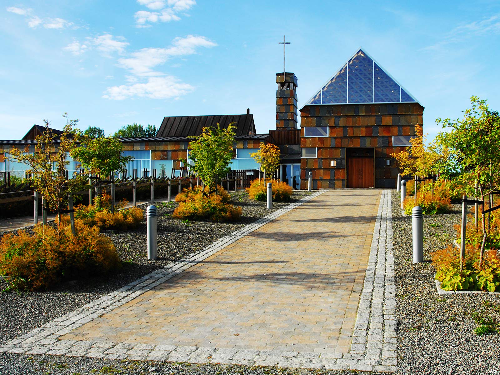
In 1999 a new Cistercian nun monastery was founded on Tautra. In 2006 the nuns moved into the new building, part of which is shown here. To the right is the church consecrated in 2007. The church is open every day from 04:00 till 20:00 and the silence should be respected.
(2010-09-05)
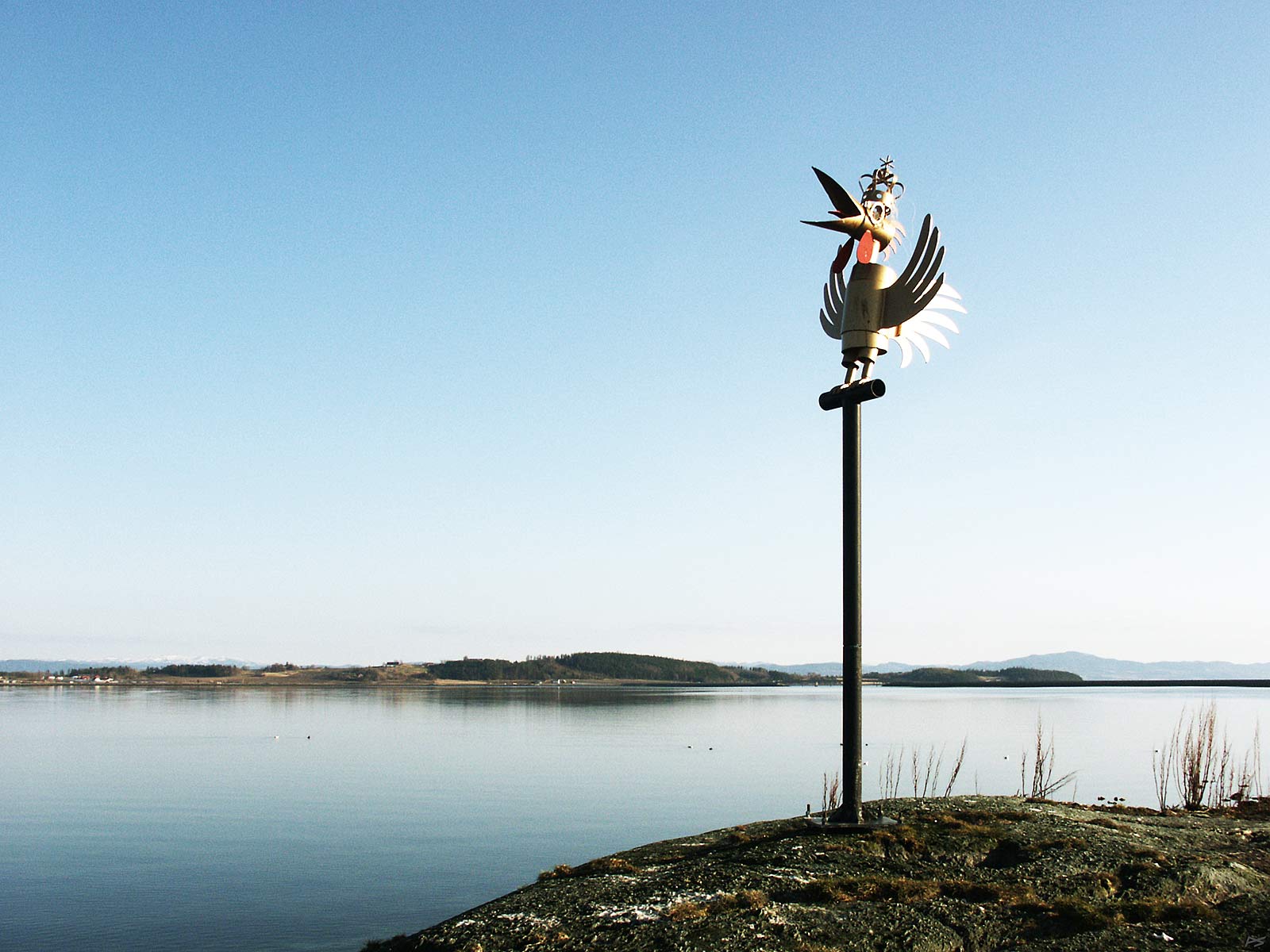

A sculpture on the east headland (Åbåten). It's a rooster, a literal interpretation of a less common Norwegian word, "glohane" = "ember rooster", here taken to mean "pork meat roasted on a spit". One may also suspect a second meaning, local to Trondheim: "a strong alcoholic drink", which also seems to be appropriate. Members of "Trondhjems Seilforening" (yachting club) sail past for their annual barbecue in the vicinity and raised this "seamark" for their 1998 centennial.
(On the calm sea behind a few eider couples can be discerned. The female duck is dark (brown), the male has a lot of white during the mating season and the whole winter. More about the eiders below.)
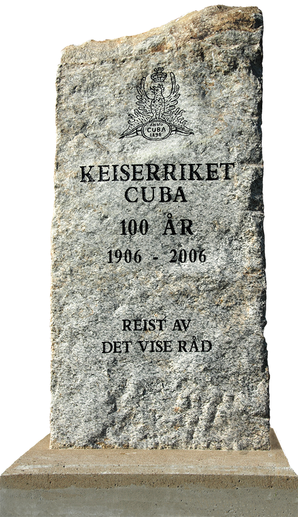
The members of "Trondhjems Seilforening" are a strange bunch. Near the sculpture they own a large cabin and at the road to this cabin they put up this monument to celebrate another centennial. The heading is, translated, "The Empire Cuba / 100 years / 1906–2006 / / Erected by the Wise Council". Centennials are great excuses for celebrations, and you may have noted that there was one in 1998 and one in 2006. The first barbecue (glohane) took place in 1898 on a inhabited islet a little more than two kilometres south of Tautra, called Øksningen (discernible in the second last picture below). The islet was "annexed" and the "Republic of Cuba" was born. In 1906 there was a "coup d'état" and the "republic" turned into "The Empire of Cuba". We may also note that landing on Øksningen may be rather difficult, and after the "citizens" had been soaked a few times, also externally, the small "nation" was transferred to Tautra.
Trondhjems Seilforening was founded when both Norway and Cuba were in the process of obtaining independence. Norway was in union with Sweden from 1814 till 1905 and nationalism growing all the time. Cuba had been a Spanish colony since its "discovery", and in 1868 the fight for independence started. When it became known that hundreds of thousands of Cubans died in concentration camps, USA intervened and conquered Cuba in 1898, which resulted in the free Republic of Cuba in 1902.
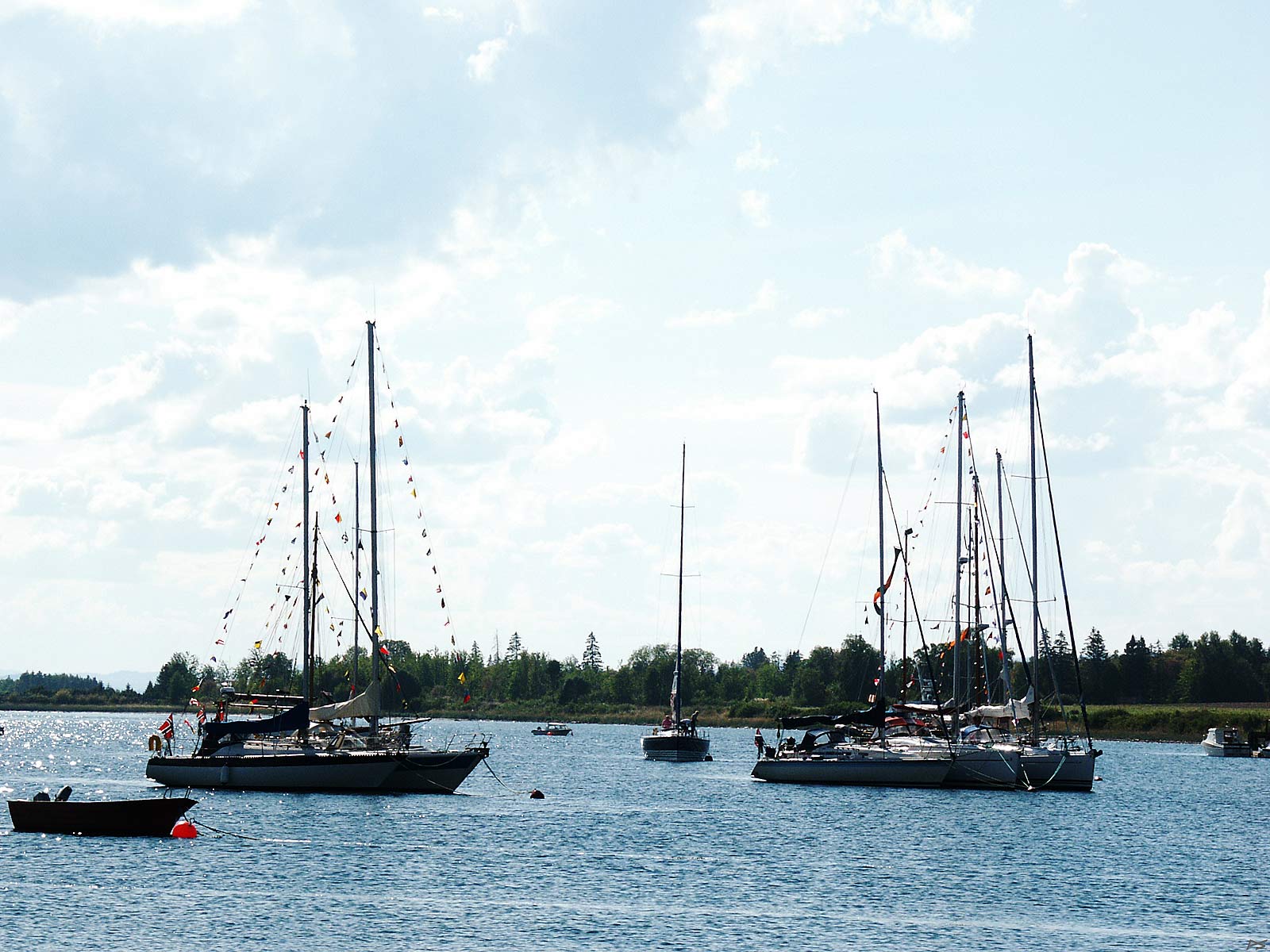
Sailboats on the leeward side of the island Tautra, near Trondhjems Seilforening's cabin, during the annual barbecue weekend. (Most boats seem to have left.)
(2006-08-27)
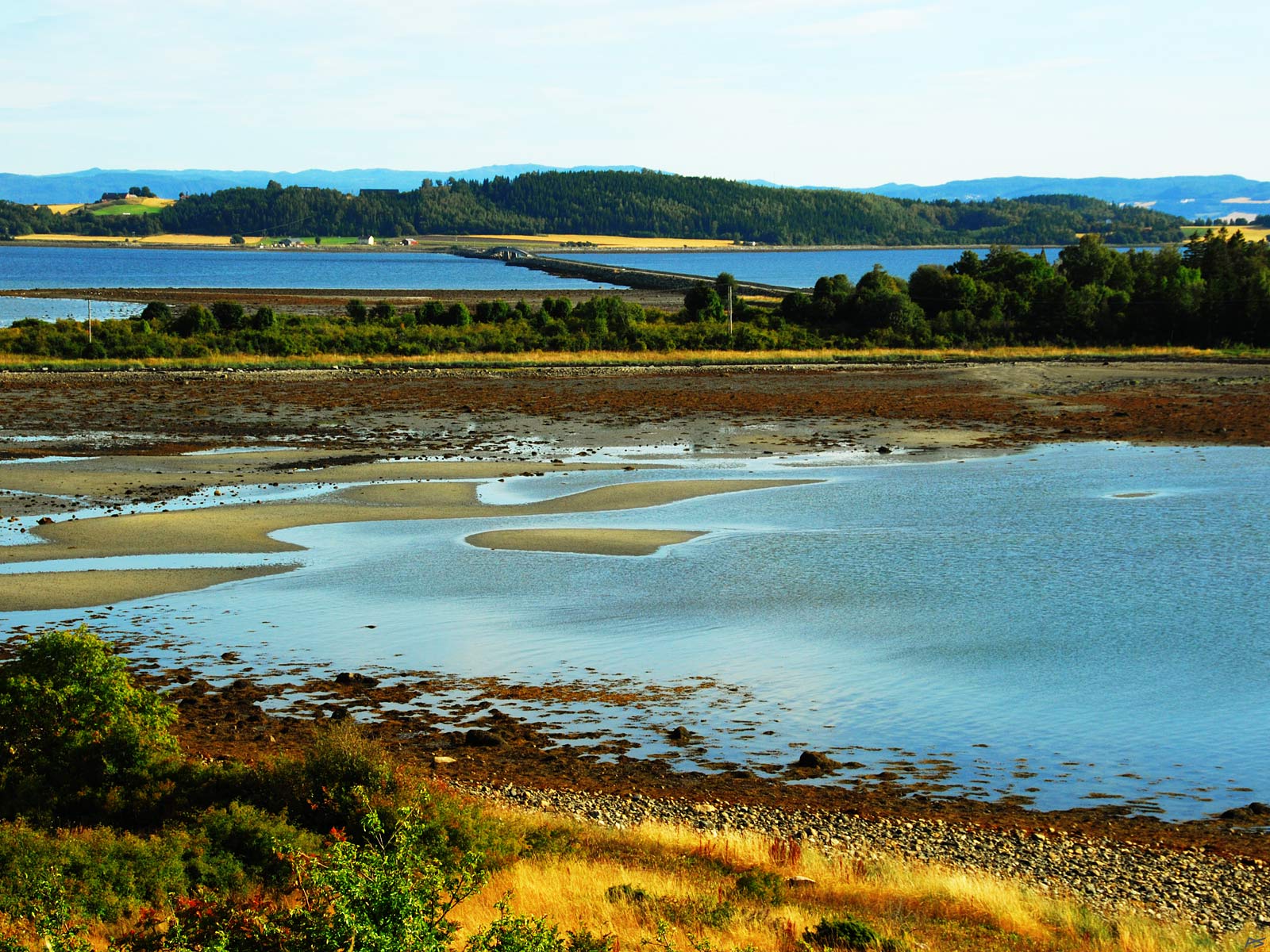
A picture taken from the hilltop west of the monastery ruins. The tide is low and the bay between the north and south part of the island is partly dry, and so is the strait (Svaet) towards the mainland. The road to the mainland, including the bridge. can be seen.
(2010-09-05)
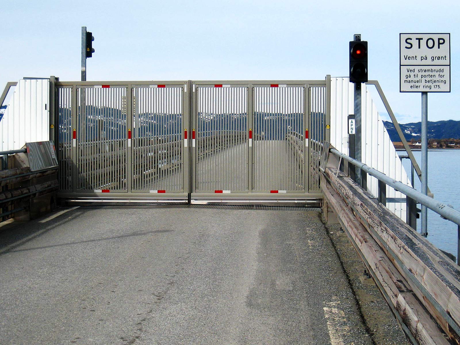
This island use to be an important breeding site for the (wild) eiders. There were no predators and the shallow strait towards the mainland provided plenty of the bird's food, the common mussels. In 1979 a 2½ kilometre road had been built across the strait. This had two effects: The road stopped the tidal current trough the strait so that the mussels didn't thrive there anymore, and foxes, badgers and stoats had free access to the eggs and chickens on the island. In 2003 some of the road stone filling was replaced by a bridge and the automated gate shown here is intended to prevent the predators from crossing the bridge. Now the mussels are back and if the gate's failure rate now will stay low, there is hope for the eiders. Well, there are stories about badgers waiting at the gate for a car to appear...
(2013-04-21)
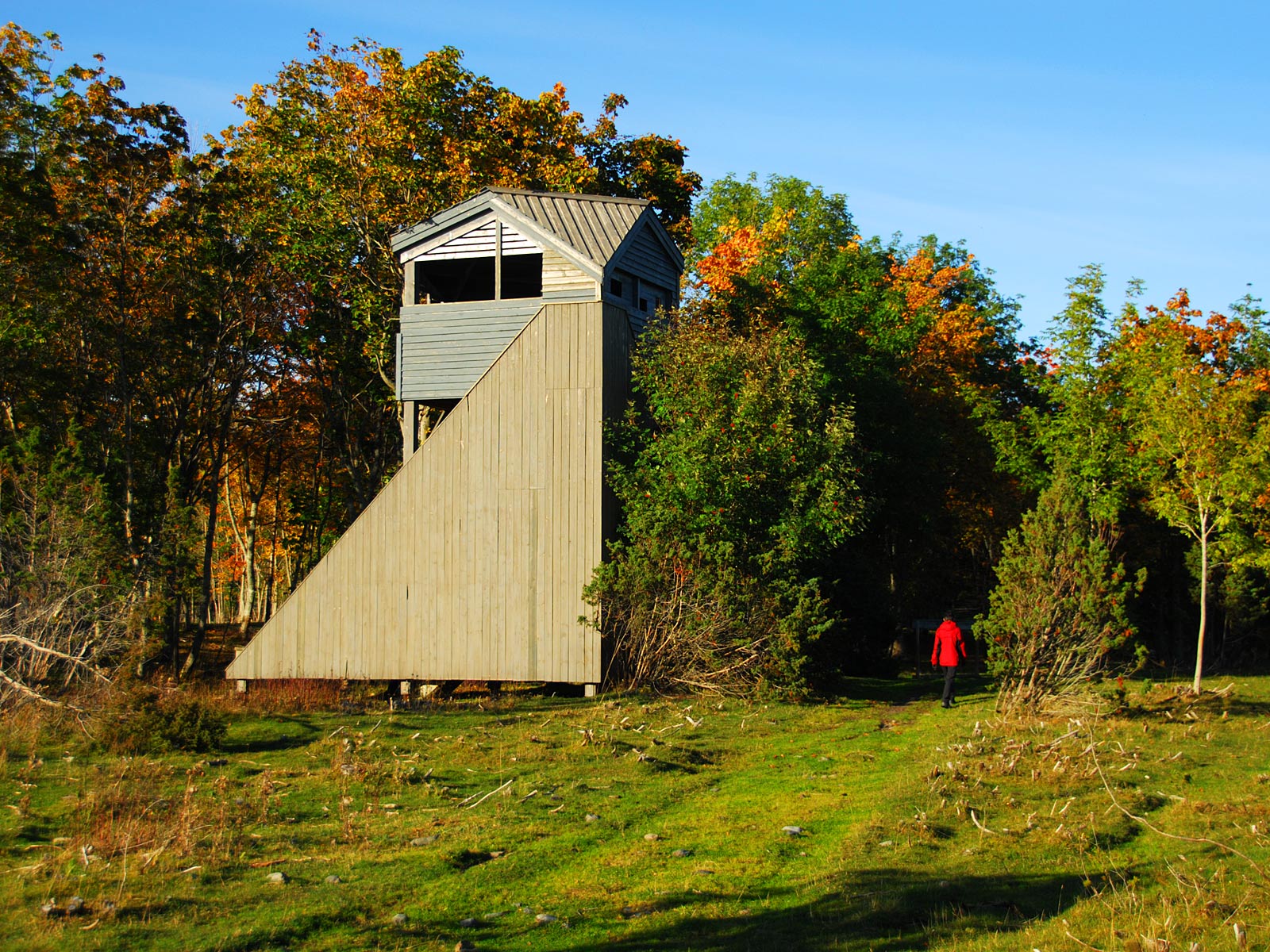
The bird watching tower in the autumn.
(2012-09-23)
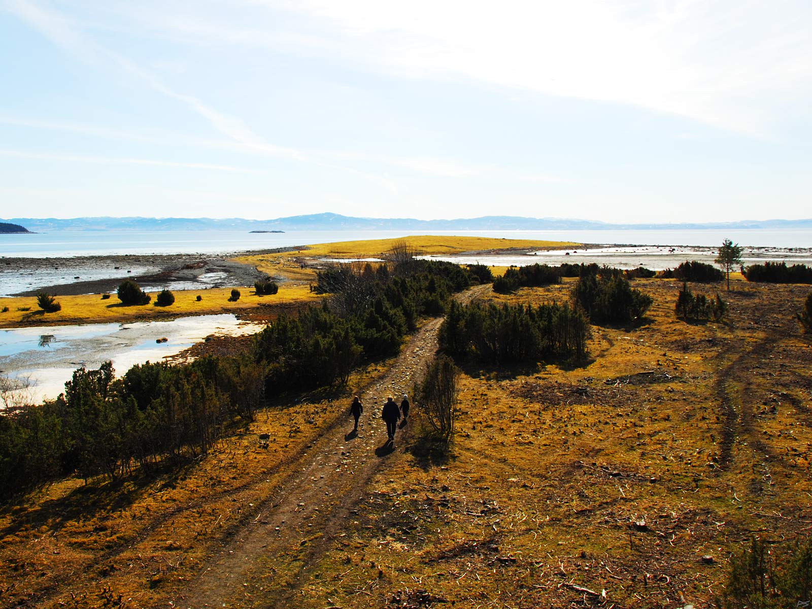
View from the bird watching tower on the south part of the island towards 'Store Holmen' (= large islet). Far out to the right the mist is hiding the town of Trondheim. To the left a small part of the closest mainland (Frosta) is seen, and in-between the islet Øksningen mention earlier is discernible. It's early spring and the snow has just gone, but here is still ice on the pond Sjødammen to the left. This part of the island is nice for hiking, sunning and birdwatching (parking e.g. at the cemetery). Hiking in the nature reserve (see map on top of the page) is prohibited during the bird breeding season 1. April–15. July. However, the path to the bird watching tower from the road north of it may be used.
(2010-04-11)
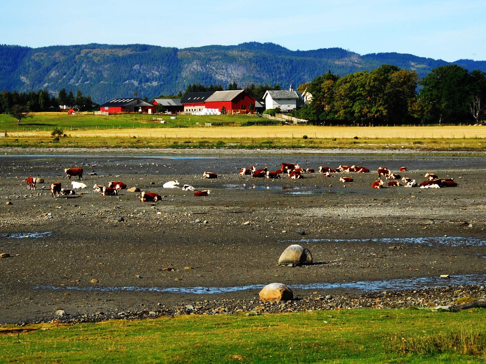
View from 'Store Holmen'. The tide is low and the cattle is ruminating on the sand. Most people here live from farming, but like on the adjoining mainland Frosta, producing potatoes and vegetables may be more common than cattle farming.
Be aware that dogs are prohibited in areas where cattle is grazing, which in this case in most of the southern part of the island. Bringing a dog is also dangerous, as the otherwise docile cows may attack the dog, especially if they have calves. Although cows are not trained fighters, they do weight at least half a ton each and may be numerous.
(2010-09-05)